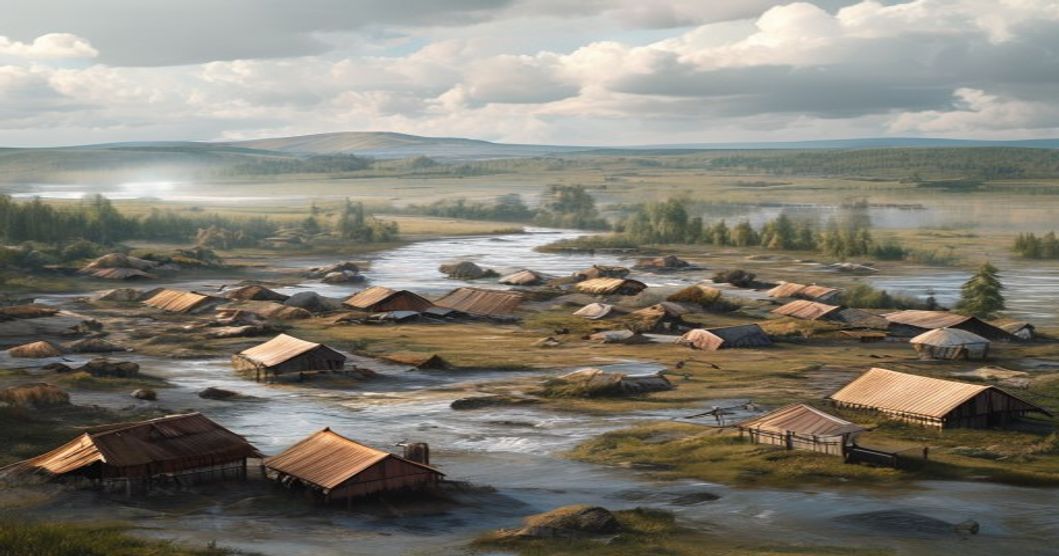
Understanding Traditional Land Use in Sami Territories
The Sámi land management system evolved across the Fennoscandian archipelago through continuous adaptation to subarctic and alpine ecosystems. Rather than treating territory as a fixed asset, traditional frameworks operate on cyclical access patterns that align with seasonal resource availability. Migration routes traverse thousands of kilometers between winter pastures in boreal forests and summer grazing zones in exposed highlands. Reindeer herding demands precise tracking of lichen regeneration rates, snow depth variations, and predator migration corridors. Herders assess pasture quality by examining root systems and soil compaction levels to prevent long-term degradation.
Coastal populations developed specialized marine resource management techniques that synchronized with tidal cycles and fish spawning patterns. Ice fishing stations utilized thermal current mapping to locate cod and herring beneath frozen surfaces. Inland communities implemented strict rotational harvesting schedules for moose, bear, and ptarmigan, ensuring population stability across hunting districts. Summer activities focused on targeted berry collection, medicinal plant processing, and structural timber preparation using sustainably felled birch and Scots pine.
- Seasonal pasturage rotation prevented overgrazing by allowing lichen beds to recover during summer months while winter grazing occurred on exposed rock surfaces where vegetation growth remained dormant.
- Navigational markers consisted of stacked stones, carved tree trunks, and specific mountain ridges that transmitted route knowledge across generations without written documentation.
- Ecological boundary enforcement relied on sacred sites that prohibited extraction in watershed headwaters, preserving groundwater quality and preventing soil erosion in fragile tundra environments.
Historical governance functioned through elder councils that resolved resource disputes by referencing environmental capacity rather than political authority. Customary regulations mandated fallow periods for berry stands and enforced catch limits during salmon migration windows. Contemporary mapping initiatives overlay satellite imagery with oral route archives to reconstruct pathways disrupted by border divisions and assimilation programs. These embedded spatial planning protocols demonstrate how indigenous ecological knowledge anticipates modern habitat restoration methodologies through continuous monitoring, adaptive allocation, and species-specific carrying capacity assessments.
Historical Foundations of Sami Territorial Practices
Pre-colonial Sami communities structured their territorial claims around ecological rhythms rather than fixed political boundaries. Land management operated through the siida system, a decentralized network of kinship groups that coordinated grazing zones, fishing lakes, and hunting grounds based on seasonal resource availability. Historical records from Norse sagas, Russian chronicles, and early Scandinavian tax registers reveal a landscape divided by transhumance corridors connecting interior highland pastures with winter feeding areas along coastal fjords and river valleys.
- Seasonal migration routes followed reindeer behavior patterns, requiring precise knowledge of lichen growth cycles, snow depth, and predator movements.
- Territorial boundaries shifted annually according to herd size, weather conditions, and inter-community agreements rather than static survey lines.
- Customary law enforced through elder councils resolved conflicts over grazing rights, fishing weirs, and berry harvesting zones without centralized authority.
The medieval period introduced external administrative frameworks that gradually fragmented traditional land access. Danish-Norwegian, Swedish, and Russian state expansions imposed crown grants, church tithes, and military roads that cut across ancient migration corridors. Despite these pressures, Sami groups maintained functional territorial control through adaptive strategies, including seasonal camp clustering, resource rotation, and strategic alliances with local nobility. Oral transmission preserved topographic knowledge across generations, ensuring continuity even when written documentation favored state officials.
Tax rolls from the sixteenth to eighteenth centuries document reindeer headcounts, fishing net allocations, and hunting permit distributions that functioned as de facto land tenure records. These administrative artifacts demonstrate how territorial rights were negotiated through economic contribution rather than conquest. The nineteenth-century border treaties between Norway, Sweden, Denmark, and Russia formalized national boundaries that ignored historical grazing patterns, forcing communities to adjust traditional practices while preserving core territorial logic.
- Community-led mapping initiatives in the early twentieth century recorded historical pasture names, burial sites, and seasonal camps before state surveys replaced indigenous knowledge systems.
- Legal challenges during the mid-twentieth century relied on archaeological evidence, oral histories, and historical tax records to assert continuous territorial use.
Ecological Principles Embedded in Sami Resource Management
The Sámi approach to land and resource management operates on a foundation of reciprocal observation rather than extraction. Centuries of continuous adaptation to subarctic and alpine environments have generated a sophisticated ecological framework that treats ecosystems as interconnected systems rather than isolated commodities. Reindeer herding forms the operational core, yet it extends into comprehensive landscape stewardship through calculated grazing distribution. Pastures are deliberately rotated across tundra, taiga, and coastal zones to prevent vegetation degradation and maintain soil structure. This rotational pattern allows vascular plants and cryptogamic crusts to regenerate naturally, preserving the hydrological balance essential for permafrost stability.
- Functional Biodiversity Maintenance: Traditional protocols limit harvest intensity during critical reproductive windows, actively protecting keystone species such as reindeer lichen (Cladonia spp.) and medicinal flora. Grazing density is continuously calibrated against natural regeneration rates, preventing overgrazing thresholds.
- Disturbance Regime Management: Controlled burning strategies stimulate nutrient cycling and promote fresh forage growth while maintaining open habitats required by ground-nesting avian species. These interventions align with modern patch dynamics theory, demonstrating how targeted stressors enhance ecosystem resilience.
- Indicator-Based Monitoring Networks: Long-term ecological tracking relies on generational observation of migratory birds, aquatic populations, and snowpack composition. This decentralized monitoring system provides real-time feedback for adjusting migration routes and seasonal camp placements without artificial boundaries.
Sámi resource governance inherently operates as a closed-loop model where extraction rates are mathematically linked to ecological feedback mechanisms. Modern conservation biology increasingly validates that these traditional practices support carbon sequestration in peatlands, protect watershed integrity, and maintain genetic diversity across domesticated and wild species. The integration of adaptive
Reindeer Husbandry as a Core Land Use Strategy
Reindeer herding constitutes the foundational land management practice across Sami territories in Fennoscandia. This system operates through seasonal migration corridors known as siida, which require precise ecological timing and collective decision-making. Herders track snow depth, lichen biomass, predator activity, and microclimate variations to navigate grazing routes that frequently cross Norway, Sweden, and Finland. The economic viability of these communities depends on maintaining herd sizes within natural carrying capacities. Lichen pastures form the primary winter feed source and require decades to regenerate after soil disturbance or heavy trampling. Sustainable rotation prevents overgrazing while preserving tundra biodiversity. Modern infrastructure projects, including logging roads, hydroelectric dams, and renewable energy installations, regularly disrupt these historic pathways. Herders counteract fragmentation through digital monitoring tools, GPS tracking networks, and formal grazing rights negotiations. The practice also functions as a cultural transmission mechanism, embedding traditional ecological knowledge into youth education and community governance.
- Predator management forces adaptive calving ground selection during spring months to minimize wolf encounters
- Soil microbiome preservation occurs through dispersed grazing patterns that enhance carbon sequestration in permafrost-adjacent zones
- Economic valuation prioritizes herd resilience over maximum yield in cooperative frameworks, ensuring genetic diversity and disease resistance
Unlike intensive livestock models, reindeer husbandry minimizes external inputs, relies on natural forage cycles, and maintains soil structure through continuous movement. Legal frameworks such as regional land court rulings continue to shape access rights, yet practical implementation remains contested. The system demonstrates remarkable adaptability, integrating satellite vegetation indices and weather forecasting with ancestral route knowledge. This dual approach ensures ecological stability while sustaining cultural continuity in rapidly changing Arctic environments. Market integration occurs through regulated slaughter quotas and value-added products like antler crafts and traditional textiles, which generate supplementary income without compromising grazing timelines. The strategy ultimately functions as a dynamic land stewardship model, balancing subsistence requirements with long-term ecosystem maintenance across fragile biomes.
Cultural and Spiritual Dimensions of Sami Land Stewardship
The Sami relationship with the landscape operates as a continuous cosmological framework rather than a resource management system. Land stewardship functions through reciprocal obligations where human activity maintains ecological balance and spiritual harmony simultaneously. Reindeer husbandry exemplifies this integration, requiring practitioners to interpret weather patterns, vegetation cycles, and animal behavior through inherited observational protocols. Migration routes follow seasonal corridors established over centuries, ensuring pastures recover naturally while preserving grazing rights that prevent soil compaction and maintain alpine biodiversity.
Sacred geography structures territorial awareness through noaidie sites and sieedi stones, which historically served as focal points for shamanic mediation between physical and spirit realms. Communities perform seasonal offerings at these locations to honor land spirits and request favorable conditions for hunting, fishing, and herding. This practice reinforces territorial boundaries without physical markers, relying instead on collective memory and ritual repetition to maintain spatial order.
- Joik vocalization encodes topographical data, historical events, and ecological knowledge into melodic structures that function as auditory land maps.
- Duodji craftsmanship requires harvesting materials from specific microhabitats at precise biological windows, reinforcing botanical awareness and sustainable yield practices.
- Traditional toponymy creates linguistic archives where each place name describes terrain composition, seasonal usage patterns, or spiritual significance.
Contemporary environmental governance increasingly recognizes these intangible dimensions as active conservation technologies. Legal frameworks across Nordic jurisdictions now integrate indigenous ecological knowledge into watershed management and peatland restoration projects. The intergenerational transmission of place-based observations enables rapid detection of climate shifts, vegetation changes, and wildlife migration disruptions. Modern land rights negotiations must therefore treat cultural practices not as historical artifacts but as functioning stewardship mechanisms that require institutional protection and adaptive funding to sustain territorial continuity.
Sacred Sites and Seasonal Migration Routes
The Sami relationship with the landscape transcends mere economic utility, embedding spiritual significance into every ridge, lake, and forest clearing. Sacred sites, known locally as sieidi or goahti, function as active nodes in a continuous cultural landscape rather than static monuments. These locations often mark critical junctures where reindeer herds cross natural barriers, rest in sheltered valleys, or gather for communal rituals. Archaeological evidence reveals that stone formations and ancient birch groves served as waypoints for seasonal movement, aligning with solar cycles and lunar phases to optimize herd health and resource availability.
Seasonal migration routes follow precise ecological corridors dictated by terrain, snowpack depth, and lichen distribution. Winter pastures typically occupy elevated plateaus where wind scours remove heavy snowfall, exposing the ground layer reindeer rely upon for survival. Summer grazing shifts toward coastal lowlands and inland birch forests, where fresh vegetation supports lactation and calf development. These pathways are not arbitrary; they represent centuries of accumulated ecological knowledge, mapped through oral tradition and reinforced by generational herding experience.
- Winter Corridors: Route selection prioritizes wind-exposed ridges that prevent deep snow compaction, ensuring consistent access to reindeer lichen during extreme cold periods.
- Summer Movement Patterns: Herds traverse river valleys and coastal tundra zones where nutrient-rich grasses accelerate post-calving recovery and antler development in bulls.
- Ritual Waypoints: Designated resting grounds incorporate natural acoustic features and mineral deposits used for seasonal offerings, maintaining spiritual alignment with environmental transitions.
Modern land-use policies frequently fragment these corridors through infrastructure development and resource extraction zones. When migration paths intersect with commercial forestry boundaries or mining concessions, reindeer herds experience chronic stress, reduced calving rates, and diminished pasture quality. The disruption extends beyond livestock economics, eroding the cultural continuity that depends on predictable seasonal rhythms. Communities maintain detailed mental maps of historical stopping points, water sources, and ritual grounds, documenting shifts in vegetation patterns and wildlife behavior to adapt to changing climatic conditions.
Preservation efforts increasingly recognize these routes as living heritage systems requiring spatial protection alongside ecological management. Integrating traditional knowledge into land-use planning improves corridor connectivity, reduces human-wildlife conflict, and sustains the spiritual geography that defines Sami identity. Mapping projects combine satellite telemetry data with elder testimony to identify critical bottlenecks and seasonal pressure points, ensuring that mobility remains intact despite expanding industrial activity.
The continuity of these practices relies on legal recognition of customary land rights and community-led stewardship models. When traditional governance structures guide spatial planning, both biodiversity and cultural transmission benefit from aligned management objectives. Maintaining access to sacred locations ensures that ritual calendars remain synchronized with environmental cues, preserving the foundational logic that has sustained reindeer husbandry across arctic ecosystems for millennia.
Oral Traditions and Intergenerational Knowledge Transfer
The Sami relationship with ancestral landscapes operates through non-written transmission channels that function as living ecological archives. Knowledge keepers encode survival protocols, seasonal migration corridors, and micro-climate indicators within narrative structures that double as practical field manuals. Each account preserves precise coordinates for reindeer pastures, reliable snow bridges, wind patterns, and medicinal plant locations essential for subsistence economies.
Youth acquire spatial literacy through embedded apprenticeship rather than classroom instruction. Seasonal driving camps become active learning environments where navigation skills develop through repeated exposure to terrain features and herd behavior. The yoik tradition transforms topographical data into mnemonic devices, allowing complex geographical information to persist across decades without written records. When environmental conditions shift due to rapid climate change or industrial development, these oral frameworks provide the cognitive architecture needed to adjust land management practices while maintaining ecological balance.
- Winter modules teach snowpack evaluation, wind tracking for game localization, and ice formation reading on river systems.
- Summer instruction focuses on lichen regeneration cycles, berry harvesting coordinates, and salmon spawning stream mapping.
- Material workshops demonstrate reindeer hide processing, structural engineering for temporary dwellings, and natural dye extraction.
Contemporary revitalization programs emphasize participatory learning models that reconnect younger generations with seasonal cycles disrupted by centralized education systems. Preserving these transmission pathways requires protecting physical access to traditional territories, as geographic displacement directly severs the practical application of inherited knowledge. Sustainable land stewardship in Sami regions remains contingent upon maintaining unbroken lines of experiential instruction. Digital preservation initiatives capture audio recordings and video documentation, yet authentic competency demands hands-on engagement with herds, snow evaluation, and seasonal resource mapping. Community-led workshops now integrate traditional pedagogies into structured curricula, ensuring that ecological literacy stays grounded in direct observation rather than theoretical abstraction.
The transmission process relies heavily on contextual feedback loops between elders and learners. Modern policy frameworks increasingly recognize that protecting Sami land rights directly supports biodiversity conservation, as traditional knowledge systems prioritize long-term resource sustainability over short-term extraction. Educational institutions collaborating with Sami communities now adopt place-based learning approaches, allowing students to map historical grazing routes alongside contemporary satellite imagery. This synthesis bridges generational gaps while reinforcing the practical relevance of inherited ecological data. Policy interventions must prioritize territorial continuity over administrative convenience. Without continuous field-based instruction, the nuanced understanding of tundra ecosystems risks permanent fragmentation, directly undermining regional conservation efforts and cultural resilience.
Language Preservation Through Territorial Terminology
The Sámi languages rely heavily on a highly specialized lexicon that maps directly onto the Arctic and subarctic landscape. Place names function as precise ecological descriptors rather than arbitrary administrative labels. A single territorial term encodes soil composition, seasonal grazing cycles, ice stability, or historical reindeer migration corridors. When these terms disappear from active speech, the underlying land management knowledge vanishes alongside them.
Linguistic preservation requires systematic documentation of toponymy across Sápmi’s fragmented dialect zones. Indigenous researchers and university linguists collaborate to record how different language varieties classify terrain features. The North Sámi word duottar describes a specific type of barren, wind-swept plateau optimized for summer grazing, while várri denotes steep, rocky elevations unsuitable for herding but critical for traditional hunting routes. These lexical distinctions preserve centuries of environmental observation.
Contemporary mapping initiatives integrate archived place names with geographic information systems, enabling communities to overlay historical land use patterns against modern municipal boundaries. Language revitalization frameworks in Norway, Sweden, and Finland embed territorial vocabulary into formal education, ensuring students acquire both grammatical structures and the spatial logic embedded within each term. Community-driven documentation projects prioritize elder speakers who maintain traditional naming conventions for rivers, peat bogs, and birch forest gradients.
Standardized cartographic policies often erase these distinctions by replacing indigenous labels with uniform administrative markers, accelerating linguistic fragmentation. Protecting territorial terminology sustains cultural continuity while retaining practical ecological data necessary for managing fragile northern ecosystems under shifting climate conditions. Semantic analysis of herding terminology reveals how lexical precision prevents resource conflicts. Dialectal variations in land classification highlight historical migration patterns and trade networks. Archival recordings capture phonetic shifts that correlate with environmental changes over generations. Digital lexicon platforms now allow real-time comparison between historical documents and contemporary usage, supporting evidence-based language policy development.
Legal Frameworks and Contemporary Policy Challenges
The legal architecture governing Sami territories operates across multiple jurisdictions, each presenting distinct regulatory tensions between state sovereignty and indigenous land rights. International instruments such as ILO Convention No. 169 and the United Nations Declaration on the Rights of Indigenous Peoples establish binding principles for free, prior, and informed consent, yet domestic implementation varies significantly across Norway, Sweden, Finland, and Russia. Cross-border coordination remains fragmented, as migratory patterns disregard national borders while legal instruments operate within isolated statutory boundaries. National legislations often prioritize resource extraction and agricultural development, creating structural friction with customary land use practices centered on reindeer husbandry, seasonal migration routes, and sustainable harvesting.
- Statutory Recognition Gaps: Many jurisdictions lack explicit constitutional provisions recognizing collective land tenure, forcing Sami communities to rely on administrative permits rather than inherent rights.
- Overlapping Regulatory Zones: Forestry, mining, and energy licenses frequently intersect with designated grazing corridors, triggering institutional conflicts that delay project approvals and increase litigation costs.
- Consultation Mechanisms: While FPIC protocols exist on paper, practical application often reduces engagement to procedural notifications rather than substantive negotiation, undermining community authority over territorial management.
Recent judicial decisions have begun reshaping policy trajectories. The Norwegian Finnmark Act transferred ownership of approximately 95 percent of the county’s land to a local estate managed by elected representatives, yet operational control remains constrained by national environmental statutes and infrastructure mandates. Swedish courts have increasingly referenced historical usage evidence in property disputes, though compensation frameworks rarely address cumulative ecological degradation. Finnish constitutional reforms have expanded Sami Parliament advisory powers, but legislative vetoes over commercial developments remain absent. Policy modernization requires harmonizing land-use zoning with migratory calendars, establishing independent monitoring bodies, and funding community-led mapping initiatives that document customary boundaries for legal adjudication.
Historical Treaties and Indigenous Land Rights Recognition
For centuries prior to colonial boundary imposition, Sami land governance operated through customary systems anchored in seasonal migration, reindeer husbandry, coastal fishing, and forest hunting territories. Ownership was conceptualized as collective stewardship tied to ecological rhythm and kinship networks rather than individual title deeds. The 1751 Border Treaty between Sweden and Denmark-Norway introduced fixed frontiers that disrupted traditional transhumance corridors, yet it never extinguished Sami usage rights. Subsequent state-building in the nineteenth and twentieth centuries prioritized timber extraction, mining, agriculture, and hydroelectric infrastructure, often classifying ancestral territories as dominium directum or unoccupied crown land, thereby marginalizing indigenous tenure in statutory frameworks.
Legal recognition evolved through domestic litigation, legislative adjustment, and transnational human rights mechanisms. Norway’s Finnmark Act (2005) established an independent commission to investigate land ownership based on continuous use since 1814, ultimately transferring approximately ninety-five percent of the county to collective local ownership, with Sami communities receiving formal title recognition. Sweden has not ratified ILO Convention No. 169 but safeguards reindeer husbandry through the Reindeer Herding Act (1971) and recognizes the Sami Parliament as a consultative body in spatial planning. Finland embeds indigenous protections in its Constitution and court jurisprudence, including Supreme Court rulings that affirm cultural practice as a basis for land use claims, though full ratification of ILO 169 remains pending.
- Treaty Architecture: Early agreements addressed taxation, military conscription, and trade monopolies rather than property rights, leaving customary tenure legally unrecorded.
- Judicial Evolution: Nordic high courts have progressively shifted from documentary proof to usage-based validation, prioritizing historical continuity over formal registration.
- International Benchmarks: UNDRIP (2007) and ILO 169 establish normative standards for free, prior, and informed consent, yet ratification and enforcement differ across jurisdictions.
Contemporary land governance increasingly incorporates traditional ecological knowledge into municipal planning, yet disputes over mineral concessions, renewable energy installation, and national park expansion persist. Statutory recognition does not guarantee operational control; co-management protocols and environmental impact assessments remain fragmented. The progression from territorial exclusion to conditional acknowledgment reflects a structural recalibration in Nordic governance, but effective sovereignty over land use requires sustained institutional alignment between state authority and Sami self-governance structures.
Modern Legislation Across Norway, Sweden, Finland, and Russia
The legal landscape governing traditional Sami land use diverges significantly across the four nations that encompass Sápmi, each shaped by distinct colonial histories, constitutional frameworks, and resource extraction priorities.
In Norway, the Reindeer Husbandry Act of 1978 establishes exclusive grazing rights within designated utmark zones, yet these boundaries frequently conflict with modern forestry permits and renewable energy projects. The Finnmark Act of 2005 transferred approximately 96% of county land to the Finnmark Estate, mandating joint management through a commission where Sami representatives hold decisive voting power. Norwegian courts have increasingly recognized customary use as binding under constitutional provisions, though enforcement remains inconsistent when state infrastructure projects override grazing corridors.
Sweden operates under the Reindeer Husbandry Act of 1971, which legally defines designated pastures while simultaneously subordinating traditional access to national timber management plans. The landmark 2020 forest rights ruling acknowledged that historical hunting and fishing practices could constitute property rights under international law, yet domestic implementation lags behind regional environmental directives. Municipal zoning laws continue to restrict seasonal migration routes, forcing herders to negotiate passage agreements with private landowners.
Finland’s 2014 Forest Act amendment introduced limited recognition of reindeer husbandry in forestry licensing, but the legal threshold requires documented continuous use since the early twentieth century. The Finnish Sami Parliament advises on environmental impact assessments, yet lacks veto authority over mining permits under national resource statutes. Cross-border herding agreements with Norway remain diplomatically sensitive, as Helsinki prioritizes domestic regulatory control over transboundary ecological continuity.
Russia presents the most constrained environment. Soviet collectivization dismantled traditional land tenure systems, and contemporary federal law classifies Sami communities as small-numbered peoples without specific territorial ownership rights. Constitutional court decisions acknowledged historical ties to ancestral territories but deferred jurisdiction to regional authorities. Current legislation permits only seasonal use permits for fishing and hunting, heavily regulated by federal ministries that prioritize Arctic industrial development over indigenous stewardship practices.
- Jurisdictional fragmentation creates legal uncertainty for cross-border herding routes spanning multiple administrative zones.
- Environmental impact requirements under regional directives apply in Norway, Sweden, and Finland but remain unenforced in Russian territories.
- Customary law recognition varies from judicial precedent in Scandinavia to statutory exclusion in post-Soviet frameworks.
Conflicts Between Extractive Industries and Sami Sovereignty
The expansion of mining operations, timber harvesting, and renewable energy infrastructure across the Sápmi region directly challenges established patterns of Sámi land tenure and resource management. Extractive corporations frequently secure permits through national licensing frameworks that prioritize economic development over indigenous stewardship models. This structural imbalance generates persistent friction because Sámi communities operate on a seasonal pastoral system where reindeer migration corridors, fishing grounds, and berry harvesting zones require uninterrupted ecological continuity.
National governments in Norway, Sweden, and Finland often classify these territories as state-owned or public domain, sidelining historical usage rights documented through oral testimony and generational land management records. The absence of legally binding free, prior, and informed consent protocols allows infrastructure projects to proceed despite documented opposition from local Sámi parliaments and reindeer herding districts. Legal challenges mounted by indigenous representatives frequently encounter jurisdictional barriers, as domestic property law does not fully recognize customary land tenure systems.
- Ecological disruption: Road networks, tailings dams, and clear-cut logging fragment critical reindeer winter pastures and summer calving grounds. Soil compaction and heavy metal runoff degrade water quality, directly impacting fish populations that sustain traditional food security.
- Economic displacement: Wage-based employment models introduced by mining companies create internal community divisions, as younger generations pursue industrial jobs while elders maintain pastoral obligations. This shift erodes intergenerational knowledge transfer essential for sustainable land use.
- Jurisdictional fragmentation: Cross-border Sámi territories face inconsistent regulatory enforcement. One nation may grant environmental clearance while neighboring jurisdictions approve incompatible infrastructure, rendering localized conservation efforts ineffective.
Court proceedings in the Nordic region have produced mixed precedents regarding indigenous resource rights. Supreme Court rulings occasionally reaffirm historical usage as a recognized legal interest, yet enforcement mechanisms remain weak when corporate licenses carry statutory protection. International frameworks like ILO Convention 169 and the UN Declaration on the Rights of Indigenous Peoples provide normative guidance, but domestic implementation lags behind treaty obligations. Corporate social responsibility initiatives frequently focus on compensation packages rather than co-management agreements, leaving decision-making authority firmly within state-controlled agencies.
Monitoring data from environmental impact assessments often underestimates cumulative effects across multiple overlapping projects. When several extraction sites operate simultaneously within a single watershed, baseline ecological thresholds are exceeded without triggering regulatory intervention. Sámi advisory boards attached to permitting authorities typically hold consultative status, lacking veto power or binding influence on zoning decisions. The resulting governance gap sustains systemic tension between industrial expansion objectives and indigenous sovereignty claims.
Environmental Sustainability and Climate Adaptation
Traditional land management practices across Sápmi have long operated as a living framework for ecological balance. Reindeer pastoralism, the cornerstone of Sami livelihoods, functions as a natural regulator of tundra and boreal forest ecosystems. Seasonal migration routes prevent overgrazing in sensitive zones, allowing vegetation to recover while maintaining soil stability and carbon sequestration capacity. This rotational grazing model reduces permafrost degradation by minimizing ground disturbance during critical thaw periods.
- Semi-nomadic herding patterns align with natural forage cycles, preserving lichen beds that serve as both winter sustenance and carbon sinks
- Low-impact land traversal techniques minimize soil compaction, protecting microbial networks essential for nutrient cycling
- Indigenous fire management practices historically controlled undergrowth density, reducing catastrophic wildfire risks in boreal transition zones
Climate shifts across Arctic latitudes are accelerating permafrost thaw, altering hydrological patterns, and destabilizing traditional migration corridors. Sami communities respond through hybrid adaptation strategies that merge generational ecological knowledge with satellite telemetry and climate modeling. Real-time tracking of reindeer movement data reveals how herds adjust grazing pressure in response to vegetation stress indicators. This dynamic monitoring enables proactive land zoning, preventing ecosystem overload during erratic weather windows.
Water resource management remains central to long-term sustainability planning. Traditional wetland conservation methods maintain peatland integrity, which stores vast carbon reserves and regulates regional temperature fluctuations. Community-led riparian buffer restoration projects now incorporate historical land-use maps to guide native plant reintroduction, stabilizing riverbanks against increased precipitation events. These interventions directly support biodiversity corridors for migratory birds and aquatic species facing habitat fragmentation.
Policy frameworks increasingly recognize indigenous land stewardship as a measurable climate mitigation tool. When Sami co-management agreements govern conservation zones, biodiversity metrics consistently outperform top-down protected area models. The integration of seasonal ecological calendars into regional adaptation strategies ensures that infrastructure development and resource extraction align with natural recovery cycles rather than opposing them.
Traditional Fire Management and Soil Conservation Techniques
The Sami peoples have historically managed boreal landscapes through carefully timed burning practices that align with seasonal grazing cycles and ecological recovery periods. Controlled fires were not accidental but deliberate tools for pasture renewal, particularly in lichen-rich tundra and taiga zones where reindeer rely on ground vegetation during winter months. By allowing low-intensity burns to consume accumulated dead biomass, herders accelerated the regeneration of nutrient-dense forage while simultaneously reducing the risk of uncontrolled wildfires that could devastate entire territories. This method required precise observation of wind patterns, soil moisture levels, and vegetation density, knowledge passed down through generations without written documentation.
- Seasonal Fire Timing: Burns were typically conducted during late spring or early autumn when humidity was low enough to sustain ignition but high enough to prevent rapid spread toward settlements or critical grazing zones.
- Patch-Mosaic Management: Reindeer herders deliberately maintained a heterogeneous landscape by burning small, irregular plots. This approach prevented uniform vegetation loss and created natural firebreaks that protected core pasture areas.
- Nutrient Cycling: Ash from controlled burns released potassium, calcium, and magnesium directly into the topsoil, improving fertility without synthetic inputs or mechanical tillage.
Soil conservation in Sami territories relied on complementary practices that minimized erosion and preserved organic matter. Terracing along steep slopes prevented water runoff from washing away nutrient-rich layers, while the strategic placement of moss, birch bark, and reindeer fur acted as natural mulch to retain moisture during harsh winters. Overgrazing was strictly regulated through rotational grazing systems that
Biodiversity Monitoring Through Indigenous Ecological Knowledge
Sami communities have developed highly sophisticated biodiversity monitoring systems rooted in centuries of continuous land stewardship. Rather than relying on isolated scientific surveys, these practices emerge from daily interactions with reindeer herds, migratory bird routes, coastal fisheries, and alpine flora. The core mechanism involves tracking phenological shifts through direct observation of snow depth, ice formation rates, and vegetation green-up timelines. Herders note subtle changes in lichen availability, which directly indicate pasture degradation or overgrazing long before satellite imagery detects visible land cover changes.
- Spatial Tracking Protocols: Traditional route mapping integrates microclimate data, soil moisture indicators, and historical grazing patterns to identify resilient forage zones under fluctuating precipitation regimes.
- Faunal Behavior Indicators: Reindeer antler development cycles, caribou calving ground selection, and wolverine denning activity serve as biological barometers for ecosystem stress levels.
- Hydrological Signatures: River flow velocity, permafrost thaw depth, and wetland freeze-thaw sequences are recorded using generational benchmarks rather than modern instrumentation alone.
These observational frameworks operate as decentralized early warning networks. When local knowledge holders document delayed spring thaw or premature autumn frost, they cross-reference these signals with historical harvest yields and predator movement patterns. This layered verification process reduces false positives common in single-variable climate models. Modern research institutions increasingly incorporate Sami monitoring logs into longitudinal biodiversity databases, recognizing that indigenous datasets capture temporal granularity that remote sensing frequently misses. The integration does not replace peer-reviewed ecology; it calibrates it. Field teams utilize these traditional baselines to design targeted sampling protocols, validate species distribution models, and adjust conservation thresholds in real time.
Adaptive management emerges as the direct outcome of this knowledge exchange. Land managers apply Sami-derived indicators to adjust grazing quotas, restore degraded wetland corridors, and implement seasonal access restrictions during critical breeding windows. The monitoring approach inherently prioritizes ecosystem resilience over static species counts, aligning conservation metrics with functional habitat integrity. Consequently, biodiversity assessments in northern latitudes gain actionable precision when indigenous ecological frameworks guide data collection parameters and interpret environmental variability.
Climate Change Impacts on Pastoral Land Use Cycles
The pastoral rhythms of Sami reindeer herding depend on finely tuned seasonal migrations that align with historical snowpack depth, lichen availability, and calf birth windows. Climate volatility fractures this alignment through multiple compounding mechanisms. Rain-on-snow events now occur more frequently across Fennoscandian tundra zones, creating impenetrable ice crusts that prevent reindeer from accessing underlying forage. When herds cannot break through the frozen layer, starvation spreads rapidly during winter months. Simultaneously, delayed snowmelt in northern catchments pushes spring calving into periods of peak predator activity and reduces the window for fat accumulation before autumn rutting.
- Phenological mismatch: Earlier vegetation green-up decouples plant nutrient peaks from reindeer digestive requirements, forcing herds to traverse longer distances with diminished nutritional returns.
- Lichen degradation: Repeated freeze-thaw cycles and increased summer precipitation accelerate lichen mat compaction, reducing forage quality by up to forty percent in affected pastures.
- Infrastructure strain: Thawing permafrost destabilizes traditional crossing points and seasonal enclosures, requiring constant structural reinforcement that diverts labor from herd management.
Economic calculations shift when migration routes become unpredictable. Herders report increased veterinary expenses, higher mortality rates among young calves, and declining adult body weights that directly impact meat yield and antler harvests. Cultural transmission suffers as younger generations observe traditional navigation markers lose reliability due to altered landscape features. Digital mapping tools and satellite telemetry now supplement ancestral knowledge, yet algorithms cannot replicate the intuitive reading of wind patterns, ice transparency, or reindeer behavioral cues that historically dictated movement decisions.
Adaptation strategies emerge through cross-regional knowledge exchange and modified grazing rotations. Some herding districts implement rotational winter pastures to allow lichen recovery periods, while others adjust calving locations toward coastal zones where maritime moderation reduces extreme ice formation. Government monitoring programs integrate meteorological forecasts with historical migration data, though policy frameworks often lag behind ecological tempo changes. Sustainable pastoral continuity requires dynamic land-use planning that prioritizes ecological resilience over static boundary enforcement.
Community-Led Conservation and Revitalization Initiatives
Sámi communities across Fennoscandia are restructuring ecological stewardship through indigenous governance frameworks that merge historical land management practices with contemporary conservation science. Local herding districts operate autonomous grazing councils that monitor reindeer migration routes, adjust pasture rotation schedules, and implement rotational fallow periods to prevent tundra degradation. These decentralized decision-making structures bypass top-down environmental regulations, allowing real-time adjustments based on snowpack depth, lichen biomass, and wildlife movement patterns documented across generations.
- Traditional Ecological Knowledge integration programs train younger herders in ice reading, vegetation phenology tracking, and microclimate observation techniques that modern sensors cannot fully replicate.
- Community-managed peatland restoration projects utilize ancient drainage reversal methods to combat permafrost thaw while preserving carbon sinks critical for regional climate stability.
- Indigenous-led biodiversity monitoring networks deploy standardized sampling protocols aligned with national environmental agencies, ensuring data sovereignty remains within Sámi jurisdiction.
Land trusts established by local duodár and cultural preservation societies acquire degraded grazing corridors through strategic land exchanges and conservation easements. These holdings enable controlled burn management, invasive species removal, and native grassland rehabilitation without commercial extraction pressures. Educational cooperatives partner with regional universities to document oral histories of seasonal resource harvesting, translating intergenerational wisdom into peer-reviewed ecological datasets.
National policy shifts increasingly recognize Sámi stewardship models as viable alternatives to conventional protected area frameworks. Cross-border conservation corridors now incorporate historical fire management techniques, controlled grazing patterns, and wetland hydrology restoration methods originally developed by northern pastoralists. Funding mechanisms prioritize direct community allocation rather than institutional intermediaries, strengthening grassroots capacity for long-term landscape monitoring and adaptive resource management.
Youth Engagement in Territorial Stewardship Programs
Sami youth are actively reshaping territorial stewardship by bridging centuries-old ecological knowledge with contemporary conservation strategies. Community-led initiatives across indigenous regions prioritize hands-on participation, allowing younger generations to document seasonal migration routes, monitor reindeer grazing patterns, and restore degraded wetlands. These programs operate outside formal academic structures, embedding learning directly into the landscape through daily land management practices. Participants track permafrost thaw rates, map lichen recovery zones, and maintain traditional fence lines that prevent overgrazing.
Successful stewardship frameworks integrate intergenerational mentorship, where experienced herders and land custodians guide participants in tracking environmental indicators, managing controlled burns, and maintaining seasonal infrastructure. Digital mapping workshops enable youth to translate oral histories and ancestral place names into geospatial databases, creating legally defensible records that support indigenous land claims. Language revitalization efforts remain central, as Sami terminology for terrain, weather patterns, and medicinal plants carries precise ecological data lost in translation. Field researchers now pair satellite imagery with traditional wind-reading techniques to predict snowpack stability.
Core components of effective youth territorial programs include:
- Direct apprenticeship under certified land managers and reindeer herding cooperatives
- Community-verified environmental monitoring using both scientific instruments and traditional observation methods
- Legal literacy training focused on indigenous rights, resource extraction regulations, and cross-border conservation treaties
- Cultural documentation projects that archive seasonal knowledge through audio recording, video mapping, and illustrated field journals
Youth participation has directly influenced regional land-use planning in Norway, Sweden, and Finland. Student-led environmental assessments now inform municipal zoning decisions, while peer-to-peer training networks have stabilized traditional livelihood sectors. When stewardship programs align with actual territorial governance structures, they generate measurable outcomes: restored grazing ecosystems, documented cultural heritage sites, and increased indigenous representation in environmental policy committees. Funding mechanisms increasingly require youth co-leadership, ensuring long-term continuity for land-based knowledge systems.
Digital Mapping and GIS Applications for Land Documentation
Geographic Information Systems have fundamentally transformed how indigenous communities document ancestral territories. For Sami reindeer herders, hunters, and fishers, spatial accuracy directly impacts legal recognition and resource management. Modern GIS platforms integrate high-resolution satellite imagery, historical cartography, and ground-truthed field data to create layered digital records that reflect centuries of seasonal migration routes, grazing grounds, and fishing sites.
The integration of traditional ecological knowledge with geospatial technology requires specialized methodologies. Participatory mapping workshops enable community members to digitize oral histories, reindeer herding district boundaries, and place names onto coordinate systems used by municipal and national authorities. This hybrid approach bridges the gap between customary land tenure frameworks and formal cadastral registries that historically excluded non-written claims.
- Temporal Landscape Analysis: Long-term tracking of vegetation shifts and snowpack patterns reveals how climate variability and infrastructure development alter reindeer grazing corridors, providing measurable evidence for land use negotiations.
- Cross-Border Data Harmonization: Standardized GIS formats allow Norway, Sweden, and Finland to share boundary coordinates while respecting distinct legal jurisdictions over Sami territories and seasonal migration paths.
- Open-Source Implementation: Platforms like QGIS combined with mobile GPS field applications enable low-cost documentation without reliance on proprietary software or external technical consultants.
Administrative agencies increasingly accept geospatial evidence when paired with consistent community verification protocols. Review committees evaluate spatial datasets based on metadata completeness, projection accuracy, and the documented chain of custody for each mapped feature. When Sami cooperatives submit GIS-derived boundary proposals alongside historical land tax records and winter pasture inventories, evaluation processes shift from skeptical to collaborative.
Data sovereignty remains a critical operational requirement. Indigenous mapping initiatives now embed custom permission layers that restrict commercial extraction while maintaining academic and governmental access for conservation planning. Secure authentication protocols and version-controlled repositories protect sensitive site locations of rare lichen growth areas, nesting grounds, and culturally significant landmarks from unauthorized exploitation or misappropriation.
Cross-Border Sami Cooperation on Shared Ecological Zones
The Sámi reindeer herding system operates across continuous ecological landscapes that ignore modern political boundaries. Shared grazing territories span the tundra, alpine plateaus, and boreal forest transitions across Norway, Sweden, Finland, and the Kola Peninsula. These zones function as integrated hydrological and botanical networks where lichen meadows, birch forests, and winter feeding grounds shift seasonally. Political borders historically fragmented these routes, forcing herders to navigate complex permit systems while maintaining ecological continuity. Cross-border coordination emerged as a practical necessity to preserve herd mobility and prevent overgrazing in sensitive valleys.
Formal cooperation structures now align traditional migration patterns with transnational land management protocols. The Sámi Council and regional Lapland programmes facilitate joint monitoring of pasture quality, snow depth measurements, and wildlife corridors. Herder associations negotiate shared grazing permits that recognize historical usage rights rather than state-imposed zones. Digital mapping tools overlay satellite vegetation indices with generational route knowledge, enabling real-time adjustments when weather patterns disrupt seasonal calendars. Cross-border veterinary protocols and disease tracking networks protect herd health during long-distance movements.
- Joint Pasture Assessment Committees conduct annual surveys across mountain passes to balance grazing pressure between neighboring districts.
- Transboundary Winter Corridors remain legally protected from industrial development through coordinated lobbying and indigenous land claim frameworks.
- Climate Adaptation Working Groups integrate ice-layer formation data with traditional forecasting methods to prevent livestock mortality during unseasonal thaws.
State border infrastructure, including fencing and checkpoint expansions, directly interrupts ecological flow and forces costly route realignments. Mining concessions and hydroelectric projects further fragment watershed systems that sustain both human communities and reindeer populations. Cooperative agreements now mandate environmental impact assessments that require Sami consultation before resource extraction permits are issued. Scientific research on permafrost degradation and lichen regrowth rates feeds directly into pasture rotation schedules, ensuring that land use remains calibrated to ecological carrying capacity rather than administrative convenience.
Economic Models and Sustainable Livelihood Strategies
The economic foundation of Sami territories rests primarily on reindeer husbandry, a highly specialized pastoral system that operates across transnational borders in Norway, Sweden, and Finland. This model diverges fundamentally from conventional livestock agriculture, relying instead on precise ecological knowledge to manage semi-domesticated herds through annual migration routes known as reingards. Herders track snow conditions, lichen availability, and predator movements to optimize grazing cycles, ensuring herd resilience while maintaining pasture recovery periods. The economic output extends beyond raw meat production, encompassing hides, antlers, bones, and dairy, all processed through community-led cooperatives that stabilize market fluctuations.
Sustainable livelihood strategies have evolved through adaptive integration of traditional practices with contemporary markets. Sami artisans utilize duodji craftsmanship to produce functional textiles, tools, and jewelry, which now reach global buyers via digital platforms while retaining cultural authenticity. Reindeer meat distribution follows direct-to-consumer supply chains, emphasizing traceability and ethical sourcing to command premium pricing in European retail sectors. Tourism operations, when structured under indigenous ownership, generate revenue through guided wildlife safaris, cultural workshops, and eco-lodges, deliberately limiting visitor impact through carrying capacity assessments.
- Seasonal Resource Allocation: Herding districts are divided into winter pastures in mountain forests and summer grazing zones in coastal fells, preventing overgrazing and maintaining soil microbiome health.
- Digital Market Integration: Blockchain tracking systems monitor reindeer lineage and slaughter compliance, satisfying international food safety regulations while preserving transparency for consumers.
- Mutual Aid Networks: Community labor pools distribute veterinary costs, equipment maintenance, and emergency rescue operations across multiple households during extreme weather events.
Legal frameworks such as the Finnmark Act and cross-border herding agreements continue to shape land tenure rights, directly influencing economic viability. Climate-induced shifts in precipitation patterns force continuous route adjustments, requiring real-time meteorological data collection by herders. Land use zoning regulations mandate rotational grazing boundaries that align with lichen regeneration cycles, directly protecting soil nitrogen fixation rates. Commercial partnerships require profit-sharing clauses that reinvest into youth training programs and herd health diagnostics. Investment in renewable energy microgrids and electric snowmobile charging infrastructure reduces operational carbon footprints without compromising mobility. Cross-border trade permits facilitate the movement of livestock during winter months, reducing administrative friction while maintaining biosecurity protocols. Financial resilience depends on balancing state subsidies with independent enterprise development, ensuring that livelihood adaptation remains culturally anchored rather than externally dictated. Cooperative pricing models and collective bargaining against commercial processors prevent margin compression, while digital payment systems streamline cross-regional transactions during rapid seasonal transitions.
Balancing Commercial Activities with Cultural Preservation
Commercial development in Sápmi requires precise alignment with reindeer husbandry calendars, migratory corridors, and sacred landscape boundaries. Mining concessions, logging operations, and large-scale tourism infrastructure frequently intersect with winter pastures and calving grounds, triggering conflict over land access rights. The resolution of these tensions depends on legally binding consultation protocols mandated by the Indigenous Peoples Convention (ILO 169) and national Sámi Parliament frameworks. Communities that implement zoning agreements with commercial operators report higher economic returns and lower environmental degradation.
Sustainable revenue models integrate traditional ecological knowledge into impact assessments. Reindeer herding cooperatives negotiate joint ventures with eco-tourism providers, offering guided cultural experiences while restricting vehicle access to sensitive zones. Revenue sharing mechanisms fund language revitalization programs, apprenticeship networks for young herders, and maintenance of historic winter camps. Digital mapping tools track grazing patterns alongside commercial land-use permits, enabling real-time adjustments that protect cultural sites from irreversible disruption.
Policy instruments such as the Finnmark Act in Norway and the Swedish Reindeer Herding Act establish co-management committees where Sámi representatives hold veto power over projects threatening livelihood infrastructure. Commercial enterprises operating without formal community consent face operational delays due to environmental injunctions and reputational risk mitigation costs. Conversely, businesses that embed cultural preservation into their supply chain secure long-term social license to operate.
Infrastructure planning must account for acoustic pollution, which disrupts reindeer navigation and alters migration timing. Noise barriers and seasonal construction bans align with breeding cycles, reducing behavioral stress in livestock. Commercial tourism operators adopt carrying capacity limits that prevent trail erosion near sacred rock formations and ancient dwelling sites. Certification programs verify compliance through independent audits conducted by indigenous experts rather than external consultants. These measures ensure economic expansion does not outpace ecological thresholds or erode intergenerational knowledge transfer.
Eco-Tourism Development and Community Benefit Sharing
Eco-tourism initiatives in Sami territories operate on a strict community-governed framework that aligns commercial activity with ancestral land stewardship. Rather than relying on external developers, local cooperatives structure seasonal programs around reindeer migration patterns, traditional fishing sites, and duodji craft workshops. These operations require explicit permits from regional land-use authorities and must comply with environmental carrying capacity limits to prevent soil degradation and wildlife disturbance. Revenue streams are channeled through transparent accounting systems managed by elected community boards.
Benefit distribution follows a tiered model that prioritizes direct participants over secondary vendors:
- Indigenous guides receive standardized certification programs covering ecological monitoring, first aid, and historical interpretation.
- Contracts with transportation providers and accommodation operators include mandatory profit-sharing clauses, typically ranging from 15 to 25 percent of gross earnings.
- Local handicraft cooperatives secure exclusive retail slots at visitor centers, ensuring authentic merchandise rather than mass-produced imports.
Financial audits are published annually in both Sami dialects and the national language, maintaining accountability while preventing revenue leakage to external corporations. Long-term viability depends on integrating tourism planning with grazing rights and forest management protocols. Seasonal restrictions during calving periods and fish spawning cycles automatically reduce visitor capacity, protecting ecological balance while creating premium, low-impact experiences. Training scholarships funded by tourism levies enable younger generations to pursue degrees in sustainable resource management and cultural heritage conservation.
Legal frameworks such as the Finnmark Act and regional Sami Parliament directives mandate that all commercial land use agreements include binding community consent clauses. Developers must submit environmental impact assessments that model visitor flow against pasture recovery rates. Revenue allocation follows a fixed ratio: forty percent supports direct operational costs, thirty-five percent funds cultural preservation projects, and the remaining twenty-five percent establishes a long-term conservation trust. This structured approach eliminates speculative pricing, ensures transparent fund tracking, and guarantees that ecological monitoring remains fully financed regardless of seasonal fluctuations.
Grant Funding and Institutional Support for Land-Based Projects
Securing financial backing for Sami land-based initiatives requires navigating a complex network of public, private, and indigenous-specific funding mechanisms. The European Union’s INTERREG North Sea Region and Arctic programs frequently allocate capital to cross-border cultural preservation projects, with particular emphasis on Sápmi regions spanning Norway, Sweden, Finland, and Russia. National governments provide targeted grants through ministry-led environmental and cultural heritage departments. In Norway, the Norwegian Directorate for Cultural Heritage offers direct subsidies for mapping traditional reindeer herding routes and documenting seasonal migration patterns. Sweden’s Sami Parliament collaborates with the Swedish Research Council to finance ethnographic studies focused on land rights and sustainable resource management. Finland directs funds through the Academy of Finland and the Ministry of Education and Culture, prioritizing projects that integrate indigenous knowledge with contemporary conservation science.
Institutional frameworks extend beyond direct financing. Universities across Scandinavia establish research partnerships that provide technical infrastructure, GIS mapping tools, and academic mentorship. Land management NGOs like WWF Sápmi and the International Work Group for Indigenous Affairs supply legal compliance guidance to ensure funding applications meet regulatory standards. Digital heritage platforms such as the European Heritage Label and UNESCO’s Intangible Cultural Heritage fund often recognize Sami land-use practices, unlocking additional grant eligibility pathways.
- Application Architecture: Proposals must align with measurable ecological recovery metrics, documented youth engagement in traditional skills, and verified improvements in land tenure security.
- Funding Streams: The Raute Foundation, Nordic Sami Council, and the Sámi Education Institute distribute annual grants specifically designed for community-led land mapping, digital archiving of traditional place names, and restoration of degraded grazing pastures.
- Compliance Requirements: Success depends on precise budget allocation, transparent reporting mechanisms, and demonstrable community ownership of each funded initiative.
Applicants should prioritize partnerships with accredited academic institutions to strengthen proposal credibility. Cross-border funding bodies require standardized impact assessments that track long-term land stewardship outcomes rather than short-term deliverables. Institutional support networks also provide technical workshops on grant management, audit preparation, and cultural heritage documentation protocols. Leveraging these resources ensures sustained financial stability for traditional land-use preservation efforts.
Frequently Asked Questions
What is Traditional Land Use in Sami Territories?
Traditional land use in Sámi territories refers to the indigenous practices of reindeer husbandry, fishing, hunting, and gathering that have been sustained for centuries across the Arctic regions of Norway, Sweden, Finland, and Russia. These activities are deeply intertwined with Sámi culture, spirituality, and livelihoods, governed by customary laws and sustainable ecological knowledge passed down through generations.
Key facts about Traditional Land Use in Sami Territories
Key facts include: (1) Sámi land use is guided by seasonal migration routes for reindeer herding; (2) it requires collective management and community decision-making; (3) historical treaties and modern legal frameworks increasingly recognize Sámi rights to ancestral lands; (4) climate change and resource extraction threaten traditional practices; and (5) Sámi knowledge contributes significantly to biodiversity conservation and sustainable ecosystem management.