Introduction to Traditional Sami Travel Knowledge
The Sámi people, indigenous to the northern territories spanning Norway, Sweden, Finland, and Russia, cultivated a highly refined system of travel knowledge forged through centuries of Arctic adaptation.
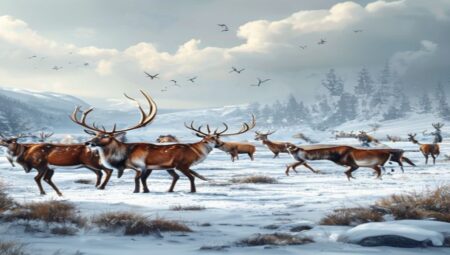
This expertise extends far beyond simple route-finding; it represents a continuous dialogue between human movement and environmental cycles. Traditional navigation depended on interpreting subtle terrain features: wind-loaded snowdrifts revealed safe corridors during whiteout conditions, while the solar arc and circumpolar stars provided reliable orientation across featureless tundra. Reindeer migration patterns functioned as living pathways, dictating seasonal human displacement toward coastal summer pastures and sheltered boreal forest valleys in winter.
Seasonal calendars structured every journey. Spring movements followed thawing riverbeds to nutrient-rich grazing zones, while autumn expeditions retraced ancestral trails back to established reindeer enclosures. Travelers measured distance and elapsed time by analyzing animal track density, lichen growth on stone markers, and the structural integrity of wind-bent trees. Ice assessment required specialized techniques; experienced herders tapped frozen lakes with reinforced wooden poles, listening for acoustic changes that indicated safe load-bearing thickness. Meteorological forecasting emerged from tracking cloud layering, goose migration altitude, and sudden shifts in air pressure, enabling communities to prepare for polar storms well before they arrived.
- Wayfinding markers: Carved birch posts and rock cairns documented historical routes and resource locations across vast territories.
- Seasonal mobility protocols: Strict migration timelines prevented overgrazing and aligned human activity with reindeer calving cycles.
- Environmental reading techniques: Snow depth measurement, wind direction analysis, and stellar navigation formed the core of pre-modern orientation systems.
Knowledge transmission occurred through immersive field practice, generational apprenticeship, and oral tradition encoded in regional place names. Artifacts such as reindeer-hide footwear and collapsible wooden skis were engineered for maximum efficiency in deep snow and subzero temperatures. Contemporary navigation instruments have augmented these methods, yet Sámi livestock managers continue mapping routes using ancestral memory to maintain ecological balance and cultural continuity. This embedded spatial literacy demonstrates how adaptive mobility systems remain vital for sustainable land stewardship in rapidly shifting northern ecosystems.
Origins and Historical Context of Sami Navigation
The foundations of Sami travel knowledge emerge from millennia of continuous adaptation across Fennoscandia’s extreme northern latitudes. Long before written records, indigenous communities developed highly sophisticated route-planning systems dictated by glacial topography, permafrost cycles, and seasonal light variations. Early settlements along the Scandinavian mountain ranges and coastal fjords required precise understanding of microclimates, ice thickness thresholds, and wind channeling through narrow valleys. This environmental literacy formed the bedrock of a mobile subsistence economy centered on reindeer herding, marine hunting, and inland fishing. Navigation was never merely about direction; it encompassed predictive modeling of weather shifts, identification of sheltered passages during katabatic winds, and recognition of subtle terrain markers that remained consistent across decades of climatic fluctuation.
Historical documentation reveals that Sami wayfinders utilized multiple overlapping reference systems. Drum maps, traditionally carved with symbolic patterns representing waterways, mountain passes, and sacred sites, served as cognitive frameworks rather than literal cartographic instruments. These visual aids were interpreted orally during communal gatherings, embedding geographical data within mythological and spiritual contexts. Practical navigation relied on acute observation of avian flight patterns, lichen growth orientations, and the refractive properties of quartz crystals in low-light conditions. During polar nights, travelers tracked auroral activity and stellar positions relative to fixed glacial landmarks. The integration of these methods created a redundant navigational network that minimized reliance on any single environmental cue.
- Pre-Viking Era Foundations: Archaeological evidence indicates seasonal movement corridors established between 4000 and 2000 BCE, aligning with ancient reindeer migration routes and coastal resource availability.
- Norse Chronicler Accounts: Medieval Scandinavian texts reference indigenous guides who navigated uncharted territories using knowledge of hidden waterways and terrain shortcuts unknown to settled populations.
- Oral Transmission Mechanisms: Route memorization depended on rhythmic chanting, topographic storytelling, and generational mentorship during long winter migrations across frozen tundra.
The historical persistence of these navigational practices reflects a dynamic knowledge ecosystem that absorbed external influences while maintaining core structural integrity. Despite centuries of border demarcation, religious conversion campaigns, and state-imposed settlement policies, the underlying principles of terrain reading and resource forecasting remained intact. Modern archaeogeography confirms that ancient Sami travel routes frequently followed geomagnetic anomalies and bedrock formations that provided reliable orientation during whiteout conditions. This systemic approach to spatial navigation operated independently of formal cartography, relying instead on embodied expertise and environmental symbiosis that continues to inform contemporary Arctic mobility studies.
Core Principles Guiding Sami Journeys
Sami travel traditions operate on a continuous feedback loop between human movement and Arctic ecosystems. These routes were never arbitrary. Every path emerged from centuries of observation, where survival depended on reading subtle environmental cues rather than relying on fixed coordinates. The foundational approach treats the landscape as a living archive, where terrain features, vegetation patterns, and wildlife behavior function as natural navigation markers.
- Terrain Integration: Journeys follow natural drainage lines, elevated ridges, and frozen waterways that provide reliable passage across shifting snowfields. Movement aligns with geological stability rather than forcing straight lines through unstable ground.
- Seasonal Rhythm Mapping: Routes change according to freeze-thaw cycles, reindeer migration corridors, and ice formation timelines. Travelers adjust departure windows based on wind direction, temperature gradients, and daylight duration instead of calendar dates.
- Animal Behavior Tracking: Reindeer hoof prints, lynx trails, and bird flight paths serve as real-time indicators of safe crossings, hidden crevasses, and emerging ice conditions. These biological signals remain more reliable than static maps in rapidly changing polar environments.
- Microclimate Reading: Snow density, crust formation, and wind-drift patterns dictate daily movement strategies. Experienced travelers interpret frost lines, air temperature shifts, and cloud formations to predict whiteout conditions or safe travel windows.
- Ethical Resource Allocation: Movement minimizes ecological disruption through rotational grazing paths, temporary camp placement that allows ground recovery, and strict waste management protocols that prevent soil contamination in fragile tundra zones.
Knowledge transmission occurs through direct field instruction rather than theoretical documentation. Elders demonstrate how to test ice thickness by listening to acoustic resonance, interpret lichen growth angles for wind direction, and construct temporary shelters using locally available materials without altering surrounding vegetation. This experiential learning model ensures that each generation adapts traditional routing techniques to contemporary environmental shifts while preserving the core methodology of observing, responding, and moving with ecological precision. Additional wayfinding methods include tracking sun position relative to landscape features, interpreting snowdrift orientations for historical wind patterns, and utilizing carved wooden markers placed at critical junctions to maintain route continuity across featureless tundra expanses.
Environmental Mastery in Sami Travel Routes
Route calibration depended on continuous ecological monitoring rather than fixed geographic coordinates. Sami travelers mapped terrain through observable biological markers, including lichen density on northern rock faces, specific birch root exposures, and glacial till deposits that remained visible across seasonal cycles. Reindeer migration corridors dictated human passage points, with travel paths deliberately aligned to natural windbreaks and sheltered depressions that reduced exposure to polar blizzards. Experienced navigators interpreted cloud layer movement, ice translucency on frozen lakes, and snowpack color gradients to forecast weather shifts days before they materialized. This predictive capacity minimized expedition risks and prevented livestock loss during sudden temperature drops or whiteout conditions.
- Terrain navigation utilized carved wooden staffs to record elevation changes, while reindeer antler alignments provided magnetic reference points when positioned toward migration corridors.
- Seasonal pathway adjustments reflected precise microclimate knowledge; summer routes prioritized elevated drylands to bypass thawing bogs and insect concentrations, whereas winter passages followed frozen river systems that offered stable surfaces and natural drainage away from avalanche zones.
- Bird flight patterns, particularly ptarmigan movement and raptor soaring routes, signaled hidden valleys and air currents before seasonal snowfall sealed those areas off completely.
Resource mapping formed an essential component of this navigational framework. Waypoints incorporated sites where spring water emerged ahead of ice melt, locations with reliable berry yields, and designated firewood reserves positioned near established tracks. Elders transmitted route knowledge through structured oral instruction and practical demonstration, ensuring that each generation internalized the relationship between terrain features, animal behavior, and atmospheric pressure shifts. This accumulated expertise allowed communities to traverse hundreds of kilometers across unmarked wilderness without losing positional awareness or compromising herd safety. Modern GIS mapping initiatives now validate these historical pathways, demonstrating how traditional ecological knowledge optimized travel efficiency while maintaining strict environmental sustainability standards that contemporary expedition planning continues to struggle with.
Seasonal Migration Patterns and Wildlife Tracking
The seasonal movement of the Sami people was never arbitrary but calculated through centuries of direct observation and ecological adaptation. Reindeer herding formed the backbone of these migrations, yet the broader travel network also encompassed moose hunting, coastal fishing, and bird harvesting. Each season dictated a specific trajectory across the Arctic tundra, boreal forests, and mountain ranges. In spring, herders followed thawing routes to calving grounds where snow melt revealed early lichen growth. Summer movements shifted toward higher elevations to avoid biting insects and access nutrient-rich forage. Autumn migrations aligned with rutting seasons and fat accumulation periods, while winter journeys tracked deep snow corridors that preserved reindeer hooves and facilitated long-distance travel.
Wildlife tracking relied on a sophisticated reading of micro-environmental cues rather than fixed landmarks. Skiers and foot travelers examined snow density, wind scouring patterns, and ice crust formation to determine safe passage and locate animal trails. A thin layer of hoarfrost indicated stable temperatures, while sudden ice layers signaled approaching warmth. Track analysis revealed direction, speed, and group size based on stride length, depth, and spacing. The Sami monitored vegetation phenology—particularly the emergence of dwarf willow, birch leaves, and cloudberry flowers—as biological calendar markers that synchronized with animal behavior.
- Snow profile assessment: Hand-testing snow layers to identify wind-packed surfaces versus loose powder, ensuring efficient travel and predator avoidance.
- Vegetation succession tracking: Timing movements to match lichen recovery cycles and preventing overgrazing in sensitive alpine zones.
- Aerial wildlife indicators: Interpreting migratory bird flights, owl hunting patterns, and fish surface activity as proxies for ground animal presence.
- Hydrological monitoring: Observing river ice break-up timing and stream flow velocity to predict moose crossing points and reindeer ford locations.
These seasonal pathways were institutionalized through the siida system, a cooperative management structure that allocated grazing territories, hunting grounds, and migration corridors across multiple families. Routes were transmitted orally through place names describing animal behavior, terrain features, and historical events. Modern reindeer herders still validate these traditional routes using GPS collars, which frequently confirm the ecological efficiency of ancestral paths. The correlation between indigenous tracking methods and contemporary wildlife telemetry demonstrates that Sami migration knowledge operates on precise environmental feedback loops rather than generalized seasonal assumptions.
Weather Prediction Through Natural Indicators
Traditional Sami travelers relied on a highly refined system of environmental observation to forecast weather conditions across the Arctic and subarctic landscapes. This knowledge was not speculative but built upon centuries of empirical tracking, where survival depended on anticipating sudden shifts in temperature, wind direction, and precipitation. Route planning required reading microclimates that varied sharply over short distances due to elevation changes and coastal proximity.
- Cloud formations and sky color: High cirrus clouds often signaled approaching low-pressure systems, while a reddish horizon at dawn indicated dry air masses moving eastward, favorable for travel. Overcast skies with a greenish tint frequently preceded heavy snowfall.
- Snow texture and wind drifts: Hard-packed snow with sharp ridges suggested strong katabatic winds ahead, whereas soft, powdery surfaces often preceded falling snow or warming fronts. Ice crystals embedded in fresh drifts revealed temperature gradients during the previous night.
- Animal behavior patterns: Reindeer shifting to higher ground, Arctic foxes digging deeper dens, and specific bird flocks altering flight paths all served as reliable precursors to storm development. Insect activity levels also indicated ground warmth and upcoming thaw cycles.
The Sami monitored the aurora borealis, noting that a still, glowing arc typically preceded clear, cold conditions, while flickering or downward-moving lights often indicated atmospheric instability. Horizon clarity and the scent of distant pine forests helped gauge humidity levels and impending moisture. These indicators were integrated into route planning, pack loading, and timing for long-distance migrations across frozen lakes, mountain passes, and coastal fjords. The practice required direct engagement with local topography, where wind channels and thermal pockets created distinct weather zones that generalized forecasts could not capture.
Modern meteorology has since validated many of these observations through atmospheric physics and fluid dynamics. Wind shear patterns detected by animal sensitivity align with pressure gradient changes, while snow crystal density correlates with temperature inversions. The Sami approach remains a testament to localized, experience-based climate literacy that prioritizes adaptive decision-making over fixed schedules.
Cultural Practices Embedded in Travel Traditions
The mobility of the Sami people operates through a highly structured siida system, a cooperative land-management framework that dictates seasonal movement patterns across Arctic and subarctic territories. Reindeer herding families follow established migration corridors that align with ecological shifts, ensuring sustainable pasture rotation while maintaining territorial boundaries recognized through generations. These routes encode centuries of environmental observation, mapping river valleys, mountain passes, and wintering grounds onto the landscape through mental cartography rather than written coordinates. Waypoint markers include stacked stone cairns, carved bark strips left on conifer branches, and specific snowdrift formations that remain visible long after fresh falls.
Navigating these territories requires precise reading of natural indicators. Travelers interpret wind direction by observing lichen growth patterns on northern tree trunks, track animal trails to locate hidden water sources, and calculate distance using the position of the aurora borealis or specific star constellations during polar nights. Terrain features serve as permanent waypoints. A distinctive rock formation, a frozen waterfall, or a particular moss cluster functions identically to modern GPS coordinates, enabling accurate wayfinding even in whiteout conditions where visibility drops below ten meters.
- Spring calving camps establish temporary boundaries using reindeer horns and birch branches
- Summer grazing routes follow riverbanks to avoid midge swarms and utilize highland pastures
- Autumn slaughter migrations align with herd fatigue thresholds and early snowfall patterns
- Winter hunting trails connect frozen lakes to forest edges where predator activity peaks
Movement across these territories remains intertwined with spiritual obligations and communal rituals. Before crossing a new ridge, herders perform brief offerings at sieidi stones, acknowledging the land as a living entity rather than a resource to be extracted. Seasonal transitions trigger specific ceremonies: spring gatherings mark calving season preparations, while autumn migrations incorporate drumming sequences that align with reindeer herd behavior. These practices reinforce ecological balance by embedding respect for wildlife cycles directly into travel protocols.
Knowledge transmission occurs through immersive apprenticeship. Young members learn route memorization by walking alongside experienced herders, internalizing topographical cues through repetition rather than formal instruction. Practical gear adapts to climatic demands without disrupting traditional mobility. Reindeer-hide boots maintain thermal regulation across extreme temperature shifts, while hand-carved wooden skis distribute weight over snowpack to prevent submersion. This integration of cultural protocol and environmental adaptation ensures that travel remains a continuous expression of Sami identity rather than a historical artifact.
Storytelling and Oral Transmission of Route Knowledge
The foundation of traditional Sami wayfinding rested on a sophisticated system of cognitive mapping encoded through narrative rather than cartography. Routes across the Fennoscandian tundra functioned as dynamic ecological scripts passed from one generation to the next. Elders did not simply recite directional instructions. They integrated seasonal cycles, predator movements, glacier melt patterns, and lichen distribution into structured narratives that operated as spatial databases. Each journey required learners to internalize these stories, transforming auditory memory into tactile and visual navigation skills. The absence of physical maps was compensated by an elaborate framework of environmental signifiers, where every rock formation, wind corridor, and animal trail carried precise geographical data.
This oral architecture operated through layered pedagogical techniques that aligned memory retention with survival imperatives. Young herders and hunters learned route selection by participating in guided expeditions where narrative instruction occurred simultaneously with physical movement. Storytelling moments were strategically placed at decision points—river crossings, mountain passes, or seasonal grazing boundaries—to anchor critical information in emotional and sensory context. The joik tradition served as both mnemonic device and cultural regulator, embedding risk assessments, resource locations, and spiritual protocols into melodic structures that could be memorized across vast distances. When community networks fractured or linguistic transmission slowed, these navigational archives faced immediate erosion, demonstrating how deeply route knowledge depended on continuous interpersonal engagement.
- Landscape Memory Anchors: Topographical features were assigned narrative identities, allowing travelers to recall complex routes through associative storytelling rather than coordinate memorization.
- Seasonal Narrative Cycles: Routes shifted according to ecological calendars; oral accounts documented microclimate variations, snow stability patterns, and vegetation recovery timelines specific to each corridor.
- Risk Assessment Folklore: Stories about past expeditions encoded hazard recognition, teaching travelers how to interpret ice thickness, avalanche precursors, and wildlife behavior through generational case studies.
- Resource Mapping Through Metaphor: Water sources, medicinal plants, and hunting territories were cataloged within narrative frameworks that prioritized ecological sustainability over extraction.
Contemporary documentation efforts now cross-reference these oral archives with satellite telemetry and ground-truthing surveys to preserve navigational intelligence before linguistic attrition accelerates. Researchers in cultural geography and indigenous knowledge systems recognize that Sami route narratives contain climate adaptation data spanning centuries, offering insights into long-term tundra ecosystem shifts that instrumental records cannot capture. Revitalization initiatives prioritize intergenerational teaching models where elders guide youth through actual terrain while reconstructing fragmented story sequences. This methodology ensures that navigation remains an embodied practice rather than a digitized artifact, maintaining the ecological reciprocity that originally sustained these pathways across Arctic landscapes.
Sacred Sites and Spiritual Navigation Methods
The Sami relationship with the Arctic landscape transcends mere geography, embedding spiritual markers directly into the terrain used for centuries of seasonal migration. Sacred sites, known locally as sieidi, function as both physical waypoints and energetic anchors within travel routes. These formations—often singular boulders, distinctive rock outcrops, or ancient tree stumps—were historically approached with deliberate ritual behavior. Travelers would pause to offer reindeer antlers, tobacco, or iron tools before continuing, a practice that acknowledged the land as a living entity requiring permission and respect. Navigating across fjell, tundra, and coastal shallows relied on interpreting these landmarks not as isolated monuments but as nodes within a continuous spiritual grid.
Spiritual navigation methods operated through layered environmental literacy. Elders taught younger generations to read subtle topographic shifts: the direction of lichen growth on northern rock faces, the silence patterns of ptarmigan signaling approaching storms, and the specific flight corridors of migratory birds that indicated safe passage over frozen waterways. Celestial observation formed another critical layer, with star positions calibrated to seasonal hunting windows and grazing cycles. The Sami did not rely on compasses alone; they tracked the North Star relative to specific mountain silhouettes, using those alignments to maintain course during whiteout conditions.
- Sieidi Placement: Strategic locations where terrain narrows or water shifts direction, serving as natural orientation points and ritual stops.
- Wind and Lichen Mapping: Persistent wind patterns carve distinct vegetation zones that indicate prevailing weather routes and sheltered valleys.
- Joik-Based Spatial Memory: Melodic traditions encode topographic features, allowing travelers to mentally reconstruct routes through auditory and rhythmic recall.
- Ancestral Trail Calibration: Reindeer migration paths were adjusted over generations to intersect with sacred coordinates, ensuring both ecological sustainability and spiritual continuity.
Modern archaeological surveys confirm that historical Sami camps consistently cluster near these marked sites, validating the practical utility of spiritually guided navigation. The integration of ritual pauses with wayfinding reduced disorientation risks while reinforcing intergenerational knowledge transfer. Each journey required active participation in a landscape that demanded both physical endurance and cultural attentiveness.
Tools and Techniques Used by Sami Travelers
The mobility of Sámi communities across Arctic landscapes depended on specialized equipment refined over centuries of survival in subzero environments. Skis formed the foundation of winter transit, with each region developing distinct shapes optimized for speed, climbing, or carrying heavy loads. Long hunting skis allowed silent movement through deep snow, while shorter turning skis enabled rapid direction changes during reindeer herding. Reindeer-drawn sleds, often constructed from bent birch wood and covered with cured hides, provided efficient cargo transport across frozen tundra. These vehicles required precise weight distribution to prevent sinking into soft drifts.
Navigational accuracy relied entirely on environmental reading rather than mechanical instruments. Travelers assessed snow structure by probing with wooden poles, identifying wind-packed crust layers that supported heavier loads or dangerous honeycomb formations that concealed thin ice. River crossings demanded experience in evaluating ice thickness through sound and visual clarity, while route selection followed historical migration corridors marked by subtle terrain features like lichen-covered ridges and glacial erratics. Seasonal timing dictated every journey, with communities tracking astronomical markers such as the sun’s arc and specific star positions to maintain directional consistency during polar nights.
- Ice axes and walking staffs: Carved from dense hardwood or antler, these tools provided stability on steep inclines and served as probing devices for testing snow density near avalanche-prone slopes.
- Woven load carriers (gáhppár): Reinforced with birch bark and lichen padding, these flexible containers distributed weight evenly across the back during long pedestrian treks.
- Fur-lined footwear: Multi-layered reindeer hide boots incorporated specialized tread patterns that prevented slipping on glazed ice while retaining heat through trapped air pockets.
- Navigation markers: Natural signposts including carved wooden posts, stone cairns, and distinctly shaped tree stumps created a non-verbal route system understood across generations.
Tool maintenance followed strict seasonal routines. Wooden equipment underwent controlled smoking to preserve flexibility and resist moisture absorption, while hide components received regular treatment with fish oils to prevent cracking in extreme cold. Knowledge transmission occurred through practical demonstration rather than written records, ensuring that each generation internalized the relationship between material preparation, terrain adaptation, and efficient movement across unforgiving Arctic conditions.
Craftsmanship in Route Mapping and Memory Aids
Sami navigators historically relied on intricate tactile and visual systems to record terrain features, seasonal waypoints, and ecological markers across vast Arctic landscapes. These memory aids were not mere sketches but highly structured mnemonic frameworks encoded through deliberate craftsmanship. Carved wooden boards served as portable reference tools, featuring grooves that mirrored river valleys, ridges, and ice formations. Each incision carried specific directional cues, while raised nodes indicated critical landmarks such as nesting grounds, fishing straits, or safe crossing points. The depth and spacing of carvings conveyed distance gradients, allowing travelers to mentally reconstruct topography without visual contact.
- Knot-based cord systems functioned as three-dimensional route logs. Artisans tied precise sequences using reindeer sinew or braided grass, where knot size, placement, and twisting direction encoded temporal data like migration windows, weather patterns, and resource availability.
- Symbolic drum maps integrated cosmological knowledge with practical wayfinding. Painted or incised panels displayed concentric zones representing territorial boundaries, sacred sites, and seasonal camps. Color pigments derived from ochre, lichen, and berry extracts differentiated terrain types, while geometric patterns denoted wind directions and glacial movement.
- Topographic modeling techniques involved layering birch bark with carved channels that replicated watershed drainage. Navigators traced these channels to predict spring melt timing and identify safe passage routes before ice fragmentation occurred.
The craftsmanship behind these systems demanded years of apprenticeship. Carvers learned to interpret micro-topography by studying lichen growth, snow drift patterns, and animal trails. Cord makers calibrated tension and fiber alignment to match seasonal flexibility, ensuring aids remained functional in extreme cold. The precision of these tools required standardized measurement practices, where finger-widths and thumb-joints served as consistent units for spacing carved markers. Every element served dual purposes: immediate wayfinding utility and long-term cultural continuity. Modern ethnographic studies confirm that these memory aids operated as cognitive extensions, compensating for limited visibility through systematic environmental encoding rather than guesswork.
Integrating Ancient Wisdom into Contemporary Navigation
Traditional Sami wayfinding operated through a multi-sensory framework that interpreted micro-environmental shifts rather than fixed coordinate systems. Practitioners tracked snow density variations to identify hidden crevasses or ice bridges, analyzed wind-scoured drift patterns to determine prevailing weather fronts, and mapped lichen succession zones to estimate seasonal progression. Celestial navigation relied on precise memorization of stellar alignments relative to horizon landmarks, particularly during polar nights when solar orientation failed. This cognitive cartography developed over generations produced highly adaptive routing protocols that prioritized terrain permeability over direct distance.
Modern Arctic navigation frequently encounters GNSS signal degradation due to ionospheric disturbances, dense canopy cover, or severe electromagnetic interference from
Community Led Conservation of Travel Routes
The stewardship of traditional Sámi travel routes relies on intergenerational transmission of ecological literacy rather than external management frameworks. Sámi herding communities have historically maintained these pathways through kinship-based governance, seasonal migration calendars, and continuous observation of snowpack depth, lichen availability, and wildlife movement patterns. Route preservation emerges from daily reindeer husbandry practices where grazing rotations prevent overutilization of critical winter pastures. Local knowledge systems identify microclimates that determine route viability during extreme weather events, ensuring both human and animal survival while maintaining ecological equilibrium.
Community-led conservation operates through decentralized decision-making structures where elder herders document waypoints using cairns, carved tree markers, and oral route descriptions passed within family units. These physical and cognitive landmarks are continuously updated to reflect changing terrain conditions caused by permafrost thaw or altered precipitation patterns. Conservation committees established within local duodji cooperatives monitor trail erosion by cross-referencing traditional indicators with satellite imagery. When infrastructure development threatens historical corridors, community representatives deploy participatory mapping workshops to negotiate corridor protection with municipal planners and transportation authorities.
- Participatory GIS Documentation: Local herders overlay generational route data onto digital terrain models to identify degradation hotspots and prioritize restoration efforts.
- Customary Grazing Rotations: Seasonal movement schedules prevent vegetation depletion while allowing natural regeneration of sensitive alpine tundra ecosystems.
- Cross-Border Stewardship Networks: Sámi parliamentary councils coordinate route protection across national boundaries through shared monitoring protocols and joint winter grazing agreements.
Modern conservation challenges require adaptive strategies that honor indigenous epistemologies while addressing contemporary pressures. Climate variability disrupts traditional snow stability windows, forcing communities to recalibrate migration timing without abandoning historical pathways. Tourism expansion along fragile route segments demands community-managed access zones with designated carrying capacities. Youth engagement programs pair apprentice herders with GPS tracking technology to verify route accuracy against historical records. Legal recognition of customary land tenure remains essential for preventing agricultural encroachment and mining permits that fragment corridor continuity. Sustainable route maintenance ultimately depends on institutionalizing community authority over landscape management rather than treating traditional knowledge as supplementary data.
Educational Programs Teaching Sami Wayfinding
Contemporary educational initiatives focused on Sami wayfinding operate through community-managed frameworks that prioritize experiential learning over theoretical instruction. These programs are structured around seasonal migration cycles, requiring participants to spend extended periods in field conditions where landscape interpretation becomes the primary curriculum. Instructors, typically certified knowledge holders from local communities, guide learners through systematic terrain analysis, emphasizing snowpack evaluation, wind-scoured ridge identification, and subtle vegetation shifts that indicate safe passage or hidden hazards.
The pedagogical model relies heavily on oral transmission paired with immediate practical application. Students memorize route sequences by associating geographic features with narrative markers rather than relying on modern cartographic references. Curriculum modules address celestial navigation during extended daylight periods, seasonal star positioning for winter travel, and the interpretation of animal movement patterns to predict weather changes or locate crossing points. Programs also incorporate environmental safety protocols specific to Arctic conditions, including ice thickness assessment, crevasse recognition, and emergency shelter construction using traditional materials.
- Elder-led mentorship cycles that establish multi-year learning trajectories with progressive skill certification
- Terrain reading workshops focusing on micro-topography, snow crystal formation, and historical trail erosion patterns
- Digital mapping integration where GPS tracking data is cross-referenced with oral route descriptions to preserve spatial memory
- Language immersion components ensuring navigation terminology remains linguistically active within contemporary instructional settings
- Cross-generational documentation projects that record route variations across decades to monitor ecological and climatic shifts
Academic partnerships with northern universities have formalized these community-driven frameworks into accredited cultural preservation courses. Standardized assessment methods now combine practical navigation trials with oral defense sessions, requiring students to articulate route rationale using indigenous terminology rather than translated equivalents. Certification pathways distinguish between recreational route familiarity and professional guidance qualifications, with advanced tiers mandating independent expedition planning under variable weather conditions.
Climate variability has forced continuous curriculum adaptation, with recent program updates emphasizing dynamic landscape interpretation over static route memorization. Institutions now train participants to recognize altered permafrost drainage patterns, shifting reindeer corridor boundaries, and modified snow accumulation zones. This adaptive methodology ensures traditional travel knowledge remains functionally relevant while maintaining strict adherence to culturally prescribed navigation principles.
How Does Sami Route Planning Differ From Modern GPS?
Traditional Sami route planning operates on a foundation of multi-generational ecological literacy, whereas modern GPS relies entirely on satellite triangulation and pre-programmed coordinates. Sami navigators do not follow fixed paths; instead, they continuously interpret micro-environmental signals to determine safe passage across Arctic and sub-Arctic landscapes. This includes reading snow density for reindeer grazing, tracking wind direction through vegetation movement, observing bird flight patterns, and identifying subtle terrain variations that indicate stable ground or hidden crevasses. The knowledge is encoded in oral tradition, place names, and seasonal calendars, creating a dynamic routing system that adapts to daily weather shifts and long-term climate cycles.
Modern GPS technology, by contrast, calculates position through constant communication with orbiting satellites, delivering geometric precision at the cost of contextual awareness. A navigation device will output identical coordinates regardless of sudden blizzard conditions, shifting river ice, or seasonal pasture depletion. Sami route planning prioritizes survival and resource optimization over straight-line efficiency. Navigators choose routes based on wind shelter, proximity to freshwater sources, historical grazing data, and animal behavior patterns that digital mapping platforms cannot quantify. The traditional approach treats the landscape as a living archive, where every ridge, valley, and tree line holds navigational data accumulated over centuries of observation.
- Knowledge Transmission: Sami routing relies on experiential learning and generational storytelling, while GPS depends on software updates and signal reception.
- Adaptability: Traditional methods adjust instantly to environmental feedback; digital navigation follows predetermined algorithms unless manually overridden.
- Data Sources: Sami planners utilize biological indicators, soil composition, and atmospheric pressure cues, whereas GPS measures only electromagnetic wave travel times.
The divergence extends beyond methodology into land stewardship. Sami route planning inherently minimizes ecological disruption by aligning movement with natural recovery cycles and avoiding sensitive breeding grounds during critical periods. Modern navigation systems lack this embedded sustainability framework, often directing travelers across fragile tundra or through restricted wildlife corridors without warning. Bridging these two approaches requires recognizing that satellite coordinates measure location, but traditional environmental reading measures livability.
What Challenges Do Practitioners Face Today?
Traditional Sami travel knowledge relies on centuries of accumulated observation regarding snow conditions, ice thickness, animal behavior, and landscape features across Fennoscandia. Practitioners currently navigate a complex landscape of environmental, legal, and cultural disruptions that threaten the continuity of these navigation systems. Rapid climate shifts have fundamentally altered seasonal patterns, causing unpredictable freeze-thaw cycles that compromise winter travel routes. Reindeer herders report increasingly unstable ice conditions on lakes and rivers, which historically served as primary summer corridors for livestock movement. Simultaneously, earlier snowmelt forces premature route adjustments, disrupting established grazing calendars and increasing animal mortality rates during extreme weather events.
- Infrastructure expansion continues to fragment ancestral pathways. Wind energy projects, mining concessions, and highway networks occupy critical migration corridors without adequate consultation with indigenous communities. These physical barriers restrict herd movement and force practitioners to navigate legal permits and compensation frameworks that rarely accommodate traditional seasonal timing.
- The erosion of intergenerational knowledge transfer poses a structural threat. Formal education systems prioritize standardized curricula over immersive land-based learning, leaving fewer youth fluent in Sami dialects where directional terminology, weather indicators, and topographical references are encoded. Urban migration further disconnects younger generations from daily practice, weakening the practical application of mental mapping techniques that historically replaced modern instruments.
- Regulatory constraints compound these pressures. National park designations and conservation policies often restrict traditional land use under the guise of environmental protection, despite indigenous stewardship practices aligning with long-term ecosystem balance. Practitioners must allocate significant time to administrative compliance rather than actual herding or route maintenance, reducing operational efficiency and increasing financial strain.
Adaptation strategies emerge through cooperative mapping initiatives, digital documentation projects, and legal advocacy for land tenure recognition. However, integrating satellite telemetry with ancestral navigation requires careful calibration to preserve the contextual wisdom that makes traditional systems resilient. Practitioners continue negotiating between technological convenience and ecological literacy, ensuring that route selection remains grounded in environmental feedback rather than algorithmic optimization alone.
Where Can Learners Access Authentic Training Materials?
Locating genuine instructional resources on Traditional Sami Travel Knowledge requires moving beyond mainstream tourism platforms and generalized academic databases that often strip cultural context from practical survival techniques. Authentic materials emerge primarily through direct engagement with Sámi-governed institutions and community-led educational networks. The University of Tromsø, now integrated into UiT The Arctic University of Norway, maintains specialized archives on reindeer husbandry routes, snow navigation methods, and seasonal migration patterns documented by researchers in collaboration with local herding families. These collections include field journals, topographical maps annotated with indigenous place names, and oral history recordings that preserve route-specific decision-making frameworks.
Sámi Allaskuvla operates a dedicated curriculum framework for reindeer husbandry and wilderness navigation, offering both structured digital modules and in-person seminars focused on practical application. Learners gain access to primary source documents through the Norwegian Sámi Parliament’s cultural heritage portal, which hosts verified manuscripts, historical photographs of traditional travel gear, and standardized terminology glossaries developed by native linguists. Regional duodji centers across Finnmark, Troms, and Nordland frequently host seasonal workshops where master practitioners demonstrate ice reading, emergency shelter construction, and wildlife tracking techniques that have been transmitted orally for generations.
- Institutional Archives: UiT Arctic University’s Sámi Studies Department provides open-access digitized field notes, historical route maps, and climate adaptation records. Access requires registration through their public research portal.
- Community-Based Programs: Local reindeer herding cooperatives in Norway, Sweden, and Finland organize guided seasonal immersions. Participation typically requires advance applications submitted directly to the cooperative boards.
- Digital Repositories: The Sámediggi Cultural Heritage Database hosts verified audio recordings, traditional map overlays, and navigation manuals. All materials include community attribution tags and explicit usage guidelines.
Evaluating resource authenticity demands verification of sourcing protocols. Materials originating from commercial tour operators or unverified academic publications often generalize techniques or remove ecological constraints tied to specific grazing districts. Legitimate training frameworks require learners to acknowledge land rights, follow seasonal restrictions, and engage with community representatives before accessing practical instruction. Academic institutions like the Sámi University of Applied Sciences publish peer-reviewed methodology guides that outline proper documentation standards for recording traditional knowledge.
Direct correspondence remains the most reliable pathway to accurate materials. Contacting regional Sámi cultural boards, submitting formal research inquiries to indigenous-led museums, and participating in verified community exchange programs ensures alignment with ethical documentation practices. Learners must prioritize resources that explicitly state community consent, specify geographic boundaries for technique application, and prohibit commercial repackaging without written authorization.
Frequently Asked Questions
What is Traditional Sami Travel Knowledge?
Traditional Sami Travel Knowledge refers to the centuries-old navigation, survival, and wayfinding techniques used by the indigenous Sámi people across Fennoscandia. It relies on deep environmental observation, reading weather patterns, tracking animal migrations, understanding snow and ice conditions, and utilizing natural landmarks to traverse vast Arctic landscapes safely and sustainably.
Key facts about Traditional Sami Travel Knowledge
Key facts include its oral transmission across generations, reliance on reindeer herding routes that double as travel corridors, use of natural compasses like the position of the sun and stars, specialized footwear for snow travel, and a profound emphasis on harmony with nature rather than domination over it. This knowledge remains vital for modern Arctic survival and cultural preservation.