How Sami Hunters Read Tracks in Snow
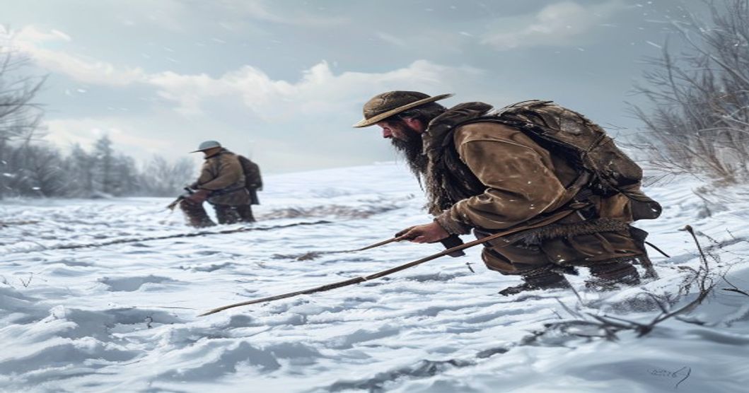
Sami hunters interpret snow tracks through a systematic evaluation of physical impressions, environmental conditions, and behavioral indicators. Track depth reveals recent activity; deep, sharply defined depressions indicate fresh passage, while collapsed or wind-scoured edges suggest older movement. Stride length and symmetry provide critical data on animal type, speed, and direction. Regular spacing points to steady walking patterns, whereas irregular gaps signal fleeing or injured individuals navigating difficult terrain.
Snow composition directly impacts track visibility. Wind-loaded surfaces create hard crusts that preserve fine details like individual toes or claw marks for extended periods. Loose powder snow obscures impressions rapidly as grains shift under thermal expansion and contraction. Hunters monitor temperature gradients throughout the day, noting how freeze-thaw cycles soften edges or merge adjacent prints into continuous furrows.
Secondary environmental cues complete the reading process. Hunters analyze multiple indicators to verify movement corridors:
- Disturbed lichen patches mark prolonged feeding stops and grazing duration.
- Broken branches and scattered scat clusters reveal group size, recent routes, and feeding behavior.
- Vegetation density shifts indicate natural windbreaks or elevation changes where prey seeks shelter.
Seasonal snowpack transformations require adaptive strategies. Winter compaction layers preserve older tracks longer, while spring thaw exposes hidden migration paths as animals transition toward open tundra or dense forest edges. Mapping techniques integrate traditional observation with spatial analysis. Hunters record compass bearings alongside topographic features to reconstruct movement corridors. Snow depth variations around rocks or tree lines indicate wind direction and storm patterns that affected the area. This methodical approach eliminates guesswork by aligning hunting routes with verified animal pathways rather than speculative searches. Mastery develops through consistent field exposure, where environmental reading becomes intuitive yet remains grounded in measurable physical evidence.
Snow Density and Temperature Gradient Analysis
Snow density fundamentally controls track preservation across Arctic terrain. Initial snowfall typically registers between 50 and 150 kilograms per cubic meter, forming a porous matrix that captures precise hoof impressions with sharp margins. As wind compaction or thermal cycling progresses, density frequently exceeds 400 kg/m³, collapsing track depth and blurring edge definition. Hunters calibrate their visual scanning by testing surface resistance against packed snow boots and identifying wind crust thickness to avoid misreading superficial impressions as genuine movement data.
Temperature gradients within the snowpack dictate metamorphism rates and structural stability. When the ground remains near zero degrees Celsius while air temperatures drop below negative twenty degrees, a steep thermal gradient forms, accelerating depth hoar development. This crystalline layer fractures unpredictably under weight, creating irregular depressions that mimic animal movement patterns but lack consistent directional markers. Experienced trackers distinguish genuine tracks by examining stride length, heel drag marks, and alignment with established migration corridors.
- Wind slabs and sastrugi alter surface resistance, generating false trails or erasing recent prints within hours.
- Thermal bridging occurs when dense ice layers conduct heat downward, softening underlying strata and causing tracks to slump rapidly.
- Metamorphic gradients shift track longevity from days to minutes during rapid warming events, demanding constant environmental reassessment.
Hunters cross-reference density readings with gradient maps to estimate track age, adjust pursuit angles, and conserve energy by selecting routes where snowpack stability supports clear visual markers. Monitoring how temperature fluctuations drive sintering or melt-freeze cycles allows trackers to predict when fine details like individual hoof fibers remain visible versus when structural collapse obscures movement history. This analytical approach replaces guesswork with measurable environmental variables, ensuring efficient tracking protocols during critical hunting windows.
Paw Print Geometry and Weight Distribution Patterns
The geometry of a paw print in snow encodes precise biomechanical data regarding an animal’s locomotion, mass transfer, and immediate physical condition. Sami trackers decode spatial arrangements of digital pads, metatarsal impressions, and claw markings to reconstruct movement sequences without visual confirmation. Each species exhibits distinct anatomical signatures. Reindeer hooves fracture under load, producing symmetrical V-shaped depressions that widen during sprint acceleration but compress into tight parallel lines at consistent velocity. Canids generate triangular dorsal pads with four forward-facing toe marks and a posterior heel impression, while mustelids leave elongated, narrow traces featuring pronounced claw scarring from sudden deceleration or digging maneuvers.
Weight distribution patterns dictate penetration depth, margin fracture, and internal compaction within the snowpack. Animals exceeding forty-five kilograms channel primary load through the metatarsal region, creating compressed central cores surrounded by granular collapse zones. Lighter species displace minimal volume, yielding shallow impressions that preserve crisp edges until thermal cycling or wind abrasion alters the crystalline matrix. Trackers evaluate pressure gradients by measuring rim elevation, powder displacement radius, and bilateral symmetry between left and right prints. Asymmetrical compression frequently indicates fatigue, joint strain, or active prey pursuit.
- Stride length relative to hip height reveals gait phase transitions from walk to trot to gallop.
- Cadence consistency correlates with metabolic demand and terrain resistance.
- Lateral drift during directional changes demonstrates weight shift mechanics and traction loss points.
Variable compression depths along a single track line signal hesitation, obstacle negotiation, or snow density fluctuations. Sami hunters cross-reference these metrics with pack hardness, temperature stratification, and recent precipitation to
Gait Cycle Recognition and Movement Direction Mapping
Understanding gait cycles in snow requires precise observation of limb placement, weight distribution, and kinetic sequencing. When an animal moves across a frozen surface, each phase of the locomotor cycle leaves a measurable imprint that reveals both species identification and behavioral intent. Sami trackers analyze stride length, diagonal versus lateral print alignment, and impression depth to determine whether the subject is walking, trotting, pacing, or galloping. The distance between consecutive prints of the same paw indicates speed, while irregular spacing often signals hesitation, injury, or environmental resistance.
Directional mapping relies on interpreting the geometric arrangement of these tracks over terrain. Hunters examine print orientation, drag lines from claws or hooves, and snow compaction gradients to establish a primary movement vector. A consistent arc pattern suggests a turning radius, whereas straight parallel lines indicate direct travel. Weight transfer is visible through deeper front impressions during acceleration phases and shallower rear prints when the animal decelerates. Tracking professionals also monitor pivot points where an animal shifts its center of gravity, often marked by disturbed snow and asymmetric print clusters.
- Stride Regularity: Consistent intervals confirm steady locomotion; irregular gaps indicate stops, turns, or environmental obstacles.
- Print Orientation: The angle of toe marks relative to the central axis reveals turning direction and pivot mechanics.
- Snow Compaction Depth: Progressive deepening along a track line signals acceleration; shallow impressions suggest deceleration or rest preparation.
- Drag & Claw Marks: Linear disturbances behind prints identify species-specific limb movement and directional momentum.
Environmental variables directly influence track preservation. Wind scouring, temperature fluctuations, and underlying terrain slope alter impression clarity, requiring hunters to cross-reference multiple data points rather than relying on isolated prints. By integrating gait analysis with topographical features such as tree lines, ridge crests, and frozen waterways, trackers can reconstruct movement corridors with high accuracy. This method eliminates guesswork and transforms scattered impressions into a continuous spatial narrative, enabling precise prediction of an animal’s path, speed adjustments, and likely stopping zones.
Wind Scouring Effects on Track Preservation
Wind scouring fundamentally alters the structural integrity of fresh snow surfaces, directly impacting how game tracks remain visible and interpretable across tundra terrain. When sustained airflow moves across a snowpack, it selectively removes loose crystals from elevated areas while depositing them in sheltered zones. This redistribution creates wind slabs with hardened crusts that quickly seal over any depressions left by hoof prints or paw impressions. A reindeer track exposed to moderate winds above twenty kilometers per hour typically loses its defining edges within two hours. The original depth diminishes as surface crystals are lifted and transported, leaving behind a smoothed depression that lacks the vertical relief necessary for accurate species identification. Hunters must recognize that wind does not merely erase tracks; it distorts their geometry. Circular impressions become elongated along the prevailing wind axis, while parallel tracks may appear to converge or diverge artificially due to asymmetric erosion patterns.
Snow density plays a critical role in degradation rates. In settled granular snow, wind removes material more slowly than in fresh powder where crystals interlock loosely. However, once a wind crust forms over a track, the sealed surface prevents further infiltration of moisture or falling snow, effectively preserving a false impression while masking the true depth beneath. Sami trackers compensate by examining the surrounding sastrugi formations and drift boundaries. These wind-carved ridges reveal the dominant airflow direction, allowing hunters to mentally reverse the scouring process and reconstruct the original track morphology. Looking at the lee side of small snowdrifts often reveals partially buried tracks that escaped total erosion. The preserved portion typically shows clearer weight distribution patterns and sharper toe or hoof outlines.
- Wind speed thresholds: Tracks above thirty centimeters deep retain structural clarity for up to six hours in sustained twenty-five kilometer per hour winds, but shallow impressions under ten centimeters vanish within ninety minutes.
- Snow crystal metamorphism: Prolonged wind exposure accelerates faceted crystal growth at the track base, creating a weak layer that eventually causes the print to collapse inward rather than erode outward.
- Directional compensation: Hunters align their reading path perpendicular to prevailing winds to capture cross-sectional profiles where wind scouring leaves steeper, more identifiable walls intact.
Tracks older than four hours rarely retain distinct edges in exposed terrain, but their residual depressions still interact with subsequent snowfall to create layered impressions that indicate movement direction. Understanding these aerodynamic interactions transforms wind scouring from an obstacle into a chronological marker.
Terrain Slope Evaluation and Surface Crust Assessment
Evaluating terrain slope and surface crust forms the foundation of accurate snow tracking in Sami hunting traditions. Gradient directly influences animal movement patterns, weight distribution, and track preservation. Steep inclines force reindeer and wolves to alter their stride length, compressing deeper into the snowpack and leaving more defined impressions. Hunters read these gradients through direct observation, compass measurements, and generational knowledge of topographic features. A gradual rise between 5 and 12 degrees typically preserves clear track lines, while slopes exceeding 30 degrees scatter prints or bury them under fresh drifts.
Surface crust assessment requires analyzing thermal cycles, wind exposure, and solar radiation. Repeated freeze-thaw cycles create layered ice structures that fracture under weight, revealing track depth and recent activity. Wind-loaded leeward slopes develop hard rind surfaces that protect underlying tracks from weathering, while sun-facing aspects undergo rapid metamorphism, softening the snowpack within hours. Hunters tap the surface with a ski pole or boot heel to test crust resistance. A sharp cracking sound indicates a thin ice layer over loose snow, signaling fresh movement. A dull thud suggests depth hoar or wind-packed slabs that mask older prints.
- Slope angle measurement: Use a clinometer or natural landmarks to determine gradient before committing to a tracking route.
- Crust thickness testing: Apply controlled pressure to identify load-bearing capacity and differentiate between wind crust, sun crust, and frost layers.
- Track preservation zones: Prioritize north-facing slopes and sheltered depressions where crust integrity remains stable across temperature fluctuations.
Combining slope data with crust analysis allows hunters to reconstruct animal trajectories. Tracks on concave terrain often pool in troughs, creating concentrated print clusters that indicate resting or feeding sites. Convex ridges expose prints to wind scouring, requiring rapid documentation before abrasion erases key details. Experienced trackers correlate crust hardness with recent weather patterns to estimate track age. A rigid surface formed during sub-zero nights preserves detailed hoof or paw impressions for up to forty-eight hours, while daytime solar warming softens the upper layer, blurring edges and complicating species identification.
Practical application demands systematic observation. Hunters move parallel to contour lines rather than ascending directly, maintaining consistent pressure on the snowpack to avoid creating misleading tracks. Crust fractures are mapped in relation to slope aspect, wind direction, and thermal exposure. This methodical approach minimizes false positives and maximizes tracking efficiency across dynamic Arctic conditions.
Vegetation Displacement and Natural Trail Markers
When snow blankets the Arctic tundra or boreal forest floor, the ground becomes a hidden canvas of subtle disturbances. Sami hunters rely heavily on vegetation displacement to decode movement patterns that would otherwise vanish beneath fresh powder. Every step compresses underlying flora, leaving behind micro-deformations that persist long after surface tracks fade. A bent willow branch at waist height indicates recent passage, while snapped twigs near ground level suggest heavier weight or faster movement. The angle and tension of displaced vegetation reveal directionality: a consistent lean points toward the path’s trajectory, whereas scattered fragments imply hesitation or circling behavior.
Vegetation displacement operates on measurable physical principles that require precise observation. Reindeer hooves fracture delicate lichen networks, creating radial cracks that expand with each passing hour. Hunters assess the degree of fragmentation to estimate time elapsed since passage. Older disturbances show weathered edges and partial snow refreezing over broken stems, whereas fresh breaks retain sharp, clean lines and remain lightly dusted. Wind exposure plays a critical role in marker preservation. Sheltered valleys retain displaced vegetation longer, while exposed ridges accelerate degradation through abrasion and sublimation.
- Branch tension analysis: Bent stems store elastic energy; sudden snaps indicate high velocity or panic responses.
- Lichen compression depth: Measured in millimeters, this metric correlates directly with animal mass and gait patterns.
- Snow bridge formation: When an animal forces its way through dense undergrowth, it creates narrow corridors that channel meltwater or catch drifting snow, guiding trackers along routes not immediately visible on the surface.
Natural trail markers also include altered drainage patterns and soil exposure. Hunters cross-reference vegetation height, species distribution, and seasonal growth cycles to contextualize findings. During spring thaws, sun-facing slopes release early moisture, causing plants to recover quickly; this accelerates marker decay, demanding faster observation. Conversely, autumn frost locks displaced flora in place, extending the tracking window by days.
Mastery of these indicators requires spatial memory and pattern recognition honed through generations of practice. Tracking is not merely about following broken stems but reading the landscape’s layered history. Each displaced branch, crushed moss patch, and shifted snow bridge contributes to a continuous narrative of movement, weight distribution, and behavioral intent.
Historical Reindeer Herding Methods and Cultural Context
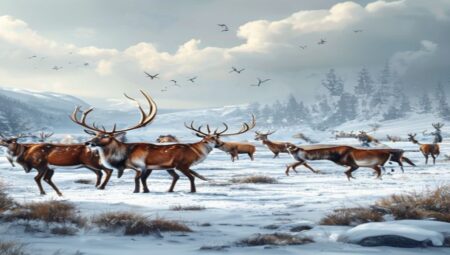
The ancestral practices of reindeer herding among the Sámi people established a foundational framework for interpreting snow-covered landscapes long before modern tracking techniques emerged. Generations of pastoralists developed sophisticated observational systems tied to seasonal migration routes known as siida territories, where herd movement followed precise ecological cues rather than arbitrary boundaries. Track analysis became an extension of daily herding routines, requiring hunters and herders to distinguish between individual animals based on stride length, weight distribution, and the angle of hoof impressions left in varying snow densities.
- Snow depth and compaction levels dictated how much pressure each reindeer exerted, allowing experienced readers to identify age groups, health status, and whether an animal was walking, trotting, or galloping.
- Historical camp layouts relied on wind direction and terrain features to minimize track disturbance, which meant that herders learned to read residual impressions from previous days when fresh signs were obscured by blowing snow.
- Vocal call sequences and rhythmic drumming patterns used during drives created auditory markers that correlated with visual trail data, enabling coordinated navigation across frozen plateaus and dense boreal forests.
- Traditional grooming techniques like antler brushing and ear tagging left physical identifiers that herders cross-referenced with track patterns to monitor herd composition without breaking camp.
Cultural transmission of these techniques occurred through direct mentorship rather than written documentation. Elders taught younger herders how to interpret crust formation, ice layering, and vegetation exposure patterns left by wandering reindeer. The relationship between human movement and animal behavior remained deeply reciprocal, with tracking skills serving both practical survival needs and spiritual frameworks tied to land stewardship. Archaeological evidence from pre-Christian Sámi sites shows deliberate placement of tracking stones and bone markers along migration corridors, confirming that systematic observation was institutionalized centuries ago. Modern ecological studies continue to validate these traditional methods, demonstrating that historical reindeer herding practices encoded precise environmental literacy essential for surviving subarctic conditions. Herders utilized natural landmarks like lichen-covered boulders and frozen riverbeds as reference points, creating mental cartographies that aligned track interpretation with topographical memory.
Essential Arctic Tracking Equipment and Tools
Sami hunters rely on a carefully curated set of tools to navigate frozen terrain and interpret subtle snow formations. Traditional equipment forms the foundation of their tracking methodology. The ski remains indispensable, with its waxed base reducing friction and allowing silent movement across hard-packed snow. Trackers often carry a specialized track rod, a slender wooden or carbon-fiber pole used to probe depth, test crust stability, and mark recent animal passages without disturbing the surface. For detailed observation, a compact magnifying glass with anti-fog coating helps examine hair fragments, claw marks, and pellet composition embedded in the snowpack.
Modern adaptations complement these traditional items. A ruggedized GPS device with offline topographic maps provides spatial context, while a durable compass remains critical when battery power fails in sub-zero conditions. Hunters also carry a lightweight snow shovel for clearing observation pits, revealing stratified layers that indicate travel dates and weather patterns. Insulated gloves with touch-compatible fingertips allow quick note-taking on a waterproof field journal, documenting track dimensions, gait patterns, and directional shifts.
- Cold-Rated Optical Gear: Polarized lenses reduce glare from fresh powder, while macro capabilities capture micro-impressions left by cloven hooves or padded paws.
- Stratigraphy Probes: Weighted metal rods measure snow density gradients, helping trackers calculate the age of a trail based on crust formation and wind drift patterns.
- Field Preservation Kits: Airtight sample bags and desiccant packets protect collected hair, dung, or broken twigs from moisture degradation during transport back to camp.
Safety and durability dictate material choices. All gear must withstand temperatures below minus thirty degrees Celsius without becoming brittle or losing functionality. Carbon-fiber poles resist snapping under pressure, while titanium carabiners prevent cold-induced joint freezing. Waterproof containers protect optical instruments and electronic devices from moisture intrusion during rapid temperature fluctuations. The integration of time-tested Sami craftsmanship with contemporary cold-weather engineering ensures reliable performance in extreme environments where precision determines success.
Maintenance routines directly impact tracking accuracy. Waxing skis with region-specific compounds prevents ice buildup that obscures track impressions. Regular cleaning of optical lenses with microfiber cloths removes frost residue that compromises detail analysis. Lubricating moving parts on folding tools with cold-rated grease ensures smooth operation during prolonged field use. Hunters also pack a multi-tool featuring serrated edges for processing hide samples and sharpening tracking rods when tips become worn. Each piece of equipment serves a distinct function within the broader observational framework, transforming raw environmental data into actionable intelligence. Understanding how these tools interact with snow physics allows trackers to extract maximum information from minimal surface disturbances, maintaining a critical advantage in Arctic wildlife navigation.
Step-by-Step Field Assessment Protocol
Initial field assessment begins with a systematic scan of the snowpack to identify surface disturbances against natural wind crust formations. Hunters first distinguish between fresh impressions and older tracks by examining edge definition, crystal structure integrity, and secondary melt-refreeze cycles. The primary objective is isolating target species prints through morphological analysis of hoof or paw geometry, stride length, and gall width.
- Print Classification: Measure the diameter of the central pad and outer cloven hooves. Reindeer tracks typically span 8 to 12 centimeters with distinct dewclaw impressions. Moose prints exceed 15 centimeters and display a pronounced V-shaped split. Secondary species like arctic foxes or wolverines leave smaller, asymmetrical patterns with visible claw striations.
- Movement Dynamics: Calculate stride length from heel to heel impressions. Shortened strides indicate caution, heavy load carriage, or uneven terrain navigation. Regular stride intervals suggest steady locomotion, while erratic spacing reveals evasion behavior or group dispersal. Gall measurements between parallel tracks determine lateral spacing within a herd or individual gait deviations.
- Environmental Cross-Referencing: Correlate track placement with micro-topography, prevailing wind direction, and recent precipitation layers. Snow drift patterns often mask older prints while preserving fresh impressions on leeward slopes. Vegetation compression depth and bark stripping height provide supplementary data regarding animal age, sex, and feeding duration.
- Freshness Verification: Assess track degradation through granular recrystallization rates, riming formation, and edge erosion. Fresh prints maintain sharp margins and retain original snow density within the impression cavity. Temperature fluctuations above freezing accelerate structural collapse, while subzero conditions preserve print fidelity for extended periods.
Field practitioners compile these observations into a sequential spatial map, noting directional shifts, feeding pauses, and terrain transitions. This data directly informs approach vectors, wind-relative positioning, and anticipated animal movement corridors. Continuous tracking requires recalibration of stride expectations based on snow depth variations, crust thickness, and underlying ground contour changes.
Common Misinterpretations and Error Correction Techniques
Novice observers routinely confuse wind-etched snow ridges with actual animal movement, creating false trails that consume valuable time and energy. Sami trackers resolve this by analyzing stride consistency, drag lines, and the compression angle of surrounding snowpack rather than relying on isolated impressions. Beginners also frequently assume larger tracks always indicate a mature male, ignoring how seasonal nutrition directly alters hoof imprint depth and spacing. A reindeer navigating deep powder leaves elongated, widely spaced prints compared to one moving across wind-compact crust. Another frequent error involves neglecting micro-topography; experienced hunters read how tracks interact with leeward slopes, frozen vegetation stems, and buried branch networks instead of treating the snow surface as a flat canvas.
- Wind Direction Verification: Trackers establish prevailing wind patterns using lichen orientation and snow drift alignment, then cross-reference this data with track trajectory to confirm natural movement versus weather distortion.
- Snowpack Density Probing: Using a reinforced antler staff, hunters measure compression gradients to determine whether impressions formed before or after freeze-thaw cycles, revealing the true timeline of animal passage.
- Behavioral Marker Analysis: Observers document pause points, grazing depressions, and sudden directional shifts that indicate predator proximity, herd coordination, or seasonal route changes.
- Corroborative Evidence Collection: When uncertainty arises, hunters backtrack along the suspected route to locate droppings, disturbed vegetation, or secondary tracks from accompanying animals before committing to a pursuit path.
Generational migration maps stored in oral tradition provide critical baseline data for comparison. Hunters overlay current observations against historical movement corridors, adjusting their reading techniques for variations in snow density, temperature fluctuations, and herd composition. Regular field calibration with elders ensures that subtle distinctions in hoof shape, ear positioning, and tail drag are recorded accurately. This systematic verification process eliminates guesswork, prevents costly detours, and maintains sustainable harvesting practices by confirming animal health status and route viability before engagement.
Ethical Considerations in Modern Snow Tracking
Modern snow tracking operates at the intersection of ancestral knowledge and contemporary conservation ethics. Practitioners must navigate a complex framework that prioritizes ecological integrity while respecting indigenous land stewardship protocols. The primary ethical obligation involves minimizing wildlife disturbance thresholds during track documentation. Approaching animal trails requires calculated distance maintenance to prevent stress responses in species such as reindeer, arctic foxes, or wolverines. Noise discipline and wind direction awareness become non-negotiable standards rather than optional techniques. Track preservation also demands strict adherence to leave-no-trace principles, ensuring that snow surface modifications do not alter microhabitats or compromise subsequent biological readings.
Cultural sovereignty remains a foundational pillar of ethical tracking practices. Indigenous hunters historically developed track-reading methodologies through centuries of environmental reciprocity. Contemporary practitioners must acknowledge these origins and avoid commodifying sacred knowledge without explicit community consent. Collaborative frameworks that integrate traditional ecological knowledge with modern GPS mapping require transparent benefit-sharing agreements and clear intellectual property boundaries. Unauthorized commercial exploitation of indigenous tracking routes violates both ethical guidelines and emerging data protection regulations.
- Wildlife Interaction Protocols: Maintain minimum approach distances during active tracking periods. Avoid altering snow structures that serve as temporary denning sites or migration corridors.
- Data Transparency Standards: Publish generalized track coordinates rather than precise geolocations to prevent poaching pressure and habitat degradation.
- Regulatory Alignment: Cross-reference local wildlife protection statutes with traditional hunting rights to ensure compliance across jurisdictional boundaries.
- Educational Integrity: Attribute knowledge sources explicitly. Distinguish between verified indigenous practices and speculative modern interpretations in all published materials.
Technological integration introduces additional ethical layers. Drone surveillance, camera traps, and AI-assisted pattern recognition must operate within legally defined airspace and wildlife protection zones. Automated tracking algorithms should never replace human observational judgment, particularly when assessing animal welfare indicators or weather-related track degradation. Ethical practitioners continuously audit their methodologies against peer-reviewed conservation studies and adjust field protocols accordingly. The discipline ultimately demands humility, recognizing that snow serves as a temporary archive rather than a resource to be extracted or controlled.
Preserving Indigenous Knowledge for Future Generations
The capacity to interpret snow tracks operates as a dynamic cognitive system rather than a fixed set of rules. Sami hunters transmit this traditional ecological knowledge through sustained immersion in winter landscapes. Elders guide learners across frozen terrain, emphasizing real-time observation of track depth, edge fragmentation, and wind drift patterns. Each species leaves distinct pressure markers on ice crusts, while reindeer herds display behavioral signatures that predict movement corridors. This transmission occurs primarily through shared field experience, where verbal instruction merges with tactile feedback and environmental context.
Preservation frameworks prioritize adaptive documentation strategies that respect the relational nature of landscape knowledge. Community archives now integrate geotagged video analysis of track formations with audio recordings of elder narratives. These resources function as living reference systems rather than static repositories. Mentorship programs pair younger generations with veteran trackers during active hunting seasons, ensuring theoretical understanding remains grounded in seasonal reality. Educational institutions incorporate land-based modules where students practice identifying species trajectories, assessing snowpack stability, and forecasting microclimate shifts through natural indicators.
Climate volatility introduces unprecedented challenges to knowledge continuity. Warmer temperatures and irregular freeze-thaw cycles disrupt historical track preservation patterns, forcing communities to develop observational flexibility while maintaining core interpretive principles. Preservation efforts now emphasize the following structural components:
- Intergenerational funding models that sustain year-round mentorship programs across remote settlements
- Digital mapping integration that tracks microclimate variations without replacing direct field engagement
- Epistemological alignment ensuring documentation methods reflect Sami relational frameworks rather than detached academic extraction
- Institutional recognition of traditional tracking as a living scientific discipline requiring continuous adaptation
Long-term viability depends on balancing technological augmentation with land-based pedagogy, guaranteeing that future practitioners inherit both analytical precision and cultural continuity.
Frequently Asked Questions
What is How Sami Hunters Read Tracks in Snow?
This refers to the traditional and highly specialized skill of Sámi reindeer herders who interpret animal tracks, snow conditions, wind patterns, and subtle environmental cues to locate prey or navigate terrain during winter months. It relies on generations of indigenous knowledge passed down through families and community practice.
Key facts about How Sami Hunters Read Tracks in Snow
Sámi hunters use track size, stride length, direction, and snow depth to determine the species, age, speed, and recent activity of animals. They also read wind drifts, ice layers, and vegetation traces hidden under fresh snow. This knowledge is deeply tied to Sámi culture, sustainable hunting practices, and Arctic survival techniques that have been recognized as part of UNESCO intangible cultural heritage.