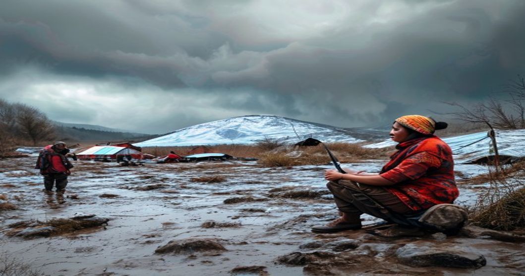
How Sami Communities Anticipate Weather Shifts
Sami weather forecasting relies on centuries-old observational frameworks deeply integrated with reindeer husbandry and Arctic survival strategies. Rather than depending on modern meteorological instruments, practitioners analyze microclimatic shifts through direct environmental engagement. The methodology operates on a continuous feedback loop between human activity, animal behavior, and atmospheric changes across tundra and forest-tundra ecosystems.
Snow structure provides critical data regarding upcoming temperature fluctuations and precipitation events. Experienced herders examine snow depth, crust formation, and wind-drift patterns to predict storm trajectories. A sudden increase in ice layers beneath the surface typically signals an approaching warm front that will melt existing cover before refreezing into hazardous sastrugi. Observing how snow settles around vegetation reveals prevailing wind directions and intensity, allowing communities to adjust grazing routes days before visible weather changes occur.
- Reindeer herd dynamics serve as highly reliable biological indicators. When animals begin clustering in specific wind-protected valleys or altering their feeding patterns, it often precedes rapid barometric drops.
- Avalanche risk assessment depends on tracking new snow accumulation rates and temperature gradients within the snowpack, preventing catastrophic losses during sudden thaw cycles.
- Cloud morphology and solar halos indicate moisture density and pressure systems. Clear skies with a pronounced halo frequently signal approaching low-pressure zones within twenty-four hours.
Bird migration timing, particularly the movement of ptarmigan and waterfowl, correlates strongly with seasonal transitions. Wind behavior around mountain ridges offers additional predictive value; sudden stillness followed by localized gusts often marks the passage of a cold front. River ice thickness and acoustic patterns during freezing periods indicate rapid temperature drops, while seasonal katabatic winds reveal moisture availability for coming months. These observational techniques remain actively deployed across Sápmi regions, particularly during calving seasons and winter pastures where mobile communication networks may be unreliable. The knowledge is transmitted through intergenerational field instruction rather than written documentation, preserving highly localized atmospheric literacy. Contemporary researchers increasingly validate these traditional methods against satellite data, confirming their accuracy in short-term Arctic weather prediction. Integration of indigenous meteorological practices with modern forecasting models enhances resilience against rapid climatic variability in northern latitudes.
Core Framework of Sámi Traditional Ecological Knowledge
The Sámi weather anticipation system relies on a multilayered observational methodology passed through oral transmission and direct environmental interaction. Central to this framework is the continuous monitoring of atmospheric pressure shifts, wind patterns, and snow crystal morphology. Practitioners analyze the density and grain structure of fresh snowfall to determine upcoming temperature fluctuations. Ice thickness along riverbanks, combined with the acoustic resonance of freezing water, provides early indicators of seasonal transitions. Animal behavior serves as a critical secondary dataset. Reindeer antler positioning, migratory timing deviations, and avian flight altitudes are cross-referenced against historical records maintained within family lineages.
- Atmospheric layering: Practitioners track cloud formation speed and color gradients to map upper-level wind currents before surface pressure drops.
- Snowpack stratigraphy: Core samples reveal temperature history through ice lens distribution and wind-slab compression patterns.
- Hydrological acoustics: Freezing river edges produce distinct acoustic frequencies that signal imminent freeze-thaw cycles.
- Vernacular meteorology: Over sixty precise dialect terms encode wind direction, humidity levels, and temperature thresholds into a single lexical unit.
This linguistic precision functions as a data compression system, allowing rapid interpretation of complex atmospheric states. Knowledge transmission occurs through structured apprenticeship rather than formal education. Elders guide younger members during actual weather events, emphasizing pattern recognition over memorization. Field practice replaces theoretical study, ensuring immediate applicability and error correction. The framework operates on a cyclical feedback mechanism where observed outcomes validate or adjust future predictions. Community consensus validates predictive accuracy across generations, maintaining system reliability without institutional oversight. Modern validation studies confirm that Sámi indicators correlate strongly with microclimate variations in Arctic and subarctic regions. The methodology integrates geomorphology, hydrology, and atmospheric science into a unified observational protocol. This synthesis enables accurate forecasting within localized terrain features where satellite data lacks resolution. The framework remains active because it prioritizes empirical verification over abstract modeling, creating a self-correcting knowledge ecosystem optimized for rapid environmental change.
Analyzing Snow Crystallization and Wind Drift Patterns
The structural evolution of snow during formation provides precise atmospheric data that Sami weather forecasters interpret with remarkable accuracy. When temperatures drop below freezing while moisture remains abundant, dendritic crystals form rapidly, signaling stable high-pressure systems over the tundra. Conversely, the presence of needle-like or hollow-column formations indicates subsiding air masses and impending temperature fluctuations. Herders distinguish between fresh precipitation and wind-compacted layers by examining crystal bonding density under direct sunlight. Depth hoar, characterized by large cup-shaped grains formed through steep temperature gradients within the snowpack, serves as an early warning for structural instability and rapid warming trends that disrupt traditional migration schedules.
- Crystal Morphology Tracking: Observers document shape transitions from plates to rounded granules, which directly correlate with relative humidity shifts and approaching frontal boundaries.
- Sastrugi Orientation Mapping: Parallel ridges aligned perpendicular to prevailing winds indicate sustained aloft currents that will intensify surface gales within twelve to twenty-four hours.
- Leverage Point Identification: Wind drift creates natural snow bridges over ravines and exposes rock surfaces on leeward slopes, helping locate sheltered grazing areas before blizzard conditions reduce visibility.
Forecasting accuracy depends on recognizing threshold values in both crystal density and drift velocity. When wind shear strips
Interpreting Reindeer Foraging Routes as Atmospheric Barometers
Reindeer possess physiological adaptations that allow them to detect microclimatic variations long before they become visible to human observers. Their nervous systems respond rapidly to barometric pressure drops, wind shear, and humidity shifts, triggering immediate adjustments in grazing behavior. When atmospheric conditions deteriorate, the animals instinctively alter their movement corridors, seeking terrain that offers shelter or exposes nutrient-dense forage.
The Sami monitor these behavioral markers by tracking hoof impressions, trail depth, and feeding site selection across vast tundra landscapes. A sudden reduction in trail frequency along established valleys typically indicates an approaching pressure front. Conversely, the appearance of fresh tracks on exposed ridges suggests wind scouring has removed surface snow, revealing underlying lichen beds that only remain accessible during stable high-pressure periods.
- Snow Density Correlation: Reindeer avoid areas where wind-drifted snow exceeds forty centimeters, as the animals cannot break through the crust without expending lethal energy reserves. Their avoidance patterns map subsurface ice formation, which precedes freezing rain events by hours.
- Vegetation Response Timing: The timing of lichen exposure directly reflects wind direction and velocity changes. Sudden shifts in foraging concentration toward sheltered depressions signal incoming low-pressure systems that will soon bring precipitation or temperature inversion layers.
- Spatial Aggregation Patterns: When herds cluster tightly in specific micro-topographies, the Sami interpret this as a pre-storm behavioral response. The animals seek terrain that minimizes wind chill and preserves caloric intake during atmospheric instability.
- Trail Depth Variation: Consistent hoof penetration depth indicates snowpack stability. Rapid deepening of tracks within a twenty-four-hour window signals moisture infiltration and impending crust formation, allowing the Sami to redirect herds before pasture becomes inaccessible.
The correlation between trail density and atmospheric pressure gradients operates through direct physiological feedback loops. Reindeer hoof sensitivity detects ground temperature fluctuations that precede air mass changes. This tactile data combines with olfactory cues from wind-borne particulate matter, creating a multi-sensory weather prediction model. The Sami decode these signals by cross-referencing current foraging paths with historical pressure patterns, establishing reliable predictive thresholds for each regional microclimate. Modern meteorological validation confirms that reindeer movement corridors often align with pressure gradient shifts twelve to twenty-four hours ahead of official atmospheric readings. This generational knowledge transforms animal foraging behavior into a precise, land-based forecasting mechanism.
Mapping Glacial Melt Cycles and River Flow Indicators
The Sami people have historically relied on precise environmental observations to navigate the Arctic and subarctic landscapes. One critical method involves tracking glacial melt cycles, which serve as natural barometers for seasonal temperature fluctuations. By monitoring the timing of snowline retreat, ice thickness reduction, and the emergence of proglacial lakes, communities can forecast spring thaw patterns and summer precipitation trends. Glacial mass balance data, though traditionally gathered through visual assessment rather than satellite telemetry, reveals how atmospheric pressure systems interact with regional climate zones.
River flow indicators complement glacial monitoring by providing real-time hydrological feedback. Sami herders and hunters observe water clarity, current velocity, and suspended sediment load to determine meltwater volume and upstream precipitation levels. Turbid flows typically signal rapid snowmelt or heavy rainfall events, while clear, steady currents indicate stable atmospheric conditions. These observations are cross-referenced with historical knowledge passed down through generations, allowing for highly localized weather predictions that modern meteorological stations often miss due to sparse data collection in remote terrains.
Mapping these hydrological patterns requires systematic documentation of water levels, ice break-up dates, and floodplain saturation. Traditional Sami practitioners record seasonal milestones on birch bark, reindeer antlers, or later, paper charts, creating visual timelines that correlate glacial retreat with river discharge rates. When meltwater peaks align with specific wind patterns or aurora activity, it reinforces predictive models for storm development or prolonged dry spells.
- Meltwater Discharge Timing: Early peak flows indicate accelerated warming, prompting earlier livestock relocation.
- Sediment Color Grading: Gray to brown water shifts suggest upstream glacier exposure, while white or clear flows denote snowpack stability.
- Floodplain Saturation Markers: Moss growth depth and tree line inundation zones serve as baseline references for annual hydrological comparison.
This integrative approach enables early adjustments to migration routes, fishing schedules, and settlement locations, minimizing exposure to sudden climate volatility. The synergy between empirical field observation and intergenerational data accumulation forms a resilient forecasting framework that adapts to shifting Arctic conditions without relying on external technological infrastructure.
Decoding Storm Formation Through Sámi Oral Meteorological Lore
The Sámi understanding of storm development relies on centuries of systematic environmental observation encoded in generational oral transmission. Rather than relying on isolated indicators, traditional practitioners synthesize atmospheric, biological, and acoustic signals to forecast cyclonic activity across the Arctic tundra. Central to this practice is the recognition of pre-storm barometric shifts, which manifest through subtle changes in air density and temperature gradients. Elders monitor how moisture accumulates on reindeer antlers before precipitation, noting that heavy dew or frost patterns often precede frontal systems by twelve to twenty-four hours.
Animal behavior serves as a critical diagnostic tool within this knowledge system. Reindeer herds instinctively migrate toward elevated terrain or leeward slopes when atmospheric pressure drops rapidly. Herders track these movements alongside avian responses, particularly the sudden silence of ground-nesting birds and the low-altitude flight patterns of Arctic terns, which indicate approaching wind shear. Aquatic indicators remain equally precise; Sámi fishers observe how surface tension breaks on fjords and lakes, with rapid ripple formation signaling strong upper-level divergence and imminent gale conditions.
- Cloud Architecture: Cumulonimbus towers develop along thermal boundaries where warm maritime air collides with cold continental masses. Practitioners identify the anvil-shaped tops and dark, rolling bases as definitive markers of severe storm development.
- Auditory Forecasts: Distant thunder travels differently across frozen versus thawed terrain. Acoustic reflections off ice fields allow experienced listeners to calculate storm distance and trajectory within minutes.
- Wind Signatures: The Sámi distinguish between katabatic drainage winds and synoptic frontal gusts by analyzing turbulence patterns through snow drift formation and vegetation displacement.
This oral meteorological framework operates as a dynamic forecasting model, integrating real-time ecological feedback with historical climate baselines. Modern atmospheric science validates many of these empirical observations, particularly regarding pressure-induced physiological responses in both humans and wildlife. The continuity of this knowledge ensures that Arctic communities maintain operational resilience against increasingly volatile weather patterns, preserving predictive accuracy where satellite data often lacks ground-truth validation.
Spring Thaw Detection Using Antler Scrape Markings
Reindeer antler scrapes function as highly calibrated environmental sensors embedded within the boreal landscape. When male reindeer shed their winter antlers during early spring, they strip bark from trees at heights that directly correspond to the remaining snowpack depth. Sámi herders track these vertical markers to calculate melt progression with remarkable precision. The upper boundary of each scrape indicates where heavy snow pressure previously compressed against tree trunks. As temperatures rise and radiation intensifies, the exposed wood begins to desiccate at a measurable rate. Herders compare fresh stripping patterns against historical baseline trees to determine whether the thaw follows typical diurnal freeze-thaw cycles or deviates into rapid melt events.
- Scrape elevation relative to lichen beds: Markings positioned above traditional reindeer grazing zones signal accelerated upper-snowpack melting and earlier ground exposure.
- Bark fracture patterns: Shattered, fibrous bark indicates prolonged moisture retention and delayed thaw, while clean peeling suggests dry air mass incursions and faster temperature ascent.
- Moss compression response: Flattened cushion moss around the scrape base demonstrates recent snow ablation and immediate soil warming potential.
- Tree species differential: Scots pine retains antler marks longer than birch due to bark thickness variations, allowing herders to cross-verify melt timelines across mixed forests.
This observational framework eliminates reliance on remote sensing delays or meteorological station gaps located far from grazing corridors. By mapping scrape networks across multiple drainage basins, communities forecast pasture accessibility windows with three-to-five-day accuracy. The data directly governs reindeer drive routes, calving ground selection, and risk avoidance during fragile ice crust formation. Traditional practitioners record these indicators through generational memory rather than digital logging, yet the underlying methodology aligns with modern cryospheric phenology tracking. Each antler mark represents a localized climate reading that integrates solar angle, wind direction, humidity levels, and antecedent temperature anomalies into a single visual datum. Herders also monitor sap flow initiation beneath stripped bark as a secondary validation metric for soil temperature thresholds. This granular tracking reduces reliance on institutional weather forecasts that often miss microclimatic shifts specific to high-altitude pastures.
Summer Thunderstorm Prediction via Cumulonimbus Structure Analysis
The Sámi weather forecasting tradition relies on meticulous observation of convective cloud morphology during the brief Arctic summer months. When atmospheric instability reaches critical thresholds, cumulonimbus formations develop with distinct structural characteristics that seasoned herders interpret as precise meteorological signals. The base elevation serves as the primary indicator; clouds hovering below eight thousand feet typically signal imminent precipitation within two hours, while higher development suggests prolonged dry intervals despite surface moisture.
Vertical texture analysis remains central to traditional assessment. A tightly packed cauliflower structure with rapid upward movement indicates strong updrafts capable of sustaining heavy rainfall or hail. The Sámi track the transition from soft, fibrous edges to sharp, defined margins as a reliable marker for storm intensification. Greenish or yellowish tints along the cloud base frequently denote large hydrometeors aloft, prompting immediate relocation of livestock to elevated terrain before flash flooding occurs.
- Anvil Symmetry and Spread: Asymmetric spreading toward the northeast indicates wind shear patterns that may produce damaging downdrafts, while uniform radial expansion suggests stable storm progression with predictable rainfall distribution.
- Base Coloration Gradients: Deep charcoal or purple undertones reveal dense water content and high electrical activity, signaling severe lightning risk. Bright gray bases correlate with lighter precipitation that rarely impacts grazing routes.
- Debris Cloud Behavior: Low-hanging ragged clouds forming beneath the main structure indicate rain shafts reaching the ground. Their speed and direction allow herders to calculate storm movement velocity and adjust herd trajectories accordingly.
Acoustic monitoring complements visual analysis in traditional practice. The interval between lightning flash and thunder reception provides distance estimation, while echo patterns across mountain ridges reveal storm layering and atmospheric temperature gradients. Reindeer behavioral shifts often precede structural cloud changes by forty to sixty minutes, offering an additional biological confirmation layer. This integrated observational framework enables precise micro-weather forecasting without modern instrumentation, preserving ecological adaptation strategies refined across generations.
Autumn Freeze Preparation Through Lichen Stress Signals
Lichens function as highly sensitive poikilohydric organisms, meaning their physiological state shifts instantly alongside ambient moisture and temperature fluctuations. In subarctic pastures, reindeer herders monitor specific Cladonia species to detect microclimatic transitions that precede seasonal freeze events. When autumn air temperatures drop below critical thresholds, lichen thalli undergo measurable stress responses. The primary indicator involves a transition from pliable, hydrated tissue to rigid, desiccated structures. This change occurs because lichens lack internal water regulation; their metabolic activity halts rapidly as ambient humidity falls and nighttime frost potential increases.
- Thallus rigidity: Healthy autumn lichen bends without fracturing. Impending freeze conditions cause cellular dehydration, resulting in a brittle texture that snaps under minimal pressure.
- Surface coloration shifts: Normal grey-green pigmentation darkens or develops a pale, waxy crust as the photobiont layer reduces chlorophyll production and accumulates stress metabolites like usnic acid.
- Moisture retention capacity: Lichen beds that rapidly lose dew within two hours of dawn indicate declining atmospheric saturation, signaling clear skies and radiative cooling patterns typical of pre-freeze nights.
Sami pastoralists translate these botanical signals into precise livelihood adjustments. Herding groups relocate reindeer herds away from exposed ridge lines where frost accumulates faster, moving them toward sheltered valleys with thermal buffering from snow retention and wind disruption. Fodder storage protocols activate simultaneously, ensuring supplemental nutrition when lichen beds become inaccessible beneath hardening snow crusts. Traditional knowledge systems track these indicators across generational observation cycles, correlating lichen stress onset with historical ground-frost records to refine migration timelines.
Modern phenological research validates these observational markers. Controlled microclimate studies demonstrate that lichen desiccation rates align precisely with radiation frost formation windows in northern latitudes. Integrating hyperlocal bioindicators with satellite-derived soil temperature models creates a dual-layer forecasting framework. This approach compensates for sparse weather station networks across Sápmi, delivering actionable data for reindeer welfare, pasture rotation scheduling, and infrastructure reinforcement before winter conditions solidify.
Winter Visibility Assessment and Katabatic Wind Tracking Methods
Sami weather forecasting during winter months depends on systematic visual calibration against polar twilight conditions. Practitioners analyze snow surface albedo shifts, noting how granular metamorphism alters light reflection before precipitation events. A sudden drop in horizon contrast signals approaching moisture fronts, while persistent blue-white crystalline structures indicate stable high-pressure systems. Observers track atmospheric refraction patterns across frozen lake surfaces to detect pressure gradients that precede rapid temperature drops.
- Snow Crystal Density Mapping: Manual sampling reveals grain size progression from depth hoar to rounded corn, directly correlating with upcoming wind velocity and storm severity.
- Horizon Diffraction Analysis: Displacement of distant mountain silhouettes against the sky dome indicates moisture density at altitude, allowing prediction of whiteout conditions up to twelve hours in advance.
- Ice Acoustics Monitoring: Cracking frequencies on frozen rivers reveal subsurface thermal currents. Rapid expansion sounds precede katabatic surges that drop valley temperatures by fifteen degrees within ninety minutes.
Katabatic wind detection requires multi-sensory triangulation across topographic depressions. Herders monitor frost flower formation on reindeer lichen, noting how crystalline patterns shift from radial to linear as dense cold air masses slide down slopes. Wind scour marks on bedrock outcrops expose stratified snow layers that document historical flow directions. When these exposed strata show abrupt density changes, practitioners adjust grazing routes to avoid sudden ice sheet formation over pasture zones. Temperature inversion layers become visible through steam rising from unfrozen springs, creating distinct thermal boundaries that guide movement planning.
- Valley Floor Thermal Mapping: Frost progression rates across different elevations reveal katabatic acceleration points. Faster freezing on north-facing slopes indicates channelized cold air drainage ahead of frontal systems.
- Avalanche Snowpack Response: Surface wave patterns on leeward slopes mirror subsurface wind loading. Irregular snowdrift formations signal turbulent airflow that will compromise visibility during subsequent storms.
Modern Integration of Indigenous Weather Observation Systems
Sami weather forecasting relies on centuries of environmental calibration, now converging with computational meteorology through structured technological frameworks. Traditional indicators such as cloud formations, snow crystal density, wind direction against mountain ridges, and animal behavior patterns serve as ground-truth validation for satellite-derived atmospheric models. Researchers and herders co-develop mobile applications that map microclimate variations across reindeer grazing corridors. These platforms ingest real-time telemetry from soil moisture probes and anemometers deployed in seasonal pastures, cross-referencing the data with historical ecological memory recorded by elder knowledge holders.
- Geospatial Overlay Mapping: Digital elevation models are layered with traditional grazing routes to predict wind chill exposure and snow drift patterns across topographical features.
- Calibration Protocols: Indigenous phenological markers adjust algorithmic thresholds in automated weather stations, reducing false positives during rapid Arctic temperature fluctuations.
- Participatory Data Architecture: Community-led servers store localized observations under sovereign data frameworks, preventing external extraction while enabling cross-regional climate modeling.
Implementation requires rigorous standardization without erasing contextual nuance. Weather stations positioned along migration corridors transmit data via low-orbit satellite networks to central dashboards accessible through encrypted community interfaces. Machine learning classifiers trained on verified traditional observations improve short-term prediction accuracy for sudden blizzard onset and ice crust formation. Herders receive route optimization alerts that factor in both algorithmic forecasts and real-time field assessments from neighboring camps.
Sustained integration depends on institutional frameworks that recognize epistemic parity between scientific meteorology and Sámi environmental science. Funding mechanisms now prioritize co-authorship models where indigenous researchers lead data interpretation phases. Academic institutions provide computational resources while community councils retain decision-making authority over observation frequency, sensor placement, and knowledge dissemination boundaries.
The convergence of algorithmic forecasting and ancestral atmospheric literacy produces adaptive management strategies capable of addressing accelerated Arctic warming. Continuous feedback loops between field practitioners and data scientists refine predictive accuracy across seasonal transition periods. This methodology establishes a replicable template for other indigenous groups navigating climate volatility while maintaining ecological sovereignty.
Cross-Referencing Sámi Predictions with Satellite Meteorology Data
Indigenous Sámi weather forecasting relies on generations of hyper-local environmental observation, tracking wind direction patterns, cloud stratification, animal migration timing, snow crust density, and aurora intensity. Modern meteorology depends on satellite imagery, radar networks, and atmospheric modeling algorithms. Bridging these distinct systems requires systematic data mapping rather than direct substitution. Researchers overlay historical Sámi observational logs with MODIS and Sentinel satellite datasets to identify correlations between traditional indicators and measurable atmospheric phenomena. Specific cloud layering patterns documented across northern Fennoscandia frequently precede pressure drops detectable by geostationary satellites. The validation process demands temporal alignment of indigenous reports with meteorological station records and orbital passes. This integration functions as a ground-truthing mechanism for microclimate variations that coarse satellite resolution routinely overlooks. Sámi indicators excel at detecting rapid localized shifts, including sudden katabatic winds or early freeze-thaw cycles, which often fall below the sensitivity threshold of automated weather stations. Cross-referencing methodology employs coordinate-matched data points to verify predictive accuracy against orbital telemetry.
- Spatiotemporal Mapping: Aligning oral forecasts with precise satellite overpass timestamps to verify predictive accuracy across seasonal transitions.
- Microclimate Calibration: Using traditional snowpack assessments to correct thermal imaging data in areas where topography creates localized temperature inversion zones.
- Behavioral Correlation: Cross-checking animal movement patterns recorded by herders against atmospheric moisture sensors and wind shear metrics.
Collaborative frameworks between Sámi knowledge holders and meteorological institutes utilize shared geographic information systems to quantify predictive reliability. This methodological convergence enhances regional forecasting models by incorporating hyper-localized ecological feedback loops that satellite algorithms typically filter as statistical noise. The process demands rigorous documentation protocols to translate qualitative observations into quantifiable metrics without stripping cultural context or historical continuity. When paired with high-resolution atmospheric moisture sensors, traditional forecasts reveal consistent patterns regarding snowpack stability and wind drift formation long before automated systems register significant changes. This symbiotic approach strengthens Arctic and subarctic prediction architectures by combining orbital data infrastructure with centuries of adaptive environmental literacy.
Community-Led Early Warning Networks for Extreme Precipitation Events
Sami communities across northern Scandinavia and the Kola Peninsula have engineered decentralized alert systems that bridge indigenous observational practices with modern hydrological monitoring. These networks operate through localized coordination hubs where trained community members track precipitation patterns, soil saturation levels, and rapid snowmelt indicators. Traditional ecological knowledge serves as the foundational layer, with elders mapping historical flood routes and identifying terrain features that accelerate water accumulation. Modern telemetry sensors complement this data by transmitting real-time rainfall intensity and river discharge metrics to regional dispatch centers.
The operational framework relies on layered communication protocols designed for remote geography. VHF radio networks maintain continuous contact between dispersed herding camps, coastal fishing stations, and municipal emergency offices. Digital platforms supplement analog channels by distributing hyperlocal forecasts through lightweight mobile applications optimized for low-bandwidth environments. Each settlement maintains a designated weather coordinator responsible for validating incoming data against ground conditions before disseminating actionable directives. Verification steps prevent false alarms while ensuring rapid deployment when predefined thresholds are breached.
- Observation Infrastructure: Field markers and water level gauges positioned at historical overflow zones enable continuous visual monitoring without relying on external power sources.
- Protocol Activation: Alert levels trigger predefined response matrices tailored to specific livelihoods, including livestock relocation routes, equipment storage protocols, and evacuation timelines.
- Knowledge Integration: Cross-generational training sessions standardize terminology between meteorological reports and indigenous weather indicators, eliminating miscommunication during critical periods.
Resource allocation follows predictive modeling that incorporates topographical data, precipitation forecasts, and seasonal migration schedules. Community funds prioritize portable rain gauges, satellite messengers, and reinforced storage facilities in high-risk zones. Regular simulation exercises maintain operational readiness, with participants practicing rapid document retrieval, secure animal containment, and alternative transport routing under simulated flood conditions. The system’s effectiveness stems from its ability to function independently while maintaining seamless integration with national meteorological services.
Archiving Oral Histories for Regional Climate Resilience Planning
Indigenous knowledge systems function as essential baseline infrastructure for adaptive environmental governance across rapidly shifting northern latitudes. Sami elders and seasonal observers document generational weather patterns through structured field interviews, calibrated audio capture, and georeferenced observational logs. These ethnographic archives preserve microclimatic indicators that conventional meteorological networks routinely overlook, including lake ice fracture sequences, katabatic wind behavior in narrow valleys, and lichen growth cycles along traditional reindeer migration routes.
Community-directed documentation protocols emphasize methodological precision alongside cultural continuity. Professional archivists partner with knowledge holders to transcribe narratives across North, South, and Eastern Sami dialects while embedding contextual metadata that tracks temporal markers, landscape features, and observed atmospheric conditions. Modern repositories now implement standardized Dublin Core extensions that synchronize spoken accounts with satellite-derived snow cover maps, soil moisture readings, and historical temperature anomalies. This structured digitization converts qualitative observations into machine-readable environmental datasets.
- Recording elder testimonies using directional microphones in traditional turf and timber structures to preserve acoustic authenticity
- Layering historical weather accounts against contemporary Landsat and Sentinel imagery for spatial validation
- Establishing cross-institutional data sharing agreements that grant communities full ownership of archived meteorological records
- Creating standardized terminology dictionaries that align indigenous atmospheric classifications with IPCC reporting frameworks
Archived narratives directly shape municipal adaptation strategies by establishing long-term ecological baselines. Regional planners extract predictive insights from these records to recalibrate avalanche risk models, modify grazing rotation calendars, and redesign watershed management infrastructure. When fused with sensor network outputs, oral historical archives reveal localized feedback mechanisms that significantly improve the accuracy of seasonal forecasting algorithms.
Sustainable preservation requires addressing structural vulnerabilities including fragmented grant cycles, language attrition, and declining intergenerational transmission pathways. Long-term viability depends on dedicated funding streams, community-controlled data governance models, and continuous field training for younger researchers. Maintaining these archives ensures that predictive weather intelligence remains operational for future resilience planning across Arctic and subarctic jurisdictions.
Cultural Continuity and Educational Implementation Strategies
Preserving indigenous meteorological knowledge requires structured pedagogical frameworks that bridge ancestral epistemology with modern academic standards. Sami educational institutions integrate traditional weather observation techniques into formal curricula through place-based learning models. Elders function as primary instructors, guiding students along seasonal migration routes where snow density, wind direction, and reindeer behavior serve as real-time atmospheric indicators. This mentorship model operates outside conventional classroom settings, emphasizing experiential retention over theoretical abstraction.
Schools across Finnmark, Tromsø, and northern Lapland have established Sámi-language meteorology modules that decode historical cloud formations, ice thickness patterns, and auroral activity into predictive models. Digital archives now catalog decades of handwritten weather logs, cross-referenced with satellite telemetry to validate traditional forecasting accuracy. Community-led workshops utilize geospatial mapping applications that overlay historical precipitation records onto contemporary topography, enabling youth to visualize climatic shifts across multiple generations.
- Intergenerational knowledge transfer relies on structured field immersion during critical seasonal transitions, particularly spring calving periods and autumn reindeer roundups.
- Sámi universities incorporate indigenous forecasting into geography and environmental science programs, requiring students to document microclimate variations across different terrain types.
- Municipal grants fund bilingual weather prediction textbooks that pair Sami terminology with scientific meteorological classifications, ensuring linguistic and technical precision.
Implementation challenges include rapid climatic destabilization and declining elder populations. Educational consortiums respond by standardizing observation protocols across multiple Sámi territories, creating unified datasets that maintain forecasting relevance despite ecological disruption. Teacher training programs emphasize pedagogical adaptation, instructing educators on how to translate oral meteorological traditions into measurable academic outcomes without diluting cultural context.
Funding mechanisms prioritize community-controlled curriculum development, preventing external academic institutions from standardizing indigenous knowledge. Local councils establish seasonal weather academies where students analyze historical storm patterns alongside contemporary radar data. This dual methodology reinforces predictive accuracy while sustaining linguistic heritage, ensuring that atmospheric forecasting remains an active cultural practice rather than a static historical record.
Teaching Youth Meteorological Observation Through Land-Based Practices
Transmission of meteorological knowledge within Sami communities relies on immersive, terrain-driven instruction rather than abstract theoretical frameworks. Elders guide young observers through direct interaction with environmental cues that signal atmospheric shifts. Snow structure analysis forms a foundational component of this pedagogy. Youth learn to assess wind slabs, depth hoar, and ice crust formations by examining cross-sections in drifts near reindeer grazing routes or historical travel corridors. Each layer reveals historical weather patterns, temperature fluctuations, and storm trajectories. Practitioners train observers to correlate snow density with upcoming precipitation intensity and thermal stability.
Atmospheric tracking extends beyond the ground. Wind direction and velocity are measured through vegetation markers and topographic response. Lichen growth patterns on northern-facing bedrock, snowdrift alignment against mountain ridges, and frost flower development on exposed soil function as natural barometers. Instruction occurs during seasonal transitions when atmospheric instability peaks. Mentors teach learners to read cloud formations in relation to valley topography. Valley fog behavior, high-altitude cirrus streaks, and sudden changes in bird migration patterns provide early warnings for pressure drops and incoming storms.
- Snowpack stratigraphy: Youth map temperature gradients by measuring hardness at twenty-centimeter intervals across windward and leeward slopes.
- Vegetation microclimate reading: Learners track moss moisture levels and lichen color shifts to predict humidity changes and fog formation.
- Animal behavioral indicators: Reindeer antler positioning, grouse roosting height, and fox den activity are recorded alongside manual weather logs.
Modern mentorship programs integrate these land-based methods into structured field assessments. Communities document observations through standardized environmental journals while maintaining oral explanation protocols. Tactile familiarity with terrain response to moisture accumulation, wind shear, and thermal inversion layers replaces classroom theory. Consistent repetition across generations transforms abstract atmospheric data into lived environmental literacy, ensuring predictive accuracy remains aligned with ecological reality.
Digitizing Sámi Weather Vocabulary for Preservation Archives
The Sámi meteorological lexicon represents centuries of Arctic observational precision, capturing microclimatic phenomena that conventional scientific terminology frequently overlooks. Traditional terms describe ice formation on specific lichen species, wind behavior across tundra plateaus, and atmospheric pressure shifts preceding heavy snowfall. These lexical items carry predictive value essential for historical climate reconstruction and modern adaptation strategies. Digital preservation initiatives prioritize urgent documentation before intergenerational language shift accelerates vocabulary loss.
Field researchers deploy multichannel audio equipment to record elder speakers articulating traditional weather indicators across Sápmi territories. Each phonetic variation maps directly to localized ecological conditions. Metadata classification systems organize entries by geographic origin, seasonal applicability, and observational methodology. Digital repositories integrate acoustic waveforms with orthographic transcriptions, enabling direct cross-referencing against instrumental climate datasets from the nineteenth century. Computational linguistics models trained on this corpus identify phonological patterns that correlate with documented atmospheric events.
- Acoustic Documentation: High-fidelity recordings preserve tonal nuances essential for accurate pronunciation restoration and dialect mapping.
- Spatial Mapping: GIS overlays reveal how lexical boundaries align with historical grazing routes, permafrost degradation zones, and microclimate shifts.
- Metadata Standards: Custom Dublin Core extensions capture cultural context, speaker lineage, ecological specificity, and seasonal applicability.
Institutional partnerships between indigenous language centers and university research departments establish sustainable hosting infrastructure. Cloud-based archives implement persistent identifiers for each lexical entry, guaranteeing long-term accessibility regardless of platform migration. Open-access protocols enable community contributors to upload field recordings while maintaining cultural governance over restricted knowledge. Academic analysis of digitized corpora validates traditional forecasting accuracy against modern instrumental records, confirming consistent predictive reliability for short-term atmospheric shifts.
This digital archive operates simultaneously as a linguistic repository and an ecological database. Preserving weather terminology supports cognitive research on environmental perception while supplying baseline data for comparative meteorology. Community-led curation ensures digital representation respects indigenous epistemological frameworks rather than reducing complex observational systems to simplified glossaries. Subsequent development phases will integrate interactive mapping interfaces and generative audio synthesis to restore pronunciation patterns currently limited to aging speaker populations.
Bridging Indigenous Elders and Academic Climatologists in Research
Collaborative frameworks between Sami elder knowledge holders and academic climatologists operate through structured co-production models that prioritize reciprocal data exchange. Researchers establish long-term field partnerships where traditional ecological indicators—such as snowpack density variations, lichen growth patterns, and migratory timing of reindeer herds—are systematically cross-referenced with instrumental meteorological records. This method bypasses the common pitfall of extractive research by embedding climate scientists within seasonal grazing cycles, enabling real-time validation of predictive models against lived environmental thresholds.
The integration process relies on standardized knowledge mapping protocols. Elders contribute generational timelines that document atmospheric pressure shifts, wind direction anomalies, and precipitation behavior across decades. Academic teams translate these qualitative observations into quantifiable datasets using geospatial analysis and time-series modeling. Joint workshops facilitate the alignment of local forecasting terminology with scientific meteorological classifications, ensuring both epistemological frameworks remain intact during data synthesis.
- Co-designed monitoring stations: Community-managed weather nodes deployed across traditional territories provide hyperlocal atmospheric data while operating under Sami data sovereignty agreements.
- Intergenerational research cohorts: Youths trained in both scientific instrumentation and oral history documentation serve as technical liaisons, reducing cultural translation gaps during field operations.
- Adaptive validation cycles: Predictive outputs undergo seasonal review panels where elder assessors verify model accuracy against observed ecological milestones before peer publication.
Ethical infrastructure remains foundational to these partnerships. Researchers adhere to strict data governance protocols that recognize collective ownership of climatic observations, preventing commercial exploitation and ensuring community control over published findings. Academic institutions now integrate FPIC requirements into grant applications, mandating transparent benefit-sharing arrangements and co-authorship standards for all resulting publications.
The operational outcome manifests in hybrid forecasting systems that combine satellite-derived atmospheric modeling with ground-truthed traditional indicators. These dual-track approaches yield earlier detection of microclimate disruptions, particularly during transitional seasons when instrumental sensors frequently register anomalies. Policy implementations derived from this collaboration now inform regional land-use regulations, emergency response protocols, and agricultural planning frameworks across northern Scandinavian municipalities.
Safeguarding Traditional Forecasting Rights Under Contemporary Regulations
Contemporary legal architectures increasingly recognize indigenous weather forecasting as a protected cultural and intellectual practice rather than historical folklore. International instruments such as the United Nations Declaration on the Rights of Indigenous Peoples establish foundational precedents for knowledge sovereignty, while national legislation in Norway, Sweden, and Finland explicitly integrates Sámi customary rights into environmental governance frameworks. These statutes mandate that meteorological authorities consult recognized Sámi representatives before deploying new monitoring infrastructure or altering land-use policies affecting traditional grazing routes. The legal distinction between public domain climate data and indigenous forecasting methods remains critical; modern regulations prohibit the commercial appropriation of traditional ecological observations without explicit consent, establishing clear boundaries against biopiracy and data exploitation.
Institutional safeguards operate through multi-tiered governance structures. Sámi Parliaments in each jurisdiction function as statutory advisory bodies with veto power over resource extraction projects that intersect with seasonal migration corridors. Co-management agreements require joint oversight of weather station placements, ensuring that automated sensors do not disrupt animal navigation or violate sacred sites. Regulatory compliance demands that environmental impact assessments incorporate traditional forecasting indicators alongside satellite telemetry, creating hybrid evaluation matrices that weight indigenous observations equally with technological outputs.
- Mandatory consultation protocols that trigger when proposed infrastructure encroaches upon reindeer grazing zones or coastal fishing grounds historically monitored through atmospheric and biological cues.
- Intellectual property classifications that treat traditional forecasting methods as collective cultural heritage, shielding them from patent applications by external research institutions.
- Data governance frameworks requiring explicit Free, Prior, and Informed Consent before any meteorological dataset containing indigenous observations enters public archives or commercial climate models.
- Judicial review processes that allow Sámi communities to challenge administrative decisions where traditional forecasting rights are overridden without substantive justification.
- Funding allocations directed toward community-led documentation initiatives that archive seasonal patterns using sovereign digital infrastructure rather than relying on external academic repositories.
Implementation challenges persist within bureaucratic systems that prioritize standardized metrics over contextualized knowledge. Modern regulatory bodies often struggle to quantify atmospheric phenomena observed through lichen growth, ice transparency, or wind direction relative to specific terrain features. Despite these friction points, legal precedents continue to strengthen the enforceability of forecasting rights. Courts have increasingly ruled that dismissing traditional indicators violates statutory duties to preserve indigenous livelihoods and cultural continuity. The trajectory points toward institutionalized parity between technological meteorology and Sámi forecasting practices, ensuring that contemporary climate adaptation strategies remain grounded in centuries of empirical observation rather than supplanting them with standardized models.
Frequently Asked Questions
- What is How Sami Communities Anticipate Weather Shifts?
- “How Sami Communities Anticipate Weather Shifts” refers to the traditional ecological knowledge and observational practices used by the indigenous Sami people of Sápmi to predict changes in weather and climate. This knowledge is passed down through generations and relies on monitoring natural indicators such as animal behavior, cloud formations, wind patterns, snow conditions, and celestial movements.
- Key facts about How Sami Communities Anticipate Weather Shifts
- Key facts include: (1) The Sami possess deep, place-specific knowledge refined over thousands of years of reindeer herding and hunting. (2) They observe subtle environmental cues like the direction of snow drifts, the behavior of birds and reindeer, and the appearance of halos around the sun or moon. (3) This forecasting is not based on modern meteorological instruments but on holistic observation and intergenerational oral tradition. (4) It plays a critical role in their livelihood, cultural preservation, and adaptation to rapidly changing Arctic climates.