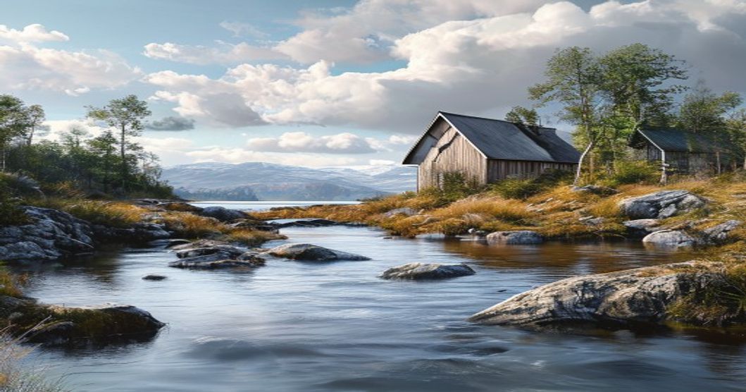
The Natural Wonders of Sápmi: A Comprehensive Geographic and Ecological Guide
Sápmi spans across the northern reaches of Norway, Sweden, Finland, and Russia, encompassing a landscape shaped by Pleistocene glacial movements, subarctic climate gradients, and ancient tectonic activity. The topography transitions from jagged coastal fjords and granitic archipelagos to rolling fell ranges, plateau highlands exceeding 1,500 meters, and deeply incised river valleys. Glacial scouring carved U-shaped basins that now host thousands of oligotrophic lakes across the Finnmark plateau, while discontinuous permafrost governs soil drainage patterns and limits root penetration in higher elevations.
Ecologically, the region functions as a critical ecotone between boreal taiga and arctic tundra. The natural treeline marks a sharp physiological boundary where Scots pine, downy birch, and mountain ash yield to lichen-dominant ground cover, reindeer moss, and low-growing shrubs adapted to rapid freeze-thaw cycles. Extensive peatland complexes accumulate carbon at accelerated rates due to waterlogged conditions and slow decomposition, making these wetlands vital regulators of regional hydrology and global carbon budgets. River networks drain northward into the Barents Sea and southward into the Nordic Seas, sustaining anadromous fish populations, intertidal invertebrate communities, and migratory seabird colonies along exposed coastlines.
- Photoperiod shifts dictate primary productivity across this terrain, with extended daylight hours triggering intense photosynthetic activity during summer months while prolonged darkness forces physiological dormancy in both vascular plants and overwintering mammals.
- Soil profiles exhibit distinct podzolization stages, with iron and aluminum oxides leaching into subsoil horizons while organic matter accumulates in surface layers. Dwarf shrubs deploy antifreeze proteins and shallow root mats to exploit the active thaw layer during brief growing seasons.
- Microclimates formed by wind scouring on fell summits maintain snow-free patches that support late-blooming alpine flora, while sheltered ravines preserve older forest stands with high epiphytic lichen diversity. These localized environmental gradients sustain exceptional species richness relative to latitude.
Traditional reindeer husbandry corridors follow snowpack gradients and lichen availability, demonstrating a direct link between subsistence practices and ecological carrying capacity. Contemporary land
Understanding the Arctic Circle Boundaries and Regional Topography
Sápmi spans a vast latitudinal range across northern Fennoscandia and the Kola Peninsula, positioning its core territories directly beneath and adjacent to the Arctic Circle. This geographic boundary is not static; it drifts approximately 15 meters southward each year due to axial precession and tidal deceleration. Modern surveys place the 66°33′46.6″N parallel through coastal Tromsø, inland Finnmark, Swedish Lapland near Gällivare, Finnish Lapland around Rovaniemi, and the Russian Kola Peninsula near Kirkenes. The intersection of this celestial line with Sápmi creates a distinct environmental gradient that dictates regional topography.
The landscape emerges from intense glacial sculpting during the Quaternary period. Retreating ice sheets carved deep U-shaped valleys, exposing Precambrian bedrock and Paleozoic sedimentary layers. The Scandinavian Mountains form the western spine, rising sharply to elevations exceeding 2,000 meters before descending into steep fjord systems along the Norwegian coast. These fjords penetrate hundreds of kilometers inland, creating microclimates that moderate winter temperatures despite high latitudes. Eastward, the terrain flattens into the Finnmarksvidda plateau, a karstic limestone and sandstone expanse dotted with sinkholes, subterranean rivers, and sparse birch forests.
- The coastal zone features dramatic relief changes, where glacial troughs plunge beneath sea level and emerge as jagged archipelagos.
- Inland plateaus maintain permafrost patches above 68°N, influencing drainage patterns and soil composition.
- River networks like the Tana and Muonio follow fault lines, carving parallel valleys that serve as natural migration corridors for both wildlife and reindeer herds.
Topographical variation directly controls ecological zonation. Below 400 meters, boreal coniferous forests dominate, transitioning into alpine tundra above the treeline. The Arctic Circle marks the southern limit of continuous permafrost in western Sápmi, while eastern regions experience discontinuous ground ice due to continental climatic influences. This latitudinal and altitudinal interplay generates high biodiversity gradients, preserving unique geomorphological features such as patterned ground, pingos, and glacial erratics that remain visible throughout the year.
Iconic Landscapes Defining the Sápmi Region
The Sápmi region spans across the northern reaches of Norway, Sweden, Finland, and Russia, where Arctic geography creates a distinct topographical identity. Ancient mountain ridges of the Scandinavian Caledonides rise sharply above flat tundra plains, forming dramatic elevation gradients that dictate microclimates and biodiversity patterns. These peaks, many exceeding 2,000 meters, remain snow-capped year-round in higher elevations and serve as natural drainage basins for massive river networks.
- Scandes Mountain Range: A geological spine stretching over 1,700 kilometers, featuring sheer granite faces, glacial cirques, and high-altitude plateaus that support rare alpine flora like arctic poppies and saxifrage.
- Tundra Ecosystems: Permafrost-influenced soils create vast peat bogs and seasonal wetlands. Spring thaw triggers massive water flow across flat plains, forming intricate delta systems before rivers reach coastal fjords.
- Fjord Coastlines: Deep glacially carved inlets cut hundreds of meters into the bedrock, creating sheltered marine corridors that sustain rich plankton blooms and seasonal salmon runs critical to local food webs.
National parks within Sápmi preserve these geological extremes without human modification. Sarek’s glacial valleys contain Europe’s last true wilderness river system, where waterfalls plunge directly into untracked valleys. Muddus preserves ancient boreal swamp forests dominated by dead standing pines and dense reindeer lichen mats. Øvre Pasvik maintains pristine taiga-fennoscandian transition zones where boreal conifers meet arctic shrublands. Seasonal light cycles dramatically alter landscape perception; the midnight sun in summer accelerates photosynthesis rates across short growing seasons, while polar night conditions freeze surface water and shift animal migration corridors toward coastal ice edges.
Geological activity over millions of years produced mineral-rich bedrock formations that influence soil chemistry and vegetation distribution. Iron oxide deposits stain certain valley walls red, while quartz veins reflect intense summer sunlight across barren slopes. These physical characteristics create distinct ecological boundaries that limit tree line elevation to approximately 500–700 meters above sea level in most areas, leaving alpine tundra as the dominant upper zone.
Laponia National Park and UNESCO Heritage Classification
Spanning over five thousand square kilometers across the northern reaches of Swedish Lapland, Laponia represents one of Europe’s last vast wilderness areas. The designation does not refer to a single protected zone but rather an interconnected network comprising three national parks—Sarek, Padjelanta, and Stora Sjöfallet—alongside two legally protected nature reserves encompassing the Kebnekaise massif and the Rapa River valley. This mosaic of glacial valleys, tundra plateaus, and deep river canyons remains entirely free of roads, bridges, or commercial infrastructure, preserving ecological continuity across altitudinal gradients that support distinct climate zones within a compact geographic footprint.
UNESCO inscribed the area on the World Heritage List in 1996 under cultural landscape criteria, acknowledging the seamless integration of natural processes and centuries-old Sami land-use practices. The classification specifically recognizes how indigenous reindeer herding routes, seasonal migration patterns, and traditional grazing methods have actively shaped and maintained the region’s biodiversity. Rather than treating nature and culture as separate entities, UNESCO documentation emphasizes their co-evolution: the open tundra landscapes result directly from controlled livestock movement, while ancient Sami place names encode detailed ecological knowledge passed through generations.
- Geological formation: Shaped by Pleistocene glaciations, the terrain features U-shaped valleys, roche moutonnées, and overdeepened basins that now hold pristine alpine lakes.
- Biodiversity corridors: Functions as a critical habitat for Eurasian lynx, wolverine, Arctic fox, and reindeer herds comprising over 35,000 animals managed by multiple Sami communities.
- Management framework: Operates under a joint governance model between the Swedish Environmental Protection Agency and Saami councils, requiring consensus on any infrastructure or visitor management adjustments.
The UNESCO designation carries strict monitoring protocols. Annual assessments track reindeer population dynamics, tundra vegetation recovery rates, glacial retreat measurements, and indigenous land rights compliance. Visitor access remains regulated through designated entry points in Jokkmokk and Svanvik, with mandatory guided crossings over the Lule River during summer months. The area continues to serve as a baseline reference for wilderness conservation studies across Fennoscandia, demonstrating how Indigenous stewardship and state protection mechanisms can operate in parallel without compromising ecological integrity or cultural continuity.
Finnmark Plateau Erosion Patterns and Coastal Inlet Systems
The Finnmark Plateau rests on a complex basement of Precambrian gneiss and Caledonian metamorphic rocks, which dictate its baseline resistance to weathering. Glacial retreat during the late Pleistocene exposed these strata to intense periglacial processes. Freeze-thaw cycles fracture bedrock along joint systems, generating extensive block fields known locally as fjellvidda. Wind abrasion further polishes exposed surfaces, while seasonal meltwater exploits vertical fractures, carving shallow drainage networks that gradually lower the plateau surface toward a near-peneplain state.
Fluvial erosion operates at a subdued pace due to low precipitation and permafrost remnants, yet it remains critical in shaping valley bottoms. Tributary streams transport coarse regolith downslope, depositing alluvial fans at base levels. Chemical weathering proceeds slowly in acidic peat-dominated soils, leaching iron and aluminum while leaving resistant quartzite ridges intact. These differential erosion patterns produce a stepped topography where harder lithologies form escarpments and softer layers create gentle depressions filled with organic-rich sediment.
The transition from plateau to coast generates intricate inlet systems characterized by drowned glacial troughs and fractured bedrock margins. Tidal currents penetrate these fjords, accelerating along narrow channels and enhancing lateral bank erosion. Wave refraction around headlands concentrates hydraulic action at inlet throats, while longshore drift redistributes eroded material into submerged terraces. Saltwater intrusion alters pore pressure in coastal cliffs, promoting mass wasting events that supply fresh detritus to nearshore environments.
Sediment dynamics link plateau degradation directly to coastal geomorphology. Riverine discharge during spring thaw delivers coarse gravel and boulders to estuarine zones, where tidal sorting creates distinct grain-size zonation. Brackish mixing zones foster unique sediment chemistry, influencing carbonate dissolution rates and clay mineral stability. Archipelago formation results from differential subsidence and glacial scouring along structural weaknesses, creating sheltered basins that mitigate open-ocean wave energy. These interconnected processes maintain a dynamic equilibrium between terrestrial denudation and marine reworking.
Polar Light Phenomena and Continuous Daylight Cycles
The aurora borealis emerges when charged particles from the solar wind collide with Earth’s magnetosphere, channeling toward the polar regions where they ionize oxygen and nitrogen molecules in the upper atmosphere. This process generates luminous ribbons of green, purple, and crimson light that dance across the night sky above Sápmi. The region’s high geomagnetic latitude places it directly beneath the auroral oval, making it one of the most reliable zones on Earth for consistent displays. Solar wind velocity typically ranges between 400 and 800 kilometers per second, with coronal mass ejections accelerating particles to supersonic speeds that compress the magnetosphere and trigger geomagnetic substorms. Optimal observation requires clear atmospheric conditions, minimal cloud cover, and absolute darkness, typically between late September and early March. Local topography, including fjord valleys and open tundra, provides unobstructed horizons that enhance visibility. The Sámi communities have documented these light formations for centuries, integrating them into oral traditions and seasonal calendars that guide reindeer migration patterns.
- Solar activity follows an approximately 11-year cycle, directly influencing auroral intensity and frequency.
- Kp-index values of 3 or higher indicate strong geomagnetic storms capable of producing vivid displays at lower latitudes.
- Low ambient temperature preserves atmospheric clarity, reducing light scattering and improving contrast.
Continuous daylight during the summer months results from Earth’s axial tilt, which positions Sápmi above the Arctic Circle for extended periods. The sun remains
Indigenous Ecological Practices and Land Management
The Sámi people have cultivated a sophisticated system of land stewardship over millennia, rooted in continuous observation and reciprocal relationship with the Arctic and subarctic environments. Central to this approach is reindeer pastoralism, which operates as integrated ecosystem management rather than resource extraction. Herders follow ancient migration corridors that align precisely with seasonal vegetation cycles, allowing pastures to regenerate naturally. This rotational movement prevents soil compaction, maintains lichen bed structure, and preserves nutrient distribution across vast territories.
- Seasonal grazing rotation divides the landscape into distinct pasture zones, ensuring moss and lichen communities recover during dormant periods while minimizing trampling damage to fragile tundra soils.
- Migratory timing protocols rely on historical records of snowmelt patterns, insect emergence indices, and wind direction to optimize forage quality and calving ground selection.
- Spatial documentation utilizes traditional place names to map ecological boundaries, seasonal water sources, and rest periods without formal surveying infrastructure.
Controlled burning represents another critical component of this management framework. Historically applied to clear dense undergrowth and stimulate new forage growth, these prescribed fires follow precise meteorological windows based on relative humidity, ground moisture levels, and frost depth. Low-intensity burns reduce catastrophic wildfire risks while releasing phosphorus and potassium back into the nutrient-poor tundra soil. Ecological surveys confirm that Sámi fire practices enhance habitat heterogeneity, supporting ground-nesting birds, arthropod populations, and reindeer calving grounds.
Water resource stewardship operates through seasonal fishing restrictions and wetland preservation protocols. Communities historically established undisturbed buffer zones around lakes and rivers to protect spawning corridors and maintain aquatic microclimates. These practices are reinforced by customary regulations that prioritize long-term watershed health over immediate harvest volume. Contemporary hydrological studies validate that Sámi-managed catchments exhibit higher macroinvertebrate diversity, stabilized sediment loads, and more resilient permafrost thaw patterns compared to adjacent industrial zones.
The integration of traditional knowledge with landscape monitoring creates a dynamic feedback loop. Land managers track ice thickness, lichen maturity indices, and avian migration timing to adjust grazing pressure and land access in real time. This adaptive framework allows ecosystems to absorb climatic volatility while maintaining functional integrity. When external development pressures threaten these territories, Sámi councils deploy historical usage maps and ecological baseline data to negotiate protected boundaries with regional planning authorities.
Reindeer Migration Corridors and Seasonal Grazing Territories
Reindeer migration in Sápmi follows ancient pathways shaped by centuries of ecological adaptation and indigenous land management.
Winter territories rely heavily on ground-dwelling lichen species, which reindeer excavate through deep snow using specialized hooves. The availability of these cryptogamic communities dictates the southern boundaries of winter ranges, while summer pastures shift northward toward alpine tundra and coastal wetlands where nutrient-dense grasses, sedges, and shrubs emerge during the brief Arctic growing season.
Modern land-use conflicts frequently disrupt these historical routes. Infrastructure development, including wind farms, mining operations, and transportation networks, fragments continuous grazing landscapes. When corridors narrow or become blocked, herds face prolonged travel distances, reduced forage quality, and increased stress on weaker animals. Climate volatility compounds these pressures. Rain-on-snow events create impenetrable ice layers over lichen beds during winter months, while warmer temperatures accelerate shrub encroachment in southern grazing zones, altering vegetation composition and reducing accessible forage volumes.
Sámi reindeer husbandry operates under a dual framework of customary law and national agricultural regulations. Grazing territories are not static boundaries but dynamic networks managed through seasonal livestock movement patterns passed down through generations. Contemporary conservation initiatives prioritize corridor restoration by integrating traditional ecological knowledge with satellite telemetry data. Land-use planning committees now require environmental impact assessments that account for movement timelines, calving ground proximity, and lichen regeneration cycles before approving development projects.
The ecological function of these migration routes extends beyond livestock nutrition. Reindeer trampling influences snow distribution patterns, seed dispersal mechanisms, and nutrient cycling across tundra ecosystems. Their grazing pressure maintains open landscapes that support biodiversity hotspots for migratory birds and small mammals. Protecting uninterrupted seasonal pathways remains critical for both cultural continuity and Arctic ecosystem resilience.
Sámi Traditional Knowledge Applied to Modern Conservation
Sámi traditional ecological knowledge operates on centuries of continuous observation across Arctic and subarctic ecosystems. Herders track microclimates, soil moisture levels, and lichen growth patterns to determine optimal grazing zones. These observations inform land-use decisions that maintain vegetation resilience. Modern conservation frameworks increasingly recognize that indigenous monitoring methods capture variables standard scientific tools often miss. Seasonal migration corridors preserve fragmented habitats while preventing overgrazing in sensitive tundra regions.
The integration of Sámi practices into contemporary environmental strategy follows several documented pathways. Reindeer herding acts as a natural land management tool. Controlled grazing stimulates plant diversity, reduces shrub encroachment, and maintains open ground for bird nesting. Snow depth measurements and ice thickness readings guide winter access routes that minimize soil compaction and protect vulnerable root systems. Plant harvesting follows strict seasonal windows that allow regeneration cycles to complete before extraction resumes. These methods prevent nutrient depletion and maintain microbial health in frozen soils.
- Cross-validation of indigenous weather forecasting with satellite data improves early warning systems for permafrost thaw.
- Co-management agreements in Norway, Sweden, and Finland allocate decision-making authority to local Sámi councils.
- Traditional fire management techniques restore peatland carbon storage capacity without synthetic interventions.
Scientific institutions now embed Sámi monitors within research teams. Field protocols incorporate indigenous sampling methods alongside genomic analysis and drone mapping. This hybrid approach yields more accurate baselines for species distribution modeling. Conservation funding mechanisms have shifted toward community-led stewardship grants rather than top-down directives. Pilot projects demonstrate that indigenous governance structures reduce enforcement costs while increasing compliance rates. Local rangers track soil erosion markers and water pH fluctuations to adjust buffer zones in real time.
Climate adaptation strategies increasingly rely on Sámi land-use calendars to predict vegetation shifts and wildlife movement patterns. These calendars encode generational data on bloom timing, insect emergence, and predator behavior. Researchers use this information to adjust protected zone boundaries dynamically. The result is a responsive conservation model that adapts faster than static legislative frameworks. Indigenous knowledge systems continue to shape how Sápmi balances ecological preservation with cultural continuity, ensuring long-term habitat stability across changing climatic conditions.
Logistical Framework for Regional Exploration
Navigating Sápmi requires precise coordination across four national jurisdictions, each enforcing distinct transit protocols. Regional access primarily channels through three international gateways: Tromsø Airport (TOS), Rovaniemi Airport (RVN), and Kiruna Airport (KRN). From these hubs, travelers must transition to regional bus networks operated by Finnmark fylke, Laplandinlinjat, and Ylläs-Linja. These routes operate on fixed winter timetables that frequently adjust based on snow accumulation and road clearance priorities. Private vehicle operators should verify tire requirements annually; studded tires remain mandatory from October through May in Norwegian and Swedish sectors, while Finnish roads switch to chains only during active blizzars.
- Cross-Border Documentation: Carrying valid travel documents alongside Schengen-compliant passports is essential. Border checkpoints between Norway, Sweden, and Finland conduct random inspections requiring advance declaration for livestock transport or large camera equipment.
- Remote Transit Options: Standard road networks terminate at municipal boundaries. Reaching highland plateaus requires registered snowmobile rentals with documented trail permits, or guided reindeer caravans arranged through certified Sami family enterprises operating under the Sámediggi licensing framework.
- Seasonal Infrastructure Shifts: Winter ice roads connect isolated fishing villages but close completely during spring thaw. Summer alternatives rely on hydrofoil ferries between coastal communes and scheduled helicopter charters for mountain rescue zones, which also service research stations and remote cabins.
Accommodation logistics demand advance reservation windows extending twelve months for peak aurora season. Municipal camping permits require GPS coordinates submitted to local nature management offices 48 hours before arrival. Commercial lodges in protected zones operate under strict carrying capacity limits, with utility connections dependent on geothermal or solar microgrids. Travelers utilizing self-catering cabins must verify fuel delivery schedules for diesel heaters, as seasonal supply chains freeze during polar night conditions.
Communication infrastructure remains fragmented across mountain ridges. Primary mobile networks cover valley corridors but drop entirely above 600 meters elevation. Carrying dual-channel satellite communicators ensures contact with regional search and rescue teams. Mountain radio frequencies require licensed operators for group coordination. Emergency protocols mandate registered itineraries left with municipal dispatch centers, as weather systems advance rapidly without meteorological warning stations in unpopulated sectors.
Permit acquisition follows compartmentalized jurisdictions. National park zones demand separate entry passes calculated per visitor day. Fishing and berry collection require species-specific licenses issued through county agricultural departments. Drone operations face strict altitude restrictions near reindeer grazing corridors and archaeological sites. All commercial photography requires property release forms from landowners holding traditional use rights under the Finnmark Act.
Regulatory Requirements and Leave-No-Trace Protocols
Access to Sápmi’s pristine landscapes operates within a complex framework of national legislation, indigenous land rights, and environmental conservation mandates. Visitors must navigate distinct legal structures across Norway, Sweden, and Finland, each balancing public access with ecological preservation. In Norway, the Right to Roam (Jenteloven) permits free movement across uncultivated land, yet explicitly restricts activities within reindeer herding districts during critical seasons. Sweden’s Allemansrätten grants similar privileges but enforces stricter penalties for damaging vegetation or disturbing wildlife. Finland’s Nature Code mandates that all visitors maintain a respectful distance from protected zones and adhere to seasonal fire bans. These regulations are not arbitrary; they safeguard fragile tundra ecosystems, migratory pathways of reindeer herds, and centuries-old Sámi cultural sites from irreversible degradation.
Compliance requires proactive planning rather than reactive compliance. Before entering any region, travelers must verify current restrictions through official tourism boards and municipal websites. Commercial photography, drone operations, and guided expeditions demand specific permits issued by county administrations or national park authorities. Violations result in substantial fines and permanent access bans. The legal landscape prioritizes sustainability over convenience, ensuring that infrastructure development never compromises watershed integrity or soil stability.
- Waste Management: Pack out all non-biodegradable materials. Composting facilities are unavailable in remote zones; human waste must be deposited at least 200 meters from water sources and buried in catholes eight inches deep to prevent pathogen contamination.
- Fire Restrictions: Open flames are prohibited above the tree line and during extended dry spells. Use designated fire rings only, and keep wood gathering within established logging boundaries to prevent habitat fragmentation and carbon release.
- Wildlife Buffer Zones: Maintain a minimum 150-meter distance from reindeer herds, wolverine denning sites, and breeding grounds for ptarmigan. Sudden movements trigger stress responses that reduce survival rates and disrupt natural foraging patterns.
- Vegetation Preservation: Walk on established trails or durable surfaces like bedrock and gravel. Arctic plants recover extremely slowly; stepping off-trail causes permanent soil erosion, permafrost thaw acceleration, and lichen destruction.
- Cultural Site Respect: Do not touch, remove, or photograph sacred markers, ancient stone cairns, or traditional camping grounds. These areas hold legal protections under indigenous land claims and require absolute non-interference.
Enforcement relies on community reporting and satellite monitoring of high-traffic corridors. Local Sámi authorities collaborate with environmental agencies to adjust seasonal boundaries based on snowpack levels and animal migration patterns. Visitors who integrate these protocols into their itinerary support long-term conservation while minimizing liability risks. Sustainable travel practices align directly with regional economic goals, ensuring that tourism revenue funds habitat restoration and infrastructure maintenance without compromising ecological thresholds.
“`html
Frequently Asked Questions About The Natural Wonders of Sápmi
What is The Natural Wonders of Sápmi?
The Natural Wonders of Sápmi refer to the breathtaking and pristine landscapes found across Sápmi — the traditional homeland of the Sami people spanning northern Norway, Sweden, Finland, and Russia’s Kola Peninsula. This vast Arctic region is renowned for its dramatic Northern Lights displays, the magical Midnight Sun during summer months, expansive fells and tundra, crystal-clear glacial lakes, powerful waterfalls, deep boreal forests, and untouched wilderness that has remained largely unspoiled by modern development.
Key facts about The Natural Wonders of Sápmi
Here are the key facts about The Natural Wonders of Sápmi:
1. Sápmi covers approximately 388,200 km² across four countries — Norway, Sweden, Finland, and Russia.
2. The region lies mostly within the Arctic Circle, giving rise to extreme seasonal phenomena like months of continuous daylight in summer and polar nights in winter.
3. Sápmi is home to some of Europe’s last remaining large carnivore populations, including wolves, wolverines, brown bears, and leopards (in Russia).
4. The area features diverse ecosystems ranging from coastal fjords and archipelagos in the west to mountain fells, vast river valleys, and frozen tundra in the interior.
5. Sápmi’s natural sites hold deep spiritual and cultural significance for the Indigenous Sami people, who have lived in harmony with the land for thousands of years through reindeer herding, fishing, and hunting.
6. Several UNESCO World Heritage Sites are located within or near Sápmi, including the Kvarken Archipelago (Finland/Sweden) and the West Coast of Norway’s fjord landscapes that extend into Sami territory.
“`
“`json
{
“@context”: “https://schema.org”,
“@type”: “FAQPage”,
“mainEntity”: [
{
“@type”: “Question”,
“name”: “What is The Natural Wonders of Sápmi?”,
“acceptedAnswer”: {
“@type”: “Answer”,
“text”: “The Natural Wonders of Sápmi refer to the breathtaking and pristine landscapes found across Sápmi — the traditional homeland of the Sami people spanning northern Norway, Sweden, Finland, and Russia’s Kola Peninsula. This vast Arctic region is renowned for its dramatic Northern Lights displays, the magical Midnight Sun during summer months, expansive fells and tundra, crystal-clear glacial lakes, powerful waterfalls, deep boreal forests, and untouched wilderness that has remained largely unspoiled by modern development.”
}
},
{
“@type”: “Question”,
“name”: “Key facts about The Natural Wonders of Sápmi”,
“acceptedAnswer”: {
“@type”: “Answer”,
“text”: “Here are the key facts about The Natural Wonders of Sápmi:
1. Sápmi covers approximately 388,200 km² across four countries — Norway, Sweden, Finland, and Russia.
2. The region lies mostly within the Arctic Circle, giving rise to extreme seasonal phenomena like months of continuous daylight in summer and polar nights in winter.
3. Sápmi is home to some of Europe’s last remaining large carnivore populations, including wolves, wolverines, brown bears, and leopards (in Russia).
4. The area features diverse ecosystems ranging from coastal fjords and archipelagos in the west to mountain fells, vast river valleys, and frozen tundra in the interior.
5. Sápmi’s natural sites hold deep spiritual and cultural significance for the Indigenous Sami people, who have lived in harmony with the land for thousands of years through reindeer herding, fishing, and hunting.
6. Several UNESCO World Heritage Sites are located within or near Sápmi, including the Kvarken Archipelago (Finland/Sweden) and the West Coast of Norway’s fjord landscapes that extend into Sami territory.”
}
}
]
}
“`