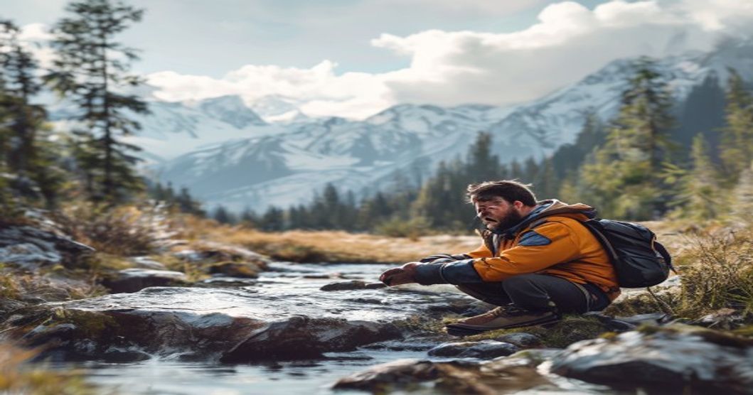
Mastering Sami Outdoor Lifestyle and Nature Skills for Wilderness Excellence
The Sami outdoor lifestyle emerges from centuries of adaptation to the Arctic and subarctic environments of Fennoscandia. Survival in these regions demands precise ecological literacy rather than reliance on manufactured gear. Practitioners develop an intimate understanding of microclimates, soil composition, and vegetation cycles that dictate reindeer migration patterns. This knowledge transfers directly to wilderness navigation, where landmarks shift with snowfall and daylight hours change dramatically across seasons.
Core nature skills begin with environmental reading. Experienced practitioners interpret wind direction through moss growth on rock faces, predict weather shifts by observing cloud formations above mountain ridges, and locate water sources by tracking insect activity and ground moisture. Seasonal knowledge dictates tool selection and movement timing. During winter months, snow density determines travel routes, while summer demands navigation through wetlands using elevated terrain features.
- Tracking & Sign Analysis: Distinguishing reindeer, predator, and human footprints requires understanding weight distribution, gait patterns, and recent weather impacts on trail preservation.
- Natural Shelter Construction: Building windbreaks using fallen birch branches, reindeer antlers, and layered moss creates insulation without damaging living trees.
- Water Sourcing & Purification: Identifying spring-fed streams involves examining plant indicators like willow clusters and calculating flow rates based on ice melt patterns.
- Firecraft in Extreme Conditions: Preparing dry tinder from birch bark resin, using flint or steel with natural char cloth, and constructing wind-resistant fire lay structures ensures reliable heat generation during sub-zero temperatures.
Sustainability remains foundational to Sami wilderness practice. Rotational grazing patterns prevent overgrazing, while seasonal harvesting follows strict ecological windows that allow plant regeneration. Practitioners monitor wildlife behavior closely, adjusting movement routes to avoid stress periods during calving or mating seasons. This approach minimizes environmental disruption while maintaining long-term resource availability.
Modern wilderness excellence integrates these traditional methods with contemporary safety protocols. GPS devices supplement natural navigation but never replace compass and map reading fundamentals. Layered clothing systems using reindeer wool provide superior moisture management compared to synthetic alternatives. Knowledge of local flora enables identification of edible plants, medicinal herbs, and toxic species that thrive in boreal ecosystems. Continuous practice under varying conditions builds the muscle memory required for emergency response without panic.
Foundational Principles of Traditional Fieldcraft
Traditional fieldcraft rooted in Sámi outdoor practice relies on systematic environmental reading and adaptive decision-making rather than static technique memorization. Practitioners develop acute pattern recognition through sustained exposure to microclimates, soil composition shifts, and wildlife behavior cycles. This knowledge operates as a continuous feedback loop where observation dictates action, and action refines future observation.
Directional navigation depends on cross-referencing multiple natural indicators rather than relying on single points of reference. Wind patterns carve distinct snow drifts that align with prevailing seasonal pressures, while lichen density on tree trunks reveals moisture gradients and sun exposure over decades. Water flow direction, combined with bank erosion angles, provides reliable downstream orientation even during whiteout conditions where visual landmarks disappear entirely.
- Spatial awareness emerges from mapping terrain mentally through elevation changes, vegetation transitions, and acoustic reflections in open valleys.
- Resource tracking requires understanding animal movement corridors, seasonal forage availability, and predator-prey dynamics to locate supplies without disturbing ecological balance.
- Weather prediction utilizes barometric shifts detected through joint sensitivity, cloud formation rates, and the behavior of avian species before atmospheric pressure drops.
Sustainable harvesting operates on a zero-waste framework where every component of harvested material serves a functional purpose. Reindeer antlers become tool handles, sinew transforms into thread, and fat insulates against subzero temperatures. This efficiency stems from recognizing that waste represents a failure in preparation and respect for the environment that sustained the practitioner.
Mental resilience forms the operational foundation. Decision-making under extreme fatigue demands emotional regulation and compartmentalized problem-solving. Practitioners train to separate immediate discomfort from strategic assessment, ensuring cold stress or hunger does not override calculated risk evaluation. This psychological discipline emerges through repeated exposure to controlled hardship during youth apprenticeships, where elders enforce patience over haste.
Knowledge transmission occurs through direct participation rather than theoretical instruction. Novices learn by carrying gear, maintaining equipment in freezing conditions, and correcting mistakes before they compound into survival threats. The curriculum emphasizes repetition until muscle memory replaces conscious thought, allowing complex field tasks to execute automatically during high-stress scenarios.
Essential Survival Techniques for Remote Environments
Navigating unmarked terrain demands precise route-finding discipline. Carry a topographic map and magnetic compass as primary tools, and practice declination adjustments before entering wilderness zones. Relying solely on digital devices risks battery failure or signal loss; instead, master triangulation using prominent landmarks and maintain a consistent bearing to prevent circular walking patterns. Terrain association techniques reduce cognitive load by matching ground features directly to contour lines.
Water procurement remains the highest priority in survival scenarios. Natural sources rarely provide potable water without treatment. Boiling for at least one minute eliminates most pathogens, while chemical purification tablets offer a lightweight backup. In arid regions, construct solar stills using moisture-absorbing vegetation and clear plastic sheeting to extract groundwater through evaporation. Always filter particulate matter before chemical treatment to prevent clogged absorption.
Shelter construction must align with environmental conditions. Cold climates require insulated ground platforms using dry branches, leaf litter, or pine boughs to prevent conductive heat loss. Hot environments demand elevated cots or mesh hammocks to maximize airflow and deter ground-dwelling insects. Always select sites away from dead trees, avalanche paths, and riverbanks prone to flash flooding.
- Fire Starting: Prepare tinder bundles from dry grass, birch bark, or char cloth before departure. Use ferrocerium rods in wet conditions, as they outperform matches when damp. Maintain a fire lay with progressively larger fuel wood to sustain heat without rapid consumption.
- Emergency Signaling: Carry a mirror for daylight reflection and a whistle rated for high decibel output. Construct three parallel smoke signals or ground-to-air markers using contrasting materials like dark branches on light snow.
- Mental Resilience: Implement the STOP protocol (Stop, Think, Observe, Plan) during disorientation. Prioritize immediate needs over long-term goals until stable conditions are established.
Regular equipment maintenance extends survival windows. Inspect knife edges for nicks, check compass needle movement, and verify battery levels in multi-tools before each expedition. Knowledge of local flora provides additional resources; edible plants like dandelions and cattails offer nutritional support, while poison ivy identification prevents life-threatening rashes. Documenting trail conditions and
Navigating Diverse Terrains with Precision Mapping
Precision mapping forms the operational foundation of reliable outdoor navigation, particularly when moving through environments where visual landmarks disappear and weather patterns shift without warning. Effective terrain traversal begins with selecting topographic maps calibrated to 1:25,000 or 1:50,000 scale, which deliver sufficient contour resolution while remaining manageable during extended field operations. Contour lines must be read as continuous elevation pathways rather than isolated marks, allowing you to identify saddle points, drainage divides, and safe crossing zones before committing to a route.
Magnetic declination adjustment represents the most common source of navigational drift. Earth’s magnetic poles do not align with geographic true north, and this angular difference varies by region and shifts annually. Failure to apply the correct declination value introduces systematic bearing errors that multiply over distance. Always consult the latest survey authority data printed on your map’s margin, verify the current year’s variation, and apply the documented adjustment to every compass reading taken in the field.
- Azimuth plotting: Place a baseplate compass along your intended route line, rotate the bezel until orienting arrows align with grid north, lock the housing, and walk while keeping the magnetic needle aligned with the orienting arrow.
- Back bearing verification: When confirming position or establishing retreat routes, face your reference point, rotate the compass housing to match magnetic north, and confirm the reciprocal angle matches your planned exit corridor.
- Three-point triangulation: Identify three distinct landmarks, measure their magnetic bearings, transfer each line onto the map using a protractor or parallel rulers, and pinpoint your location at the intersection triangle’s center.
Digital navigation systems provide rapid coordinate generation but remain vulnerable to hardware failure, signal obstruction, and battery depletion. Maintain analog redundancy by carrying a sealed baseplate compass, a waterproof topographic map set, and a reliable pacing strap. Calibrate your stride length across multiple substrates—loose talus demands shorter steps than consolidated soil, directly influencing distance estimation accuracy when GPS coverage drops.
Terrain type dictates mapping strategy. Wooded canopies obscure aerial reference points; prioritize hydrological features like stream confluences and ridge crests that remain visible through dense foliage. Coastal navigation requires tidal curve integration alongside contour analysis to prevent isolation during rapid water level changes. Desert environments demand route selection guided by thermal shading data, utilizing map-derived wind corridor patterns and leeward ravines to minimize heat exposure during peak solar hours.
Field competence develops through deliberate repetition under controlled stress. Practice low-visibility navigation by moving between predetermined waypoints using only compass bearings and calibrated step counts. Record bearing discrepancies, terrain mismatches, and corrective maneuvers in a dedicated navigation log. Consistent application transforms map interpretation into an automatic cognitive routine, ensuring reliable orientation across unpredictable landscapes.
Topographic Analysis and Natural Wayfinding Methods
Topographic analysis forms the backbone of reliable navigation when digital tools fail or remain unavailable. Mastering contour interpretation requires recognizing how line spacing correlates with slope gradient. Closely packed contours indicate steep terrain that demands careful footing and energy management, while widely spaced lines reveal gradual descents suitable for sustained movement. Elevation profiles help predict wind exposure on ridgelines and identify sheltered depressions where cold air settles overnight. Cross-referencing these map features with actual ground conditions builds spatial awareness before committing to a route.
- Slope Assessment: Calculate grade changes by counting contour intervals between your current position and target elevation. Each standard interval represents a fixed vertical gain, allowing precise energy expenditure planning.
- Landform Identification: Concentric closed loops denote peaks or depressions depending on tick marks. V-shaped patterns pointing uphill indicate tributary valleys, while those pointing downhill mark drainage channels that reliably guide movement toward lower ground.
- Safety Corridors: Locate natural escape routes by mapping parallel drainages and identifying saddle points between ridges. These depressions provide alternative exits when primary paths become compromised by weather or terrain collapse.
Natural wayfinding complements map reading by translating environmental cues into directional certainty. Sun trajectory provides baseline orientation, but accurate bearing requires accounting for seasonal declination shifts and local magnetic anomalies. Wind patterns reveal prevailing pressure systems that shape vegetation density on leeward versus windward slopes. Stream networks flow downhill toward larger waterways, creating predictable linear guides through complex forested terrain. Observing canopy gaps, frost distribution, and snowmelt timing further refines positional awareness during low-visibility conditions.
- Celestial Alignment: Track star positions relative to fixed horizon markers to maintain consistent headings across featureless plains or dense tree cover where compass readings drift due to mineral deposits.
- Vegetation Indicators: Note directional growth patterns in lichen, bark texture variations, and leaf orientation. These biological responses reflect long-term light exposure and moisture gradients rather than short-term weather fluctuations.
- Terrain Memory Mapping: Record distinctive junctions, rock formations, and elevation changes during forward progress. Reconstructing this mental grid upon return trips eliminates route dependency and reduces disorientation risks.
Integrating topographic study with natural observation creates a redundant navigation system that withstands equipment failure or environmental interference. Practitioners who combine contour analysis with ground-truthed indicators develop adaptive decision-making skills essential for prolonged wilderness immersion. This methodology aligns directly with traditional Sami outdoor practices, where terrain reading replaces artificial aids and environmental literacy sustains movement across frozen tundra, dense boreal forests, and unpredictable mountain passes.
Weather Pattern Recognition and Adaptive Routing
Recognizing shifting weather patterns requires systematic observation of atmospheric indicators that precede environmental changes. Sky conditions offer immediate clues; rapidly building cumulonimbus formations signal convective instability, while a sudden drop in barometric pressure often indicates approaching low-pressure systems. Wind behavior provides secondary confirmation; sustained directional shifts combined with increased turbulence typically mark frontal boundaries. Observers must cross-reference these visual and tactile cues with local terrain features, as mountain valleys channel winds differently than open plateaus, altering microclimate behavior significantly.
Adaptive routing transforms raw meteorological data into navigational strategy. When atmospheric instability emerges, route selection prioritizes elevation gradients and wind corridors over direct distance metrics. Ridges amplify wind exposure and lightning risk, while leeward slopes offer temporary shelter but may trap cold air or moisture. Navigators must calculate safe passage windows by monitoring cloud base descent rates and evaluating soil saturation levels near creek beds. Flash flood zones demand immediate detours when precipitation intensity exceeds infiltration capacity, requiring knowledge of drainage topography and historical water flow paths.
- Pressure Monitoring: Track barometer readings every two hours; a fall exceeding 3 millibars per hour warrants route modification within thirty minutes.
- Vegetation Indicators: Wind-sheared branches and asymmetrical tree growth reveal prevailing storm directions, guiding shelter placement away from windthrow zones.
- Terrain Association: Map alternate descents before entering unfamiliar corridors; ensure viable exit points exist regardless of sudden visibility loss or ground saturation.
Effective weather-responsive navigation integrates manual observation with structured decision frameworks. Compass bearings must be adjusted for wind drift, while terrain association techniques help identify natural windbreaks like rock outcrops or dense conifer stands. Seasonal pattern memorization enhances predictive accuracy; spring thunderstorms follow predictable diurnal heating cycles, whereas autumn fronts move with consistent pressure gradients. Field experience compounds these observations, allowing rapid pattern matching without electronic dependency.
Selecting Equipment and Managing Field Resources
Selecting reliable equipment demands a systematic approach that prioritizes function over aesthetics and weight distribution over convenience. Every component must withstand environmental stressors without compromising mobility. Shelter systems require wind resistance ratings calibrated to exposed ridgelines and precipitation levels matching regional climate patterns. Sleeping insulation needs temperature thresholds adjusted for individual metabolic rates plus a fifteen-degree safety buffer. Water purification devices must process high-turbidity sources while maintaining a minimum flow rate of one liter per minute. Navigation infrastructure relies on layered redundancy; electronic GPS units fail during prolonged cloud cover or battery depletion, making magnetic compasses and contour maps non-negotiable backups.
Field resource management follows strict inventory protocols designed to prevent mid-expedition shortages and optimize energy expenditure. Daily water requirements scale between two and four liters depending on ambient temperature and exertion intensity. Carrying chemical treatment tablets alongside mechanical filters establishes dual contamination barriers. Food selection prioritizes caloric density per ounce; dehydrated proteins and compressed fat blocks outperform bulky fresh alternatives during extended treks. Tracking daily consumption forces disciplined rationing schedules and prevents sudden energy depletion. Implementing a simple logbook or digital counter helps maintain accurate supply visibility across multi-day routes.
- Pack Organization: Utilize waterproof compression sacks to separate moisture-generating items from critical dry gear. Place heavy components directly against the back panel to align the center of gravity with your spine.
- Pre-Deployment Testing: Simulate trail conditions by loading full gear weights and walking elevation profiles before departure. Identify chafing points, seam weaknesses, or zipper failures during this phase.
- Maintenance Cycles: Remove salt deposits after coastal expeditions, dry moisture traps completely, and inspect stitching integrity weekly during long-term use. Deferred upkeep guarantees system failure when weather turns severe.
Environmental considerations dictate gear material choices as well. Synthetic insulation retains warmth when saturated, whereas down collapses without proper hydrophobic treatment. Cutting tools require high-carbon steel edges that sharpen easily on natural stones. Emergency signaling devices must operate independently of cellular networks, favoring mirror
Weight Optimization Strategies for Extended Expeditions
Reducing pack mass directly correlates with endurance, joint preservation, and trail velocity during multi-day wilderness traverses. Expedition planners must distinguish between fixed base weight and variable consumables to apply targeted reduction tactics without compromising safety.
Base Weight Engineering demands rigorous inventory auditing. Every item must survive a function-to-weight ratio test. Replace aluminum trekking poles with carbon fiber alternatives, swap cotton insulation for synthetic fill or down with hydrophobic treatments, and migrate to ultralight tarp shelters instead of traditional tents when weather patterns allow. Multi-function tools eliminate redundancy; a titanium pot that doubles as a cooking vessel, bowl, and water container saves critical ounces. Always prioritize gear with proven durability under abrasive terrain to avoid replacement costs mid-expedition.
- Fuel Density Optimization: Switch from standard butane canisters to liquid fuel systems for cold-weather reliability and reusability. Calculate exact boiling requirements per meal rather than packing excess propane. A 100g titanium stove with a reflective heat shield reduces fuel consumption by up to forty percent compared to bulkier setups.
- Food Caloric Density: Target minimum two thousand calories per pound of carried provisions. Dehydrate meals at home to eliminate packaging weight, and replace bulky condiments with single-serving oil packets or concentrated electrolyte mixes. Plan resupply drops every seventy-two hours in accessible trail towns to keep daily carry under eight pounds.
- Hydration Strategy: Carry only the volume required between reliable water sources. A 0.5-liter soft flask paired with a gravity filter system weighs less than rigid bottles while maintaining continuous flow. In arid corridors, pre-plan spring locations and adjust daily mileage to match natural refill intervals rather than hauling unnecessary reserves.
Packing architecture dictates balance efficiency. Place heavy items close to the spine and centered vertically to align the load with your center of gravity. Utilize compression sacks selectively; over-compressing down insulation destroys loft, while lightly compressing synthetic layers maintains thermal performance. Wear boots, base layers, and bulky electronics instead of storing them in the pack. Regularly weigh every component on a calibrated scale before departure. Eliminate items that fail the three-question protocol: does it serve a primary survival function, replace multiple tools, or meet a strict weight threshold below twenty grams? Systems built around mass discipline consistently deliver faster turnover rates and reduced injury incidence across extended alpine and desert corridors.
Water Sourcing and Fire Crafting Protocols
Locating viable water sources requires systematic landscape analysis rather than random searching. Identify vegetation signatures such as willows, cottonwoods, and cattails, which indicate shallow groundwater tables. Trace animal trails converging on depressions or follow dry creek beds upstream to locate seepage zones where moisture persists during extended droughts. When surface water is unavailable, deploy a solar still by excavating a two-foot diameter hole, placing a collection vessel at the base, covering the opening with clear plastic, and weighting the center with a stone to condense vapor. Morning dew can be harvested by dragging a clean cotton cloth across grass blades before sunrise, then wringing the moisture into a container.
Water purification protocols must address pathogens regardless of visual clarity. Boil water at a rolling boil for one minute at elevations below 6,500 feet, extending to three minutes at higher altitudes to neutralize bacteria, viruses, and protozoa. For chemical treatment, use iodine or chlorine dioxide tablets following manufacturer dosage rates, allowing adequate contact time before consumption. Mechanical filtration with a pump filter rated at 0.2 microns removes Giardia and Cryptosporidium cysts, but requires post-treatment for viral contamination in developed waterways. Store treated water in rigid, food-grade polyethylene containers to prevent UV degradation and chemical leaching.
- Fuel Hierarchy Management: Separate materials into tinder (dry grass, birch bark, petroleum-jelly-soaked cotton), kindling (split sticks up to pencil thickness for rapid drying), and fuel wood (wrist to thigh diameter). Maintain a three-to-one ratio between tinder volume and kindling mass.
- Ignition Execution: Strike ferrocerium rods at a 45-degree angle toward the tinder bundle, directing the spark stream into the center. Shield flames from wind using hand placement or natural berms. Avoid petroleum-based accelerants near established fire pits due to unpredictable flare-ups.
- Site Preparation & Extinguishment: Clear all combustible material within a six-foot radius down to mineral soil. Construct teepee or log cabin frameworks depending on wind direction and humidity levels. Drown the fire with water, stir ashes until steam ceases, and verify temperatures by hand proximity before abandoning the site.
Fire crafting success depends on moisture assessment and structural adaptation. Test tinder by bending it; brittle materials ignite faster, while flexible fibers retain hidden moisture. Split seasoned wood to expose dry interiors, as bark acts as a waterproof barrier. Adjust framework geometry to channel heat toward the ignition point during startup, then expand outward once embers establish consistent thermal mass. Always verify local fire restrictions before deployment, as regulatory compliance prevents ecological damage and maintains trail accessibility for future use.
Risk Assessment and Emergency Response Systems
Wilderness navigation requires a structured methodology for identifying hazards and calculating exposure levels before entering remote terrain. Risk assessment begins with topographical review, seasonal precipitation patterns, and group fitness mapping. Variables such as altitude gain, river crossing depths, wildlife corridors, and trail erosion rates must be documented to establish baseline decision thresholds. When environmental conditions shift, pre-calculated data prevents panic-driven choices and keeps the team aligned with safety protocols.
Emergency response systems function through layered redundancy and standardized procedures. Primary communication depends on satellite messengers and personal locator beacons, since cellular infrastructure rarely reaches backcountry zones. Route planning must integrate alternate egress points every two to three hours of travel, ensuring that sudden injuries or blocked passes do not isolate the group. Real-time weather monitoring tools track barometric drops, wind shifts, and precipitation windows, enabling proactive schedule adjustments rather than reactive retreats.
- Hazard Mapping: Charting avalanche paths, flash flood channels, and unstable scree slopes prior to deployment.
- Communication Protocols: Defining check-in intervals, distress signals, and satellite device activation sequences.
- Medical Triage Alignment: Matching first aid supplies with regional trauma risks, including hypothermia management, bite response, and splinting materials.
- Extraction Planning: Mapping helipad coordinates, vehicle access routes, and ranger station distances for rapid evacuation.
Sustainable outdoor practices connect risk evaluation with environmental awareness. Camp selection avoids dry washes, deadfall zones, and exposed ridgelines that amplify structural failure risks. Leadership demands continuous monitoring of fatigue levels, gear distribution, and group morale alongside terrain challenges. When emergency protocols activate, execution relies on drilled responses rather than improvisation. Regular simulation exercises condition teams for shelter construction, signal deployment, and rapid evacuation sequencing under stress.
Post-trip debriefing transforms field experience into refined safety frameworks. Logging near-miss incidents, gear failures, and decision timing creates a feedback loop that sharpens future route planning. Consistent documentation of weather deviations, trail conditions, and group response times builds institutional knowledge. Teams that track these metrics consistently reduce incident rates and improve recovery speed when emergencies occur.
Trauma Care Applications in Isolated Locations
Uncontrolled hemorrhage remains the leading preventable cause of death in remote trauma scenarios. When professional medical extraction takes hours or days, immediate field intervention shifts from supportive care to life preservation. The first operational priority involves rapid identification of arterial versus venous bleeding and deployment of a commercial tourniquet high on the limb. Improvised alternatives like belts or rope lack consistent pressure distribution and often fail under sustained tension. Hemostatic gauze infused with kaolin or chitosan accelerates clotting cascades in deep wound cavities, but requires direct packing rather than superficial placement. Every second counts during the golden hour, yet isolation extends that window into a prolonged survival phase.
- Hemorrhage Control: Apply tourniquets two inches above the injury site. Tighten until distal pulse cessation and external bleeding stops. Document application time with permanent marker on skin or gear.
- Airway Management: Position the casualty in the recovery posture to maintain patency without advanced airway devices. Clear obstructions manually if vomiting occurs, especially after head or spinal trauma.
- Hypothermia Mitigation: Remove wet clothing and insulate with emergency blankets, dry layers, or ground pads. Core temperature drops exponentially in wind or water, accelerating coagulopathy.
- Communication Constraints: Satellite messengers or two-way radios enable medical dispatch coordination. Pre-programmed evacuation codes reduce transmission time during high-stress events.
- Gear Optimization: Carry individual trauma kits alongside group rescue packs. Weight distribution must balance accessibility with pack stability on technical terrain.
Long-term wound management demands frequent dressing changes to monitor infection markers and tissue viability. Natural environments introduce contamination vectors like soil bacteria, plant sap, and stagnant water. Antiseptic solutions degrade quickly in UV exposure, so sealed ampoules or iodine swabs provide reliable alternatives. Splinting fractured extremities with padded trekking poles, snowshoes, or rolled tarps stabilizes fractures and reduces secondary vascular damage. Immobilization must maintain circulation distal to the injury while preventing movement at fracture sites.
Psychological strain compounds physiological decline during extended isolation. Caregivers experience decision fatigue when managing multiple casualties without rotation support. Structured triage protocols like START or JumpSTART standardize prioritization under resource scarcity. Deliberate practice through scenario drills builds muscle memory for clamp placement, bandage tension, and shelter construction. Regular equipment inspections prevent failure modes like tourniquet strap slippage or gauze desiccation. Remote trauma survival depends less on advanced medical degrees and more on systematic execution of proven field medicine principles.
Signaling Techniques and Rescue Coordination
Effective signaling in remote terrain relies on layered redundancy rather than a single method. Visual indicators must contrast sharply with the surrounding environment. Ground-to-air symbols require a minimum length of three meters for aerial visibility, constructed using contrasting materials such as rocks, logs, or disturbed earth against snow or sand. International distress markers include three parallel lines, an inverted V, or the letter X. Mirror signaling operates at line-of-sight distances exceeding five kilometers under clear conditions; direct sunlight reflection should target aircraft or ground searchers with short, rhythmic flashes rather than continuous beams to conserve optical device functionality and prevent glare blindness.
Auditory signals penetrate dense forest canopy where visual methods fail. Standardized distress patterns utilize three repeated bursts separated by one-minute intervals. Whistle blasts carry significantly farther than vocal calls while consuming minimal energy, making them ideal for prolonged scenarios. Metallic percussion against tree trunks or bedrock produces sharp acoustic echoes that traverse valleys more effectively than human voice.
- Electronic Communication Protocols: Personal Locator Beacons transmit 406 MHz distress frequencies directly to Cospas-Sarsat satellites, generating GPS coordinates within fifteen minutes. Satellite messengers require registered accounts and subscription plans but enable two-way text exchange with emergency coordination centers. Mobile phones should prioritize SMS over voice calls during network congestion, as data packets often route through weaker cellular towers.
- Location Preparation: Clear a twenty-meter square landing zone free of loose debris, overhead branches, and tall grass. Position reflective materials at cardinal points to establish precise coordinates for aerial teams. Maintain a visible fire source with green foliage during daylight to generate thick white smoke, contrasting against dark forest canopies.
- Rescue Interaction: Remain stationary once your position is confirmed by search aircraft or ground teams. Sudden movement disrupts triangulation efforts and increases injury risk during extraction. Conserve water and caloric intake while awaiting medical evaluation, as adrenaline masking delays symptom recognition until rescue personnel arrive.
Coordination with emergency response units demands strict adherence to established communication hierarchies. Provide exact grid coordinates, terrain description, and injury status during initial contact. Avoid improvising extraction routes without professional guidance, as secondary injuries frequently result from untrained movement in unstable environments. Signal maintenance requires continuous monitoring of weather patterns, equipment functionality, and surrounding rescue activity to maximize survival probability until formal evacuation concludes.
Seasonal Adaptation and Ecological Preservation
Surviving and thriving in remote environments demands a precise understanding of seasonal rhythms. Sami outdoor traditions have long recognized that ecological preservation is not optional but foundational to continuity. Each season dictates specific material choices, movement patterns, and resource management protocols. During winter months, practitioners rely on layered insulation techniques using reindeer hides and dense pine bark. These methods minimize heat loss while preserving local vegetation. Summer adaptations shift toward ventilation, moisture control, and rapid decomposition management. Open shelters with adjustable canvas flaps allow airflow without compromising insect protection or wildlife disturbance.
Ecological preservation operates through deliberate restraint. Traditional fire rings are built with flat stones to prevent soil scarring. Ash is distributed away from root zones to maintain microbial balance. Water sources are accessed downstream of natural filters, ensuring minimal disruption to aquatic ecosystems. Seasonal food storage requires underground pits lined with birch bark and packed with dry moss. This technique extends shelf life without artificial preservatives while returning organic matter to the soil when decomposed.
- Winter protocols prioritize snow trenching for windbreaks, reducing timber collection by up to sixty percent compared to unsheltered setups.
- Spring thaw management involves avoiding saturated ground with lightweight sleds instead of boots, preventing trail erosion and wetland compaction.
- Autumn preparation focuses on caching non-perishable goods near established campsites rather than venturing into fragile breeding grounds.
- Summer fire restrictions require using existing metal grates or constructing temporary rock rings that can be fully dispersed after use.
Climate variability has intensified the need for adaptive monitoring. Practitioners track phenological markers such as lichen growth stages, bird migration shifts, and ice thickness progression. These indicators replace fixed calendars with dynamic decision-making frameworks. Modern gear integration follows the same principle: synthetic insulation mimics traditional layering without degrading sensitive alpine tundra. Packable shelters leave zero trace when disassembled correctly. Knowledge transfer occurs through guided field exercises where participants learn to read terrain, forecast microclimates, and adjust camp placement daily. Ecological resilience depends on recognizing that every action alters the landscape. Sustainable outdoor practice requires continuous observation, measured intervention, and strict adherence to seasonal carrying capacities.
Winter Camp Construction and Cold Weather Navigation
Building a secure winter camp requires precise site selection and structural adaptation to extreme cold. Prioritize natural windbreaks like dense conifer stands or rocky outcrops to reduce wind chill factors by up to forty percent. Clear snow to bare ground only where necessary, then pack it into compact blocks for foundation stability. Traditional Sami shelters utilize a conical framework covered with reindeer hides and layered birch bark to trap body heat while maintaining critical airflow. Modern equivalents combine geotextile ground sheets with reflective insulation panels beneath sleeping platforms to prevent conductive heat loss. Always position fire pits at least three meters from structural walls, using stone rings to contain embers and reflect radiant heat inward.
- Snow Compaction Techniques: Pack snow in layers of ten centimeters, compressing each with weighted boards before adding the next. This creates load-bearing density exceeding two hundred kilograms per square meter.
- Ventilation Management: Cut a six-centimeter diameter exhaust hole at the highest point of any enclosed shelter. Carbon monoxide buildup occurs within forty minutes without continuous air exchange.
- Frost Heave Prevention: Elevate storage platforms twelve centimeters above frozen ground using timber spacers to block capillary moisture migration and preserve gear integrity.
Navigating sub-zero environments demands continuous environmental calibration. Whiteout conditions eliminate horizon reference points, requiring compass bearings calculated from magnetic declination charts updated for current year variations. Track terrain features through tactile feedback: snow depth shifts indicate wind scouring patterns, while ice thickness variations signal safe crossing zones over frozen waterways. Traditional route markers use asymmetric pole arrangements that read differently from frontal and rear approaches, preventing disorientation during return journeys. Monitor battery performance in electronics, as lithium cells lose thirty percent capacity below minus fifteen degrees Celsius. Carry mechanical backup compasses alongside digital units, since cold-induced condensation frequently shorts circuit boards. Sun position tracking remains viable during polar twilight, with shadow length providing latitude estimates when celestial navigation tools remain inaccessible.
Sustainable Practices for Long Term Wilderness Access
Long-term wilderness access depends entirely on preserving the ecological baseline that makes outdoor experiences viable. Repeated foot traffic compresses soil structure, reducing porosity and accelerating surface runoff. To counteract this, experienced practitioners establish temporary campsites at least two hundred feet from water sources and shift locations every few nights to allow native vegetation recovery. Durable surfaces like established rock beds, dry gravel, or hardened pine needles serve as primary grounding zones, minimizing root damage while maintaining natural drainage patterns.
Water protection requires strict filtration protocols and chemical-free waste removal. Human waste must be buried in catholes six to eight inches deep, situated away from seasonal flood lines and spring heads. For extended stays, portable wastewater systems with biodegradable surfactants prevent nutrient loading in alpine streams. Campfires demand strategic fuel selection; only deadfall below wrist thickness should be collected, and fires must remain contained within existing stone rings or metal grates. Extinguishing procedures involve drowning, stirring, and testing until the mixture reaches ambient temperature, eliminating residual heat that ignites dry leaf litter. Soil pH balance remains intact when ash is dispersed over a wide area rather than concentrated in one spot.
- Tailored gear maintenance: Regular cleaning of waterproofing membranes and resin-based pole coatings extends equipment lifespan, reducing microplastic shedding during field repairs.
- Seasonal rotation scheduling: Mapping high-use corridors against wildlife breeding windows prevents habitat fragmentation. Shifting basecamp locations between spring snowmelt and autumn leaf fall aligns with natural recovery cycles.
- Community stewardship protocols: Documenting trail erosion points and sharing topographic data with local land management agencies enables proactive maintenance before washouts occur.Progressive Training Frameworks and Skill Verification
Structured outdoor skill development requires a systematic approach that maps technical proficiency against real-world application. Training programs must establish clear competency tiers, starting with foundational navigation and shelter construction before advancing to complex route planning and emergency response protocols. Each phase introduces controlled variables that gradually increase environmental uncertainty, forcing participants to adapt rather than memorize isolated techniques.
- Foundational Tier: Focuses on core survival mechanics, including firecraft, water sourcing, and basic shelter assembly under guided conditions.
- Intermediate Tier: Introduces unassisted navigation, weather interpretation, and group logistics with increasing terrain complexity.
- Advanced Tier: Requires independent expedition planning, wilderness first response, and risk mitigation strategies in remote environments.
Verification relies on objective performance metrics rather than theoretical knowledge. Practical evaluations include timed wilderness first aid scenarios, blindfolded rope knot replication under simulated fatigue conditions, and unassisted shelter builds using only provided materials. Instructors document progress through standardized checklists that track accuracy, efficiency, and decision-making speed. Peer review sessions add a layer of accountability, requiring candidates to explain their methodology while peers identify potential inefficiencies or safety gaps.
Skill validation extends beyond initial certification. Competency maintenance demands periodic re-assessment intervals calibrated to skill degradation curves. Technical abilities like firecraft and water purification require quarterly refreshers, while navigation proficiency needs biannual field exercises with escalating terrain complexity. Digital tracking systems log cumulative hours, successful outcomes, and failure points, creating an auditable record that demonstrates sustained capability. Mentor sign-offs carry weighted importance during advancement reviews, ensuring that progression aligns with both technical mastery and situational judgment.
This framework eliminates guesswork from outdoor education. Participants receive transparent progression pathways, instructors gain reliable assessment tools, and organizations maintain consistent quality standards across diverse training cohorts. The system rewards deliberate practice over passive attendance, transforming theoretical knowledge into verified field competence.
Structured Curriculum Paths for Beginner to Advanced Levels
The learning framework operates on a tiered progression model designed to eliminate guesswork and build competence through deliberate practice. Beginners start with foundational survival mechanics, focusing on immediate physiological needs. This initial phase requires mastering portable water purification methods, constructing emergency debris shelters within thirty minutes, and generating friction fire under damp conditions. Each module incorporates field assessments where students must demonstrate consistent success rates before advancing.
- Foundation Phase: Focuses on core physiological priorities, including water sourcing, thermal regulation, and basic tool maintenance.
- Intermediate Integration: Shifts toward environmental mapping, seasonal resource identification, and structured risk assessment matrices.
- Advanced Autonomy: Demands solo expedition planning, extended weather exposure management, and ecological impact minimization.
Learners analyze topographic maps using only a baseplate compass and natural indicators, practice seasonal foraging protocols that distinguish edible species from toxic lookalikes, and develop proficiency in cold-weather insulation techniques. The curriculum introduces structured risk assessment matrices, teaching participants to evaluate terrain stability, weather windows, and group fatigue thresholds before initiating expeditions. Gear selection becomes systematic, emphasizing weight distribution and redundancy over premium branding.
Advanced pathways demand autonomous decision-making under constrained conditions. Students execute seventy-two-hour solo navigation challenges without GPS assistance, construct long-term winter camps using snow trenching and paraffin lanterns, and perform wilderness trauma stabilization for compound fractures and hypothermia. The final tier emphasizes ecological stewardship and instructional methodology. Participants design low-impact camp layouts that preserve soil microbiomes, implement Leave No Trace principles at scale, and develop peer-teaching frameworks that translate technical knowledge into accessible field exercises.
Every stage utilizes competency-based validation rather than time-based promotion. Field instructors evaluate progress through scenario simulations, gear maintenance audits, and post-exercise debriefs that analyze decision latency and resource allocation efficiency. Skill retention relies on spaced repetition drills conducted across varying biomes. Participants rotate through forested valleys, alpine ridges, and coastal intertidal zones to adapt techniques to distinct humidity levels, wind patterns, and substrate compositions. Instructors track progress using standardized field logs that document error frequency, recovery speed, and adaptive strategy deployment. Continuous refinement remains mandatory, with annual recertification requiring updated proficiency in first responder protocols, climate-adaptive shelter engineering, and group dynamics management during high-stress evacuations.
Frequently Asked Questions
What is Sami Outdoor Lifestyle and Nature Skills?
Sami Outdoor Lifestyle and Nature Skills refers to the traditional knowledge, practices, and cultural heritage of the indigenous Sami people regarding survival, sustainability, and living in harmony with northern European and Scandinavian wilderness environments. It encompasses reindeer herding, foraging, tracking, navigation, shelter building, and ecological wisdom passed down through generations.
Key facts about Sami Outdoor Lifestyle and Nature Skills
- Cultural Heritage: Rooted in the indigenous Sami culture across Sápmi (Norway, Sweden, Finland, and Russia’s Kola Peninsula).
- Sustainability: Deeply emphasizes ecological balance, seasonal migration patterns, and respectful resource utilization.
- Nature Skills: Includes advanced tracking, weather reading, traditional navigation by stars and terrain, and wilderness first aid using native plants.
- Lifestyle Integration: Blends modern living with ancient practices, promoting self-reliance, mindfulness, and connection to nature.
- Recognition: UNESCO has acknowledged Sami cultural practices as Intangible Cultural Heritage of Humanity.