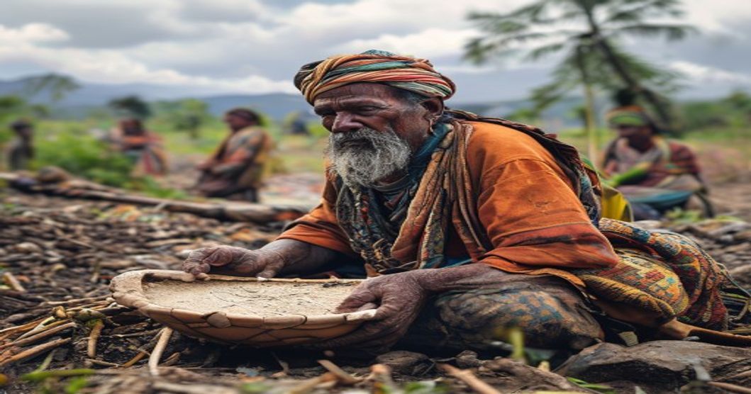
How Sami Communities Managed Natural Resources for Centuries
The Sami people developed a highly adaptive resource management system rooted in millennia of observation and ecological feedback loops across Fennoscandia. Central to this framework was the siida, a cooperative social unit that regulated land access, coordinated seasonal movements, and enforced communal harvesting rules. Rather than treating nature as a static backdrop, Sami communities viewed landscapes as dynamic corridors where reindeer, fish, forest, and tundra intersected.
- Seasonal Transhumance Patterns: Herders tracked reindeer across vertical and latitudinal gradients, moving herds between coastal winter pastures rich in crustose lichen and inland summer grazing grounds. This rotation prevented overgrazing and allowed vegetation recovery cycles.
- Controlled Fire Ecology: Strategic burning cleared dense undergrowth, promoted young lichen growth critical for reindeer nutrition, and reduced catastrophic wildfire risk by eliminating accumulated
Kinship Networks and Collective Decision Making in Resource Allocation
The traditional management of natural resources across Sami territories relied heavily on tightly knit kinship networks that functioned as both social glue and economic framework. These networks were not merely familial ties but operational units that dictated access to grazing lands, hunting grounds, and fishing waters. Authority rested with experienced elders who possessed extensive ecological knowledge passed down through generations. Resource allocation followed strict customary laws that prioritized community survival over individual gain, ensuring that no single family could monopolize critical assets.
Collective decision-making emerged through regular assemblies where representatives from each household gathered to discuss seasonal movements, pasture conditions, and wildlife populations. Disputes were resolved through mediated dialogue rather than imposed judgments, maintaining social cohesion while adapting to environmental fluctuations. The siida system served as the primary organizational structure, linking multiple families into cooperative herding units that shared labor, equipment, and risk. Decisions required broad consensus, with dissenting voices addressed through iterative negotiation until alignment was achieved.
- Siida Cooperation: Flexible groupings of related households that adjusted membership based on herd size, weather patterns, and economic necessity.
- Seasonal Pasture Rotation: Strictly enforced migration calendars that prevented overgrazing and allowed ecosystems to recover between usage periods.
- Intergenerational Knowledge Transfer: Oral instruction during practical activities ensured continuous refinement of ecological forecasting techniques.
- Conflict Mediation Protocols: Structured dialogue sessions led by respected elders who applied historical precedents to resolve boundary or resource disputes.
This decentralized yet highly coordinated approach enabled Sami communities to maintain ecological balance across harsh northern landscapes for centuries. Resource rights were treated as custodial responsibilities rather than permanent ownership, reinforcing accountability and long-term stewardship. When environmental pressures intensified, kinship networks rapidly reconfigured their strategies without external intervention, demonstrating remarkable institutional resilience embedded in cultural practice.
Pre-Colonial Governance Structures and Territorial Boundaries
Pre-colonial Sami societies operated through decentralized, kinship-based governance systems that prioritized ecological balance over territorial expansion. Authority rested with the siida, a seasonal community unit comprising extended families bound by mutual obligation and shared resource rights. Decision-making emerged from consensus among elders and experienced herders, fishers, and hunters who evaluated environmental indicators rather than administrative decrees.
- Territorial boundaries were fluid, defined by seasonal migration corridors, river basins, mountain passes, and forest ecotones that shifted according to reindeer calving cycles, salmon spawning periods, and berry harvest windows.
- Land use rights followed ancestral occupancy patterns, where access to hunting grounds, fishing sites, and grazing pastures was inherited through paternal or maternal lines depending on regional custom.
- Resource allocation relied on rotational access, seasonal closures during breeding periods, and communal monitoring that prevented overexploitation of reindeer herds, fish stocks, and game populations.
- Disputes over boundary crossings or resource depletion were resolved through mediated councils rather than punitive measures, reinforcing inter-community reciprocity and long-term sustainability.
Evidence from oral traditions, archaeological campsite distributions, and early Scandinavian land survey records confirms that these communities maintained precise ecological knowledge across generations. Territorial markers consisted of cairns, carved tree trunks, and culturally significant landscape features that functioned as living maps rather than fixed legal lines. Governance operated without centralized taxation or standing armies; instead, legitimacy derived from demonstrated stewardship, successful harvests, and adherence to customary law known as duodji regulations. This adaptive framework allowed Sami populations to sustain large reindeer herds, manage complex watershed systems, and preserve biodiversity long before external states imposed rigid jurisdictional boundaries. Historical accounts consistently document how seasonal resource quotas were negotiated annually, ensuring that extraction rates never exceeded natural regeneration capacities.
Ecological Principles Underpinning Long-Term Stewardship
The foundation of Sami resource management rests on centuries-old ecological principles that prioritize balance over extraction. Central to this system is the concept of adaptive coexistence, where human activity aligns with natural cycles rather than attempting to dominate them. Reindeer herding, the cornerstone of traditional livelihoods, operates as a dynamic grazing model that prevents overgrazing and promotes soil regeneration. Herders follow carefully mapped seasonal routes, allowing pastures to recover during dormant periods while maintaining genetic diversity in both plant and animal populations.
- Seasonal Rotation Systems: Land is utilized in cyclical patterns that mirror natural vegetation recovery rates. Summer highlands and winter lowlands serve as complementary zones, reducing pressure on any single ecosystem and preventing nutrient depletion.
- Observation-Driven Decision Making: Real-time environmental monitoring replaces fixed schedules. Changes in snow depth, lichen growth, or animal behavior directly dictate movement timing, ensuring resource use never exceeds ecological carrying capacity.
- Customary Resource Zoning: Community-established boundaries separate grazing areas, fishing grounds, and hunting zones based on historical usage data and environmental sensitivity. Violations are addressed through social accountability rather than punitive enforcement.
These practices emerge from a deep understanding of trophic relationships and landscape dynamics. Sami stewardship recognizes that lichen productivity depends on air quality, grazing intensity, and ground moisture levels. By maintaining herd sizes in proportion to forage availability, herders inadvertently support predator-prey equilibrium, prevent soil compaction, and preserve wetland hydrology. The system also incorporates intergenerational knowledge transfer, where youth learn spatial reasoning, weather reading, and species identification through direct participation rather than theoretical instruction.
Modern ecological studies validate these traditional frameworks. Research demonstrates that Sami-managed landscapes exhibit higher plant diversity, faster carbon sequestration, and greater resilience to climate fluctuations compared to intensively managed alternatives. The underlying mechanism is simple yet powerful: low-intensity, high-frequency observation combined with flexible response protocols. This approach transforms stewardship from a static practice into a living feedback loop, where human activity continuously adapts to environmental signals rather than imposing rigid extraction schedules.
Reindeer Herding Dynamics and Pasture Rotation Systems
The reindeer herding systems developed by Sámi communities operate as a highly calibrated ecological framework rather than simple animal husbandry. Herd movements follow precise seasonal corridors that align with vegetation recovery cycles and microclimate variations across Scandinavian landscapes. Summer grazing occurs primarily in open fjell terrain where wind exposure reduces insect harassment while the animals forage on shrubs, mosses, and grasses. Winter pastures shift to boreal forest zones where snow depth remains manageable and ground lichens remain accessible through natural wind scouring or reindeer digging behavior.
- Lichen recovery forms the structural backbone of pasture rotation. Species like Cladonia rangiferina require three to seven years without grazing pressure to regenerate fully. Herders map these zones using generational knowledge, dividing territories into numbered pastures that cycle through active use and fallow periods based on measurable biomass indicators rather than arbitrary timelines.
Herd size directly correlates with carrying capacity calculations embedded in traditional management protocols. When snow conditions prevent access to primary lichen beds, herders deploy supplementary feeding strategies only during extreme weather events, avoiding dependency cycles. Wind direction, crust formation on snowpack, and ice layer thickness dictate daily movement patterns rather than fixed schedules. Reindeer digestive physiology dictates grazing intensity limits. Their ability to extract nutrients from low-quality lichen during winter requires extended foraging windows, making pasture proximity critical. Herders monitor body condition scores and antler development across age classes to adjust rotation timelines dynamically.
- Knowledge transmission occurs through structured mentorship rather than written documentation. Young herders learn terrain reading, animal behavior interpretation, and pasture assessment through direct participation in seasonal migrations. This experiential learning ensures adaptive capacity remains intact despite climate fluctuations or regulatory changes.
Historical resource allocation operated under community consensus mechanisms that prioritized long-term ecological stability over short-term yield optimization. Pasture boundaries were maintained through visual markers, natural landmarks, and oral agreements that prevented overlapping claims. When a specific zone shows reduced biomass or increased soil exposure, it enters an extended fallow period regardless of seasonal calendars. This responsive management prevents the degradation cycles that plague unregulated pastoral systems. Modern land tenure frameworks increasingly reference these traditional rotation models to establish sustainable coexistence with forestry, mining, and renewable energy infrastructure.
Forest Ecology, Medicinal Plant Harvesting, and Fire Management
The Sami relationship with boreal ecosystems rests on centuries of observational data and adaptive land-use strategies. Forest ecology within these communities was never treated as a static backdrop but as a dynamic resource network governed by seasonal rhythms and ecological feedback loops. Reindeer pastoralism dictated movement patterns across lichen-rich pine forests, birch woodlands, and mountain taiga. Elders tracked soil moisture levels, needle litter decomposition rates, and understory vegetation shifts to determine grazing thresholds. This empirical monitoring prevented overgrazing and maintained forest regeneration cycles. Knowledge of tree species distribution particularly Scots pine and silver birch guided settlement placement, shelter construction, and fuel sourcing. Soil pH variations dictated which medicinal species established successfully in specific microhabitats. Microtopographical features like kettle holes and drumlin ridges created distinct hydrological zones that influenced species distribution.
- Medicinal plant harvesting operated under strict temporal and spatial protocols. Harvesters collected birch bark during spring sap flow when medicinal compounds like betulin peaked. Reindeer lichen was gathered only after winter snowmelt to allow fungal regeneration. Pine resin extraction required precise temperature windows to preserve terpene profiles without damaging cambium layers.
- Processing techniques included air-drying in ventilated shelters, fermentation in sealed birch containers, and cold-pressing of floral oils. Each preparation method targeted specific alkaloid concentrations while minimizing tissue degradation.
- Sustainable extraction followed a rotational system where individual stands were left fallow for three to five years. Knowledge transmission occurred through hands-on mentorship
Transmission of Indigenous Knowledge Across Generations
Sami ecological knowledge operates through continuous oral transmission, practical apprenticeship, and ritualized seasonal cycles that embed resource management into daily life.
Elders function as living archives, conveying landscape reading techniques, migratory corridor mapping, and species behavior patterns through direct field instruction. Young herders learn to track reindeer hoof impressions across snow crusts, interpret wind shifts for microclimate prediction, and identify lichen growth stages that indicate pasture recovery timelines. This embodied learning requires sustained exposure to terrain variability rather than classroom simulation.
- Oral narratives and joik traditions encode precise geographic coordinates, historical overwintering sites, and ecological boundaries that prevent resource depletion across fragmented terrain.
- Intergenerational mentorship demands active participation in ice thickness assessment, salmon run timing, and berry harvesting windows to avoid soil compaction and nutrient loss during sensitive growth periods.
- Sacred site protocols (sieidi systems) restrict human activity in fragile wetlands, breeding grounds, and mineral-rich zones until natural indicators confirm ecological recovery capacity and vegetation regrowth reaches threshold biomass.
Transmission rejects abstract documentation in favor of kinesthetic repetition. Children accompany herding families during autumn drives, learning to read terrain drainage patterns that determine safe grazing routes. When spring arrives, the same youth monitor river ice melt sequences to time fishing operations without disrupting spawning cycles or altering sediment deposition.
Community governance reinforces this knowledge pipeline through collective decision-making assemblies where resource quotas, rotational pasture schedules, and seasonal movement plans receive validation from multiple generations. Boundary disputes resolve through comparative analysis of
Oral Traditions and Place-Based Learning Methods
Intergenerational knowledge transfer within Sami territories operates through spoken narratives, seasonal chants, and direct environmental observation rather than written documentation. These oral traditions encode precise ecological data that governs sustainable resource extraction across arctic and subarctic landscapes. Herders memorize migration corridors by tracking wind patterns, snow density, and lichen regeneration rates over multi-decade cycles. Fishing communities record spawning timing through rhythmic verses that align with river temperature shifts and ice breakup sequences. The pedagogical framework relies on spatial immersion where elders guide younger participants across specific terrain features, transforming abstract ecological concepts into actionable survival skills.
- Yoik mapping systems encode geographic coordinates, water sources, and seasonal grazing zones through melodic structures that function as acoustic navigation tools
- Seasonal narrative cycles synchronize with reindeer calving windows, whitefish runs, and cloud berry harvests to regulate extraction pressure before ecological thresholds are reached
- On-site demonstration protocols require tool forging, hide preparation, and sustainable harvesting techniques to be performed directly within the resource environment
- Kinship-based knowledge networks distribute ecological information through extended family lines and regional herding districts rather than centralized administrative bodies
Contemporary conservation models frequently misinterpret these methods as folkloric practices instead of adaptive management frameworks. Governance structures emerge directly from these learning methods, establishing clear harvesting quotas based on observed animal health indicators and plant vitality rather than arbitrary calendar dates. When communities reference historical drought sequences through ancestral storytelling, they adjust grazing density or shift fishing grounds proactively before ecological thresholds are breached. Place-based education reinforces accountability because resource access remains tied to demonstrated competence and collective stewardship obligations. Fragmenting oral archives into isolated digital recordings strips ecological context from the knowledge system. Integrating spoken records with soil moisture monitoring, satellite vegetation tracking, and water quality testing creates resilient management protocols that honor indigenous epistemology while meeting modern sustainability metrics.
Apprenticeship Models and Intergenerational Skill Transfer
Traditional Sami ecological stewardship relied on structured apprenticeship frameworks that embedded resource management knowledge into daily practice rather than formal instruction. Younger members integrated directly into herding caravans, fishing camps, and seasonal foraging routes under the direct supervision of experienced elders. This immersive model required years of repeated exposure to environmental cues, animal behavior patterns, and terrain navigation before independent decision-making was permitted. Knowledge transmission occurred through continuous observation, corrective feedback, and narrative instruction
Adaptation Mechanisms in Response to Environmental Shifts
The Sami peoples developed sophisticated observation systems that translated subtle environmental signals into actionable resource management protocols. Generations of reindeer herders tracked wind direction, snow density, and ice formation across tundra and forest-tundra ecotones. These indicators dictated seasonal movement patterns long before modern meteorological instruments existed. Herds were guided toward sheltered valleys during katabatic wind events and redirected when surface hoar or crust formation threatened forage accessibility. This granular understanding of microclimates prevented overgrazing in fragile zones while maximizing nutritional intake for reindeer herds during critical calving and rutting periods.
Mobile pastoralism functioned as the primary buffer against climatic volatility. Rather than fixed territorial boundaries, Sami communities utilized rotating seasonal camps that adjusted annually based on pasture recovery rates and precipitation levels. During prolonged winters or early thaws, migration corridors shifted hundreds of kilometers to align with lichen availability and terrain stability. Herd composition itself served as an adaptive tool; larger mixed-age groups could be split into specialized sub-herds targeting different ecological niches. This flexibility minimized dependency on single resources and distributed risk across multiple environmental variables.
- Snowpack Analysis: Core samples were extracted to evaluate compaction layers, guiding sled routes and preventing herd exhaustion.
- Vegetation Cycling: Pastures were left fallow during lichen regeneration phases, with recovery periods extending up to seven years in arid zones.
- Multi-Seasonal Foraging: Berry harvesting, fish spawning cycles, and bird migration windows were mapped against reindeer grazing schedules to prevent resource overlap.
- Intergenerational Calibration: Elders transmitted location-specific climate memory through encoded song forms and route narratives, ensuring rapid response to anomalous weather patterns.
Community governance structures reinforced these ecological adaptations. Grazing rights were negotiated through kinship networks and seasonal assemblies that evaluated pasture conditions in real time. Decisions regarding herd sales, culling, and supplementary feeding followed strict environmental thresholds rather than fixed calendars. This decentralized management model allowed localized groups to pivot quickly when glacial melt accelerated or permafrost degradation altered drainage patterns. The resulting resilience emerged not from static preservation of traditions, but from continuous recalibration of practices against measurable ecological feedback.
Historical Climate Variability and Herding Strategy Adjustments
For centuries, the Sami people navigated a highly dynamic Arctic landscape where climatic fluctuations directly dictated pastoral economics and territorial organization. Medieval Warm Period warming expanded tundra vegetation northward, enabling extended summer grazing windows and larger herd accumulations across Finnmark and Troms regions. Conversely, the Little Ice Age forced rapid recalibration of seasonal movements as tree lines retreated and snowpack duration increased by several weeks. These environmental shifts required precise synchronization between reindeer biology and meteorological patterns. Pasture degradation during prolonged cold spells triggered strategic reductions in herd size to prevent overgrazing on fragile lichen beds. Communities mapped microclimates along elevation gradients, utilizing sheltered valley bottoms for winter conservation while reserving exposed alpine plateaus for summer thermoregulation periods.
- Route diversification: Parallel migration corridors developed across multiple valleys to distribute grazing pressure and buffer against localized blizzards or ice crust formation.
- Seasonal camp rotation: Winter encampments shifted toward sheltered fjord margins where maritime moderation reduced wind chill, while summer operations moved higher into exposed ridges for insect avoidance.
- Herd composition optimization: Selective breeding prioritized hardy phenotypes with thicker undercoats and enhanced foraging efficiency during deep snow conditions.
- Communal risk pooling: Neighboring clans exchanged calves and shared emergency fodder stores when extreme weather isolated specific territories for extended periods.
Intergenerational knowledge systems encoded precise correlations between auroral activity, wind direction, and upcoming precipitation patterns. Elders trained younger herders to read ice thickness on frozen lakes, interpret lichen discoloration as drought indicators, and track bird migration timings as seasonal markers. This empirical forecasting framework minimized catastrophic herd losses during unpredictable transitions. Historical land use records demonstrate that communities actively redistributed grazing rights when glacial advances blocked traditional corridors, establishing flexible tenure systems rather than rigid boundaries. Modern climate models confirm that these adaptive responses align closely with reconstructed paleoclimatic data, demonstrating a sophisticated understanding of ecosystem carrying capacity long before formal environmental science emerged.
Material adaptations accompanied these ecological adjustments. Reindeer sleds were redesigned with wider runners to distribute weight across deep snow, while birch-bark wrapping techniques protected harness lines from abrasion during ice storms. Herders implemented rotational grazing calendars that aligned with lichen regrowth cycles, typically allowing three to five years of rest between intensive use periods. This systematic approach prevented irreversible soil exposure and maintained forage biomass within sustainable thresholds. The integration of meteorological observation, territorial negotiation, and biological management created a resilient pastoral system capable of absorbing centuries of climatic volatility without collapsing.
Biodiversity Monitoring Through Indigenous Ecological Indicators
Sami communities have historically relied on precise ecological indicators to track biodiversity shifts across Arctic and subarctic landscapes. These indicators function as continuous environmental sensors rather than periodic data points. Lichen coverage serves as a primary indicator for reindeer grazing health. When specific foliose lichen species decline, it signals overgrazing or soil degradation, prompting rotational pasture management. Bird migration patterns also operate as seasonal biodiversity barometers. Species like the rock ptarmigan and Arctic tern provide early warnings of climate-induced habitat shifts. Their nesting success rates and timing directly correlate with insect abundance and tundra vegetation cycles.
Water quality indicators remain equally critical. Sami herders monitor macroinvertebrate populations in streams and lakes to assess watershed health. The presence or absence of stonefly larvae and caddisfly nymphs reveals oxygen levels, pH balance, and pollution sources without laboratory equipment. Soil microbiome composition acts as a foundational indicator. Traditional knowledge identifies specific moss layers and fungal networks that indicate nutrient cycling efficiency. When these biological signals align, grazing pressure is adjusted, hunting grounds are recalibrated, and medicinal plant harvesting follows strict seasonal windows.
- Lichen distribution mapping tracks pasture recovery cycles across different microclimates.
- Avian phenology records document shifts in breeding seasons linked to temperature fluctuations.
- Benthic organism surveys establish baseline water quality metrics for lake and river systems.
Modern conservation frameworks increasingly validate these observations through peer-reviewed ecological studies. Remote sensing data now cross-references historical lichen distribution maps with current satellite imagery, confirming the accuracy of centuries-old monitoring techniques. Community-led tracking protocols integrate oral documentation with GPS mapping, creating dynamic biodiversity databases that adapt to rapid environmental changes. This indigenous approach treats ecosystem health as an interconnected system rather than isolated species counts. Monitoring relies on continuous observation rather than periodic surveys. Knowledge transfer occurs through practical field instruction, ensuring indicators remain culturally relevant and ecologically precise. The methodology demonstrates how localized ecological literacy sustains long-term resource resilience across fragile northern biomes.
Risk Mitigation During Resource Scarcity and Famine Periods
Traditional Sami survival relied on dynamic risk distribution across multiple ecological zones and economic activities. When climate fluctuations or reindeer herds faced stress, communities activated layered mitigation protocols rooted in intergenerational knowledge. Seasonal transhumance allowed herders to track optimal grazing corridors, shifting between coastal winter pastures and inland summer ranges. This spatial mobility prevented localized overgrazing and provided fallback forage when snow conditions deteriorated or ice sealed critical river crossings.
- Spatial Mobility & Pasture Rotation: Herders divided large herds into specialized sub-herds based on age, sex, and lactation status. This fragmentation reduced pressure on specific lichen beds and enabled rapid relocation when weather fronts altered wind patterns or buried grazing grounds under heavy accumulation.
- Subsistence Diversification: Households maintained parallel income streams combining reindeer husbandry with seasonal fishing, wild berry harvesting, fur trapping, and cross-regional trade. Economic buffers emerged through surplus exchange networks that connected coastal and inland groups. During lean years, protein reserves from dried fish, salted meat, and rendered tallow sustained populations before herd recovery became possible.
- Communal Resource Pooling: Herd fragmentation during crises followed established kinship protocols, ensuring vulnerable families received livestock without market transactions. Decision-making rested with experienced reindeer herders who monitored snow depth, lichen coverage, and animal body condition scores to trigger early movement or slaughter directives.
- Traditional Ecological Monitoring: Communities tracked indicator species including snowshoe hares, ptarmigan populations, and lichen growth cycles to forecast pasture viability. Early warning signals triggered preemptive herd splitting or trade negotiations with neighboring agricultural settlements.
Storage infrastructure adapted to subarctic conditions using insulated root cellars, elevated wooden granaries, and frozen ground preservation methods. Inter-community coordination minimized localized collapse by redistributing surplus across ecological boundaries. Maritime Sami groups exchanged salted fish and whale blubber for inland reindeer meat during winter shortages, creating interdependent supply chains that survived extreme weather events. Governance structures enforced seasonal movement quotas and grazing rotation schedules, preventing resource depletion through collective monitoring rather than centralized authority. These protocols transformed environmental volatility into manageable operational parameters through continuous adaptation.
Contemporary Integration and Legal Recognition Frameworks
Modern legal systems across Scandinavia and northwest Russia have gradually shifted from historical assimilationist policies toward structured recognition of Sami resource governance. Norway established the Finnmark Act in 2005, transferring state-owned territories to the Finnmark Estate, a collaborative management body where Sami representatives hold decisive voting authority. This framework operationalizes customary reindeer herding and fishing rights through joint administrative committees that monitor grazing quotas, watershed protection, and mineral exploration permits.
Institutional co-management structures now form the backbone of contemporary resource allocation. The Sámi Parliaments of Norway, Sweden, and Finland negotiate binding agreements with environment ministries, translating historical land use patterns into statutory quotas and biodiversity monitoring programs. Regulatory agencies mandate adaptive management plans that adjust seasonal harvesting limits based on real-time climate data and reindeer population metrics, directly incorporating Sami observational records into national environmental databases.
- Sweden follows a parallel trajectory with constitutional acknowledgments of indigenous status, enabling formal consultation mechanisms for infrastructure development and conservation zoning under the Reindeer Husbandry Act.
- Finland integrates Sami resource claims within the Land Use and Building Act and national park regulations, requiring comprehensive environmental impact assessments to incorporate traditional ecological knowledge before approving forestry concessions or mining licenses.
- Russia’s framework remains fragmented, though regional agreements in Murmansk Oblast occasionally recognize seasonal migration corridors under federal wildlife protection statutes.
International instruments heavily influence these domestic frameworks. The United Nations Declaration on the Rights of Indigenous Peoples establishes baseline protocols for free, prior, and informed consent, directly shaping how national governments draft resource allocation treaties. The European Convention on Human Rights, particularly Article 8 regarding private and family life, has been cited in European Court rulings to protect Sami livelihoods against industrial encroachment. Cross-border cooperation through the Sámi Council coordinates policy alignment across state boundaries, ensuring that resource management frameworks remain ecologically coherent rather than administratively fragmented. Legal recognition continues evolving through judicial precedents, statutory amendments, and participatory governance models that treat indigenous ecological stewardship as complementary to modern conservation science.
Modern Co-Management Agreements and Sovereignty Claims
The transition from centuries of autonomous Sami resource management to contemporary co-management frameworks reflects a complex negotiation between Indigenous governance models and Nordic state jurisdictions. Modern agreements typically establish joint decision-making bodies where Sami representatives, national forestry agencies, mining regulators, and environmental scientists share authority over land use planning, wildlife populations, and extraction permits. These structures operate under evolving legal instruments that recognize traditional ecological knowledge as equivalent to academic research in resource assessment protocols.
- The Finnmark Act of 2005 established the Finnmark Estate, transferring approximately ninety-five percent of county lands from direct state control to a collaborative management model where Sami institutions hold equal voting weight alongside municipal representatives.
- Norwegian and Swedish Reindeer Herding Acts mandate consultation protocols before any infrastructure development crosses designated migration corridors or grazing zones, requiring impact assessments that incorporate seasonal movement data collected by local herders.
- Joint environmental monitoring programs integrate snow depth measurements, lichen yield tracking, and predator population counts documented through generations of pastoral practice with satellite telemetry and climate modeling datasets.
Sovereignty claims emerging from these arrangements extend beyond administrative participation toward legal recognition of inherent territorial rights. Nordic governments have gradually shifted from viewing Sami resource use as a cultural privilege to acknowledging it as a constitutionally protected entitlement under international frameworks like ILO Convention 169 and the UN Declaration on the Rights of Indigenous Peoples. This juridical evolution has triggered formal boundary delimitation processes, where historical usage patterns, burial sites, and seasonal camp locations serve as primary evidence in land claims litigation.
Practical implementation reveals persistent friction between conservation objectives and economic development priorities. State authorities frequently prioritize carbon sequestration targets and biodiversity metrics that conflict with controlled burning practices and selective grazing necessary for maintaining open tundra ecosystems. Co-management councils must navigate subsidy distributions, hunting quota allocations, and renewable energy siting decisions while balancing intergenerational knowledge transfer with regulatory compliance requirements. Successful agreements demonstrate measurable improvements in habitat restoration rates and reindeer population stability when decision-making timelines align with ecological cycles rather than bureaucratic fiscal years.
Digital Mapping Technologies Preserving Traditional Landscapes
Sami communities have integrated geospatial tools to document ancestral grazing routes, reindeer migration corridors, and sacred sites with unprecedented precision. Geographic Information Systems allow indigenous groups to layer historical place names alongside topographical data, creating dynamic atlases that reflect centuries of land use. Field teams deploy handheld GPS units and drone-mounted LiDAR sensors to capture micro-topography, vegetation patterns, and permafrost shifts. These datasets feed into community-controlled databases where elders verify spatial accuracy against oral histories.
Participatory mapping initiatives bridge generational knowledge gaps by training younger members in remote sensing analysis while recording traditional ecological indicators. Satellite imagery processing reveals seasonal changes in snowpack depth and lichen coverage, critical for assessing pasture viability. Open-source platforms enable real-time collaboration across borders, allowing Sámi reindeer herding districts to share boundary disputes, water source locations, and infrastructure impacts with environmental agencies. Legal frameworks increasingly recognize these georeferenced records as admissible evidence in territorial claims.
- High-resolution orthomosaic generation captures erosion patterns along traditional fishing streams without disturbing fragile riparian zones.
- Temporal analysis of historical cadastral maps identifies shifting property lines and validates customary usage rights through spatial overlap metrics.
- Mobile data collection applications standardize place name spellings across dialects while tagging GPS coordinates with audio recordings of local terminology.
Cloud infrastructure secures sensitive location data against unauthorized extraction while maintaining version control for iterative landscape updates. When mining or forestry operations require environmental impact assessments, these curated spatial archives provide baseline conditions that resist post-hoc manipulation. Community land stewards export vector layers into regional planning software, ensuring traditional resource zones remain visible in municipal development proposals. Continuous calibration between satellite-derived vegetation indices and ground-truthed pasture quality measurements strengthens predictive models for winter grazing allocation.
Policy Evolution and International Indigenous Rights Instruments
International frameworks have progressively shifted from assimilationist land doctrines to legally enforceable recognition of indigenous resource governance. The structural turning point arrived with ILO Convention No. 169, ratified by Norway and Sweden in 1990 and 1996 respectively. This treaty dismantled the historical legal fiction that Sami territories were res nullius, replacing it with statutory acknowledgment of customary land tenure, seasonal migration corridors, and non-extractive stewardship practices. The convention established binding consultation requirements for any state-sponsored development intersecting traditional livelihoods.
- Article 14 legally entitles indigenous communities to participate in administrative mechanisms governing resource allocation, directly restructuring Sami reindeer husbandry districts and coastal fishing zones.
- Article 15 mandates prior state negotiation before authorizing mineral exploration or hydrocarbon extraction, creating procedural barriers against unilateral concession grants.
- Article 6 requires impact assessments to incorporate indigenous legal traditions, forcing environmental regulators to evaluate cumulative effects on moss pastures and salmon spawning rivers.
The normative landscape expanded dramatically following the adoption of UNDRIP in 2007. Although initially framed as declaratory, UNDRIP crystallized Free, Prior, and Informed Consent (FPIC) into customary international law through subsequent treaty body interpretations. Nordic legislatures responded by amending domestic extraction codes, particularly when renewable energy projects threatened to fragment herding grounds across municipal borders. Judicial enforcement solidified these principles. The European Court of Human Rights rulings in Sámi Parliament v. Norway and Kallio v. Finland
interpreted Convention 169 alongside Article 8 of the ECHR, ruling that unconsulted resource development constitutes a violation of cultural integrity and economic survival.Domestic implementation diverged across Nordic jurisdictions due to constitutional constraints and political resistance. Norway’s Finnmark Act (2005) transferred title over 96% of county territory to a locally elected board, embedding Sami customary law into property registries and establishing precedent for shared management councils. Sweden’s Mining Law revision (2013) mandated cultural heritage surveys that explicitly map lichen pastures and burial sites, delaying permits until siida representatives approve routing alternatives. Finland integrated resource allocation with EU Natura 2000 habitat directives, creating co-management zones where forestry clear-cutting requires dual authorization from state agencies and Sami grazing cooperatives.
These instruments collectively dismantled centralized resource monopolies by legally validating continuous occupation, ecological monitoring systems, and intergenerational knowledge transfer. Current enforcement challenges focus on FPIC operationalization gaps, particularly concerning lithium mining permits, offshore wind leases, and carbon sequestration projects that bypass traditional harvesting calendars. UN treaty bodies and ILO supervisory commissions maintain periodic review cycles that condition financial aid and trade agreements on demonstrable alignment between domestic licensing procedures and established Sami land rights frameworks.
Scholarly Analysis of Long-Term Resource Sustainability
Academic research into Sami resource management consistently highlights a sophisticated framework built on empirical observation, ecological feedback loops, and decentralized governance. Scholars examining historical land-use patterns note that the siida system functioned as a dynamic administrative unit rather than a static territorial claim. This structure enabled precise allocation of grazing lands, fishing waters, and hunting grounds based on seasonal availability and carrying capacity. Peer-reviewed studies from environmental anthropology and historical ecology demonstrate that rotational migration routes were calibrated to prevent overgrazing, allowing vegetation recovery periods that maintained soil integrity and biodiversity.
Research methodologies combining paleoecological data with oral histories reveal how knowledge transmission operated through structured apprenticeship models. Elders documented microclimatic shifts, reindeer behavior, and plant phenology using mnemonic devices and site-specific toponyms. University-led interdisciplinary projects have mapped these traditional ecological indicators against modern satellite imagery, confirming remarkable accuracy in predicting forage quality and wildlife movement corridors. The academic consensus emphasizes that sustainability emerged not from restrictive taboos but from adaptive monitoring protocols embedded in daily practice.
- Distributed decision-making: Resource allocation required collective agreement within each siida, with dissenting members exercising veto power over proposed land modifications.
- Carrying capacity thresholds: Herd sizes were intentionally regulated through selective culling and rest periods, aligning population density with documented forage regeneration rates.
- Multi-species monitoring: Ecological health was assessed through indicator species including lichens, migratory birds, and soil invertebrates rather than single-resource yield metrics.
Contemporary environmental science journals increasingly reference Sami management practices as case studies for resilience-based governance. Longitudinal analyses show that regions under historical Sami stewardship exhibit higher watershed stability and lower erosion rates compared to adjacent commercially managed landscapes. Researchers attribute this divergence to the integration of spatial memory with real-time ecological feedback, a methodology now being formalized in participatory land-management frameworks across boreal ecosystems.
Comparative Studies with Other Indigenous Stewardship Models
Indigenous resource governance systems worldwide share foundational principles of intergenerational equity and ecological reciprocity, yet operational frameworks diverge significantly based on geography, climate, and socio-political history. Sami stewardship of northern boreal and arctic landscapes stands in distinct contrast to the agroforestry networks of Mesoamerican civilizations and the maritime resource protocols of Polynesian navigators. Where Sami communities structured management around migratory reindeer herding cycles, seasonal pastures, and customary grazing rights regulated through district-based bygdelag assemblies, Andean agricultural systems relied on vertical archipelago zoning to exploit microclimates across elevation gradients. This topographical adaptation allowed simultaneous cultivation of maize, potatoes, and quinoa without soil exhaustion, whereas Sami practices prioritized pasture rotation and fire management to prevent lichen overgrazing.
Comparative analysis with Aboriginal Australian land stewardship reveals parallel reliance on deep-time ecological memory but divergent institutional structures. While Indigenous Australian groups utilized controlled burning regimes and songline mapping to maintain biodiversity across continental scales, Sami governance operated through kin-based resource allocation and collective herding cooperatives. Both systems embed knowledge transmission within oral tradition and ritual practice, yet Sami customary law historically integrated with Norwegian, Swedish, and Finnish state jurisdictions differently than Aboriginal land councils negotiated post-colonial native title claims. The legal recognition of Sámi utmark remains fragmented across Nordic borders, contrasting with the unified statutory protection granted to Australian heritage sites under national environmental legislation.
- Māori kaitiakitanga emphasizes guardianship over ownership, mirroring Sami ecological ethics but diverging in resource focus from terrestrial caribou dynamics to marine and freshwater fisheries managed by tribal hapū authorities.
- Modern policy studies indicate that jurisdictions aligning formal conservation laws with Indigenous customary institutions consistently report higher biodiversity retention rates across comparative biomes.
- Integrating traditional monitoring techniques with remote sensing data has enabled cross-regional knowledge exchange, particularly in tracking permafrost degradation, pasture recovery cycles, and wildlife migration patterns.
The structural differences underscore how environmental constraints shape institutional design. Sami resource allocation depended on continuous mobility across transboundary territories, requiring flexible conflict-resolution mechanisms that evolved independently of centralized state bureaucracy. In contrast, settled agricultural Indigenous models developed permanent infrastructure and surplus storage systems that facilitated trade networks but demanded stricter territorial demarcation. Contemporary comparative frameworks now prioritize biocultural diversity metrics, recognizing that preserving linguistic variation alongside ecological practices strengthens adaptive capacity. Researchers document how Sami herding calendars, when cross-referenced with paleoclimate records, reveal centuries of deliberate landscape manipulation that sustained soil fertility and prevented overgrazing. These documented methodologies provide actionable insights for modern conservation planning across northern latitudes.
Quantitative Assessments of Ecosystem Resilience Over Time
Longitudinal ecological monitoring relies on standardized metrics to track vegetation recovery rates, soil carbon sequestration, and hydrological stability across reindeer grazing corridors. Researchers extract resilience data through high-resolution satellite imagery, normalized difference vegetation index calculations, and ground-truthed biomass surveys. These datasets are systematically cross-referenced with historical Sami land-use registries, which document seasonal migration routes, winter pasture allocation, and grazing intensity thresholds established through generational observation.
- Spatial Analysis: Geographic information systems map historical grazing boundaries against contemporary vegetation cover. Buffer zone modeling reveals how rotational pasturing reduces soil compaction and maintains lichen diversity above critical ecological thresholds. Spatial autocorrelation metrics quantify patch connectivity across fragmented landscapes.
- Temporal Modeling: Autoregressive integrated moving average frameworks process decades of climate and land-use data to identify recovery cycles after drought or heavy snowfall events. These statistical models demonstrate how traditional rest periods align precisely with natural regrowth windows, minimizing cumulative stress indicators.
- Bioindicators & Sediment Cores: Pollen stratigraphy and peat bog analysis reconstruct vegetation shifts over four centuries. Stable isotope ratios in reindeer antler fragments correlate historical grazing pressure with watershed nutrient retention, providing reliable proxy data for long-term ecosystem stability.
Quantitative resilience indices consistently demonstrate that territories managed under Sami customary rotation schedules exhibit faster post-disturbance recovery and lower biodiversity loss compared to continuously grazed or completely fenced zones. Statistical correlation coefficients between documented pastoral practices and measured soil moisture retention frequently exceed r = 0.74, indicating robust predictive relationships. Modern ecological validation confirms that historical grazing quotas function as dynamic carrying capacity regulators, preventing resource depletion while maintaining trophic balance. These measurable outcomes validate the functional precision of indigenous allocation frameworks.
Academic Debates on Continuity Versus Transformation in Sami Practices
Scholars examining Sámi resource management consistently navigate a tension between preserving ancestral ecological knowledge and acknowledging adaptive responses to external pressures. Early ethnographic accounts often emphasized unbroken continuity, framing reindeer herding, coastal fishing, and inland hunting as static traditions passed down through generations. Contemporary research, however, reveals a more complex trajectory shaped by state policies, market integration, and environmental shifts. The nineteenth and twentieth century nation-building projects imposed fixed borders, private property concepts, and conservation laws that disrupted seasonal migration corridors and restricted access to traditional grazing lands. Rather than erasing indigenous practices, these interventions triggered strategic transformations. Herders adopted snowmobiles and satellite tracking, communities negotiated co-management agreements with forestry agencies, and legal frameworks gradually recognized customary land rights through mechanisms like the Finnmark Act in Norway or regional Sámi forest codes in Sweden.
Academic discourse now centers on how continuity operates not as replication but as functional adaptation. Researchers document the deliberate retention of core ecological principles while modifying tools and governance structures. The debate extends to climate change impacts, where rising temperatures destabilize traditional reindeer pastures and force shifts in herding calendars. Some scholars argue that these adjustments demonstrate remarkable resilience, while others warn that rapid ecological disruption outpaces cultural adaptation capacities. Comparative studies highlight how Sámi communities strategically blend indigenous monitoring techniques with scientific data collection, creating hybrid knowledge systems that challenge binary classifications of tradition versus modernity.
- Methodological shifts: Research has moved from descriptive ethnography to interdisciplinary analyses combining historical GIS mapping, paleoecological data, and legal theory.
- Colonial documentation critique: Academics now interrogate how colonial archives distorted indigenous practices by labeling adaptive strategies as cultural loss.
- Institutional memory over fixed techniques: Elders transmit decision-making frameworks that allow flexible responses to unpredictable ecological variables, positioning indigenous knowledge as a living epistemology capable of rigorous scientific engagement.
This evolving framework suggests that Sámi ecological management remains fundamentally dynamic. Contemporary resource rights are no longer solely rooted in historical continuity but are actively constructed through litigation, policy negotiation, and transnational indigenous networks. The scholarly consensus increasingly treats adaptation not as a deviation from tradition but as its essential mechanism for long-term survival.
Frequently Asked Questions
What is How Sami Communities Managed Natural Resources for Centuries?
“How Sami Communities Managed Natural Resources for Centuries” refers to the sustainable practices, traditional ecological knowledge, and cultural protocols that the indigenous Sami people of northern Scandinavia have used to govern forests, waterways, reindeer grazing lands, and other natural assets over hundreds of years. Their approach emphasizes balance, reciprocity with nature, and intergenerational wisdom.
Key facts about How Sami Communities Managed Natural Resources for Centuries
- Sami resource management is deeply rooted in reindeer herding, which requires rotational grazing to prevent overgrazing and maintain ecosystem health.
- Traditional knowledge includes detailed understanding of seasonal changes, plant properties, and animal behavior passed down orally through generations.
- Land use was communal rather than individual, with strict cultural norms discouraging wasteful extraction or hoarding of resources.
- Modern conservation efforts increasingly recognize and integrate Sami sustainable practices into regional environmental policies.