Indigenous Tracking Skills of Sami Communities: A Comprehensive Overview
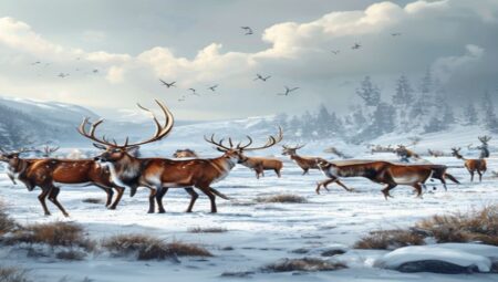
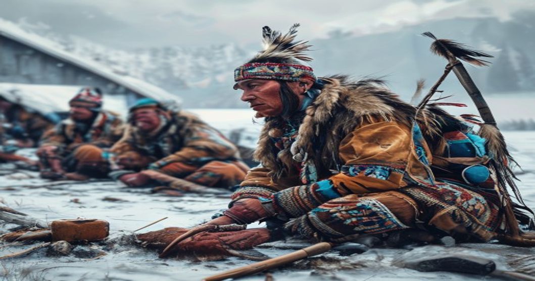
The Sámi peoples, indigenous to the Fennoscandian Arctic and northwestern Russia, cultivated tracking methodologies that function as precise environmental reading systems rather than simple sign detection. These competencies emerged from centuries of reindeer pastoralism, winter hunting, and navigation across snow-covered tundra and boreal forests. Practitioners interpret minute physical alterations in terrain to locate game, monitor herd movements, and maintain safe travel routes during polar nights and blizzards.
Core observational techniques rely on analyzing track geometry, snow density gradients, wind scour patterns, and vegetation compression. Experts distinguish species by measuring toe pad impressions, stride length variations, and weight distribution shifts across frozen surfaces. Age classification follows hoof wear patterns and body size projections relative to surrounding landscape features. Practitioners also read subtle indicators such as lichen displacement, branch bending angles, and ice crystal formations near water sources.
- Snow profile analysis reveals wind direction, temperature fluctuations, and recent animal passages through layered crust formation.
- Voice echo mapping allows hunters to locate hidden game valleys by listening to sound reflection patterns across mountain ridges.
- Terrain contour memorization enables navigation without instruments by recognizing rock strata, tree growth asymmetry, and permafrost thaw lines.
Knowledge transmission operates through direct field instruction rather than written documentation. Children begin tracking exercises during spring calving seasons, learning to read hoof prints, identify predator presence, and predict weather shifts through bird behavior and cloud movement. Elders emphasize ethical boundaries regarding hunt timing, territory rotation, and resource extraction limits. These practices maintain ecological equilibrium by preventing overharvesting and preserving migratory corridors.
Contemporary conservation initiatives integrate Sámi tracking data with satellite telemetry to monitor reindeer populations and climate adaptation patterns. Researchers document how traditional observation methods identify microclimate variations that digital sensors miss. Training programs now combine university curricula with seasonal field apprenticeships, ensuring competency transfer across generations. The methodology continues influencing Arctic rescue operations, wildlife management protocols, and cross-cultural environmental education frameworks.
Historical Foundations and Cultural Significance of Sami Tracking
The ancestral tracking methodologies developed by Sami peoples emerged from continuous adaptation to Fennoscandian boreal and tundra ecosystems over several millennia. These techniques functioned as critical survival infrastructure, enabling precise movement across terrain obscured by heavy snowfall, freezing precipitation, and rapid weather shifts. Early documentation from Norse sagas, Finnish national epic Kalevala references, and Swedish colonial surveys consistently note the Sami ability to read subtle environmental indicators that remained invisible to outsiders.
Reindeer husbandry formed the economic backbone of traditional Sami livelihoods, requiring tracking systems capable of locating scattered animals across vast winter pastures. Trackers analyzed snow depth variations, wind-drift patterns, and minute alterations in reindeer foot impressions to determine movement direction, herd size, and recent activity. Ice thickness on rivers, thaw lines along mountain slopes, and vegetation exposure provided supplementary navigation markers. Each region developed distinct nomenclature for specific track types, weather phenomena, and terrain features, creating a highly localized knowledge architecture that optimized resource distribution.
- Snowreading techniques: Differentiated between fresh tracks, wind-eroded paths, and animal trails using texture analysis and shadow evaluation during low-angle sunlight.
- Veterinary tracking: Identified illness, injury, or birthing events by observing gait alterations, dung placement, and rest site selection patterns.
- Seasonal migration mapping: Maintained mental cartography of grazing routes, calving grounds, and winter encampments transmitted through field instruction rather than written records.
Cultural transmission relied on immersive apprenticeship models. Young members accompanied experienced trackers during extended expeditions, absorbing observational frameworks through direct participation. Place names, storytelling traditions, and seasonal rituals reinforced ecological literacy while embedding tracking knowledge within broader cosmological understanding. Land acquisition was never viewed as ownership but rather as custodial responsibility, with tracking routes defining territorial boundaries through continuous use.
Colonial administrative policies from the eighteenth century onward systematically disrupted these practices. Forced settlement programs, religious conversion campaigns, and centralized land management frameworks restricted traditional movement corridors. Tracking knowledge experienced significant attrition during mid-twentieth century assimilation initiatives, as younger generations prioritized formal education and wage labor over pastoral livelihoods.
Contemporary preservation efforts utilize digital mapping, audio documentation, and community-led workshops to reconstruct degraded tracking lineages. Academic institutions collaborate with Sami reindeer herding districts to validate historical route data against satellite imagery and climate records. Traditional ecological knowledge now informs modern wildlife management strategies, demonstrating how ancestral tracking frameworks maintain relevance in rapidly changing northern environments.
Core Principles Governing Reindeer and Wildlife Observation
The Sami approach to reindeer and wildlife observation rests on a highly refined ecological literacy developed across generations. Practitioners read the landscape as a continuous record, interpreting subtle shifts in snow density, wind scarring, and vegetation patterns to anticipate animal movements. This system does not rely on isolated signs but operates through layered environmental correlation, where terrain topology, microclimate variations, and seasonal transitions function as interconnected indicators.
- Snowpack Analysis: Practitioners evaluate crust formation, depth variation, and wind drift patterns to distinguish fresh reindeer pathways from older tracks or wildlife interference. Ice layers within snowfields reveal temperature fluctuations that directly influence herd routing decisions.
- Vegetation and Browse Signatures: Lichen depletion zones, birch branch stripping patterns, and moss compression indicate prolonged grazing activity. The spatial distribution of these markers maps feeding intensity and herd linger duration before directional shifts occur.
- Scent and Wind Dynamics: Reindeer rely heavily on olfactory navigation, making wind direction a critical tracking variable. Observers position themselves upwind to detect disturbed snow crystals, hair deposits, and respiratory vapor trails that signal recent passage.
- Behavioral Baseline Recognition: Herd cohesion patterns, ear positioning, gait adjustments, and vocalization frequency provide real-time data on stress levels, calving readiness, or predator proximity. Deviations from established movement rhythms trigger immediate route reassessment.
- Seasonal Correlation Mapping: Migration corridors align with freeze-thaw cycles, insect emergence periods, and pasture regeneration rates. Observers cross-reference historical knowledge with current ground conditions to predict transition windows without disrupting natural pacing, adjusting route timing by hours or days based on ice thickness and forage accessibility.
These principles function as a dynamic decision framework rather than a static checklist. Practitioners continuously integrate real-time sensory input with accumulated experiential data, maintaining herd viability while minimizing ecological disruption. The system demands sustained attention to micro-indicators that modern tracking methods often overlook, preserving a highly adaptive observational protocol rooted in long-term land stewardship and intergenerational knowledge transfer.
Environmental Adaptation and Terrain Mastery in Arctic Landscapes
The Sami communities navigate Arctic environments through a highly specialized system of environmental reading that transforms harsh landscapes into readable data networks. Reindeer tracking requires interpreting minute variations in snow structure, where wind-packed crusts indicate travel corridors and soft powder zones signal recent animal movement. Temperature fluctuations create distinct melt-freeze cycles on exposed rock faces, leaving moisture trails that reveal herd routes across frozen plateaus. Wind direction dictates scent dispersion patterns, forcing trackers to approach from leeward angles while reading ice formations on fell slopes for directional clues.
Terrain mastery extends into seasonal adaptation strategies that optimize movement across shifting ground conditions. Winter ski trails follow elevated ridges where katabatic winds scour snow layers, creating stable walking surfaces over deep drifts. Spring tracking demands recognition of freeze-thaw boundaries near streams and lakes, where collapsing ice sheets signal dangerous travel zones. Knowledge of permafrost degradation patterns helps predict ground stability during late winter migrations, while lichen growth rates on boulders indicate microclimate exposure levels that affect animal grazing routes.
- Snow Crust Analysis: Trackers evaluate hardness gradients using pole pressure tests, identifying reindeer hooves through irregular compression patterns beneath icy layers.
- Morphological Landmarks: Birch tree lean angles, rock outcrop weathering patterns, and frozen river channel formations provide permanent orientation markers during whiteout conditions.
- Wind Drift Mapping: Snowdrift orientation reveals prevailing atmospheric pressure systems, enabling prediction of upcoming storm fronts that alter animal movement corridors.
- Biological Indicators: Bird nesting sites and lichen colonization zones mark sheltered valleys where herds congregate during extreme weather events.
Directional accuracy relies on combining celestial navigation with terrestrial markers. During polar night periods, trackers utilize stellar positions alongside traditional knowledge of magnetic field variations near mineral-rich rock formations. Snow depth measurements taken at consistent intervals create elevation profiles that map hidden terrain features beneath ice layers. Every environmental element functions as a continuous monitoring system, where subtle changes in ground color, vegetation exposure, and animal bedding sites generate real-time spatial data essential for survival across vast Arctic territories.
Interpreting Snowpack Structures and Ice Formations
The Sami people have developed intricate methods for reading snowpack layers over centuries of Arctic survival. Each wind direction, temperature fluctuation, and freezing cycle leaves a distinct signature on the snow surface and subsurface structure. Crust layers form when daytime solar radiation melts the upper millimeters, followed by rapid nighttime refreezing. These ice sheets create predictable walking surfaces but also conceal hidden hollows that can collapse under weight. Experienced Sami trackers identify these wind slabs by observing subtle color variations and listening to the acoustic resonance when stepping lightly.
Depth hoar develops in stable, cold conditions where temperature gradients drive vapor transfer within the snowpack. The resulting cup-shaped crystals create a weak layer prone to sudden failure, requiring precise route selection to avoid avalanche terrain. Ice formations along trails and frozen waterways offer additional navigational markers. Rime ice accumulates on windward surfaces through supercooled fog droplets freezing instantly on contact. Its rough texture and directional growth patterns indicate prevailing storm tracks and help estimate recent weather shifts. Glaze ice forms when rain or meltwater saturates the snowpack before refreezing, creating a dense, transparent layer that alters traction requirements entirely.
- Acoustic assessment: Tapping frozen water bodies with wooden poles reveals load-bearing capacity through pitch variation.
- Edge stratification: Alternating layers of clear and cloudy ice near riverbanks map freeze-thaw cycles during seasonal transitions.
- Track compression analysis: Moose hooves sink deeper than reindeer antlers, leaving distinct impression geometries that indicate species, direction, and travel speed.
Fresh prints retain sharp edges when temperatures remain below freezing, while rounded margins indicate recent thawing or wind scouring. Ice bridges over streams require careful approach angles to prevent fracture propagation. The Sami traditionally use narrow ski tracks carved into firm snow to distribute weight evenly, minimizing sinkage and preserving trail clarity for subsequent travel. Observing subtle depressions in frozen marshes reveals animal movement corridors long after the subjects have departed. Each structural variation within the snowpack functions as a chronological record, allowing experienced navigators to reconstruct recent environmental conditions and predict safe passage through otherwise treacherous terrain.
Wayfinding Techniques Utilizing Natural Landmarks
The Sami navigators transform the Arctic landscape into a continuous reading map through highly refined environmental literacy. Every mountain ridge, frozen river channel, and cluster of birch trees functions as a coordinate in a living grid. Practitioners read terrain contours to anticipate safe passage across unstable ice or steep slopes. Watercourses reveal directionality; meltwater streams carve consistent valleys that ultimately feed larger rivers leading to established territories. Lichen coverage patterns indicate prevailing wind directions and seasonal sun exposure, allowing trackers to orient themselves when visibility drops below critical thresholds.
- Rock formations serve as permanent reference points because their weathering profiles remain unchanged across generations.
- Snowdrift architecture provides immediate clues about recent weather systems and travel history; leeward slopes accumulate deep powder while windward faces show hard-packed crusts that dictate footfall placement.
- Reindeer migration corridors follow the same natural features, making animal movement patterns a secondary navigation layer.
- Seasonal vegetation shifts mark boundary lines between summer grazing zones and winter pastures.
Experienced guides memorize topographic sequences through iterative field practice rather than abstract mapping. Each landmark connects to the next through established travel logic that prioritizes energy conservation and risk mitigation in extreme conditions. This knowledge system operates without written records, relying instead on direct observation, tactile feedback from snow depth, and auditory cues like cracking ice or distant waterfalls. The integration of micro-terrain reading with macro-geographical awareness creates a resilient navigation framework adapted to rapid Arctic climate shifts. Navigators also monitor soil saturation levels near tree lines to identify hidden thaw zones that compromise route stability. Ground vegetation density correlates with underlying permafrost distribution, enabling safe crossing decisions during spring thaws. These interconnected observational layers form a self-correcting spatial database that requires decades of immersion to master.
Practical Tracking Methodologies and Knowledge Transmission
Practical tracking within Sámi territories relies on systematic environmental reading rather than isolated sign identification. Practitioners analyze snowpack stratification, wind drift patterns, and substrate compression to determine the age, direction, and species of recent movement. Track interpretation extends beyond hoof impressions or paw marks. Hunters examine disturbed lichen mats, broken spruce branches at precise angles, and subtle depressions in crust layers that indicate weight distribution. Weather fluctuations directly alter sign preservation; rapid temperature shifts create ice lenses beneath snow surfaces, while persistent winds reorganize drift formations. Skilled trackers cross-reference these physical markers with topographical features such as ridge lines, river crossings, and dense woodland edges where wildlife naturally funnels.
- Snow depth measurement using calibrated poles to estimate travel distance
- Bark stripping patterns
Reading Animal Behavior and Movement Patterns
Sami trackers interpret animal movement through a multidimensional lens that integrates track morphology, environmental context, and species-specific behavioral markers. The depth of a reindeer hoof print in snow reveals weight distribution and gait transitions. A shallow impression with parallel edges indicates a trotting pace, while deeper, asymmetrical depressions signal a change to galloping or sudden acceleration. Stride length further clarifies intention; elongated steps suggest forward momentum toward grazing grounds or water sources, whereas compressed intervals point to hesitation, feeding, or predator avoidance. Trackers also examine the surrounding terrain for secondary indicators such as broken twigs, disturbed lichen beds, and directional snow drifts that align with wind patterns. These micro-signs collectively reconstruct the animal’s recent activity cycle.
- Hoof imprint depth correlates directly with ground hardness and current fatigue levels of the animal.
- Stride symmetry exposes limping patterns or deliberate evasion maneuvers around territorial boundaries.
- Snow crust fractures reveal sudden stops or rapid directional shifts during predator encounters.
Behavioral observation operates concurrently with physical tracing. Ear orientation, tail elevation, and head position communicate immediate psychological states. A moose standing with ears pinned forward and neck extended is assessing potential threats, while a reindeer herd clustered tightly indicates perceived danger or approaching storm conditions. Trackers monitor feeding rhythms to predict movement corridors. When ungulates consistently strip bark from birch trees at specific angles, they reveal preferred travel routes that avoid steep inclines. Seasonal shifts demand adjusted reading techniques. Winter tracking prioritizes snow depth variations and wind-sculpted drifts, whereas summer methods focus on broken vegetation, mud displacement, and avian alarm calls that signal predator proximity.
The transmission of these observational protocols remains embedded in generational practice. Young herders learn through direct field exposure rather than abstract instruction. An experienced tracker will pause at a disturbed snowbank, point to fragmented hoof marks, and explain how the curvature indicates a recent turn away from a ravine. This experiential pedagogy ensures that tracking knowledge adapts to local topography and shifting wildlife patterns. Modern ecological studies validate these traditional methods, confirming that Sami behavioral interpretation aligns with contemporary ethological data on ungulate stress responses and migration efficiency.
Mechanisms for Preserving Oral Traditions Across Generations
Traditional knowledge transmission within Sami communities operates through structured, context-driven pedagogy rather than formal instruction. Elders and experienced hunters embed ecological data directly into daily routines, ensuring tracking techniques survive through repeated environmental exposure. Route navigation depends on mnemonic landscapes where specific rock formations, lichen patterns, and wind directions serve as cognitive anchors. Children learn to read snow crusts, track depth, and interpret animal spoor through guided field exercises during late winter expeditions.
- Seasonal Camp Cycles: Winter and summer camps function as immersive learning environments where route planning, weather forecasting, and prey behavior analysis occur continuously. Knowledge transfer happens organically during reindeer rounding, ice travel, and berry gathering.
- Narrative Encoding: Complex tracking sequences are compressed into rhythmic verses and place-specific stories. These narratives preserve topographical details, historical migration corridors, and dangerous terrain markers without relying on written maps.
- Mentorship Hierarchy: Youth progression follows a documented apprenticeship model. Novices observe first, then attempt simplified tracking tasks under direct supervision before navigating unmarked wilderness independently. Critical decision-making moments are deliberately shared to build situational awareness.
- Linguistic Anchoring: Specialized vocabulary for snow conditions, animal gait, and wind behavior creates precise mental models. Each term corresponds to a measurable environmental variable, allowing rapid communication during high-stakes tracking scenarios.
Modern preservation efforts supplement these practices through audio documentation of elder interviews and geospatial mapping of traditional routes. However, the core mechanism remains relational: knowledge stays viable only when actively applied in moving herds, tracking game, or reading shifting ice conditions. Loss of language fluency directly correlates with degraded tracking accuracy, confirming that linguistic structure and environmental literacy operate as a single cognitive system. Community-led workshops now integrate digital archiving with live field instruction to maintain this continuity.
Modern Applications and Conservation of Sami Tracking Knowledge
Traditional Sami tracking methodologies, refined over centuries of reindeer herding and Arctic survival, now intersect with contemporary environmental monitoring and Indigenous-led conservation frameworks. Herders utilize precise snow density assessment, wind-sculpted drift pattern analysis, and subtle animal sign interpretation to navigate terrain where satellite imagery frequently lacks ground-level accuracy. Rather than displacing ancestral techniques, modern instruments such as GPS waypoints, drone-assisted herd mapping, and real-time microclimate sensors function as complementary layers within a hybrid navigation system. This integration preserves cognitive spatial awareness while improving operational efficiency across vast, logistically complex pastures.
Conservation programs increasingly recognize Sami tracking knowledge as critical ecological intelligence. Researchers collaborate with Sámi herders to monitor migration route shifts, pasture degradation, and predator behavior under accelerating climate conditions. The community’s capacity to detect early environmental anomalies—such as ice rime formation, altered vegetation phenology, or water table changes—provides actionable data for land-use planning and biodiversity protection. Several Nordic conservation initiatives have formalized these partnerships through co-management agreements, embedding Indigenous tracking metrics into regional wildlife databases and climate adaptation models.
- Digital Knowledge Repositories: Audio recordings, annotated trail maps, and seasonal movement calendars are archived by Sámi universities and cultural institutes to prevent linguistic erosion and technical loss.
- Community-Based Training: Youth mentorship programs pair experienced herders with younger generations through seasonal field camps, emphasizing hands-on snow reading, animal behavior analysis, and terrain navigation without digital assistance.
- Policy Integration: National environmental agencies in Norway, Sweden, and Finland now require Indigenous impact assessments that explicitly value traditional tracking indicators alongside scientific surveys.
Funding mechanisms and legal recognition remain uneven across Sápmi, yet grassroots organizations continue to secure grants for tracking documentation projects and cross-border knowledge exchange. International frameworks such as the UN Declaration on the Rights of Indigenous Peoples provide leverage for protecting ancestral navigation rights against commercial land development. Researchers emphasize that conservation success depends on respecting intellectual sovereignty, ensuring data ownership remains with Sámi institutions rather than external academic bodies. As climate pressures intensify, the systematic preservation and adaptive application of Sami tracking knowledge will determine both ecological resilience and cultural continuity in Arctic ecosystems.
Contemporary Challenges Facing Indigenous Ecological Expertise
Climate volatility directly disrupts the phenological markers that generations of Sami herders rely upon for reindeer tracking and pasture navigation. Rapid winter warming reduces snow depth stability, eliminating the wind-packed crust layers that traditionally indicated animal movement routes across frozen tundra. Permafrost degradation alters ground moisture gradients, shifting lichen growth cycles and forcing migration corridors outside historical boundaries. These accelerated environmental shifts demand continuous adaptation, yet observational frameworks struggle to keep pace with non-linear ecological turnover.
- Land Fragmentation and Industrial Encroachment – Mining concessions, commercial forestry operations, and utility-scale wind installations routinely bisect ancestral grazing zones. Permanent fencing, seismic survey lines, and restricted access protocols sever critical seasonal pathways that reindeer populations require for calving grounds and winter foraging.
- Erosion of Intergenerational Knowledge Transfer – Standardized schooling calendars conflict directly with seasonal herd movements. Economic marginalization pushes younger generations toward urban employment, reducing opportunities for hands-on mentorship in snow reading, animal behavior analysis, and landscape interpretation. Dialect-specific ecological terminology continues to decline as fluent elders pass without structured documentation programs.
- Institutional and Policy Misalignment – National land management frameworks frequently prioritize resource extraction over indigenous stewardship protocols. Legal recognition of customary grazing rights remains inconsistent across Scandinavian border regions, leaving traditional governance structures without formal authority to monitor ecosystem health or enforce sustainable harvesting limits.
Modern conservation initiatives often treat indigenous ecological expertise as archival rather than operational, sidelining community-led monitoring programs in favor of standardized scientific metrics. This institutional bias undermines locally adapted management strategies that have maintained biodiversity across boreal and subarctic landscapes for centuries. Integrating real-time meteorological data with ancestral tracking techniques requires flexible policy frameworks, secure land tenure guarantees, and direct funding for community-based ecological research. Without structural support, the cumulative loss of place-specific knowledge will accelerate irreversible shifts in habitat resilience.
Synergies Between Traditional Skills and Modern Environmental Science
The integration of Sámi tracking traditions with contemporary environmental science creates a robust framework for ecosystem monitoring and conservation planning. Sámi trackers interpret micro-scale environmental indicators—snow hardness gradients, wind scour patterns, lichen displacement, and subtle animal gait variations—that modern sensors frequently overlook. These observational techniques generate high-resolution spatial data that complement satellite imagery and GPS telemetry networks. When reindeer herders map historical migration corridors through decades of track accumulation, researchers cross-reference these pathways with remote sensing vegetation indices to identify climate-driven habitat shifts. This ground-truthing process reduces reliance on purely algorithmic models, which often misinterpret seasonal snowmelt dynamics or underestimate faunal movement thresholds.
- Snowpack analysis using traditional depth measurements aligns with ground-penetrating radar studies, revealing layered precipitation events that inform hydrological forecasting.
- Animal tracking methodologies document predator-prey spatial overlap, providing field validation for camera trap datasets and acoustic monitoring arrays.
- Seasonal route knowledge maps onto landscape connectivity models, guiding wildlife corridor restoration projects across fragmented northern biomes.
Participatory research designs increasingly embed Sámi trackers as co-investigators rather than passive data sources. This structural shift corrects historical extraction patterns while improving model accuracy. Telemetry collar data from reindeer herds, when interpreted through traditional wayfinding principles, exposes behavioral adaptations to industrial infrastructure and shifting permafrost tables. Ecologists utilize these insights to calibrate predictive algorithms for range expansion, disease vector movement, and vegetation phenology. The resulting hybrid monitoring systems operate at scales where conventional academic fieldwork proves logistically prohibitive.
Conservation frameworks leveraging this synergy demonstrate measurable outcomes. Adaptive grazing management protocols reduce overwinter mortality rates while maintaining tundra plant communities. Community-led patrol networks detect illegal logging and poaching activity faster than centralized reporting mechanisms. Climate resilience strategies incorporate historical track records to establish baseline ecological thresholds, enabling proactive rather than reactive policy interventions. The methodological convergence validates indigenous epistemologies as functional scientific systems, transforming environmental management across circumpolar regions.
Frequently Asked Questions
What is Indigenous Tracking Skills of Sami Communities?
Indigenous tracking skills of the Sami communities refer to the traditional, generational knowledge and practices used by the Sami people of northern Scandinavia to read animal tracks, weather patterns, and terrain features for hunting, herding reindeer, and navigating vast Arctic landscapes.
Key facts about Indigenous Tracking Skills of Sami Communities
- The Sami have practiced these tracking techniques for thousands of years, passing knowledge orally through generations.
- Tracking is not just about animals but includes reading snow conditions, wind direction, and subtle environmental changes.
- These skills are deeply integrated into reindeer husbandry, survival in extreme climates, and cultural identity.
- Modern conservationists and researchers increasingly study these indigenous methods for sustainable wildlife management and climate adaptation.