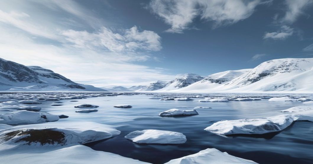
The Arctic Landscape Through Sami Eyes
The Arctic environment shapes Sámi existence not as a backdrop but as an active participant in daily survival and cultural continuity. Generations of indigenous communities across northern Fennoscandia developed a deeply integrated relationship with tundra, taiga, and ice-covered waters. This connection manifests through precise environmental reading, seasonal migration patterns, and linguistic frameworks that encode ecological data. Where mainstream observers see uniform snowfields or frozen coastlines, Sámi herders identify specific wind-carved crusts, thawing zones beneath river ice, and lichen beds critical for reindeer nutrition.
Seasonal transitions dictate the rhythm of Sámi life. Winter brings polar nights that demand specialized navigation techniques using star positions, terrain features, and animal behavior indicators. Summer midnight sun enables extended grazing cycles and rapid resource collection before autumn storms arrive. Reindeer herding requires constant movement across vast territories, following historical migration corridors that align with pasture quality, predator avoidance, and calving grounds. These routes are not arbitrary but mapped through centuries of accumulated observation.
- Snow depth variations signal impending weather shifts and guide reindeer routing decisions
- Lichen composition changes indicate overgrazing pressure and inform rotational pasture management
- Ice thickness measurements along fjords determine safe passage routes for winter crossings
Sámi toponymy preserves ecological knowledge lost in standardized mapping systems. Place names describe soil moisture levels, wind exposure patterns, and historical animal movements. A single valley might carry multiple names reflecting different seasonal uses, each encoding specific harvesting rights and resource management protocols. This linguistic precision ensures sustainable extraction practices that prevent ecosystem degradation.
Traditional Sámi clothing, architecture, and food preservation methods all derive from direct environmental adaptation. Reindeer hides provide waterproof outer layers while caribou fur offers superior insulation during extreme cold. Lavvu tents feature adjustable ventilation systems that regulate temperature regardless of external conditions. These innovations emerged through continuous experimentation rather than theoretical design, representing applied ecological engineering refined over millennia.
Contemporary Sámi communities face accelerating climate disruption that threatens traditional land use patterns. Thawing permafrost alters migration routes, unpredictable ice formation endangers winter travel, and changing precipitation patterns impact pasture quality. Indigenous knowledge systems now intersect with scientific monitoring to develop adaptive strategies for environmental management. This synthesis preserves cultural continuity while addressing modern ecological challenges.
Foundations of Sami Cartography and Terrain Recognition
The Sami approach to mapping the Arctic environment diverges fundamentally from Western coordinate-based systems, relying instead on a dynamic, experience-driven framework that integrates ecological observation, seasonal migration patterns, and linguistic precision. Traditional territory recognition operated through a network of named landmarks where each feature carried specific functional data regarding water availability, grazing quality, and shelter potential. Topographical elements such as ridgelines, river junctions, and rock formations were not merely visual markers but encoded information storage systems passed across generations through direct field instruction.
Semantic mapping formed the backbone of this territorial understanding. Every landscape element received highly specific terminology that described its physical composition, seasonal transformation, and utility for reindeer herding or hunting routes. The language functioned as a navigational database where precise descriptors replaced approximate measurements. Wind patterns, snow density variations across different exposures, and lichen growth stages on tree trunks provided continuous environmental feedback that dictated movement decisions.
- Seasonal topographical shifts required constant mental recalibration of routes as frozen waterways transformed into summer streams and compacted snowpacks gave way to uneven tundra terrain.
- Animal behavior indicators served as primary navigation aids where reindeer tracking patterns, bird flight corridors, and predator movement zones established implicit pathway networks across vast unmarked expanses.
- Celestial and atmospheric markers provided directional reference during periods of reduced visibility with stellar positions and cloud formation behaviors offering reliable orientation when geographical features became obscured by weather systems.
This environmental literacy demanded continuous physical engagement with the land where theoretical knowledge proved useless without practical application. Knowledge transmission occurred through structured apprenticeship models where young herders learned to read terrain characteristics, interpret microclimate variations, and anticipate landscape changes through direct observation rather than abstract instruction. The resulting territorial awareness functioned as a living document constantly updated by environmental feedback loops and generational refinement of route optimization strategies.
Seasonal Transformation and Nomadic Navigation Routes
The Arctic environment demands constant recalibration of movement patterns, and Sami navigators have historically mapped these shifts through direct environmental observation rather than fixed coordinates. Seasonal transformation dictates the entire rhythm of travel, with each phase requiring distinct route adjustments based on snow density, ice stability, vegetation cycles, and reindeer herd positioning. Winter passages rely on established trails carved by wind compaction and animal hooves, while summer months demand coastal and inland corridor navigation as meltwater reshapes terrain.
Winter navigation depends on reading katabatic wind directions, tracking snowdrift formations, and identifying frozen river corridors that serve as natural highways. Sami herders utilize jokkan (ice augers) to test thickness before crossing, while maintaining visual markers through stacked rocks and carved tree bark along established paths. Celestial navigation adapts to polar conditions, with the sun’s low arc during winter months providing limited but reliable directional reference points.
Spring thaw triggers a complete route reconfiguration. Meltwater creates temporary barriers that force detours around collapsing ice sheets, while emerging vegetation signals safe grazing corridors ahead of migrating herds. Summer navigation shifts toward coastal fells and inland plateaus, where reindeer follow insect-avoidance patterns through dense birch and dwarf shrub zones. Route selection prioritizes elevation gradients that minimize energy expenditure during long-distance cattle drives.
- Winter Trails: Wind-scoured paths along frozen fjords and river valleys, marked by leavttu (wayfinding stones) and reindeer antler piles.
- Spring Crossing Points: Strategic ice bridges monitored for thermal cracking, with fallback routes mapped to higher ground.
- Summer Pasture Corridors: Elevated terrain paths avoiding boggy lowlands, aligned with insect migration and lichen regrowth cycles.
- Autumn Assembly Routes: Converging trails leading to designated gathering grounds, timed with herd hormonal shifts and early snowfall patterns.
Navigation knowledge operates as a living archive transmitted through oral mapping exercises, seasonal camp rotations, and practical apprenticeship under experienced herders. Each generation updates route databases based on microclimate variations, glacier retreat, and altered permafrost stability. Modern GPS integration supplements traditional wayfinding without replacing environmental reading skills, ensuring continuity across shifting Arctic conditions.
Ecological Indicators and Traditional Environmental Monitoring
Indigenous monitoring systems rely on precise observation of micro-environmental shifts that standard meteorological stations often miss. The Sami people track snow density and crust formation to predict reindeer migration routes and assess winter grazing viability. Ice thickness measurements along river crossings directly inform safe passage timing, while subtle changes in wind direction and speed dictate the placement of temporary shelters and hunting grounds. Lichen abundance serves as a critical bioindicator; prolonged drought periods reduce nutrient availability, forcing herders to adjust grazing rotations well before official environmental reports reflect ecosystem stress.
- Snowpack stratification analysis reveals temperature fluctuations that impact root development for summer pastures
- Caribou antler growth patterns and migration timing adjustments signal shifts in seasonal boundaries
- Lichen biodiversity declines indicate long-term moisture deficits and soil degradation
- Permafrost thaw depth measurements guide infrastructure planning and pasture accessibility
- Avian nesting success rates correlate with insect emergence windows and food chain stability
Traditional observation methods operate on continuous, place-based data collection rather than periodic sampling. Elders transmit knowledge through practical instruction during seasonal migrations, ensuring real-time adaptation to rapid climatic variations. This localized monitoring framework captures hyperlocal weather anomalies, vegetation phenology shifts, and wildlife behavioral deviations that satellite imagery alone cannot interpret. The integration of historical baseline data with contemporary field observations creates a dynamic feedback loop, allowing communities to implement adaptive land management strategies before ecological thresholds are crossed.
Scientific validation of these indicators demonstrates strong correlation with broader Arctic climate trends. When combined with modern atmospheric modeling, traditional monitoring provides ground-truthed data that improves predictive accuracy for extreme weather events and long-term habitat sustainability. The methodology emphasizes relational understanding over isolated metric tracking, positioning environmental health as an interconnected system where animal welfare, plant vitality, and atmospheric conditions function as mutually reinforcing signals.
Place Names, Oral History, and Cultural Identity in the North
The Sami relationship with the Arctic terrain is encoded directly into its toponymy, where every geographic designation functions as a functional archive of ecological observation and seasonal navigation. Unlike standardized cartographic systems that prioritize administrative boundaries, traditional Sami place names describe micro-landscapes, animal migration corridors, ice thickness, wind patterns, and foraging conditions. A single valley might carry dozens of distinct names in local dialects, each marking a specific grazing zone, a historical campsite, or a seasonal hunting ground. This granular naming system transforms the landscape into a living map, preserving centuries of empirical data about resource availability and environmental shifts.
Oral transmission serves as the primary vessel for this geographic knowledge. Before widespread literacy and state-sponsored mapping, Sami elders and experienced herders conveyed spatial awareness through narrative cycles, route descriptions, and seasonal chronicles. These oral records were not static folklore but dynamic instructional frameworks updated with each generation’s observations. Knowledge about safe crossing points on rivers, lichen-rich pastures during harsh winters, or calving grounds was embedded in place names and reinforced through repeated storytelling along actual travel routes. The absence of written documentation historically did not diminish precision; rather, it demanded rigorous mnemonic techniques and direct experiential learning.
This symbiotic relationship between language, territory, and memory underpins Sami cultural identity. Geographic nomenclature operates as a claim of continuous presence and stewardship, reinforcing legal and historical arguments for land rights and resource management. When state borders divided traditional reindeer herding grounds, the persistence of indigenous place names maintained an alternative spatial reality that resisted administrative erasure. Contemporary language revitalization programs leverage this toponymic heritage to restore ecological monitoring practices, document climate impacts on pasturelands, and strengthen intergenerational transmission of land-based knowledge.
- Toponymic markers encode precise micro-climatic data, guiding reindeer movement and sustainable grazing cycles across fragmented ecosystems.
- Oral narratives function as navigational manuals, preserving safe passage routes across shifting ice conditions and snowpack variability.
- Place name retention serves as a mechanism of cultural sovereignty, countering historical assimilation policies through spatial memory and linguistic continuity.
- Modern land claims utilize traditional geographic nomenclature as evidentiary documentation of continuous territorial use and resource stewardship.
The integration of these elements ensures that Arctic landscapes remain culturally legible to Sami communities. Geographic names are not decorative labels but operational tools that sustain pastoral livelihoods, ecological monitoring, and collective memory. By maintaining this naming infrastructure, northern populations preserve a functional knowledge system that adapts to environmental change while anchoring cultural continuity across generations.
Reindeer Husbandry and Land Use Patterns Across Fells and Valleys
The relationship between Sami herders and their reindeer dictates a precise annual rhythm across the Arctic terrain. Summer pastures dominate the high fells where lichen-rich plateaus provide essential forage after snowmelt. Herders guide large groups upward to escape summer biting insects and access mineral-rich soils. As autumn approaches, the migration shifts toward lower elevations. Reindeer descend into forested valleys and sheltered basins where wind-swept snow exposes ground vegetation. This vertical movement is not arbitrary but calculated through generations of observational data tracking weather patterns, snow crust formation, and plant recovery cycles.
Land use operates on a rotational system that prevents overgrazing in critical zones. Traditional boundaries align with natural drainage lines and geological ridges rather than political borders. Herders maintain seasonal camps positioned near reliable water sources and leeward slopes. The reindeer themselves function as landscape architects. Controlled grazing pressure suppresses birch and willow encroachment, preserving the open tundra necessary for both biodiversity and future pasture regeneration. Areas left fallow for three to five years show measurable recovery in lichen biomass and soil stability.
- Summer Range Management: High-altitude plateaus require careful rotation to avoid trampling damage during fragile post-snowmelt periods.
- Winter Corridor Maintenance: Valleys must remain clear of infrastructure to allow unobstructed movement toward sheltered feeding grounds.
- Ecological Monitoring: Herders assess pasture quality through snow depth, ice layer formation, and reindeer weight distribution rather than satellite imagery.
Modern constraints intersect with these traditional patterns. Wind farms, railways, and fencing fragment historical routes. Herders adapt by negotiating crossing permits and adjusting seasonal timing, though such modifications increase stress on both animals and handlers. The survival of this system depends on maintaining contiguous land access. Every kilometer of uninterrupted corridor represents direct caloric efficiency for the herd and long-term viability for the cultural practice. Land is never owned but held in stewardship, with usage rights passing through documented family lineages and community herding associations.
Climate Change Impacts on Traditional Arctic Observations
The Arctic region is warming at roughly three times the global average, fundamentally altering the environmental cues that Sámi herders and hunters have relied upon for centuries. Traditional weather forecasting depends on precise readings of snow depth, ice translucency, wind direction, and animal behavior. Rapid permafrost degradation and unpredictable freeze-thaw cycles now produce dangerous icing events that trap reindeer beneath impenetrable ice layers, forcing communities to adjust grazing routes decades ahead of schedule.
Snowpack composition has shifted from deep, powdery winter layers to thinner, rain-on-snow formations that compromise insulation for ground vegetation and reduce calf survival rates. Sámi observers note earlier spring thaws and delayed autumn freezes, which disrupt the synchronization between calving seasons and peak forage availability. These phenological mismatches require continuous recalibration of land-use patterns and seasonal migration timelines.
Traditional ecological knowledge now intersects directly with satellite telemetry and climate modeling. Field observations regarding glacier retreat, altered river flow patterns, and shifting bird migration corridors provide ground-truth data that complements institutional research. When indigenous monitoring networks share real-time ice safety assessments and pasture condition reports, they enhance regional early warning systems for extreme weather events.
- Ice quality variation: Increased temperature fluctuations create brittle ice sheets that fail under reindeer hooves or vehicle weight.
- Snow crust formation: Thaw-refreeze cycles produce hard layers that prevent animals from accessing lichen beneath the surface.
- Microclimate instability: Localized wind patterns and humidity shifts alter perceived temperature, requiring updated forecasting techniques.
Adaptation strategies now combine historical route mapping with modern GPS tracking and meteorological APIs. Younger generations document ancestral observations through digital archives while maintaining active field practice. This dual approach preserves linguistic precision in environmental terminology and ensures that climate resilience planning remains grounded in lived experience rather than abstract projections.
Preservation Strategies for Indigenous Ecological Knowledge
The foundation of preserving Sami ecological knowledge rests on direct intergenerational transmission within active land-use contexts. Elders conduct field-based instruction during reindeer migrations, winter snow assessments, and seasonal fishing cycles. These practical sessions encode climate indicators, vegetation shifts, and animal behavior patterns that standard scientific models often overlook. Traditional teaching methods prioritize experiential learning over abstract documentation, ensuring that ecological data remains tied to lived territory rather than isolated archives.
Digital preservation initiatives must operate under indigenous data sovereignty frameworks. Community-controlled repositories store GPS-mapped grazing corridors, historical weather records, and dialect-specific ecological terminology. Access protocols restrict external researchers from extracting or repurposing sensitive information without explicit governance approval. Open-source mapping platforms now integrate ancestral place names with contemporary satellite imagery, creating dynamic reference tools that support both cultural continuity and environmental monitoring.
Institutional integration requires structural policy alignment. Nordic conservation agencies increasingly co-manage protected landscapes through formal agreements that recognize customary land rights. When traditional grazing zones overlap with national park boundaries, preservation mandates automatically trigger funding streams for youth documentation programs and mobile recording units. Educational systems across Sápmi have embedded biocultural curricula where students catalog seasonal ecological markers alongside municipal climate datasets. This parallel documentation approach generates peer-reviewed research while reinforcing spatial literacy among younger generations.
- Land tenure security remains the primary prerequisite for functional knowledge preservation. Without recognized grazing territories and resource access rights, ecological practices degrade into historical records rather than adaptive systems.
- Direct community funding models outperform centralized cultural grants by allocating resources to self-directed recording projects, elder stipends, and youth mentorship networks.
- Climate monitoring partnerships provide sustainable compensation structures when research institutions integrate traditional ecological indicators into official environmental tracking frameworks.
Sustained preservation depends on aligning cultural autonomy with territorial rights. Legal advocacy must remain coupled with continuous field practice to prevent knowledge fragmentation. When governance structures support active land stewardship alongside archival initiatives, Arctic ecological wisdom functions as a living framework rather than a static historical artifact.
“`html
Frequently Asked Questions
What is The Arctic Landscape Through Sami Eyes?
The Arctic Landscape Through Sami Eyes is a cultural and visual exploration that presents the Arctic environment from the indigenous Sámi perspective. It highlights how the Sámi people — who have inhabited the northern regions of Norway, Sweden, Finland, and Russia for thousands of years — perceive, name, and coexist with the tundra, mountains, rivers, and forests of their ancestral homeland. Rather than viewing the landscape merely as a physical or geographical space, this concept emphasizes deep spiritual connection, traditional ecological knowledge, reindeer herding routes, seasonal migrations, and storytelling traditions that weave human history inseparably with nature.
Key facts about The Arctic Landscape Through Sami Eyes
- The Sámi are the only indigenous people of the European Union, with a population estimated between 80,000 and 100,000 across four countries.
- Sámi traditional knowledge includes detailed classifications of snow, ice, and reindeer behavior that modern science has only recently begun to validate.
- The Sámi language belongs to the Uralic family, not to any Indo-European languages, making it entirely unique in Northern Europe.
- Sámi culture is deeply tied to reindeer herding, which accounts for roughly 10% of all Sámi livelihoods today.
- The traditional Sámi dwelling, called a lavvu (or goahte), is designed for extreme Arctic conditions and reflects sophisticated understanding of wind, heat, and insulation.
- Sámi joik — a traditional form of song — does not describe nature but rather embodies it, creating an auditory connection between singer and landscape.
- The Sámi Parliament exists in Norway, Sweden, and Finland, representing indigenous self-governance and land rights advocacy.
- Sámi art forms such as duodji (handicrafts) use materials sourced directly from the Arctic environment — antler, reindeer leather, birch root — each carrying cultural meaning.
“`
“`json
{
“@context”: “https://schema.org”,
“@type”: “FAQPage”,
“mainEntity”: [
{
“@type”: “Question”,
“name”: “What is The Arctic Landscape Through Sami Eyes?”,
“acceptedAnswer”: {
“@type”: “Answer”,
“text”: “The Arctic Landscape Through Sami Eyes is a cultural and visual exploration that presents the Arctic environment from the indigenous Sámi perspective. It highlights how the Sámi people — who have inhabited the northern regions of Norway, Sweden, Finland, and Russia for thousands of years — perceive, name, and coexist with the tundra, mountains, rivers, and forests of their ancestral homeland. Rather than viewing the landscape merely as a physical or geographical space, this concept emphasizes deep spiritual connection, traditional ecological knowledge, reindeer herding routes, seasonal migrations, and storytelling traditions that weave human history inseparably with nature.”
}
},
{
“@type”: “Question”,
“name”: “Key facts about The Arctic Landscape Through Sami Eyes”,
“acceptedAnswer”: {
“@type”: “Answer”,
“text”: “
- The Sámi are the only indigenous people of the European Union, with a population estimated between 80,000 and 100,000 across four countries.
- Sámi traditional knowledge includes detailed classifications of snow, ice, and reindeer behavior that modern science has only recently begun to validate.
- The Sámi language belongs to the Uralic family, not to any Indo-European languages, making it entirely unique in Northern Europe.
- Sámi culture is deeply tied to reindeer herding, which accounts for roughly 10% of all Sámi livelihoods today.
- The traditional Sámi dwelling, called a lavvu (or goahte), is designed for extreme Arctic conditions and reflects sophisticated understanding of wind, heat, and insulation.
- Sámi joik — a traditional form of song — does not describe nature but rather embodies it, creating an auditory connection between singer and landscape.
- The Sámi Parliament exists in Norway, Sweden, and Finland, representing indigenous self-governance and land rights advocacy.
- Sámi art forms such as duodji (handicrafts) use materials sourced directly from the Arctic environment — antler, reindeer leather, birch root — each carrying cultural meaning.
”
}
}
]
}
“`