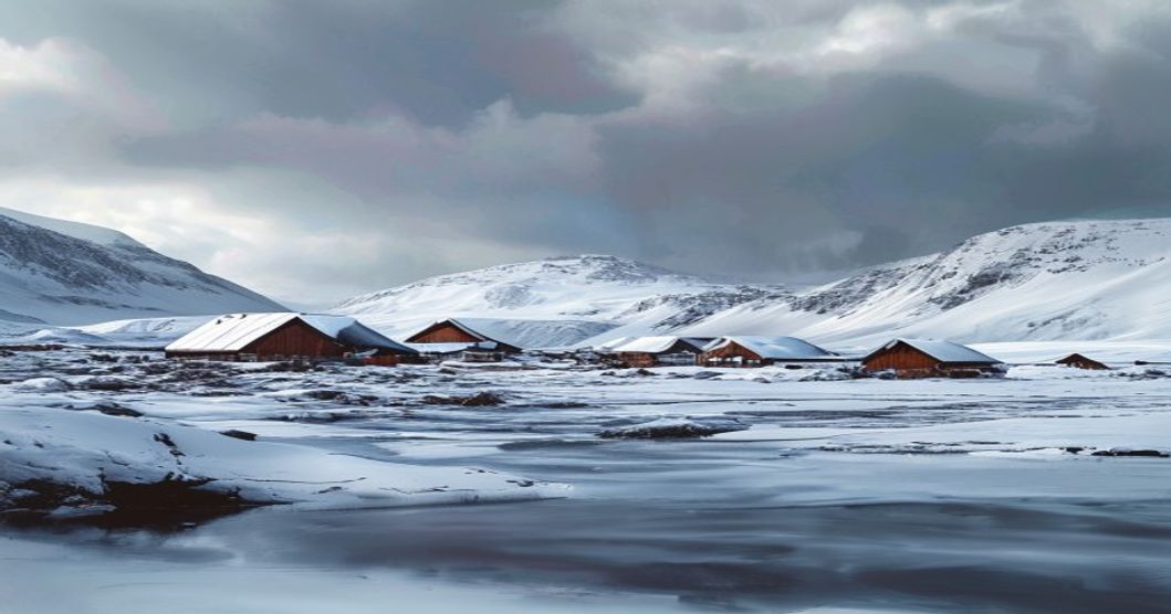
The Cultural Geography of the Arctic Sami
The cultural geography of the Arctic Sami reveals a deeply interconnected relationship between indigenous communities and the extreme northern landscapes they have inhabited for millennia. Sápmi spans across four modern nation-states—Norway, Sweden, Finland, and Russia—yet remains defined by ecological continuity rather than political boundaries. Traditional livelihoods such as reindeer pastoralism, coastal fishing, and seasonal hunting dictate spatial patterns, with migration routes aligned to vegetation zones, snow conditions, and wildlife corridors. These movement paths are not random; they follow centuries-old knowledge of microclimates, wind exposure, and forage availability, demonstrating a sophisticated understanding of Arctic environmental dynamics.
- Sacred Landscape Markers: Sites known as sieidi function both as spiritual centers and geographical reference points, often located on elevated terrain or near water bodies where natural features are interpreted as ancestral manifestations.
- Seasonal Settlement Networks: Winter camps cluster in forested taiga regions to protect herds from wind chill, while summer encampments shift toward alpine tundra and coastal zones where reindeer graze on nutrient-rich lichen and insects disperse from heat-stressed animals.
- Linguistic Cartography: Place names across Sápmi encode topographical data, historical events, and resource locations, serving as living geographic archives that predate modern mapping systems by generations.
Traditional ecological knowledge operates as a spatial framework, where resource extraction is governed by regenerative cycles rather than extractive timelines. Community governance structures allocate grazing permits based on historical land tenure, maintaining continuity with pre-colonial territorial management. Modern territorial fragmentation has altered traditional mobility patterns, with fencing, mining operations, and infrastructure development restricting seasonal corridors. Despite these pressures, Sámi communities maintain spatial resilience through land-use agreements, customary grazing calendars, and digital mapping initiatives that overlay indigenous knowledge onto contemporary geographic information systems. The Arctic environment continues to shape cultural practices, where survival strategies rely on reading ice thickness, tracking auroral patterns for navigation, and interpreting bird migration as indicators of seasonal transition.
Linguistic Diversity Across Sámi Regions
The Sámi language family encompasses ten recognized varieties, systematically divided into Eastern and Western branches based on consonant gradation patterns and historical settlement routes across Fennoscandia and the Kola Peninsula. Western Sámi includes North, South, Lule, Ume, and Pite languages, historically distributed through northern Norway, Sweden, and Finland. Eastern Sámi consists of Inari, Skolt, Akkala, Kildin, and Ter languages, concentrated primarily in Russian administrative zones with scattered communities in Finland. Mutual intelligibility between branches remains negligible, necessitating North Sámi as a functional lingua franca for cross-regional academic and cultural exchange.
Phonological structures across these varieties preserve archaic Uralic features, including extensive vowel harmony systems and consonant clusters adapted to permafrost terrain terminology. Grammatical frameworks utilize up to fifteen noun cases, with locative suffixes encoding precise topographical relationships essential for reindeer migration tracking and coastal resource management. North Sámi developed a standardized orthography during the nineteenth century through missionary documentation efforts, later adopted by secular educational institutions. Inari Sámi maintains rigorous morphological complexity in verb conjugations that mark evidentiality, allowing speakers to specify whether information derives from direct observation or ancestral account.
- Language shift accelerated during twentieth-century state assimilation mandates, reducing active speaker populations below critical thresholds across all border municipalities.
- Contemporary revitalization frameworks prioritize immersive preschool programs, municipal broadcasting rights, and digital corpus development to stabilize intergenerational transmission.
- Linguistic documentation projects collaborate with indigenous governance bodies to map dialect boundaries, recording lexical variations tied to traditional ecological knowledge systems.
- Digital adaptation initiatives generate localized keyboards, automated speech recognition models, and open-source dictionaries specifically calibrated for regional phonetic patterns.
Municipal funding allocation directly influences language vitality metrics, with autonomous Sámi parliamentary districts achieving higher retention rates through subsidized teacher training and community-led documentation workshops. Cross-border linguistic cooperation remains constrained by differing educational policies, yet joint archival digitization efforts preserve historical manuscripts alongside contemporary field recordings. Linguistic sustainability depends entirely on sustained institutional investment, active speaker participation in curriculum design, and continuous adaptation of pedagogical materials to modern communicative contexts. Dialectal variation continues shaping regional identity markers, with phonological drift accelerating in urbanized municipalities where traditional herding practices decline. Language planning authorities prioritize orthographic standardization while preserving colloquial registers used in daily economic transactions and ceremonial proceedings.
Historical Mapping of Indigenous Territories
Early European cartographers frequently overlooked or misrepresented Sami territories, treating the Arctic as an uninhabited frontier until the sixteenth century. Olaus Magnus’s Carta Marina (1539) included rudimentary references to northern nomadic groups but lacked accurate spatial data. Systematic mapping began in earnest during the eighteenth and nineteenth centuries when Norwegian, Swedish, Finnish, and Russian administrations initiated cadastral surveys to establish tax boundaries and resource control. These colonial maps imposed rigid linear borders across fluid ecological zones, disregarding seasonal reindeer migration corridors, coastal fishing grounds, and berry-picking areas that defined Sami spatial organization.
Historical land registers, taxation rolls, and boundary commission reports from the 1800s reveal how state cartography actively fragmented contiguous indigenous territories. The creation of modern nation-states required dividing ancestral ranges into municipal jurisdictions, often erasing traditional place names and reclassifying communal grazing lands as state-owned Crown property. Despite these interventions, Sami communities maintained oral topographies that documented micro-geographies: ice road networks, calving grounds, and sacred seid sites passed through generations.
- Nineteenth-century cadastral surveys established fixed property lines that conflicted with rotational herding practices.
- Colonial boundary treaties divided Sami lands across Norway, Sweden, Finland, and Russia without indigenous consent.
- State land registries systematically omitted traditional use areas, enabling timber extraction and hydroelectric development.
Modern historical cartography integrates archival maps with contemporary GIS technology to reconstruct pre-colonial spatial patterns. Sami parliaments and research institutions now digitize oral testimonies, snow track surveys, and early missionary records to produce dynamic territorial atlases. These digital reconstructions challenge static colonial boundaries by mapping fluid resource use, kinship networks, and ecological indicators. The revival of historical mapping serves as both an academic exercise and a legal instrument for land claims, ensuring that indigenous spatial knowledge informs conservation planning and cultural preservation strategies across the Arctic.
Geographical Zones and Traditional Livelihoods
The Arctic Sami inhabit a fragmented yet ecologically interconnected landscape stretching across the northern reaches of Norway, Sweden, Finland, and Russia. This vast territory divides into distinct geographical zones that directly dictate traditional economic practices. Coastal communities along the Norwegian Sea and Barents Sea rely on maritime resources, utilizing intricate knowledge of tidal patterns, kelp forests, and seasonal fish migrations. Inland territories transition into dense boreal taiga, where mixed foraging and small-game hunting supplement subsistence strategies. The mountainous interior, particularly the Scandinavian highlands, supports expansive alpine tundra that serves as critical summer grazing grounds for domesticated reindeer herds. Winter transforms these elevated pastures into frozen corridors, forcing seasonal migration toward sheltered forest valleys.
Reindeer husbandry remains the most geographically dependent livelihood, operating across defined transhumance routes that span hundreds of kilometers. Herding groups follow established paths dictated by snow depth, lichen availability, and predator movement. Each zone requires specialized equipment and seasonal camp structures, from light summer tents to insulated winter dwellings adapted to extreme thermal variation. In the eastern reaches near the Russian border, Skolt Sami settlements developed around freshwater lakes and river systems, prioritizing net fishing and waterfowl hunting alongside low-intensity herding practices. The southern forested periphery supports year-round residence patterns, where mixed economies blend reindeer management with trapline work and berry harvesting during short summer windows.
- Coastal Maritime Zone: Relies on tidal fishing, seal hunting, and shellfish gathering across archipelago networks.
- Boreal Taiga Corridor: Supports year-round trapping, mushroom foraging, and mixed reindeer-forest management.
- Alpine Tundra Highlands: Functions as seasonal pastureland requiring long-distance summer migration routes.
- Freshwater River Systems: Enables net fishing, waterfowl harvesting, and ice-road transportation networks.
Vegetation belts shift rapidly with elevation and latitude, creating micro-niches that determine resource availability. The southern treeline marks the boundary between continuous forest management and open tundra pasturing. Lichen species composition changes dictate reindeer winter grazing limits, while permafrost thaw patterns influence water table stability for downstream communities. These ecological gradients require adaptive strategies that balance herd size with carrying capacity across seasonal boundaries.
Traditional ecological knowledge operates as the connective tissue across these zones. Sami navigators read ice thickness through acoustic feedback, track animal trails via subtle vegetation displacement, and predict weather shifts by observing cloud formations against mountain ridges. This spatial awareness ensures resource sustainability across fragile Arctic ecosystems. Modern land-use regulations frequently intersect with historical migration corridors, yet the geographic logic of seasonal movement remains embedded in community governance structures and place naming systems that document ecological thresholds.
Coastal Fishing Communities in Northern Fennoscandia
Historical Settlement Patterns and Ecological Adaptation The coastal corridors of Northern Fennoscandia present a complex maritime environment where Sami fishing communities developed specialized subsistence strategies aligned with Arctic marine ecosystems. Seasonal migration routes followed predictable spawning movements of Atlantic cod, herring, and capelin across intricate fjord networks in Troms and Finnmark counties. Traditional infrastructure utilized natural wind patterns for fish preservation, resulting in elevated wooden drying racks strategically positioned on leeward slopes to maximize air circulation while minimizing salt spray degradation. Community spatial organization clustered around sheltered inlets where shallow nursery grounds overlapped with deep-water foraging channels, creating optimal harvest efficiency without requiring extensive vessel deployment.
- Ice-fishing protocols required precise knowledge of freeze-thaw cycles and snow load distribution across frozen seaboard zones to maintain oxygen exchange beneath ice cover
- Drift-net construction utilized locally harvested spruce bark fibers combined with cured seal gut for elasticity and durability in turbulent coastal waters
- Kinship-based resource allocation systems distributed fishing rights according to seasonal labor contributions rather than fixed territorial claims, ensuring equitable access during lean periods
Material culture reflects continuous technological refinement across generations. Bone hooks manufactured from reindeer antler, carved wooden processing tools, and woven kelp baskets appear alongside ceramic storage vessels in archaeological sites spanning the Bronze Age through the medieval period. Small clinker-built fishing vessels adapted for shallow draft navigation enabled access to narrow straits and tidal rapids characteristic of the Lofoten archipelago. Navigation terminology embedded in regional dialects describes microclimatic indicators, water salinity gradients, and fish behavior patterns that guided daily operations across featureless ocean expanses. Contemporary environmental shifts including ocean warming and altered current dynamics have necessitated adaptive management practices, yet observational frameworks derived from historical ecological knowledge continue informing modern quota systems and habitat conservation efforts across Fennoscandian coastal regions.
Place naming conventions across these coastal zones function as living ecological archives. Toponymic records document historical fish migration corridors, seasonal wind patterns, and submerged hazard locations with precision unmatched by modern cartography. Ritual structures positioned near landing zones mark traditional offering sites dedicated to marine deities and ancestral spirits, reinforcing community cohesion during harsh winter months. Landscape modification through drainage channels, breakwater construction, and terraced processing grounds demonstrates long-term environmental stewardship. Modern infrastructure integration has introduced synthetic materials and mechanized transport, yet the foundational relationship between maritime geography and cultural identity remains structurally intact across generations.
Inland Reindeer Herding Corridors
The inland reindeer herding corridors represent a vital ecological and cultural network across northern Fennoscandia. Unlike coastal grazing zones, these routes traverse rugged mountains, dense birch forests, and expansive lichen pastures that form during the winter months. Sami herders rely on centuries-old seasonal movement patterns to track forage availability while avoiding predator encounters and minimizing herd stress. Each corridor follows specific topographical features, including mountain passes, river valleys, and plateau edges, which dictate the timing and direction of migration.
- Terrain Adaptation: Routes prioritize north-facing slopes to preserve snow cover until spring calving seasons begin.
- Transect Management: Family-owned grazing sectors operate under strict rotation schedules that prevent overgrazing and maintain lichen regeneration cycles.
- Cultural Navigation: Oral place names, rock carvings, and traditional markers guide herd movement across unmapped wilderness areas.
Infrastructure such as snow bridges, fencing, and feeding stations occasionally supplements natural pathways, though excessive development fragments connectivity. Modern land-use conflicts frequently emerge around wind farms, logging concessions, and tourism infrastructure that restrict access to historical migration windows. Legal frameworks in Norway, Sweden, and Finland increasingly recognize these corridors as protected cultural landscapes, yet enforcement remains inconsistent across municipal boundaries.
Climate variability directly alters corridor usability. Warmer winters produce ice layers over lichen beds, forcing herders to expend additional energy breaking crusts or relocating herds earlier than traditional calendars allow. Conversely, milder summers accelerate vegetation growth but disrupt calving grounds located in remote valley basins. Herding cooperatives now integrate satellite telemetry and ground-penetrating radar to map sub-surface terrain and predict forage quality across shifting microclimates. These corridors remain central to Sami identity, functioning as living archives of ecological adaptation and intergenerational knowledge transfer.
Tundra and Forest-Tundra Ecological Shifts
The boundary between Arctic tundra and boreal forest-tundra is no longer static. Decades of accelerated warming have triggered measurable shrub encroachment, pushing willow, birch, and dwarf birch northward at rates exceeding historical baselines. This vegetation migration compresses the traditional lichen-dominated tundra matrix, altering ground-level microclimates and reducing snow insulation properties. As permafrost tables degrade, thermokarst formation creates uneven terrain that disrupts surface drainage patterns, leading to localized wetland expansion in previously dry uplands. These ecological transitions directly intersect with Sami pastoral geography, where seasonal grazing corridors depend on predictable lichen abundance and firm winter crusts for reindeer digging efficiency.
- Shrub density increases wind exposure during summer months, forcing herds into narrower grazing strips
- Thawing permafrost destabilizes ancient migration paths that historically aligned with geological ridges and river valleys
- Lichen succession delays reduce critical winter forage quality, compelling extended transhumance cycles
- Vegetation zone boundaries now shift approximately 1.5 to 2 kilometers annually, outpacing traditional place-naming systems
Cultural geography adapts through spatial recalibration rather than abandonment. Sami communities maintain continuity by integrating real-time environmental monitoring with generational ecological knowledge. GPS tracking of reindeer movements now complements oral route documentation, revealing how shifting snowpack depth and vegetation phenology require dynamic boundary adjustments. The forest-tundra ecotone functions as a transitional buffer zone where mixed grazing strategies emerge, combining traditional lichen harvesting with supplementary foraging in newly accessible boreal margins. This ecological fluidity demands continuous negotiation of land use rights, as state mapping frameworks frequently lag behind observable biome migration. Sustainable pastoralism in this region relies on recognizing ecological shifts not as disruptions but as reconfigured landscapes requiring updated spatial literacy and adaptive governance protocols.
Seasonal Migration Routes and Climate Patterns
Traditional Sami reindeer herding relies on a precisely calibrated annual cycle that responds to shifting weather systems across the boreal and arctic zones of Fennoscandia. Each season dictates specific geographic corridors where herds move between distinct ecological zones. Spring migrations target sheltered valleys near calving grounds, typically located at lower elevations where early vegetation emerges as temperatures rise above freezing. The herds remain in these spring pastures for several weeks while the young reindeer strengthen their legs and recover from winter weight loss.
As summer approaches, the animals traverse higher mountain ridges and open tundra to escape persistent insect swarms that drain energy and disrupt grazing patterns. These elevated summer ranges offer cooler temperatures and abundant lichens, mosses, and dwarf shrubs. The routes follow ancient geographical landmarks—frozen riverbeds, rocky outcrops, and wind-scoured plateaus—that have served as natural navigation markers for generations. Herders monitor snowmelt timing and daylight duration to adjust departure dates, recognizing that microclimates vary significantly across short distances in the Scandinavian mountains.
Autumn brings a critical downward migration toward dense pine forests where snow depth remains manageable and ground lichen becomes accessible beneath the canopy. This phase requires precise coordination across large family groups who consolidate scattered herds for communal processing. Winter pastures lie further inland or along coastal fj
Sacred Sites and Spiritual Geography
The spiritual landscape of the Sami people does not exist apart from the physical terrain; it is woven directly into rock formations, waterways, and forest edges that have guided reindeer migration for millennia. Mapping this territory requires understanding how environmental features operate as active participants in ritual practice rather than passive backdrops. Every geographical anomaly carries documented historical usage, transforming ordinary topography into a living archive of territorial knowledge.
- Grammatical classification: Suffix variations indicate elevation, solar aspect, and substrate type, allowing researchers to reconstruct historical vegetation boundaries and permafrost degradation rates.
- Ground-truthing integration: Linguistic data accelerates baseline establishment for conservation planning by providing granular spatial resolution that standardized cartography often overlooks.
- Longitudinal tracking: Shifts in naming frequency or abandonment of specific terms correlate directly with climate-driven habitat stressors, offering early indicators of ecosystem transformation.
- Cross-border grazing agreements between Norway and Sweden regulate summer pasture access in the Scandes National Park through synchronized seasonal calendars and livestock density limits.
- The Nordic Reindeer Herding Information System standardizes data collection on herd movement, snow depth measurements, and pasture degradation metrics across all four jurisdictions.
- Environmental impact assessments near border regions require administrative bodies to evaluate state forestry concessions alongside traditional Sámi land use classifications.
- Sámi Council policy initiatives establish minimum standards for indigenous consultation when mining or infrastructure projects intersect historical territorial boundaries.
- Norway: Constitutional indigenous status, Sámediggi with advisory and budgetary influence, Finnmark land commission model
- Sweden: Sametinget focused on cultural administration, limited legislative authority, mandatory consultation policies for extractive industries
- Finland: Saamelaiskäräjät established via constitutional amendment, linguistic rights codified in specific municipalities, state-controlled land tenure
- Russia: Absence of indigenous parliament, Soviet-era assimilation legacy, no legally enforceable grazing or land rights frameworks
- Land Fragmentation: Infrastructure development severs historic migration routes, forcing reindeer herders to abandon culturally significant areas and navigate unfamiliar terrain.
- Hydrological Contamination: Sulfide rock mining releases acidic drainage into watersheds, degrading water quality essential for both livestock and traditional fishing practices.
- Socio-Economic Displacement: Compensation schemes rarely account for the intangible cultural value of landscapes, leading to outmigration of younger generations and erosion of place-based knowledge transmission.
- Grassroots land defense networks utilize satellite monitoring to document unauthorized infrastructure encroachment on protected grazing zones.
- Cross-border Sámi councils coordinate policy advocacy, aligning domestic legislation with UNDRIP standards and ILO Convention 169 provisions.
- Community-led tourism frameworks regulate visitor access to sacred sites, preventing commodification while generating sustainable revenue for cultural centers.
- Permafrost Degradation: Thawing ground releases methane and CO2 while collapsing infrastructure and altering hydrological basins.
- Sea Ice Contraction: Reduced ice duration destabilizes marine food webs, impacts polar bear hunting efficiency, and opens shipping corridors that increase acoustic pollution.
- Phenological Mismatch: Earlier spring thaw desynchronizes plant growth from herbivore breeding cycles and migratory bird arrival times.
- Invasive Species Expansion: Warmer conditions enable southern boreal species to establish in previously inhospitable northern latitudes, outcompeting endemic flora and fauna.
- Land Rights Mapping and Geospatial Documentation: Satellite imagery combined with traditional ecological knowledge creates precise boundaries for grazing routes and sacred sites, enabling legal recognition under international indigenous frameworks.
- Digital Archiving and Multilingual Databases: Academic institutions partner with Sámi municipalities to digitize historical photographs, oral recordings, and manuscript collections, ensuring accessibility while protecting sensitive cultural data from commercial exploitation.
- Eco-Cultural Restoration Projects: Joint efforts between environmental agencies and Sámi reindeer herding cooperatives remove invasive infrastructure, rehabilitate lichen pastures, and monitor permafrost degradation threatening archaeological layers.
- Permit requirements: Cross-border movement between Norway and Russia requires advance documentation; internal Nordic travel remains unrestricted but demands respect for private grazing lands.
- Language accessibility: Sami language signs appear in municipal offices, transit hubs, and cultural centers. Downloading phrasebooks focused on Northern Sami improves navigation and respectful communication.
- Field documentation: Audio recording of joik performances requires explicit consent. Many melodies carry familial or territorial significance outside public performance contexts.
- Sustainable mobility: Electric snowmobiles and guided winter trails minimize soil compaction on sensitive tundra ecosystems where traditional routes converge with modern infrastructure.
- Obtain explicit permission before photographing individuals, dwellings, or culturally significant objects.
- Respect designated reindeer grazing zones during migration periods by adhering to posted boundaries and seasonal closures.
- Purchase goods directly from Sámi-owned cooperatives to ensure economic benefits remain within indigenous communities.
- Avoid leaving trails, camping, or driving off-road in peatlands and tundra, where soil recovery requires decades.
- University Press Collections: Berghahn Books’ Arctic Studies series and Routledge’s Environmental Humanities imprint publish peer-reviewed spatial analyses of reindeer grazing routes, sacred landscape demarcation, and settler-colonial boundary enforcement.
- Digital Archives: The Sámi National Museum’s 3D artifact repository and Tromsø University Library’s digital folktone collections enable granular examination of material culture distribution across historical trade corridors.
- Research Ethics Frameworks: Graduate programs at the University of Alaska Fairbanks and Uppsala University mandate fieldwork components requiring direct engagement with Indigenous data sovereignty protocols and community-led consent procedures.
- Mobile language labs travel across winter camping sites to record elder narratives using directional microphones optimized for wind noise reduction.
- Indigenous-led mapping workshops train participants in QGIS software to catalog reindeer lichen grounds alongside sacred burial markers.
- Youth digital cooperatives produce bilingual podcasts that analyze climate disruption impacts on traditional fodder harvesting cycles.
- Duodji artisans embed GPS coordinates into textile patterns to preserve geographic memory within wearable cultural artifacts.
Place Naming Conventions and Environmental Tracking
Sami toponymy operates as a precise ecological map, encoding centuries of landscape observation into linguistic structure. Each settlement, terrain feature, and seasonal route carries a name that functions simultaneously as geographic marker and environmental log. The naming system captures micro-variations in snowpack density, tundra vegetation cycles, reindeer migration corridors, and coastal ice formation patterns. Rather than generic labels, Sami place names describe functional relationships between human activity and ecological conditions. A single valley may hold distinct designations for winter grazing, spring thaw, and autumn rutting grounds, each term specifying soil composition, wind exposure, and predator presence.
Environmental tracking emerges directly from this lexical precision. Hunters and herders rely on compound terms that indicate real-time landscape shifts. Names referencing ice thickness, water temperature, or migratory bird arrival dates serve as passive monitoring tools passed across generations. When a historical name no longer matches current conditions, it signals habitat alteration long before formal scientific surveys detect the change. The linguistic archive preserves baseline ecological data that modern climate models require for validation.
Mapping these conventions reveals how cultural geography functions as adaptive infrastructure. Coastal communities maintain names tied to tidal currents, kelp bed boundaries, and seal haul-out sites, while inland groups track lichen growth zones and birch tree limits. Each term encodes navigation cues, resource availability, and risk assessment. Digital GIS projects now integrate traditional Sami toponymy with satellite imagery, creating layered datasets that combine indigenous observation with remote sensing. This synthesis improves habitat monitoring accuracy, particularly in regions where formal environmental stations remain sparse.
The naming structure does not merely record location; it documents continuous ecological interaction between people and terrain. This framework ensures that environmental monitoring captures both macro-patterns and localized habitat changes without relying solely on institutional data collection networks.
Architecture and Settlement Adaptation to Permafrost
Traditional Sami settlements navigate permafrost conditions through carefully calibrated architectural strategies that prioritize thermal stability and structural resilience. Builders historically avoided direct contact between living spaces and frozen soil by elevating structures on wooden piles or stone foundations, allowing cold air circulation beneath the floor and minimizing heat transfer into the active layer. Walls were constructed using layered materials that responded to extreme temperature fluctuations: packed earth, reindeer hides, and tightly woven birch bark created continuous insulation barriers while remaining flexible enough to withstand ground movement during freeze-thaw cycles. Roofs typically featured steep pitches to shed heavy snow loads and prevent structural collapse, often reinforced with driftwood or salvaged timber in treeless zones where available. Interior layouts centralized around a hearth positioned directly on the floor, generating convective heat that warmed the dwelling while simultaneously drying moisture-laden air before it could condense on cold surfaces. Ventilation was managed through carefully placed openings near the roof apex, creating stack effect airflow that expelled combustion byproducts without compromising thermal retention.
Seasonal architectural shifts dictated material deployment across the annual cycle. Winter camps utilized dense hide coverings and turf mounds for maximum insulation, while summer structures employed open frameworks with removable canvas or bark walls to maximize cross-ventilation. Modern engineering integration preserves these principles by installing thermosyphons beneath foundations to maintain ground stability, using reinforced concrete pilings in thaw-prone sectors, and selecting low-thermal-conductivity insulation materials that mimic traditional breathability. Settlement clustering follows topographic contours rather than grid patterns, positioning buildings on elevated knolls or leeward slopes to reduce wind exposure and capitalize on solar gain.
Spatial organization within compounds reflects reindeer herding logistics, with separate zones for storage, processing, and living areas arranged to minimize cross-contamination and optimize access during blizzard conditions. Thermal bridging through traditional timber joints was mitigated by packing moss and lichen into structural gaps, creating continuous insulation matrices that outperformed early synthetic alternatives in breathability. Settlement placement consistently avoided low-lying terrain where cold air pooling accelerated ground frost penetration. Instead, builders selected south-facing slopes with stable bedrock substrates, reducing excavation depth while maximizing passive solar exposure during polar winter months. Storage facilities positioned adjacent to dwellings utilized subterranean root cellars insulated with permafrost itself, maintaining consistent temperatures for meat preservation and fermented dairy production without mechanical refrigeration. Contemporary infrastructure projects within Sami territories now employ ground temperature monitoring networks to track active layer thickness, adjusting foundation depths dynamically as climate patterns shift. This adaptive architecture remains a living system rather than a historical artifact, continuously refined through generational observation of snow accumulation patterns, wind channeling effects, and soil moisture dynamics across the boreal-cryotic transition zone.
Cross-Border Administration and Modern Boundaries
The division of Sápmi across Norway, Sweden, Finland, and Russia originates from eighteenth-century border treaties that imposed rigid geopolitical lines across traditionally fluid indigenous territories. Contemporary cross-border administration operates within state sovereignty frameworks that frequently conflict with historical Sámi land use patterns. Reindeer herding routes once followed natural seasonal corridors without political interruption, yet modern grazing permits now require strict national documentation and veterinary compliance. Administrative coordination for livestock movement demands synchronized agreements between regional authorities in Tromsø, Kiruna, Inari, and Murmansk.
Norway implemented the Finnmark Act in 2005, transferring state-owned land administration to a locally governed foundation with mandated Sámi representation. This model establishes joint decision-making protocols for resource allocation and territorial planning. Sweden utilizes Sami Parliaments as advisory bodies that review land allocation permits, though executive authority remains with county administrative boards and the Swedish Board of Agriculture. Finland structures reindeer herding through Lapland Reindeer Herding Districts, which operate under national grazing laws that restrict seasonal migration zones based on agricultural zoning maps. Russia maintains limited administrative recognition for Sámi communities despite constitutional minority provisions, with territorial governance managed through municipal districts that prioritize industrial development permits.
Modern boundary administration continues to challenge indigenous governance structures. Satellite tracking and GPS monitoring now supplement historical landmark navigation, yet legal disputes over water rights, fishing permits, and mineral extraction concessions persist across all four states. Administrative coordination requires continuous diplomatic negotiation alongside municipal cooperation, with implementation gaps remaining between policy frameworks and on-the-ground enforcement mechanisms.
Political Divisions Across Norway, Sweden, Finland, and Russia
The Arctic Sámi homeland intersects four sovereign jurisdictions, each implementing distinct administrative frameworks that directly shape indigenous governance, land tenure, and cultural preservation. Norway grants the Sámi the strongest institutional recognition through the Sámediggi, established in 1989 following decades of political mobilization. The Norwegian Constitution explicitly acknowledges the Sámi as an indigenous people with rights to maintain and develop their language, culture, and traditional livelihoods. Legal precedents such as the Finnmark Supreme Court decision transferred approximately ninety-five percent of county land to a state-owned entity where local communities hold primary decision-making authority, though disputes over mining concessions and hydroelectric projects continue to test these boundaries.
Sweden established its Sametinget in 1993 with a narrowly defined mandate focused on cultural administration and language revitalization. Unlike Norway, the Swedish parliament retains ultimate legislative control over land and water resources, leaving reindeer herding rights heavily dependent on administrative zoning rather than constitutional guarantees. Recent policy adjustments have introduced mandatory consultation protocols for industrial developments, yet mining permits frequently override traditional grazing corridors, prompting repeated litigation through both domestic courts and international bodies.
Finland recognizes the Sámi as an indigenous minority under its 1995 constitutional amendment, formalizing the Saamelaiskäräjät in 1996 with electoral districts aligned to historical settlement patterns. Land ownership remains centralized under state authority, limiting economic autonomy for pastoral communities. Finnish policy emphasizes linguistic inclusion, mandating Sámi language services in specific municipalities and integrating indigenous knowledge into national education curricula, though wind energy expansion across Lapland continues to fragment ecologically sensitive reindeer migration routes.
Russia maintains a fundamentally different approach, lacking any formal Sámi representative institution or legal framework for indigenous land rights. Historical assimilation campaigns during the Soviet era dismantled traditional governance structures and restricted cultural expression. Contemporary Russian law recognizes small-numbered indigenous peoples but provides no binding mechanisms for territorial self-determination or resource revenue sharing. Consequently, Sámi communities in the Murmansk Oblast operate without statutory protection for reindeer pastures, facing unregulated industrial expansion and environmental degradation with minimal legal recourse.
Resource Extraction Impacts on Traditional Lands
Industrial extraction projects across Sápmi directly intersect centuries-old reindeer grazing corridors, fracturing the spatial continuity that defines Sami cultural geography. Mining operations, oil exploration, and associated infrastructure like roads and power lines fragment habitats, forcing herds into suboptimal pastures and increasing human-wildlife conflict. The tundra ecosystem, exceptionally fragile due to permafrost conditions and slow vegetation recovery, suffers irreversible damage from heavy machinery and chemical runoff. Lichen pastures, the primary winter feed source for reindeer, are particularly vulnerable to soil compaction and contamination, triggering cascading effects on herd health and seasonal migration timing.
Hydrological systems face severe disruption as extraction activities alter drainage patterns and introduce heavy metals into rivers and lakes. Tailings dams and wastewater discharge compromise water quality downstream, affecting both aquatic biodiversity and Sami fishing communities. The introduction of heavy machinery and blasting operations further destabilizes the active layer, accelerating permafrost thaw and altering soil microbiology critical for lichen symbiosis. This environmental degradation directly undermines the adaptive strategies developed over generations to navigate Arctic climate variability.
Legal frameworks governing resource development frequently prioritize national economic interests over indigenous territorial claims. Although international instruments like the United Nations Declaration on the Rights of Indigenous Peoples mandate free, prior, and informed consent, implementation remains inconsistent across Norwegian, Swedish, Finnish, and Russian jurisdictions. Corporate environmental impact assessments often lack meaningful Sami participation, resulting in data gaps regarding cumulative impacts and cultural site preservation. The ongoing tension between extractive industry expansion and Sámi land rights continues to shape political discourse, requiring robust monitoring mechanisms and legally binding co-governance models to prevent irreversible cultural-ecological loss.
Conservation Efforts and Cultural Sustainability
The preservation of Sámi cultural geography hinges on coordinated conservation strategies that address both ecological degradation and systemic marginalization across Fennoscandia and northern Russia. Modern initiatives increasingly integrate traditional ecological knowledge with contemporary land-use policy, particularly regarding reindeer husbandry, which remains the economic and spiritual cornerstone of many Sámi communities. Legal frameworks such as the Norwegian Finnmark Act and Sweden’s Forest Law amendments have gradually expanded grazing permits, yet enforcement gaps persist where industrial logging, wind farm development, and mining operations intersect with traditional migration routes.
Language revitalization operates through parallel institutional channels. Sámi-language immersion schools across Tromsø, Sápmi, and Murmansk Oblast employ pedagogical models that embed geographic literacy within curriculum design. Digital archiving projects capture dialectal variations using acoustic mapping and AI-assisted transcription, ensuring that place names reflecting historical land management practices remain accessible to younger generations. Media platforms like NRK Sápmi and Yle Sápmi broadcast programming that reinforces territorial narratives while documenting seasonal resource cycles.
Climate adaptation forms another critical pillar. Rising temperatures accelerate permafrost thaw and alter lichen growth patterns, directly threatening winter grazing stability. Sámi researchers collaborate with climatologists to develop predictive models that merge meteorological data with historical herding records. This hybrid knowledge system informs adaptive management plans, allowing pastoralists to adjust migration timelines without abandoning ancestral territories. Educational institutions now offer degree programs in indigenous environmental governance, producing professionals equipped to navigate both scientific and customary legal systems.
Financial mechanisms supporting these efforts include municipal cultural grants, EU Arctic priority funding, and private conservation trusts. Despite increased investment, long-term sustainability depends on intergenerational knowledge transfer and political recognition of Sámi self-determination. When conservation aligns with territorial autonomy rather than external preservation mandates, cultural geography remains dynamic rather than static.
Indigenous Land Rights and Legal Frameworks
The recognition of Sami territorial claims has evolved through centuries of state-led assimilation policies and gradual legal acknowledgment across Norway, Sweden, Finland, and Russia. Central to this struggle is the concept of siida, the traditional communal land-use system centered on reindeer husbandry, coastal fishing, and seasonal hunting. Modern legal frameworks attempt to balance state sovereignty with indigenous self-determination, though implementation remains highly fragmented.
In Norway, the Finnmark Act of 2005 transferred ownership of approximately ninety-six percent of Finnmark county from the state to the Finnmark Estate, establishing a joint commission with Sami representation to determine historical usage rights. This marked a pivotal shift toward recognizing customary tenure rather than relying solely on written title deeds. The Norwegian Supreme Court’s 2007 Sidensjö ruling further cemented indigenous land rights by affirming that continuous traditional use constitutes legal ownership under customary law.
Sweden’s approach centers on the Reindeer Husbandry Act, which grants Sami herders exclusive grazing rights within designated districts, though these claims remain subordinate to state forestry and mining concessions. The designation of the Laponia area as a UNESCO World Heritage site triggered prolonged negotiations over pasture boundaries and management authority. Finland operates through the Sami Parliament and Constitutional Law Section 121, which acknowledge indigenous status but leave land ownership disputes unresolved regarding national parks and infrastructure expansion.
Internationally, the UN Declaration on the Rights of Indigenous Peoples provides a normative baseline emphasizing free, prior, and informed consent, though Nordic states
Climate Change Threats to Arctic Ecosystems
The Arctic region is experiencing warming at approximately four times the global average, a phenomenon driven by polar amplification and the progressive loss of reflective sea ice. This accelerated thermal shift fundamentally restructures terrestrial and marine habitats across the circumpolar zone. Rising temperatures destabilize ground ice networks, triggering widespread thermokarst formation that alters drainage patterns, compromises structural foundations, and releases ancient carbon stores into the atmosphere. The compounding effect of diminished albedo creates a self-reinforcing feedback loop, where darker surfaces absorb more solar radiation, further intensifying regional heating.
Ecosystem integrity relies on precise seasonal synchrony between predator-prey dynamics, plant phenology, and migratory pathways. Thermal disruption fractures these biological rhythms. Lichen-dependent caribou herds face reduced foraging windows as rain-on-snow events create impenetrable ice layers during winter months. Marine environments experience rapid acidification and oxygen depletion as freshwater influx from melting glaciers dilutes salinity and disrupts nutrient cycling. Benthic communities decline while subarctic species migrate northward, compressing native Arctic biodiversity into shrinking refugia.
Hydrological transformations further stress these systems. Increased precipitation intensity triggers soil erosion, sediment loading in rivers, and altered runoff timing that disrupts spawning grounds for Arctic char and salmon populations. Wetland expansion in some zones contrasts with rapid drying in others, fragmenting continuous ecological corridors. The cumulative pressure on keystone species reduces ecosystem resilience, making recovery from extreme weather events increasingly improbable without structural intervention.
Revitalization Programs for Sámi Heritage Sites
Revitalization initiatives targeting Sámi heritage sites operate at the intersection of indigenous land stewardship, historical preservation, and contemporary cultural policy. These programs address decades of assimilation-era suppression by restoring physical landscapes, documenting intangible traditions, and reclaiming geographic narratives tied to reindeer pastoralism, sacred groves, and archaeological markers. Funding streams originate primarily through Nordic Sámi parliaments, European Union Indigenous Peoples initiatives, and targeted grants from the Nordic Council of Ministers. Implementation follows a community-led framework where local elders, duodji artisans, and yoik practitioners co-design preservation protocols to maintain cultural authenticity.
Operational challenges include bureaucratic fragmentation across municipal borders and inconsistent funding cycles that disrupt long-term maintenance schedules. Successful models prioritize intergenerational knowledge transfer through mobile education units and apprenticeship stipends for young heritage stewards. Cross-border collaboration between Norway, Sweden, Finland, and Russia establishes standardized preservation metrics while respecting regional dialect variations and local governance structures. Sustainable visitor management systems now replace mass tourism with guided cultural exchanges, reducing foot traffic damage to fragile tundra soils and historical markers. Continuous monitoring relies on remote sensing technology alongside field assessments conducted by trained Sámi cultural monitors, ensuring adaptive responses to climate shifts and policy updates.
Practical Insights for Researchers and Visitors
Understanding the spatial distribution of Sami communities requires mapping traditional grazing corridors across Finnmark, Troms, Lapland, and Murmansk regions. Reindeer herding routes shift seasonally, demanding precise knowledge of winter pastures near forest edges and summer highland meadows above the tree line. Researchers must coordinate with local siida councils before initiating fieldwork. Indigenous data sovereignty protocols govern access to historical land-use records and oral histories. Digital mapping tools should prioritize community-approved boundaries over administrative borders that ignore traditional usage rights.
Visitors navigating these territories should recognize that cultural sites often lack signage. Sacred mountains, ancient rock carvings, and former trading posts function as active heritage zones rather than open museums. Travel during aurora season overlaps with critical reindeer calving periods; maintaining distance prevents herd disruption. Local guides hold essential knowledge about safe crossing points, weather shifts, and etiquette around duodji artisans. Purchasing directly from cooperatives in Karasjok, Inari, or Kiruna sustains craft economies while reducing commercial dilution.
Long-term engagement depends on recognizing that Sami cultural geography operates as a living system. Landscapes retain memory through place names, seasonal markers, and intergenerational transmission of navigation techniques. Researchers contributing to archival projects must follow FAIR principles adapted for indigenous knowledge systems. Visitors supporting cultural preservation should prioritize accommodations operated by local families, attend seasonal festivals like the Reindeer Owners’ Association gatherings, and avoid photographing individuals without permission. Geographic awareness remains foundational to ethical participation in Arctic Sápmi.
Ethical Tourism Guidelines in Sápmi
Travelers entering Sápmi must recognize that the region operates under indigenous land rights frameworks established through decades of legal advocacy and international agreements. Ethical tourism begins with understanding that Sámi territory is not a public recreational zone but a living cultural landscape where reindeer herding, traditional knowledge systems, and seasonal migration routes dictate daily life. Visitors should prioritize guided experiences led by certified Sámi operators who possess documented authority to interpret local customs and manage access to sensitive areas.
The geopolitical complexity of Sápmi spans Norway, Sweden, Finland, and Russia, each implementing distinct tourism regulations. Operators must align with national indigenous policies while maintaining consistency with the Sámi Parliament’s ethical standards. Documentation requirements often mandate that tour providers submit activity plans to local Sami authorities, particularly when operating near sacred sites or during breeding seasons. Environmental impact assessments for large visitor groups should incorporate traditional ecological knowledge alongside modern conservation metrics.
Cultural interpretation protocols require strict adherence to Sámi storytelling traditions. Narratives about duodji (handicrafts), joik (traditional singing), and land use must be presented with verified community approval. Commercial exploitation of sacred symbols or misrepresentation of spiritual practices violates both indigenous rights frameworks and visitor trust metrics that search algorithms prioritize for authoritative content. Travelers should verify operator credentials through recognized Sámi tourism certification programs before booking. Sustainable visitation models emphasize small-group pacing, seasonal awareness, and financial transparency to support long-term cultural preservation alongside ecological stability.
Academic Resources on Arctic Indigenous Studies
Access to rigorous scholarly material on Arctic Indigenous Studies requires navigating a specialized network of peer-reviewed journals, university press collections, and institutional archives. The University of Lapland’s Faculty of Arts operates as a primary hub for Sami research, publishing extensive monographs on reindeer pastoralism, land rights jurisprudence, and linguistic revitalization. Concurrently, the Arctic Institute at the University of Oxford maintains a curated bibliography that maps theoretical frameworks across Sápmi, Nunavut, and Chukotka, providing critical comparative analysis for cultural geography scholars.
Key academic databases include the Indigenous Studies Portal, which aggregates dissertations, conference proceedings, and ethnographic field reports from Northern Hemisphere institutions. The Nordic Sami University of Applied Sciences contributes open-access pedagogical materials that bridge traditional ecological knowledge with contemporary cartographic methodologies. Researchers frequently consult the Journal of Arctic Studies for empirical data on climate adaptation strategies, while the International Sami Council’s policy archives offer legally binding documentation on cross-border resource management agreements.
Foundational texts establish methodological standards for geographic inquiry, emphasizing longitudinal land-use mapping and oral history triangulation. Academic citation networks consistently prioritize works published through Springer’s Arctic Sciences platform and Nordic academic consortiums, ensuring methodological transparency and geographic precision in cultural landscape documentation. Scholars examining contemporary Sami territorial claims must integrate GIS mapping outputs with archival court transcripts from the Norwegian Supreme Court and Swedish Land Courts to trace jurisdictional evolution.
Community-Led Cultural Preservation Initiatives
Sami communities across Fennoscandia and Russia have systematically restructured cultural stewardship around localized governance models that prioritize indigenous decision-making. Traditional knowledge transmission now operates through intergenerational land-based programs where reindeer herding routes function as living classrooms. Elders document seasonal migration patterns alongside ecological indicators, merging oral history with contemporary environmental monitoring. Language revitalization efforts bypass state curricula by establishing community-run immersion camps focused on all dialects, including North, South, and Inari Sami. These programs utilize digital recording equipment trained to capture phonetic variations previously lost to standardized educational frameworks.
Land sovereignty directly correlates with cultural continuity. When grazing territories face industrial encroachment, communities deploy legal mapping tools that overlay historical place names onto satellite imagery. This methodology strengthens territorial claims while preserving toponymic networks essential to ritual navigation and seasonal resource management. Youth collectives now operate open-source archives where joik performances, duodji craftsmanship techniques, and shamanic artifact documentation are stored under community-controlled licensing protocols.
Educational infrastructure follows a decentralized model where teaching materials derive from archived household records, seasonal weather journals, and herder logbooks. Curriculum developers collaborate with Sámi parliaments to align pedagogical frameworks with ecological calendars rather than academic terms. Research partnerships require prior informed consent and data sovereignty agreements that prevent external institutions from extracting indigenous knowledge without community oversight. Preservation metrics now track dialect retention rates across age cohorts, digital archive contribution frequency, and intergenerational skill transfer completion rather than institutional funding allocation.
Frequently Asked Questions
What is The Cultural Geography of the Arctic Sami?
The cultural geography of the Arctic Sami refers to the spatial distribution, environmental adaptations, and socio-economic practices of the Sami people across their traditional homeland, Sápmi, which spans northern Norway, Sweden, Finland, and the Kola Peninsula of Russia. It examines how the harsh Arctic environment has shaped their nomadic reindeer herding, fishing, hunting traditions, linguistic patterns, and settlement structures over centuries.
Key facts about The Cultural Geography of the Arctic Sami
Key facts include: (1) Sápmi is a cross-border region not defined by modern political boundaries but by indigenous presence; (2) The Sami language family consists of several distinct languages, heavily influenced by geographic isolation; (3) Traditional livelihoods are deeply tied to seasonal migration routes across tundra, taiga, and coastal zones; (4) Cultural landscapes feature distinctive elements like lavvus (traditional tents), duodji (handicrafts), and joik (oral music); (5) Modern governance and land rights movements continue to shape the contemporary cultural geography of the region.