How Sami Herders Track Thousands of Reindeer
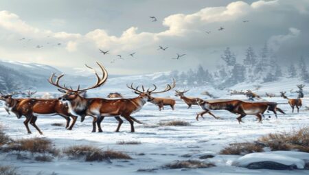
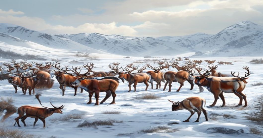
Sami reindeer herding relies on a combination of ancestral knowledge, precise environmental reading, and modern navigation tools to manage large herds across vast Arctic landscapes. Traditional tracking methods begin with generational memory of seasonal migration routes known as johttu. Herders memorize terrain features, river crossings, forest boundaries, and grazing patterns that shift annually with snow cover and vegetation growth. The reindeer themselves respond to wind direction, temperature fluctuations, and daylight changes, requiring herders to anticipate movements before visual contact is possible.
Visual identification plays a critical role in herd management. Each animal carries distinct horn shapes, coat patterns, and age classifications that experienced handlers recognize instantly from distances exceeding three hundred meters. Traditional whistles called luohti mimic bird calls and reindeer vocalizations to guide scattered groups without causing panic. These acoustic signals travel further across open tundra than voice commands, allowing a single herder to coordinate multiple family units operating in wide formations.
- Satellite GPS collars transmit location data every two hours, highlighting migration delays or health anomalies before they become visible.
- Thermal drones detect herd density during blizzard conditions when ground visibility drops to zero.
- Digital pasture maps cross-reference historical grazing records to prevent overgrazing and ensure sustainable feed distribution across seasonal ranges.
Environmental adaptation remains the core of tracking accuracy. Snow depth determines whether herds move on skis or in snowmobile convoys. Wind speed dictates signal timing, as strong gusts disrupt acoustic commands and drone flight paths. Herders monitor lichen growth rates and insect pressure levels to predict rest periods before reindeer experience metabolic stress. This synthesized approach preserves ecological balance while maintaining herd mobility across politically defined borders that cut through traditional grazing territories.
Analyzing Traditional Navigation Techniques and Arctic Landmarks
Sami reindeer herders rely on a multi-layered navigation system that merges celestial observation, microclimate reading, and generational terrain memory. During the polar night, herders calibrate their movement using Polaris for cardinal direction while tracking the Pleiades cluster to estimate seasonal shifts. Snow drift patterns reveal prevailing wind corridors, guiding herd movement toward leeward slopes where thermal retention preserves grazing lichen. Lichen orientation on rock faces indicates long-term wind exposure, helping herders identify sheltered valleys before visual confirmation. Ice thickness along river channels is assessed through acoustic resonance when striking the surface with a wooden staff, allowing safe passage calculations during spring thaw.
- Fell ridges and drainage lines serve as natural compass points, directing herd movement toward high-altitude wintering grounds
- Ancient birch forest boundaries mark historical migration routes where permafrost degradation creates new grazing corridors
- Lichen patch density gradients indicate soil depth and moisture retention, predicting herd concentration zones during extreme cold snaps
Oral geography forms the core of spatial orientation. Herders memorize terrain features through rhythmic counting systems tied to specific landforms. Each valley, rock formation, and water crossing carries a functional name that encodes distance, elevation change, and seasonal utility. Track density analysis replaces digital tracking devices in remote sectors. By examining reindeer hoof impressions, snow compaction levels, and lichen bite marks, herders calculate herd spread velocity and predict regrouping locations. Reindeer vocalizations carry differently across frozen tundra versus snow-covered plateaus, allowing precise localization of scattered groups without auditory amplification tools.
- Snow accumulation patterns around wind-scoured ridges indicate upcoming storm trajectories and safe herding windows
- Permafrost mound distributions reveal subsurface moisture levels critical for identifying spring grazing recovery zones
- River ice fracture lines signal thermal shifts that trigger natural herd movement toward deeper water sources
Terrain memory operates through geometric landmark triangulation. Herders construct mental maps using intersecting sightlines between distant peaks, ancient cairns, and seasonal grazing markers. These spatial references remain stable across decades despite climate variability. Sound propagation in narrow valleys enables long-distance herding commands to reach animals without vocal strain. Wind corridor mapping prevents herd dispersion during whiteout conditions by aligning movement with predictable air pressure systems. The integration of astronomical positioning, microclimate reading, and acoustic navigation creates a self-sustaining tracking framework that requires zero external infrastructure while maintaining precision across thousands of square kilometers.
Interpreting Environmental Cues for Seasonal Migration Patterns
Sami herders rely on centuries-old observational techniques to read the landscape before making migration decisions. Snow structure serves as the primary indicator during winter transitions. A thin ice layer over fresh powder, known locally as jiekŋa, signals safe passage for reindeer hooves and dictates movement routes. Herders assess wind exposure by observing snow drift patterns and crust formation on ridges. Open slopes that have been scoured by prevailing winds reveal underlying lichen beds, which become critical winter forage when deeper snow blocks access to vegetation.
Vegetation state and microclimate shifts provide early warnings for seasonal changes. Lichens begin recovering during late spring thaws, and herders monitor the emergence of árra (early moss species) alongside melting snowlines. Wind direction remains a constant factor; northerly gusts often bring colder air masses that delay pasture availability, while southerly flows accelerate ground thawing. Herders track these atmospheric shifts by noting changes in cloud formation and the behavior of local bird populations, particularly ptarmigan and waders, which adjust their movements ahead of temperature fronts.
- Snow track analysis: Depth, hardness, and animal density in existing trails reveal herd movement speed and route preferences. Broken crust indicates recent activity, while smooth surfaces suggest prolonged stillness or wind redistribution.
- Veterinary behavior observation: Antler rubbing frequency, grazing posture shifts, and vocalization patterns signal nutritional stress or breeding readiness. Herders follow subtle changes in herd spacing during twilight hours.
- Terrain and celestial navigation: Sun angle at dawn determines shadow length across valleys, helping map safe crossing points. River ice thickness and stream flow velocity indicate seasonal thaw progression and guide lowland transit timing.
Seasonal migration requires precise timing rather than fixed dates. Spring calving grounds are selected based on historical predator activity, drainage quality, and proximity to sheltered slopes that retain snow longer for calf protection. Autumn rutting movements follow established topographical corridors where wind disperses scent trails, reducing interference between competing bulls. Winter pastures shift annually according to lichen recovery cycles, with herders leaving older grazing zones fallow to allow biological regeneration. This adaptive routing depends entirely on continuous environmental scanning rather than predetermined calendars.
Leveraging GPS Collars and Satellite Telemetry Systems
Precision positioning relies on multi-constellation GNSS receivers embedded in lightweight polymer casings designed to withstand sub-zero temperatures and constant friction from dense reindeer coats. Each collar samples coordinates at adjustable intervals, typically ranging from fifteen minutes during migration periods to four hours during winter dormancy. The hardware routes collected latitude and longitude data through encrypted low-earth orbit satellite networks that bypass terrestrial infrastructure limitations across remote Arctic terrain.
Sami husbandry cooperatives deploy ground segment receivers linked to centralized livestock management platforms. These systems ingest telemetry streams directly from orbital satellites, applying Kalman filtering algorithms to correct positional drift caused by atmospheric ionization or mountainous topography. Herders view aggregated movement trajectories through secure web interfaces that highlight herd density clusters, perimeter breaches, and seasonal grazing boundaries. Automated threshold triggers generate priority dispatch codes when animals deviate beyond approved pasture zones or exhibit prolonged immobilization patterns.
- Solar harvesting panels integrated into collar housings maintain continuous power supply during extended daylight periods, reducing reliance on lithium-thionyl chloride backup batteries.
- Adaptive transmission protocols modulate data packet size based on network congestion levels, preventing signal collisions across thousands of simultaneous devices.
- Geofencing algorithms cross-reference real-time coordinates with historical snow accumulation models and lichen growth cycles to optimize rotational grazing schedules.
- Redundant fail-safe mechanisms automatically switch to emergency beacon mode if primary satellite links experience prolonged outages during polar storms.
Maintenance protocols require annual collar retrieval campaigns coordinated across multiple reindeer groups. Technicians verify antenna integrity, calibrate heart rate sensors against veterinary baselines, and replace degraded sealing gaskets before reattachment. Firmware deployments address satellite constellation handoff irregularities while maintaining strict compliance with Scandinavian wildlife monitoring standards that cap device weight at three percent of adult reindeer mass. Continuous data aggregation feeds predictive models that forecast pasture depletion timelines, enabling preemptive herd redistribution across municipal boundaries.
Coordinating Herd Distribution Across Winter Pastures
Winter pastures demand precise spatial management when moving herds exceeding a thousand animals across frozen tundra and dense birch forests. Sami herders rely on generational knowledge of snow depth, wind exposure, and lichen availability to map safe corridors. They read subtle environmental cues: crust thickness on snow indicates travel viability, while wind direction affects both heat loss and scent dispersion that could scatter the herd. Experienced herders position themselves at strategic vantage points—ridges, frozen riverbanks, or elevated terrain—to monitor movement patterns without disrupting natural flow.
Communication within multi-family herding units operates through a combination of vocal calls, flag signals, and radio networks. Each family maintains assigned sectors to prevent overlap and resource depletion. When merging separate groups into unified winter grazing zones, lead animals are carefully selected based on age, temperament, and route familiarity. Modern tracking collars provide real-time geospatial data, but herders interpret this information through traditional ecological literacy rather than blind digital reliance. GPS waypoints mark critical feeding beds, emergency shelter locations, and boundary markers where neighboring siida territories intersect.
Distributing animals across winter ranges requires balancing caloric intake with energy expenditure. Lichen crusts take decades to regenerate, making rotational grazing non-negotiable. Herders calculate daily movement distances based on forage density, typically allowing herds to traverse two to four kilometers before resting. They identify wind-scoured clearings where snow drifts expose vegetation, concentrating animals in these micro-zones while leaving untouched areas undisturbed. When weather shifts rapidly, they redirect groups toward leeward slopes or dense woodland cover that naturally buffers temperature drops and reduces panic-induced stampedes.
- Sector Allocation: Each herding family receives fixed geographic boundaries marked by natural landmarks, preventing competitive overgrazing and maintaining inter-community harmony.
- Lead Animal Selection: Mature bulls and experienced cows dictate herd direction. Their physiological stress thresholds determine when movement must pause or reverse.
- Microclimate Mapping: Herders document solar aspect, wind funnelling effects, and soil thermal retention to predict where lichen will remain accessible beneath ice layers.
- Emergency Relocation Protocols: When kelpi (wind-driven snowstorms) approach, groups split into smaller sub-units guided by pre-established fallback corridors toward sheltered valleys.
Bridging Generational Knowledge with Modern Data Analytics
Traditional Sámi reindeer herding relies on centuries-old observational techniques passed through oral history and field practice. Herders read snow crust density, track subtle wind shifts, interpret reindeer vocalizations, and map seasonal migration corridors based on lichen growth cycles and terrain memory. These methods require deep spatial awareness and an intuitive grasp of microclimates that digital tools alone cannot replicate.
Modern data analytics enter the workflow through GPS collars fitted with accelerometers, temperature sensors, and GSM modules that transmit position logs every fifteen minutes. When these streams feed into cloud-based dashboards, herders overlay movement heatmaps with satellite-derived vegetation indices like NDVI. The resulting datasets reveal grazing pressure thresholds, water source depletion rates, and early signs of predator activity or calving stress.
- Herders validate algorithmic migration predictions against historical route knowledge stored in family archives and community memory banks.
- Machine learning models trained on decade-long positioning data flag anomalies that match traditional warning signs such as altered group spacing or delayed dawn movement.
- Field teams use ruggedized tablets running offline-compatible analytics apps to adjust corrals, allocate supplementary feed, and reroute herds before weather fronts arrive.
The integration works because generational expertise provides ground truth for training datasets. Younger herders learn to cross-reference sensor alerts with snowpack compaction levels and lichen recovery timelines. Conversely, older herders gain access to predictive heatmaps that extend their observational range across remote fells where manual tracking is physically impossible. This hybrid system reduces herd mortality during sudden freeze events, optimizes grazing rotation cycles, and supports compliance with Nordic reindeer husbandry regulations without erasing cultural continuity.
Data governance remains critical. Herding cooperatives maintain private servers to protect location patterns from commercial exploitation while sharing aggregated metrics with regional agricultural extensions. The result is a closed-loop management model where indigenous ecological literacy and computational precision operate as complementary layers rather than competing systems.
Interoperability between legacy tracking logs and contemporary GIS platforms enables long-term pattern recognition. Herders now monitor body condition scores alongside elevation changes, allowing precise caloric intake adjustments during harsh winters. This convergence preserves Sámi land stewardship while meeting modern agricultural transparency standards.
Evaluating Conservation Strategies for Sustainable Reindeer Management
Effective reindeer conservation requires a precise balance between traditional pastoral practices and modern ecological management. The Arctic tundra ecosystem operates within narrow climatic thresholds, making habitat degradation and climate shifts immediate threats to herd viability. Sustainable management begins with rigorous population monitoring combined with real-time pasture assessment. Herders utilize drone surveys, satellite imagery, and ground-truthing to map forage availability across seasonal migration routes. These data points feed into adaptive grazing models that prevent overgrazing while maintaining genetic diversity within large herds.
Land-use planning remains the cornerstone of long-term sustainability. Strategic fencing along critical calving grounds reduces human-wildlife conflict and protects vulnerable newborns from predators and harsh weather. Grazing rotation systems, adapted from indigenous rotational practices, allow lichen fields to regenerate naturally. Infrastructure development near migration corridors is strictly regulated to prevent landscape fragmentation. Municipal planning departments collaborate with herding districts to designate exclusion zones during peak calving and rutting periods.
- Dynamic Population Control: Implementing science-based culling quotas that align with natural mortality rates and pasture carrying capacity.
- Climate Adaptation Protocols: Shifting migration timelines in response to ice layer formation events, which block access to ground forage.
- Indigenous-Scientific Co-Management: Merging generations of Sami ecological observation with GIS mapping and veterinary health tracking.
- Pasture Restoration Initiatives: Deploying targeted reforestation buffers around sensitive tundra zones to stabilize soil and regulate water retention.
- Policy Integration Frameworks: Aligning local herding regulations with national biodiversity targets and international climate adaptation funding.
Predator management strategies require careful calibration. Wolf and wolverine populations naturally fluctuate, and indiscriminate removal disrupts trophic balance. Instead, non-lethal deterrents such as range riders, livestock guardian dogs, and flashing perimeter lights prove more effective during calving seasons. Veterinary interventions focus on parasite load reduction through strategic movement patterns rather than chemical treatments that compromise soil microbiomes. Financial compensation schemes for verified predation losses stabilize herder incomes while discouraging illegal retaliation. Continuous feedback loops between field practitioners and ecological researchers ensure conservation measures evolve alongside shifting environmental conditions.
“`html
Frequently Asked Questions: How Sami Herders Track Thousands of Reindeer
What is How Sami Herders Track Thousands of Reindeer?
This refers to the traditional and modern methods used by Sámi reindeer herders in Scandinavia and Finland to monitor, manage, and navigate their large herds across vast Arctic landscapes using ancestral knowledge, GPS technology, drones, and aerial surveys.
Key facts about How Sami Herders Track Thousands of Reindeer
Key facts include the use of GPS ear tags, satellite imagery, and drones for real-time monitoring; reliance on centuries-old indigenous migration routes; seasonal round-trip migrations covering hundreds of miles; and strict legal quotas set by Nordic governments to ensure sustainable herding practices.
“`
“`json
{
“@context”: “https://schema.org”,
“@type”: “FAQPage”,
“mainEntity”: [
{
“@type”: “Question”,
“name”: “What is How Sami Herders Track Thousands of Reindeer?”,
“acceptedAnswer”: {
“@type”: “Answer”,
“text”: “This refers to the traditional and modern methods used by Sámi reindeer herders in Scandinavia and Finland to monitor, manage, and navigate their large herds across vast Arctic landscapes using ancestral knowledge, GPS technology, drones, and aerial surveys.”
}
},
{
“@type”: “Question”,
“name”: “Key facts about How Sami Herders Track Thousands of Reindeer”,
“acceptedAnswer”: {
“@type”: “Answer”,
“text”: “Key facts include the use of GPS ear tags, satellite imagery, and drones for real-time monitoring; reliance on centuries-old indigenous migration routes; seasonal round-trip migrations covering hundreds of miles; and strict legal quotas set by Nordic governments to ensure sustainable herding practices.”
}
}
]
}
“`