How Sami People Explored Northern Landscapes
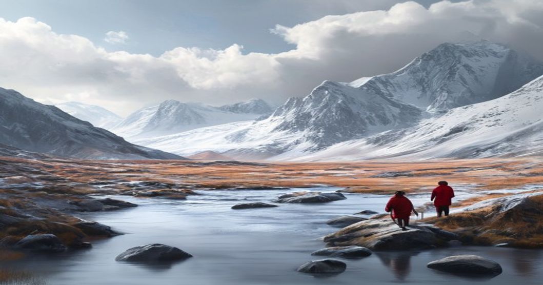
The Sámi population has navigated the extensive northern territories of Fennoscandia for generations by relying on highly developed environmental literacy rather than modern surveying instruments. Their movement across tundra, taiga, coastal fjords, and mountainous plateaus required precise reading of terrain features that functioned as permanent geographic markers. Mountain ridges, river confluences, distinctive rock formations, and coastline curves served as orientation points during long-distance travel between seasonal settlements.
Seasonal mobility dictated Sámi route planning. Winter expeditions followed frozen waterways and snow-packed valleys, while summer passages utilized inland lakes, archipelagos, and insect-free upland zones. Reindeer herding corridors demanded detailed knowledge of lichen growth cycles, calving grounds, and predator movement patterns. These pathways were never fixed on paper but encoded in place names, joik melodies, and oral histories that operated as cognitive maps passed through direct instruction.
Sámi navigators developed specialized techniques for celestial orientation and microclimate interpretation. During polar nights, travelers tracked star positions, lunar phases, and wind direction to maintain course across featureless snowscapes. Summer navigation relied on the midnight sun’s arc, cloud formations, and bird flight patterns that revealed distant landmasses or approaching weather systems.
- Snow and Ice Analysis: Experienced travelers evaluated snow hardness, wind drift patterns, and surface crust thickness to determine safe crossing points. Thin ice zones were identified through subtle color shifts, vegetation visibility beneath the surface, and acoustic resonance when probed with wooden poles.
- Vegetation and Lichen Markers: The density of reindeer lichen, birch grove edges, and moss distribution signaled nutrient-rich valleys or unstable bog terrain. These botanical indicators guided herders toward optimal grazing areas while preventing exposure to waterlogged ground that could collapse under weight.
- Avian and Atmospheric Cues: Migration routes of ptarmigan, waders, and Arctic terns provided real-time atmospheric data. Sudden directional shifts in flock movement often preceded temperature drops or precipitation, allowing communities to adjust travel schedules before conditions became hazardous.
Toponymic systems formed the foundation of Sámi spatial orientation. Every landmark carried specific names describing geological structure, historical usage, or resource availability. These linguistic markers created a dense geographic network that enabled hunters and traders to traverse hundreds of kilometers without losing directional accuracy. Auditory navigation further enhanced mobility in low-visibility conditions, as wind echoing through mountain passes and water flow beneath ice provided continuous spatial feedback.
Contemporary climate shifts are altering traditional navigation indicators, disrupting established route networks and diminishing seasonal predictability. Recording Sámi geographical knowledge and ecological monitoring techniques remains critical for preserving indigenous environmental literacy and understanding historical human adaptation to extreme northern climates.
Traditional Navigation Techniques in Arctic Environments
The Sami navigators of northern Fennoscandia relied on a highly refined system of environmental reading rather than manufactured instruments. Route-finding across tundra, fells, and seasonal ice required precise interpretation of microclimates, terrain memory, and celestial markers. Navigation was never static; it adapted to extreme light cycles where polar nights eliminated solar reference points for weeks while midnight sun provided continuous directional tracking.
- Solar and Lunar Positioning: Even during winter months, navigators tracked the sun’s arc along the horizon using notched antler markers placed at fixed vantage points. The angle of twilight shadows on snow-packed slopes indicated true north, while lunar phases guided timing for long-distance migrations.
- Wind and Air Current Analysis: Persistent katabatic winds flowing from mountain ridges created predictable pressure zones. By observing how wind shifted snow patterns on leeward slopes and how smoke from fires behaved in valleys, travelers mapped safe corridors through whiteout conditions.
- Biological and Terrain Signatures: Reindeer migration routes functioned as living cartography. Seasonal grazing trails avoided dangerous ice shelves and thin snow bridges. Birch line boundaries, permafrost mounds, and exposed bedrock outcrops served as immutable waypoints passed down through generational apprenticeship.
- Snow and Ice Reading: Surface wind crust, depth hoar layers, and sastrugi formations revealed recent weather patterns and structural stability. Navigators tapped walking poles to detect hollow ice over water channels or compacted snow ridges marking historical route lines.
Knowledge transmission occurred through direct field practice rather than textual records. Younger members followed elders across terrain while memorizing acoustic markers like glacier groaning, wind channeling through rock passes, and the directional call patterns of ptarmigan. Route calibration required continuous environmental feedback loops. Navigators adjusted stride length and pole placement based on snow density gradients, using permafrost thaw lines as seasonal boundary markers. Maps were internalized through spatial repetition and calendar alignment, ensuring route accuracy even when visibility dropped to zero. These techniques remained operational until modern surveying replaced traditional wayfinding in the twentieth century.
Reading Natural Landmarks and Celestial Bodies
The Sámi navigators of the northern boreal and arctic zones developed a spatial intelligence rooted in direct environmental observation rather than mechanical instruments. Their movement across Fennoscandia relied on a continuous mental map constructed from visible terrain markers, seasonal weather shifts, and astronomical cycles. Mountains known as duottar served as permanent reference points because their silhouettes remain consistent across vast distances. Herders tracked these elevated landforms to maintain orientation when blizzards reduced visibility to zero.
- River valleys and frozen waterways provided predictable corridors through dense forest tundra. The Sámi identified specific bends, gravel bars, and rapids by listening to water flow patterns and observing snow accumulation along banks.
- Animal migration routes functioned as natural highways. Reindeer trails marked passable terrain over permafrost, while bird flight paths indicated open ice or dangerous thin spots during spring thaw.
Celestial navigation operated alongside terrestrial cues with equal precision. The Sámi tracked the sun’s arc using wooden sighting poles aligned with solstice markers carved into stone platforms. During winter months, when daylight lasted only a few hours, navigators measured the angle of Polaris relative to known mountain peaks to calculate latitude without compasses. Lunar phases dictated grazing schedules and route planning because moonlight revealed terrain features during polar nights.
- Wind direction served as a directional anchor when fog obscured stars and landmarks. Persistent northern gales pushed cloud cover in predictable patterns, allowing herders to infer geographic location through atmospheric pressure changes.
- Seasonal star constellations shifted across the sky in ways that aligned with reindeer calving grounds. Navigators memorized these celestial movements to anticipate ground conditions months in advance.
This dual navigation system required generational knowledge transfer through oral instruction and practical demonstration. Young herders learned to read ice thickness by listening to acoustic reflections while walking across frozen lakes. They correlated star positions with terrain features during daylight training exercises before attempting solo journeys across unmarked tundra. The integration of astronomical data with micro-landscape observation created a resilient navigation framework that adapted to extreme Arctic conditions without relying on manufactured tools.
Seasonal Migration Patterns Across Tundra Regions
The seasonal migration of the Sami people across tundra ecosystems operates as a precisely calibrated response to extreme Arctic climate cycles and reindeer biology. Rather than random movement, these pathways follow generational observations of snow accumulation, vegetation recovery rates, and predator territories. Herders track microclimatic shifts that dictate when coastal fens or boreal forest edges become viable winter pastures versus when inland plateaus offer adequate summer forage.
Spring movements typically commence as wind-scoured ridges dry out and the first patches of cloudberry, bilberry, and young lichen emerge. Reindeer herds navigate across frozen rivers that have lost structural integrity, following natural drainage lines to avoid deep mud traps. The route selection prioritizes minimal energy expenditure during calving season, which aligns with high-altitude tundra zones where mosquito harassment remains manageable until insect populations peak in midsummer.
- Topographical Navigation: Herders utilize ridgelines and river valleys as natural corridors, reading snow depth variations to identify safe crossing points beneath thin ice layers.
- Vegetation Rotation: Grazing grounds remain fallow for three to five years post-departure, allowing slow-growing Arctic flora to regenerate before seasonal return.
- Climatic Indicators: Migration timing correlates with permafrost thaw depth, daylight duration exceeding sixteen hours, and the disappearance of persistent wind-crust snow that blocks forage access.
Autumn transitions trigger a deliberate retreat toward sheltered birch forests and lowland basins. Reindeer require high-protein lichen and shrub browse during antler growth and pre-winter fat accumulation phases. Herders adjust camp locations based on wind direction to protect livestock from blowing snow while maintaining proximity to traditional hunting and fishing grounds. Contemporary infrastructure, including hydropower reservoirs and mineral extraction zones, fragments historical corridors, forcing adaptive route modifications that still preserve core navigational logic.
Reindeer Herding Routes as Indigenous Mapping Systems
Reindeer herding routes operated as dynamic cartographic frameworks long before modern surveying techniques emerged across the northern hemisphere. Sami communities encoded geographical data directly into seasonal migration pathways, treating each trail as a living document of environmental conditions. These routes mapped subtle variations in terrain elevation, permafrost boundaries, and microclimates that dictated animal movement patterns throughout winter and summer cycles.
Herders identified navigational markers through precise observation of landscape features. Lichen growth patterns indicated wind exposure and soil composition, while specific rock formations served as fixed reference points during whiteout conditions. Water sources, frozen rivers, and marshland boundaries functioned as natural grid coordinates. The knowledge required to maintain these pathways demanded continuous environmental monitoring, as snow depth variations could completely alter route viability within a single season.
- Seasonal Pathway Allocation: Routes shifted systematically between summer grazing pastures and winter feeding grounds based on lichen availability and predator migration patterns.
- Cognitive Wayfinding Techniques: Herders memorized topographical sequences through generational oral instruction, translating complex terrain data into actionable movement strategies.
- Ecological Navigation Markers: Specific tree line boundaries, avalanche zones, and ice formation patterns provided reliable geographic coordinates independent of artificial surveying instruments.
The precision of these indigenous mapping systems emerged from necessity rather than academic design. Each route represented centuries of accumulated environmental data, optimized through trial and error across multiple generations. Herders recognized that successful navigation required understanding the interconnected relationship between animal behavior, vegetation cycles, and atmospheric conditions. This knowledge system functioned as a comprehensive geographical database, encoding elevation changes, resource locations, and hazard zones into practical movement protocols.
Modern geographic information systems later validated many of these traditional pathways. Satellite imagery and terrain analysis confirmed that historical reindeer routes consistently followed optimal energy conservation corridors, avoided unstable ground formations, and maximized access to critical seasonal resources. The indigenous mapping approach demonstrated that precise geographical understanding does not require technological instrumentation when derived from sustained environmental observation and systematic knowledge transmission.
Primitive Tools for Wayfinding in Extreme Weather
The Sami navigators did not rely on manufactured compasses or printed charts when traversing the Arctic tundra and boreal forests. Instead, they engineered a highly refined system of environmental reading that transformed harsh weather into navigable data. Terrain contour mapping formed the foundation of their route planning. Every ridge line, glacial valley, frozen riverbed, and cluster of fells carried specific identifiers known across generations. During winter expeditions, snow depth variations and wind‑scoured drift patterns revealed hidden trails through dense forest or open fell terrain. Navigators memorized sightlines between distant peaks and used them as bearing anchors when visibility collapsed.
Physical markers played a critical role in maintaining direction over featureless ice sheets and deep snowfields. Birch bark pieces, often treated with reindeer fat to preserve writing, functioned as portable route maps that recorded water crossings, hunting grounds, and seasonal camp locations. Carved wooden stakes placed at trail junctions or dangerous river bends provided tactile confirmation of established paths. Reindeer antler bundles stacked near cairns marked safe passage zones where wind loading created hidden crevasses. During blizzard conditions, the sun’s position relative to terrain features allowed navigators to maintain a consistent bearing without visual reference to the horizon.
- Snow compass technique: Using a flat stone or antler fragment to cast a shadow at midday, then rotating the tool to track solar movement and establish true north‑south alignment during prolonged cloud cover.
- Lichen density assessment: Reading moss and reindeer lichen distribution on rock faces to determine exposure direction, since south‑facing surfaces support thicker growth patterns in subarctic climates.
- Ice acoustics navigation: Tapping frozen lake surfaces with a wooden staff to detect subsurface water channels or thin ice zones through sound resonance before committing weight to the surface.
- Animal track triangulation: Following parallel reindeer or ptarmigan trails during whiteout conditions, as herd movement consistently aligns with established wind corridors and sheltered terrain depressions.
Extreme weather navigation demanded rapid pattern recognition. Wind direction shifts were measured using dried grass tufts attached to the collar or sleeve, providing continuous airflow feedback without breaking visual contact with the ground. Frost flower formation on vegetation indicated temperature inversions and safe travel windows. When fog or heavy snowfall eliminated all external references, navigators relied on step counting combined with terrain memory to maintain route accuracy over distances exceeding twenty kilometers. This systematic integration of tactile markers, celestial tracking, and environmental feedback loops enabled reliable transit across landscapes where modern instruments frequently fail.
Sunstones, Ice Axes, and Wind Direction Indicators
The Sami navigators of the Fennoscandian Arctic developed a highly sophisticated toolkit for traversing treacherous, light-deprived environments where magnetic compass reliability fluctuated near the geomagnetic pole. Central to their winter wayfinding was the use of Icelandic spar, a naturally occurring calcite crystal prized for its double-refraction properties. When held aloft during prolonged periods of polar overcast, these transparent mineral blocks revealed the hidden position of the sun through polarization patterns in the sky. By rotating the stone until two equally bright images aligned, travelers could determine solar azimuth with remarkable precision, allowing them to maintain a consistent bearing across featureless tundra and frozen fjords.
Ground traversal relied heavily on specialized ice axes crafted from reindeer antler, dense hardwood, or later wrought iron. These implements featured curved biting edges designed to penetrate wind-packed snow and glacial ice without fracturing under impact. The ergonomic handles were often wrapped in cured reindeer hide to prevent frostbite during extended use, while the striking surfaces were tempered through repeated heating and quenching in local water sources. Climbing steep frozen slopes required precise axe placement; navigators would test each anchor point by tapping the tool against the surface, listening for hollow resonance that indicated unstable ice layers.
- Sunstone polarization technique: Exploited light wave orientation to locate solar position beneath cloud cover or during twilight hours when visibility dropped below critical thresholds.
- Antler and iron axe construction: Utilized locally sourced materials hardened through traditional metallurgy and bone-working methods to withstand extreme thermal contraction.
- Wind drift reading: Interpreted snow dune formations, lichen asymmetry on bedrock, and animal track alignment to determine prevailing air currents and safe passage routes.
Environmental awareness extended beyond physical instruments. Sami route planners continuously monitored wind direction by observing snow crystal structure, which shifted from sharp granules in fresh gusts to rounded grains under sustained pressure. They tracked lichen growth patterns on exposed granite outcrops, noting that the thickest colonies always faced away from dominant storm directions. Animal behavior provided real-time atmospheric data; ptarmigan would alter their flight altitude before pressure drops, while reindeer herds adjusted their migration angles relative to wind shear. These observations were cross-referenced with hand-carved route markers placed at glacial crossings and river fords, ensuring that seasonal teams could navigate back along established corridors even when blizzard conditions erased all natural landmarks.
Oral Tradition and Memory-Based Geographic Knowledge
The Sami navigated the Arctic tundra, mountain ranges, and coastal waters long before modern cartography existed through a highly refined system of oral geography. Elders encoded spatial data into narratives that aligned with seasonal ecological shifts. Place names functioned as precise coordinate markers rather than decorative labels. A single Sámi toponym often described terrain composition, historical events, wildlife activity, or safe passage conditions for specific months. Children absorbed these lexical maps through repetitive storytelling during long winter nights and practical field instruction during summer expeditions.
Memory techniques relied heavily on spatial anchoring. Routes were memorized by linking distinct natural features—lichen-covered boulders, specific wind-carved ridges, seasonal meltwater streams, and animal trails—into continuous cognitive sequences. Reindeer herders tracked subtle vegetation changes across microclimates to determine optimal grazing zones. Hunting parties used celestial navigation combined with terrestrial landmarks to maintain direction during whiteout conditions. The joik tradition served as an acoustic surveying tool, where melodic patterns mirrored landscape contours and hydrological networks. Each verse preserved directional cues and resource locations that could be recalled across generations.
Knowledge transmission followed a structured apprenticeship model. Young navigators learned by shadowing experienced route-finders during critical migration windows. They practiced dead reckoning using sun position, wave patterns on fells, and snow drift formations. Errors carried immediate survival consequences, which enforced rigorous accuracy standards within the community. Geographic information remained dynamic rather than static. Routes adapted to permafrost thaw, glacier retreat, and reindeer herd movements. Oral records captured these environmental fluctuations through updated narratives that maintained functional spatial relationships.
Modern GPS technology overlays this ancestral system with digital coordinates, yet the underlying logic remains identical. Both methods require continuous environmental observation and pattern recognition. The Sámi memory landscape operated as a living database where terrain features, weather patterns, and biological indicators formed an interconnected navigation grid. Preservation of these cognitive maps depends on maintaining contact with the physical environments that originally generated them. Ethnographic studies confirm that traditional spatial cognition reduces reliance on external devices while increasing situational awareness during rapid weather changes common in subarctic regions.
Legacy of Sámi Territorial Exploration and Modern Relevance
The Sámi territorial framework emerged through centuries of hyper-localized ecological observation and adaptive mobility across Fennoscandia’s Arctic and sub-Arctic zones. Rather than relying on fixed coordinates, traditional navigation depended on interconnected seasonal waypoints that synchronized with reindeer calving grounds, fishing sites, and lichen pastures. Experienced knowledge holders memorized topographical markers such as glacial erratics, wind-scoured ridges, and permafrost thaw patterns, translating environmental cues into reliable passage networks. This mobile cartography enabled efficient resource distribution across fragmented biomes while maintaining strict ecological thresholds to prevent overgrazing or habitat degradation.
Spatial awareness was institutionalized through communal land management units known as siida, where territorial boundaries shifted dynamically based on reindeer herd behavior and climatic variability. Place names encoded navigational intelligence, describing ice thickness, wind exposure, and seasonal accessibility without requiring written documentation. These toponyms functioned as living databases, preserving generational data about avalanche zones, river crossings, and shelter locations. The systematic transmission of this geographic literacy occurred through mentorship protocols that paired novice herders with veteran route planners during extended migration cycles.
- Legal Recognition: Nordic land-use legislation increasingly validates historical mobility corridors as binding territorial claims under international indigenous rights frameworks, directly influencing municipal zoning and resource extraction permits.
- Climate Research Integration: Ecologists overlay traditional grazing maps with satellite thermal imagery to track permafrost degradation and vegetation migration patterns in real time.
- Infrastructure Planning: Development approvals for wind farms, mining operations, and transportation networks now require mandatory territorial impact assessments that respect ancestral passage lines.
- Economic Models: Community-led tourism operators utilize mapped heritage routes to design low-impact travel itineraries that generate sustainable revenue while minimizing soil compaction and wildlife disturbance.
These historical navigation systems continue to inform modern conservation strategies across the circumpolar region. Environmental agencies reference Sámi-derived ecological thresholds when establishing protected buffer zones, while academic institutions incorporate indigenous spatial data into geographic information system databases. The ongoing documentation of territorial pathways provides critical baseline metrics for measuring ecosystem resilience under accelerating climate conditions. Municipal planning committees and indigenous governance bodies collaborate directly to ensure that contemporary land management practices align with historically proven sustainability parameters.
Frequently Asked Questions
What is How Sami People Explored Northern Landscapes?
“How Sami People Explored Northern Landscapes” refers to the historical and cultural practices of the Sámi indigenous people in navigating, understanding, and adapting to the Arctic and sub-Arctic environments across Scandinavia and northern Russia. This includes their traditional knowledge of reindeer herding routes, seasonal migration patterns, snow and ice reading, and sustainable use of natural resources.
Key facts about How Sami People Explored Northern Landscapes
Key facts include: the Sámi have inhabited northern Europe for over 10,000 years; they developed specialized knowledge of terrain, weather, and animal behavior; they used traditional tools like the gákti (clothing) and skis for winter travel; their oral traditions preserve detailed geographical knowledge; and their land use practices emphasize ecological balance and sustainability.