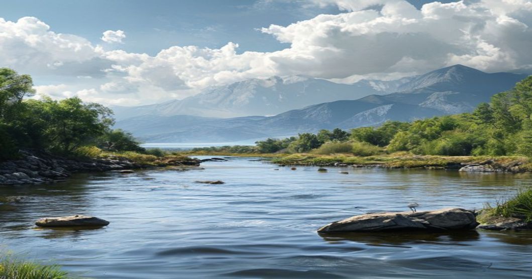
Sami Cultural Connections to Rivers and Lakes: A Comprehensive Overview
The indigenous Sami people of Sápmi have historically oriented their entire way of life around aquatic ecosystems, with rivers and lakes serving as primary arteries for survival, trade, and spiritual practice. These waterways are not merely geographical features but foundational elements that dictate seasonal migration patterns, resource distribution, and community settlement locations across northern Norway, Sweden, Finland, and the Kola Peninsula. Traditional Sami fishing techniques, developed over centuries, rely on precise knowledge of water currents, ice thickness, and fish spawning cycles, particularly for Atlantic salmon, Arctic char, and vendace.
Aquatic networks function as natural highways before modern road infrastructure existed. Kayaks crafted from reindeer hides and wooden frames allowed Sami hunters to navigate shallow, rocky shorelines where larger vessels could not operate. Lake and river fishing remained a critical protein source alongside reindeer herding, especially during winter months when terrestrial game became scarce. Fish weirs built from stones and driftwood still visible along many waterways demonstrate sophisticated hydrological engineering that maximized catch efficiency while preserving spawning populations.
Water bodies hold profound cosmological significance within traditional Sami belief systems. Rivers were viewed as living entities connected to the divine realm of Stoorak, where deities governed natural forces and seasonal transitions. Sacred sites often cluster along river confluences or deep lake basins, serving as locations for noaidi rituals involving drum ceremonies and offerings. The reflection patterns on still lake surfaces historically functioned as divination tools, while certain species like the salmon carried symbolic weight representing regeneration and ancestral guidance.
Contemporary Sami communities continue to protect these aquatic corridors through indigenous land rights movements and environmental stewardship programs. Legal frameworks in Sápmi now recognize traditional ecological knowledge as essential for sustainable watershed management, particularly regarding climate-driven changes in ice cover duration and fish migration timing. Educational initiatives document ancient fishing gear designs, hydrological calendars, and oral histories that preserve the intricate relationship between Sami identity and freshwater ecosystems.
Geographic Distribution of Key Sami River Systems
The traditional territories of the Sami people span across the northern reaches of Norway, Sweden, Finland, and the Kola Peninsula, with river systems forming the primary ecological and cultural arteries of Sápmi. These waterways do not align with modern national boundaries; instead, they carve continuous corridors that dictate seasonal reindeer migration routes, settlement patterns, and spiritual geography. The geographic distribution of key Sami river systems follows a distinct north-to-south gradient across the Scandinavian and Kola Peninsulas, each basin supporting unique microclimates, fish populations, and grazing grounds essential to indigenous livelihoods.
Tana-Deatnu System stands as the largest and most culturally significant river network in Sápmi. Flowing from the Scandinavian Mountains through Norway and Finland into the Barents Sea, this basin encompasses over 30,000 square kilometers of wetlands, fells, and boreal forests. The Deatnu tributaries serve as historic salmon fishing grounds and define the seasonal calendar for coastal and inland Sami communities alike. Torneälven-Tornionjoki forms a natural border between Sweden and Finland while maintaining uninterrupted Sami usage patterns. Its lower reaches feature extensive floodplains that historically supported summer grazing, whereas upper catchments feed into highland reindeer pastures.
- Luleälven-Lulajohka drains central Sápmi through Sweden and Finland, creating a watershed that links coastal fishing villages with inland mountain ranges. The river’s rapid flows and glacial origins sustain cold-water ecosystems critical for Arctic char and trout.
- Pasvikelva-Petsamojoki marks the northeastern frontier near the Russian border. Though narrower than southern basins, its fjord-connected estuaries provided vital winter transport routes and seal hunting access during historical Sami expansion periods.
- Kemijoki-Kemi River represents the southernmost major Sami waterway in Finland. Its extensive delta system historically functioned as a seasonal processing hub for cured fish and reindeer hides before twentieth-century border closures altered traditional movement patterns.
The spatial arrangement of these river systems reflects glacial retreat patterns from the last Ice Age, leaving behind U-shaped valleys, kettle lakes, and interconnected drainage networks that Sami communities have navigated for millennia. Each basin exhibits distinct hydrological characteristics shaped by permafrost distribution, precipitation gradients, and topographic barriers. Modern land-use policies often fragment these continuous watersheds, yet the geographic continuity of river corridors remains fundamental to understanding historical Sami territorial organization and ecological adaptation strategies.
Spiritual Beliefs and Mythological Narratives Surrounding Sami Waters
The Sami worldview treats rivers and lakes as active participants in cosmological balance rather than passive landscapes. Each significant water body traditionally hosts a localized spirit guardian, often referred to as a vættir or lake deity, whose temperament dictates fishing success, ice safety, and seasonal migration routes. These entities are not worshipped as distant gods but engaged through reciprocal respect. Historical ethnographic records document offerings of dried reindeer meat, wool strips, or iron nails left on shoreline sieidum stones to maintain favorable relations. Disregard for these customs historically triggered narratives of sudden storms, broken ice, or failed catches, reinforcing hydrological stewardship through mythic consequence.
Mythological frameworks position water as a threshold between the human realm and the underworld of ancestors and shape-shifters. Lakes across Finnmark and Tromsø frequently appear in oral traditions where drowning victims become stallo guardians, demanding moral accountability from living communities. The noaidi, or traditional shaman, utilized drum patterns to interpret water ripples during sieidum ceremonies, extracting omens regarding salmon runs, weather shifts, and clan survival. Water narratives also function as ecological instruction manuals, embedding watershed protection within generational storytelling. Prohibitions against washing tools in sacred springs or taking fish during spawning periods operate as culturally codified conservation laws.
- Mánnu, the goddess of freshwater and fertility, directly influences ice thickness and spring thaw cycles across Sami territories.
- Lake spirits demand silence near shorelines; vocal disturbances are believed to agitate submerged entities and disrupt fishing equilibrium.
- Ritual boat construction required specific timber sources blessed by water deities, ensuring vessels remained spiritually protected during winter crossings.
- Seasonal hydrological shifts dictated migration calendars, with thaw patterns serving as primary markers for reindeer drive timing and communal gatherings.
These narratives persist as living ethnographic frameworks rather than historical artifacts. Contemporary Sami communities maintain oral transmission practices that link watershed health to cultural continuity. Modern environmental initiatives frequently integrate traditional water myths with scientific monitoring, demonstrating how ancient hydrological cosmology informs current conservation strategies across Arctic ecosystems.
The Role of Rivers in Sami Cosmology and Creation Stories
Rivers function as the primary arteries of Sami spiritual geography, weaving together cosmological narratives, ancestral memory, and ecological survival. In traditional Sámi belief systems, waterways are never perceived as inert physical features; they operate as living conduits between the visible world of humans and the invisible realms governed by deities and ancestral spirits. Creation accounts across Sápmi regions consistently position rivers as divine gifts that carve paths through primordial landscapes, transforming chaotic waters into ordered territories where life could emerge.
Each major watercourse carries distinct mythological attributes shaped by local dialects and historical settlement patterns. The vássáháhtát, revered river spirits, inhabit specific rapids, confluences, and deep pools, demanding respect through ritual offerings of tobacco, dried fish, or reindeer fat. Disrespecting these sites historically triggered ecological imbalance and spiritual unrest. Noaidi practitioners navigated these aquatic boundaries during trance states, using their goavddis (shamanic drums) to map celestial alignments that mirrored river courses below.
Cosmological divisions structure the Sámi understanding of hydrological systems. The upper world (Ráfuoajvve) manifests through snowmelt and glacial feeds, the middle realm (Eana) sustains fishing grounds and seasonal camps, while the lower domain (Vuolánaš) anchors ancestral burial sites and submerged sacred stones. River confluences mark liminal thresholds where creation narratives converge, often accompanied by sieidi formations used for communal rituals during solstice transitions. Water flow patterns dictate ritual calendars, with spring thaw initiating renewal ceremonies and autumn currents closing seasonal spiritual cycles.
- Rivers serve as genealogical markers, linking clan territories through shared mythic lineages of water deities.
- Sacred hydrological sites require continuous stewardship; pollution or damming historically disrupted cosmological equilibrium.
- Oral transmission preserves precise coordinates for river spirits, ensuring intergenerational ecological and spiritual continuity.
Contemporary Sámi communities maintain these cosmological frameworks through place-based education and land rights advocacy. The mythic status of rivers transcends folklore; it operates as a living legal and spiritual framework that informs sustainable resource management, water governance, and cultural resilience against industrial encroachment.
Reindeer Migration Routes Along River Valleys
Reindeer migration routes heavily depend on river valleys because these natural corridors provide predictable topography and concentrated resource availability across vast Arctic landscapes. The geological depressions formed by centuries of water flow create sheltered passages through otherwise rugged mountainous terrain, significantly reducing caloric expenditure during long-distance seasonal movements. These waterway boundaries deliver consistent drinking sources, mineral-rich alluvial soils that sustain nutrient-dense vegetation, and wind-protected grazing zones essential for herd thermoregulation and survival.
Seasonal movement follows strict ecological timing dictated by snowmelt patterns and vegetation cycles. Spring ascension pushes herds from lowland winter pastures toward highland summer ranges. River valleys accelerate this transition by offering gradual elevation gradients and early-thaw patches that rapidly expose fresh lichen growth. Autumn descent reverses the trajectory, with animals tracking frost lines downhill along historically established watercourse pathways. The continuous hydrological flow generates localized microclimates that postpone freezing conditions, effectively extending critical foraging windows during vulnerable seasonal transitions.
Sami pastoral communities mapped and maintained these corridors through centuries of direct environmental observation and structured knowledge transmission. Navigation relies on precise landscape indicators: subtle river bends, tributary confluences, distinctive bedrock outcrops, and historical stone markers positioned at optimal crossing locations. Indigenous toponyms embedded in the terrain encode seasonal timing, terrain hazards, and pasture recovery rates. This ethnographic mapping system ensures herds traverse corridors that reduce predator exposure while optimizing forage regeneration timelines.
- River valleys function as natural windbreaks during severe Arctic storms
- Distributed tributary systems establish redundant pathways when main channels face obstruction
- Floodplain soils accelerate forage regrowth compared to exposed plateau surfaces
- Historical movement boundaries directly correspond with traditional Sami seasonal grazing territories
Modern infrastructure expansion and resource extraction frequently fragment these established corridors. Agricultural fencing, logging operations, and tourism development interrupt established movement sequences, compelling herds to detour through unsuitable terrain and deplete vital fat reserves. Conservation frameworks now designate unobstructed river valley networks as mandatory ecological infrastructure. Merging indigenous seasonal monitoring protocols with GPS telemetry data delivers precise metrics on route consistency, habitat fragmentation severity, and necessary corridor restoration priorities.
Fishing Practices and Seasonal Lake Harvesting Techniques
The Sami people have historically relied on intricate knowledge of aquatic ecosystems, developing fishing practices that align precisely with seasonal hydrological shifts and fish migration patterns.
- Winter Ice Harvesting: When lake surfaces freeze to sufficient thickness, Sami fishers cut rectangular openings through the ice to access deep-water habitats. Traditional hand lines baited with cured fish or reindeer sinew are lowered into these apertures, targeting species like Arctic char and whitefish that remain active under ice.
- Spring Spawning Runs: As snowmelt increases river flow, salmon and trout migrate upstream. Sami communities construct temporary willow and stone weirs in shallow tributaries to guide fish into controlled capture zones, maximizing yield while minimizing habitat disruption.
- Summer Shallow-Water Techniques: During warmer months, casting nets and gillnets are deployed in littoral zones where aquatic vegetation supports juvenile fish. Fishers monitor water clarity and temperature fluctuations to determine optimal net placement times.
- Autumn Preparation: Before freeze-up, communities process surplus catches through smoking, drying, and fermentation methods that ensure winter sustenance. Traditional preservation relies on controlled airflow and natural salts rather than modern additives.
Seasonal harvesting schedules are dictated by environmental indicators rather than fixed calendars. Ice thickness, snowpack depth, and bird behavior signal when harvest windows open or close. Community elders track lunar phases alongside water turbidity to determine the most productive casting periods, reducing bycatch and preserving juvenile stocks. This adaptive methodology prevents overexploitation and maintains fish population stability across generations. Fishing sites are treated with ritual respect; offerings of tobacco or reindeer fat are left at water edges to honor aquatic spirits and maintain ecological balance.
Modern Sami practitioners continue transmitting these techniques through apprenticeship models, where elders demonstrate knot tying, net mending, and ice-reading skills. The integration of indigenous hydrological forecasting with contemporary conservation science has reinforced sustainable yield limits, ensuring that traditional fishing practices remain viable amid climate-driven water cycle alterations.
Contemporary Challenges and Conservation Efforts for Sami Water Sites
The ecological and cultural integrity of Sami water sites faces mounting pressure from rapid environmental shifts and industrial expansion across northern Fennoscandia. Glacial retreat and altered precipitation patterns disrupt historic flow regimes, directly impacting fish migration routes that sustain traditional livelihoods. Mining operations, hydroelectric infrastructure, and intensive forestry alter sediment loads and nutrient cycles, degrading spawning grounds essential for whitefish, trout, and char populations. These physical changes cascade into cultural erosion, as elders lose access to intergenerational knowledge transfer points tied to specific river bends, lake shores, and seasonal ice formations.
- Industrial water extraction reduces base flows during critical summer months, forcing herders to relocate grazing routes away from historically reliable watering stations.
- Agricultural runoff introduces phosphorus and nitrogen into lowland lakes, triggering algal blooms that compromise drinking water quality and ceremonial purification practices.
- Unregulated recreational tourism concentrates foot traffic near culturally significant fishing weirs and ancestral burial grounds, accelerating soil compaction and artifact disturbance.
Conservation strategies now prioritize indigenous governance models alongside scientific monitoring. The Sami Parliaments in Norway, Sweden, and Finland have established joint watershed committees that integrate traditional ecological knowledge with hydrological data collection. Co-management agreements mandate impact assessments for new infrastructure, requiring consultation with local reindeer herding districts before dam construction or road grading near riparian zones. Digital mapping initiatives document sacred sites, enabling legal protection under national heritage laws and international frameworks like the UN Declaration on the Rights of Indigenous Peoples.
- Youth-led restoration projects combine drone surveillance with traditional ice-fishing techniques to track water quality fluctuations in real time.
- Cross-border research networks synchronize climate modeling with oral histories, predicting ecological thresholds before irreversible damage occurs.
- Legal advocacy groups file strategic litigation to enforce existing environmental standards, successfully halting several proposed tailings storage facilities near critical aquifers.
Sustainable management requires funding mechanisms that directly support indigenous monitoring stations and traditional maintenance practices like brush clearing along historical fish passes. Educational curricula now embed hydrological literacy within Sami language programs, ensuring terminology for water states, seasonal indicators, and ecological relationships remains linguistically active. Long-term resilience depends on recognizing water not as a resource to be optimized, but as a relational entity requiring continuous stewardship across generations.
Impact of Dams and Industrial Development on Traditional Sami Territories
Hydropower infrastructure and industrial expansion across northern Scandinavia and northern Finland have systematically overlapped with ancestral Sami landscapes, fundamentally altering hydrological regimes that sustained indigenous livelihoods for centuries. River damming projects redirect natural flow patterns, suppress seasonal flood pulses, and modify thermal gradients in critical riparian zones. These engineered modifications degrade benthic macroinvertebrate communities, reduce spawning substrate availability, and fragment upstream migration corridors essential for anadromous fish species such as Atlantic salmon and Arctic char. Traditional Sami fishing practices, which rely on precise knowledge of water velocity, ice cover duration, and seasonal run timing, lose their ecological foundation when regulated reservoirs replace dynamic fluvial systems.
- Hydrological alteration: Flow regulation eliminates natural spring freshets that trigger reproductive cycles in fish populations and recharge wetland pastures.
- Sediment disruption: Turbines trap nutrient-rich silt, starving downstream floodplains and degrading riparian vegetation critical for reindeer winter forage.
- Thermal pollution: Deep-water releases from reservoirs lower summer water temperatures, delaying insect emergence and reducing food availability for both aquatic species and migratory birds.
Reindeer pastoralism faces compounding pressure as industrial corridors, access roads, and fenced dam facilities fragment continuous grazing networks. Seasonal migration routes historically aligned with snowpack depth, lichen growth cycles, and predator avoidance patterns are interrupted by infrastructure barriers that force herds into suboptimal pastures. Compacted snow surfaces around transmission lines and maintenance tracks create ice layers that reindeer cannot penetrate during winter months, leading to increased mortality rates and reduced calf survival. The loss of accessible wetland zones further diminishes critical summer cooling areas and insect-free grazing grounds.
Cultural continuity erodes alongside ecological degradation. Sacred sites located along riverbanks, lake shores, and mountain passes are inundated or rendered inaccessible, severing the transmission of place-based knowledge embedded in Sami language and oral tradition. Environmental impact assessments frequently prioritize economic metrics over cultural landscape integrity, operating without securing free, prior, and informed consent from local communities. Contemporary resistance movements combine legal advocacy for land tenure recognition with community-led ecological monitoring, demanding infrastructure planning that respects hydrological baselines and indigenous spatial sovereignty.
Academic Research and Anthropological Studies on Sami Hydrology
Academic inquiry into Sámi hydrology has transitioned from early ethnographic documentation to rigorous interdisciplinary analysis, establishing how indigenous water knowledge functions as both empirical ecological system and structured cosmological framework. Early Scandinavian fieldwork catalogued seasonal migration corridors along river valleys but frequently categorized these observations through external taxonomies that obscured the technical specificity of Sámi hydrological practices. Modern anthropology addresses this methodological gap by treating water relationships as specialized knowledge domains requiring analytical precision equivalent to Western hydrological science.
Contemporary research employs mixed-method frameworks integrating participatory geographic information systems, acoustic monitoring, and longitudinal ethnography. Field teams document how reindeer pastoral communities assess ice load capacity, spring thaw progression, and groundwater discharge using lexical categories that encode generations of watershed observation. Linguistic surveys across Inari, Lule, and North Sámi dialects reveal highly differentiated terminology for flow resistance, sediment suspension, and subsurface current behavior—semantic precision that conventional hydrological mapping frequently standardizes away. Research clusters at Sámi universities and Nordic polytechnics now prioritize indigenous water governance studies, particularly analyzing how historical fish weir alignments correlate with natural floodplain nutrient cycling and riparian vegetation recovery.
Empirical findings consistently indicate that Sámi hydroological knowledge operates through adaptive feedback mechanisms rather than fixed descriptions. Researchers mapping winter ice routes in Finnmark record that path selection relies on subsurface velocity readings, exposure to katabatic winds, and historical freeze-thaw intervals preserved within family archives. Anthropological documentation further identifies designated water sites that operate as long-term ecological monitoring stations, where knowledge holders track macroinvertebrate populations, spawning migration success, and permafrost degradation decades before institutional monitoring networks register comparable data.
- University collaborations combine drone-derived watershed topography with Sámi seasonal calendars to model hydrological resilience across fragmented terrain.
- Digital lexicon projects archive hydrological terminology through structured metadata accessible to academic researchers and indigenous educators.
- Clinical partnerships between environmental scientists and Sámi knowledge keepers validate traditional water quality indicators against standardized laboratory protocols.
Current scholarly discourse positions Sámi hydrology as active environmental governance rather than historical anthropology. Peer-reviewed publications emphasize how indigenous water stewardship models provide scalable frameworks for climate adaptation, particularly in tracking altered precipitation patterns and accelerating permafrost melt. The prevailing academic position requires abandoning extractive research methodologies in favor of co-authorship structures, data sovereignty protocols, and institutional agreements formalized through Sámi parliamentary bodies.
Oral History Documentation of Sami Place Names Near Water Bodies
The preservation of Sami toponymy surrounding rivers and lakes relies predominantly on intergenerational oral transmission rather than written cartography. Indigenous knowledge keepers serve as living archives, encoding geographic information within narrative frameworks that capture hydrological behavior, seasonal migration routes, and subsistence patterns. Each water-related designation functions as a precise ecological marker, distinguishing shallow rapids from deep pools, identifying seasonal ice-breakup zones, or marking salmon spawning grounds through highly specific dialectal variations across Sápmi. Traditional memory techniques utilize rhythmic phrasing and spatial orientation cues that allow navigators to reconstruct entire watershed systems without visual reference.
Field documentation requires systematic phonetic recording paired with contextual verification. Researchers conduct structured interviews with elder community members, cross-referencing spoken accounts against historical land-use records, archaeological findings, and traditional joik melodies that traditionally anchored territorial memory. The resulting datasets map linguistic gradients where identical water bodies carry divergent names based on clan lineage, hunting territory boundaries, or historical event markers such as floods or droughts.
- Numeric prefixes indicate fish abundance or water depth measurements used for navigation
- Descriptive suffixes encode seasonal accessibility, ice thickness, and current velocity
- Possessive forms denote historical stewardship lines between traditional siida communities
Archival documentation of Sami lakeside settlements draws upon a fragmented yet rich collection of expedition logs, missionary reports, linguistic surveys, and municipal land registers spanning the late nineteenth to mid-twentieth centuries. These records capture seasonal transhumance patterns anchored around specific water bodies, where shoreline topography dictated fishing camps, reindeer staging grounds, and winter dwelling placements. Early ethnographers frequently recorded indigenous toponyms that encoded ecological knowledge: rock formations marking spawning runs, shallow bays indicating ice thickness, and submerged ridges guiding boat navigation. Contemporary researchers now overlay these historical annotations onto digital elevation models and hydrographic datasets to reconstruct settlement footprints that predate modern border divisions.
Systematic analysis of museum inventories and personal correspondence reveals how lake margins functioned as cultural nexuses rather than mere geographic features. Waterways structured kinship networks, trade exchanges, and ceremonial calendars. Field notes from Finnish Lapland archives describe how shoreline microclimates influenced net-weaving techniques and smokehouse architecture, while Norwegian parish registers document tax assessments tied to specific fishing rights along coastal fjords and inland lakes. Swedish national land surveys similarly record lease agreements that formalized access routes between forested uplands and lacustrine zones.
Digitization initiatives across Nordic institutions have begun standardizing these disparate records through controlled vocabularies aligned with the Sami Language Institute’s place name registry. Researchers apply spatial interpolation algorithms to triangulate undocumented campsites using recurring environmental markers: birch pollen stratigraphy, charcoal layers from seasonal hearths, and shell middens indicating long-term resource extraction. Cross-referencing oral testimony transcripts with cartographic drafts allows historians to distinguish between permanent habitation sites and ephemeral harvest locations. This methodological convergence strengthens geographic accuracy while preserving linguistic nuances that standardized maps historically omitted.
- Archival Sources: Missionary correspondence, land tax rolls, and expedition journals provide baseline coordinates for settlement mapping.
- Toponymic Analysis: Indigenous water names encode depth measurements, seasonal ice behavior, and aquatic species migration cycles.
- Spatial Reconstruction: LiDAR surveys combined with sediment core samples validate historical shoreline expansions and contraction phases.
Preservation frameworks now prioritize community-led verification protocols. Elder knowledge holders review digitized site coordinates to confirm cultural boundaries, correct colonial misalignments, and annotate seasonal resource zones that remain active within contemporary land-use planning. This collaborative approach ensures that archival mapping functions as both academic reference and legal documentation for territorial claims.
“`html
Frequently Asked Questions
What is Sami Cultural Connections to Rivers and Lakes?
The Sami cultural connections to rivers and lakes represent the deep, centuries-old relationship between the Indigenous Sami people of northern Scandinavia and the freshwater ecosystems that sustain their livelihoods. For the Sami, rivers and lakes are not merely sources of fish; they are sacred landscapes integral to their spiritual beliefs, traditional livelihoods such as fishing and reindeer herding, seasonal migration routes, and cultural identity. These waterways have shaped Sami language, folklore, rituals, and community organization for generations.
Key facts about Sami Cultural Connections to Rivers and Lakes
1. The Sami have inhabited the Arctic regions of Norway, Sweden, Finland, and Russia for thousands of years, relying on rivers and lakes for fishing, particularly salmon and trout, which remain central to their diet and economy.
2. Many Sami traditions include rituals and blessings performed at specific river sites, where water is considered a living entity with spiritual significance.
3. Traditional Sami fishing techniques, such as the use of fish traps and weirs built from natural materials, have been passed down through generations and are still practiced in some communities today.
4. Rivers serve as crucial migration corridors for both people and reindeer herds, linking seasonal pastures and influencing the annual Sami calendar of movement and resource use.
5. Contemporary environmental challenges such as dam construction, water extraction, and climate change threaten these cultural connections, prompting Sami communities to advocate for the protection of their waterways.
“`
“`json
{
“@context”: “https://schema.org”,
“@type”: “FAQPage”,
“mainEntity”: [
{
“@type”: “Question”,
“name”: “What is Sami Cultural Connections to Rivers and Lakes?”,
“acceptedAnswer”: {
“@type”: “Answer”,
“text”: “The Sami cultural connections to rivers and lakes represent the deep, centuries-old relationship between the Indigenous Sami people of northern Scandinavia and the freshwater ecosystems that sustain their livelihoods. For the Sami, rivers and lakes are not merely sources of fish; they are sacred landscapes integral to their spiritual beliefs, traditional livelihoods such as fishing and reindeer herding, seasonal migration routes, and cultural identity. These waterways have shaped Sami language, folklore, rituals, and community organization for generations.”
}
},
{
“@type”: “Question”,
“name”: “Key facts about Sami Cultural Connections to Rivers and Lakes”,
“acceptedAnswer”: {
“@type”: “Answer”,
“text”: “1. The Sami have inhabited the Arctic regions of Norway, Sweden, Finland, and Russia for thousands of years, relying on rivers and lakes for fishing, particularly salmon and trout, which remain central to their diet and economy.
2. Many Sami traditions include rituals and blessings performed at specific river sites, where water is considered a living entity with spiritual significance.
3. Traditional Sami fishing techniques, such as the use of fish traps and weirs built from natural materials, have been passed down through generations and are still practiced in some communities today.
4. Rivers serve as crucial migration corridors for both people and reindeer herds, linking seasonal pastures and influencing the annual Sami calendar of movement and resource use.
5. Contemporary environmental challenges such as dam construction, water extraction, and climate change threaten these cultural connections, prompting Sami communities to advocate for the protection of their waterways.”
}
}
]
}
“`