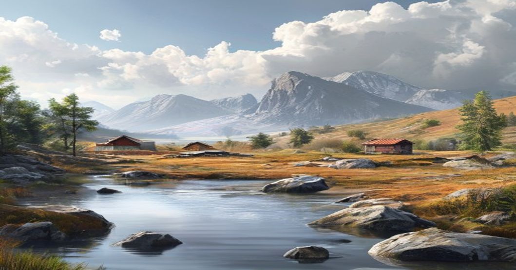
Understanding Sami Cultural Landscapes and Sacred Places
The cultural landscapes of the Sami people extend across the northern territories of Norway, Sweden, Finland, and the Kola Peninsula in Russia, collectively designated as Sápmi. These regions function as dynamic ecosystems where human activity and natural processes remain deeply interwoven. Centuries of reindeer husbandry, seasonal hunting, fishing, and berry gathering have shaped a spatial organization that prioritizes ecological balance over static land division. The indigenous perspective treats the environment not as a resource to be extracted but as a relational network where terrain features carry historical memory, spiritual weight, and practical navigation cues.
Sacred locations within these territories operate as operational centers for ritual practice, environmental observation, and intergenerational knowledge transfer. Natural rock formations, often referred to in academic literature as offering stones, mark sites where herders deposit reindeer antlers or food items to request favorable weather, herd expansion, or safe passage through difficult terrain. These markers consistently appear at ecological boundaries, particularly where mountain tundra meets birch forest, indicating a sophisticated understanding of animal movement patterns and microclimate shifts. Spiritual mediators historically performed drum ceremonies at these coordinates to align community activities with seasonal thresholds and wildlife cycles.
- Highland plateaus establish primary migration corridors, guiding summer pasturing and autumn livestock processing while simultaneously hosting ritual rest stops.
- Major waterways function as spiritual arteries where ancestral guidance is sought for fish spawning patterns and reindeer crossing points during seasonal transitions.
- Sacred meadows adjacent to lakes or glacial valleys historically hosted communal gatherings, acoustic storytelling sessions, and ecological assessments that documented plant phenology and predator behavior.
Modern conservation frameworks increasingly integrate these landscapes into protected area management through indigenous co-governance models. Legal recognition under international human rights instruments has enabled joint oversight of mining concessions, tourism development, and infrastructure projects within traditional territories. Geographic information systems now catalog historical site coordinates alongside oral histories, creating layered databases that support both cultural revitalization programs and ecological monitoring initiatives. This dual approach ensures that sacred geography remains legally protected while remaining functionally relevant to contemporary land management strategies.
Historical Foundations of Sámi Spiritual Geography
The historical roots of Sámi spiritual geography emerge from millennia of continuous interaction between indigenous communities and the Arctic and subarctic ecosystems across Sápmi. Long before external religious frameworks arrived, Sámi cosmology mapped the landscape through a living network of sacred landmarks that dictated movement, ritual practice, and seasonal survival patterns. These geographical markers were not merely symbolic; they functioned as active spiritual coordinates guiding reindeer migration routes, fishing grounds, and hunting territories.
Central to this historical framework are sieidi formations, naturally occurring rocks, cliffs, or tree stumps that served as dwelling places for nature spirits and ancestral forces. Early Norse chroniclers documented these sites in the thirteenth century, noting Sámi offerings of reindeer antlers, copper coins, and dried fish placed at elevated terrain points to secure favorable hunting outcomes. Geographic orientation relied upon wind patterns, lichen growth stages, and glacial erratics rather than arbitrary boundaries. The distribution of sieidi across Finnmark, Troms, and Lapland correlates directly with ancient ecological zones, revealing a sophisticated understanding of microclimate variation and wildlife behavior encoded in spiritual mapping.
- Hoar (hoers) functioned as outdoor altars where seasonal sacrifices maintained balance between human activity and natural cycles
- Boazovárri or reindeer mountains represented apex spiritual territories requiring strict ritual protocols during calving seasons
- Sacred groves surrounding ancient birch stands required fasting protocols before any communal gathering could commence
Lake and river systems operated as transitional zones connecting the earthly realm with ancestral underworlds in traditional Sámi cosmology. Shamanic practitioners, known as noaidi, utilized carved wooden drums to navigate these spiritual coordinates during trance journeys. The drum surfaces mapped celestial patterns alongside terrestrial landmarks, creating a dual-layered geographical system that synchronized astronomical cycles with terrestrial resource management. Missionary records from the eighteenth and nineteenth centuries frequently condemned these sites, yet archaeological surveys consistently confirm their alignment with pre-Christian trade routes and seasonal pastures. Contemporary Sámi land rights movements continue to reference these historical spiritual boundaries when negotiating territory preservation, demonstrating how ancient cosmological mapping remains structurally relevant to modern environmental stewardship.
Core Cosmology and Nature Reverence in Indigenous Beliefs
The Sami worldview operates on a fundamentally animistic framework where every natural element possesses intrinsic spiritual agency. Mountains, deep fjords, ancient birch forests, and traditional reindeer grazing routes function as active participants in daily survival rather than passive geography. This cosmological structure divides existence into three interconnected planes: the upper sky realm governed by celestial deities such as Bieggemárra and Raebis, the middle terrestrial world shared by humans and land spirits, and the lower subterranean domain overseen by Mábbelássegáhkku, who controls agricultural fertility and underground water systems. Sacred locations operate as cosmic anchors where these vertical realms intersect and exchange energy.
Sieidi formations—frequently ordinary boulders or glacial deposits to untrained observers—serve as primary conduits for ritual exchange. Practitioners historically deposited reindeer blood, copper artifacts, or preserved fish to negotiate favorable hunting conditions or mitigate environmental disasters. These interactions target the vuelie, a localized land spirit that mediates between human activity and ecological balance. Seasonal transitions directly dictate cosmological practice. Winter solstice ceremonies honor solar deities to ensure daylight returns, while spring assemblies synchronize with reindeer calving cycles to maintain herd vitality.
- Sacred Water Protocols: Rivers and lakes near sieidi sites remain strictly untouched by waste or commercial fishing, preserving their role as spiritual arteries.
- Reindeer Kinship Dynamics: Livestock receive spiritual recognition as tundra co-inheritors. Migration corridors align with constellations that guide both practical logistics and oral genealogies.
- Noaidi Drum Navigation: Traditional shamanic practitioners utilized painted reindeer-hide drums to map cosmological territories, reading animal behavior and atmospheric pressure shifts as direct ecological directives.
Contemporary Sami organizations preserve this framework as active environmental methodology rather than museum heritage. Land sovereignty campaigns consistently reference ancestral cosmology to establish legal protections for sensitive bioregions facing mining or wind farm development. The deliberate blurring of geological and theological boundaries ensures that conservation efforts remain anchored in intergenerational spiritual responsibility instead of temporary policy adjustments.
Key Sacred Sites Across Sápmi Territory
The spiritual geography of Sápmi operates through a precisely calibrated network of natural landmarks that function as active ritual centers rather than historical relics. Sacred mountains, classified as várri, serve as vertical thresholds where ecological and cosmological boundaries converge. These peaks are approached exclusively through prescribed pathways that align with seasonal reindeer migration corridors and solstitial shadow alignments. Each mountain hosts localized deity associations known as halti, requiring annual fat and copper offerings to maintain atmospheric equilibrium and community protection.
- Várddes Mountain (Norway/Sweden border): Functions as a primary wind spirit convergence point where drum rhythms are measured against altitude-induced acoustic distortion.
- Sealski Plateau (Finnish Lapland): Operates as a seasonal migration checkpoint where reindeer herders conduct ice-divination rituals to predict winter survival rates.
- Ráhpajávri Lake Basin: Serves as a reflective portal for noaidi journeying, with shoreline geometry dictating purification zone placement and ancestral communication channels.
Lacustrine and riverine territories maintain equal theological precedence. Water bodies function as dynamic memory repositories where current velocity and ice fracture patterns historically provided divination data that governed settlement cycles and hunting permissions. The spatial distribution of these sites follows a deliberate triangulation system that correlates with geomagnetic anomalies and auroral activity zones.
Lithic formations across the region operate as permanent archival structures. Standing stones and carved bedrock surfaces encode genealogical data, trade agreements, and cosmological maps through petroglyphs that predate external written records. These rock art panels are positioned at natural conductivity hotspots where stone resonance amplifies rhythmic chanting during winter solstice ceremonies. Contemporary documentation relies on participatory mapping protocols managed by local siida councils, which enforce strict access restrictions to prevent spiritual disturbance indicators such as altered avian migration timing or unnatural lichen degradation.
Sieidi Stone Formations and Tiermas Offerings
Sieidi formations represent some of the most enduring physical markers of traditional Sami spirituality across northern Fennoscandia. These natural rock structures, often characterized by irregular shapes, hollows, or distinct mineral compositions, functioned as focal points for communal worship and individual supplication. Rather than constructed monuments, sieidis emerged from geological processes and were recognized through generations of oral tradition as inhabited by nature spirits or ancestral forces. Their placement along mountain ridges, near glacial lakes, or at river confluences aligns with Sami cosmological principles that view landscape features as living entities requiring respectful engagement. Archaeological surveys indicate that many sieidis date back centuries before the Christianization of the region, maintaining continuous ritual use in northern territories despite external religious pressures.
The practice surrounding these sites centers on tiermas offerings, which operate as tangible exchanges between humans and the spiritual realm. Participants deposit items to secure favorable hunting conditions, protect reindeer herds, or request safe passage through harsh terrain. Common sacrificial materials include:
- Dried fish and preserved meat strips
- Reindeer antlers and bone fragments
- Copper coins and silver currency
- Woven wool bands and leather strips
- Personal talismans tied to specific life events
The placement method varies by region: some stones feature carved depressions designed to hold liquids like blood or beer, while others rely on simple stacking or burial of offerings at the base. Ritual timing frequently correlates with seasonal transitions, particularly during spring calving periods and autumn hunting windows, reflecting a deep integration of spiritual practice with subsistence economies.
Contemporary understanding of sieidi landscapes relies heavily on interdisciplinary research combining ethnographic records, geomorphological mapping, and community-led documentation. Preservation initiatives emphasize non-interference protocols, as unauthorized removal or disturbance of tiermas deposits violates both cultural heritage standards and modern conservation ethics. Researchers note that surviving sites often display layered material accumulation, indicating prolonged ritual activity across generations. Educational frameworks now prioritize contextual interpretation over physical interaction, guiding visitors to observe from designated distances while respecting established territorial boundaries. Academic publications continue to analyze stratigraphic samples from undisturbed sieidi zones, revealing patterns of environmental adaptation and spiritual resilience within indigenous northern societies.
Volcanic Peaks, Alpine Tundra, and Ancient Lake Basins
The terrain underlying traditional Sami territories emerges from complex geological processes that predate human settlement by millions of years. Ancient volcanic rock formations, including hardened lava flows and rhyolite outcrops from the Caledonian orogeny, create rugged ridges and elevated plateaus across the northern Scandinavian shield. These structures fracture wind patterns, concentrate precipitation, and dictate snow accumulation zones, directly shaping reindeer migration corridors and seasonal grazing boundaries. Above the timberline, alpine tundra ecosystems develop thin, mineral-rich soils adapted to extreme temperature fluctuations and abbreviated growing seasons. Dwarf shrubs, crustose lichens, and hardy grasses dominate these exposed slopes, forming a low-growing canopy that sustains both wildlife populations and traditional subsistence practices. Glacial scouring during past Pleistocene ice ages carved deep structural depressions that later filled with meltwater, establishing ancient lake basins scattered across mountain valleys and highland plateaus. These water bodies retain stable thermal properties, resist complete freezing during winter months, and function as critical hydrological anchors in otherwise arid upland environments.
Within Sami cosmology, these geological features operate as active cultural infrastructure rather than static scenery. Volcanic peaks with distinctive silhouettes historically marked territorial boundaries and navigation waypoints for seasonal reindeer herding routes. The alpine tundra provided essential materials for drum frames, traditional clothing layers, and medicinal plants harvested during specific lunar phases. Ancient lake basins served as natural meeting points for hunting parties, ritual gatherings, and seasonal exchange networks. Contemporary ethnographic research confirms that place names derived from lava formations, wind-scoured ridges, and glacial lakes appear consistently in oral histories documenting sacred geography.
- Rhyolite outcrops function as focal points for winter solstice offerings and spirit communication rituals.
- Tundra plateau edges align with traditional reindeer calving grounds and seasonal migration thresholds.
- Glacial lake basins contain submerged stone arrangements marking historical fishing weirs and ritual deposit sites.
Modern land management frameworks recognize these features as interconnected elements of living cultural landscapes. Soil stability, water retention capacity, and microclimate regulation depend on preserving the original topographic relationships between volcanic bedrock, tundra vegetation, and glacial water systems. Researchers document how traditional ecological knowledge maintains spatial awareness across elevational gradients, ensuring that extraction activities avoid zones with documented archaeological deposits or ongoing spiritual significance. The physical integrity of these formations directly supports the continuity of Sami language, material culture, and intergenerational transmission practices tied to specific geographic coordinates.
Reindeer Migration Corridors as Living Heritage Routes
Reindeer migration corridors function as dynamic ecological pathways that have sustained Sámi livelihoods for centuries. These routes are not preserved relics but actively utilized landscapes where seasonal movements dictate land management, resource allocation, and community organization. The corridors connect summer pastures in the highlands with winter grazing grounds in the northern forests, requiring precise navigation across varied terrain. Traditional herders rely on generational knowledge to track lichen availability, snow conditions, and animal behavior, ensuring sustainable grazing cycles that prevent overgrazing and maintain biodiversity.
The operational framework behind these migration paths rests on the siida system, a decentralized governance model that allocates grazing territories based on family lineage and historical usage rights. Each corridor contains specific waypoints marked by natural features such as rock formations, river crossings, and elevated ridges. These markers guide reindeer herds while simultaneously encoding cultural narratives, survival techniques, and ecological monitoring data into the landscape itself.
Spiritual dimensions remain deeply embedded within these routes. Sámi cosmology treats migration corridors as sacred geography where human activity, animal life, and natural forces intersect. Place names along the pathways document historical events, hunting observations, and ritual sites used for seasonal blessings. Certain stopping points serve as locations for traditional drum ceremonies, offering prayers for herd health and favorable weather patterns. The continuous use of these routes reinforces a reciprocal relationship between herders and the environment, where stewardship replaces ownership.
- Seasonal pasture rotation prevents soil degradation and maintains lichen regeneration cycles critical for reindeer nutrition.
- Natural navigation markers provide real-time environmental feedback without reliance on modern mapping technology.
- Intergenerational knowledge transfer ensures migration timing aligns with ecological thresholds rather than fixed calendars.
- Legal recognition frameworks increasingly protect corridor integrity against infrastructure development and mining concessions.
Contemporary pressures from climate variability, land fragmentation, and industrial expansion threaten the continuity of these living routes. Adaptive management strategies now integrate satellite tracking data with traditional forecasting methods to adjust migration schedules in response to shifting snowpack and vegetation patterns. Indigenous-led conservation initiatives prioritize corridor connectivity, recognizing that maintaining functional migration pathways preserves both cultural heritage and ecosystem resilience. The corridors remain active systems where ecological function and cultural practice operate as a single continuous process.
Cultural Practices That Define the Landscape
The Sami landscape operates as a continuous record of pastoral movement and spiritual geography. Reindeer herding establishes seasonal corridors that traverse tundra, taiga, and coastal zones. These routes follow established ecological gradients rather than political boundaries. Grazing patterns naturally regulate vegetation recovery cycles and prevent soil degradation. Winter camps position themselves near lichen-rich clearings shielded by windbreaks formed from fallen timber. Summer settlements shift toward higher elevations where alpine forage matures and insect pressure decreases.
Sacred geography emerges through deliberate interaction with specific terrain features. Sieidi stones function as ritual focal points located at ecological intersections where animal trails converge. Communities deposit antlers, copper artifacts, or birch branches to request herd safety and favorable hunting conditions. The environment itself serves as a temporal marker. Birch bud formation signals spring driving windows. Lichen snow depth dictates winter routing efficiency. Avian migration patterns determine coastal fishing access.
Place naming operates as a precise navigation framework. Every river bend, mountain pass, and valley floor carries distinct terminology describing rock composition, water velocity, and historical events. These names transmit ecological data across generations without written documentation. A single drainage basin may contain dozens of documented names reflecting seasonal resource availability and ancestral encounters. This linguistic layering ensures that land management decisions remain anchored to observable environmental indicators rather than abstract survey lines.
- Controlled burning of deadwood creates open ground for reindeer lichen regeneration
- Charcoal patches attract insects that support bird populations used in ecological monitoring
- Smoke patterns indicate wind shifts crucial for safe travel across frozen waterways
- Knowledge transfer occurs through direct participation during seasonal movements rather than formal instruction
- Traditional camp layouts mirror natural drainage patterns to prevent soil saturation and erosion
Modern land use planning frequently misinterprets these embedded practices as informal traditions. Infrastructure development often ignores migration corridors because they lack visible boundary markers. Conservation frameworks sometimes restrict grazing in areas where controlled disturbance maintains biodiversity. Recognizing cultural practices as active landscape architects reveals how Sami stewardship sustains ecological resilience across northern ecosystems.
Seasonal Pastoralism and Traditional Camp Placement
The seasonal movement of Sami reindeer herds follows a precise ecological calendar that dictates camp placement across northern Fennoscandia. Herders track vegetation phenology, snow depth, and midge activity to
Duodji Artistry and Joik Vocal Traditions in Sacred Spaces
The integration of Duodji craftsmanship within Sami sacred geography operates as a tangible expression of ecological stewardship and spiritual reciprocity. Artisans source materials directly from ritually significant territories, treating reindeer antler, birch bark, and silver not merely as raw components but as extensions of the land itself. Each carved motif encodes navigational knowledge, seasonal migration patterns, and kinship networks that map onto the terrain. When these objects are placed at natural altars or used in ritual contexts, they function as focal points for communal memory, preserving techniques that align human activity with environmental cycles.
- Raw materials undergo purification rituals before processing, ensuring spiritual cleanliness aligns with physical durability.
- Carving angles correspond to solar declination points, embedding astronomical data into handheld ceremonial tools.
- Silver clasps utilize specific tension mechanisms that replicate acoustic frequencies required for effective Joik projection.
Joik vocal traditions operate through a fundamentally different epistemological framework. Rather than describing external subjects, traditional Joik embodies the essence of its referent, whether that be a mountain, a river, or a specific reindeer herd. Performers utilize circular breathing techniques and microtonal inflections to replicate natural acoustics found in sacred valleys and coastal fjords. The vocal delivery demands precise breath control, allowing sustain durations that mirror wind patterns and water flow across the landscape. Practitioners train through immersive apprenticeship, learning to modulate pitch and resonance according to the acoustic properties of specific ritual locations.
When Duodji objects intersect with Joik performance in sacred spaces, the result forms a multisensory transmission system. Carved staffs or drum surfaces become resonant amplifiers during vocal ceremonies, while rhythmic striking patterns syncopate with melodic phrases. Elders emphasize that these practices remain active components of cultural survival rather than historical artifacts. Contemporary practitioners maintain rigorous standards for material sourcing and vocal technique, adapting to environmental shifts while preserving core ceremonial protocols. The continuity of these traditions
Preservation Frameworks and Indigenous Land Rights
The intersection of legal frameworks and Indigenous land rights forms the foundation of Sami cultural landscape preservation across Scandinavia and Finland. International instruments such as the United Nations Declaration on the Rights of Indigenous Peoples and ILO Convention No. 169 establish baseline obligations for state recognition of customary land tenure, yet implementation varies significantly across national jurisdictions. In Norway, Sweden, and Finland, domestic legislation increasingly acknowledges Sami reindeer herding rights, forest management permissions, and access to sacred sites, though statutory boundaries often conflict with commercial development permits and state-controlled resource extraction zones.
Effective preservation requires adaptive co-governance models that integrate traditional ecological knowledge with contemporary conservation science. Regional land use plans must incorporate Sami duodji practices, seasonal migration corridors, and spiritually significant terrain features such as sieidi stones and mountain pass shrines. Municipal authorities and environmental agencies are gradually adopting participatory mapping protocols where Sami communities define cultural boundaries rather than relying solely on colonial surveying methods.
- Co-management agreements between state forestry boards and Sami siida councils for sustainable forest harvesting
- Legal recognition of customary use rights under national property law amendments
- Digital heritage registries documenting sacred geography through community-led GIS mapping
- Cross-border coordination mechanisms for transnational migration route protection
Enforcement remains the primary obstacle. Mining concessions, wind farm installations, and infrastructure projects frequently override historical land claims despite court rulings affirming Sami consultation requirements. Successful preservation initiatives prioritize proactive legal defense funds, independent cultural impact assessments, and direct funding allocation to Indigenous stewardship organizations. Long-term landscape integrity depends on shifting from reactive litigation to structured partnership frameworks where Sami institutions hold decision-making authority over zoning, monitoring, and restoration programs.
Sustained protection also relies on intergenerational knowledge transfer and economic models that value cultural continuity over short-term extraction. Educational curricula in northern municipalities now include land rights law and traditional place-name taxonomy, ensuring younger generations understand both legal navigation strategies and ecological stewardship principles. When preservation frameworks align with Indigenous sovereignty, landscape conservation transcends environmental metrics and becomes a mechanism for cultural survival.
Cross Border Conservation Initiatives and UNESCO Recognition Pathways
The Sámi cultural territories span four sovereign nations—Norway, Sweden, Finland, and Russia—creating a complex mosaic of traditional reindeer pastures, sacred natural sites, and ancestral burial grounds that transcend modern political boundaries. Effective preservation requires coordinated transnational strategies, as seasonal migration routes and ecological corridors remain uninterrupted by state borders. National conservation frameworks often operate in isolation, leading to fragmented protection levels and inconsistent heritage management protocols. Cross-border initiatives mitigate these discrepancies through shared monitoring systems, joint funding applications, and unified grazing regulations that recognize indigenous land rights.
The Nordic Sami Council facilitates diplomatic alignment on heritage preservation, while the Barents Euro-Arctic Region provides administrative infrastructure for ecological data exchange. Regional working groups compile historical GIS mapping of duodji craftsmanship zones, seita locations, and sacred mountain passageways to establish baseline conservation metrics. These collaborative networks enable predictive modeling for climate impact assessment, ensuring that infrastructure projects near protected corridors undergo rigorous cultural heritage impact assessments before approval.
UNESCO recognition follows a stringent nomination trajectory requiring comprehensive documentation of intangible cultural practices alongside physical landscape integrity. Proposals must satisfy Criterion V, demonstrating a harmonious interaction between human activity and the natural environment across generations. Submissions typically enter national tentative lists before advancing to the World Heritage Committee for evaluation by IUCN and ICOMOS advisory bodies. Successful designation depends on verifiable community governance structures, continuous traditional land use validation, and legally binding co-management agreements that prevent commercial exploitation of sacred zones.
- Transboundary Monitoring Frameworks: Shared satellite tracking of reindeer herds combined with ground-level ecological surveys to map critical conservation corridors across municipal jurisdictions.
- Heritage Documentation Protocols: Standardized digital archiving of oral histories, seasonal ritual calendars, and geospatial coordinates for culturally sensitive sites requiring restricted public access.
- Nomination Strategy Alignment: Coordinated policy drafting among Nordic heritage ministries to ensure consistent boundary definitions, protection statutes, and community benefit-sharing mechanisms before international submission.
Sustained institutional backing determines whether proposed landscapes achieve World Heritage status or remain within protective buffer zones. Continuous stakeholder engagement ensures that conservation objectives align with contemporary Sámi livelihood requirements while maintaining archaeological authenticity. Strategic partnerships with environmental organizations and academic institutions provide the technical validation necessary for successful international recognition.
National Legal Protections for Sámi Sacred Natural Areas
Statutory recognition of Sámi sacred natural areas remains deeply fragmented across Norway, Sweden, Finland, and Russia, producing a patchwork of regulatory mechanisms that frequently conflict with Indigenous spiritual land tenure. In Norway, Article 108 of the Constitution establishes a state duty to protect Sámi culture and environment, yet operational enforcement depends on the Reindeer Herding Act and the Nature Diversity Act. The Norwegian Environment Agency mandates cultural heritage screenings during resource extraction permits, but sacred formations like sieidi altars or ancient burial grounds lack standalone statutory categories, rendering them vulnerable to industrial zoning approvals. Recent administrative court rulings have increasingly referenced ILO Convention 169 obligations, though ratification limitations restrict direct legal enforcement.
Sweden applies the Environmental Code, which requires pre-consultation with Sámi communities during infrastructure and mining licensing processes. Despite prolonged parliamentary negotiations surrounding an Indigenous Rights Act designed to codify collective land ownership, current legislation remains advisory rather than prohibitive. The Laponia World Heritage Site designation introduces UNESCO conservation oversight, yet state forestry agencies and private developers routinely navigate around spiritual boundaries through permit restructuring. Swedish administrative courts continue to adjudicate compensation claims following unauthorized site disturbances, but judicial remedies operate reactively after ecological and cultural damage occurs.
- Finland’s Constitution guarantees Sámi language rights and cultural autonomy, while the Nature Conservation Act allows regional authorities to designate religiously significant landscapes as protected zones. Municipal land-use plans frequently override spiritual claims, permitting commercial forestry and tourism expansion directly adjacent to or over sacred terrain without mandatory community veto power.
- Russia maintains the most restrictive regulatory environment for Indigenous sacred geography. Historical suppression eliminated traditional governance structures, and federal heritage legislation offers no specific provisions for Sámi spiritual sites. Regional cultural ministries occasionally apply generic archaeological protection statutes, yet these instruments lack funding, enforcement capacity, and explicit recognition of living religious practices.
Cross-border legal disparities persist because only Norway and Sweden partially incorporate ILO Convention 169 into domestic law, leaving substantial Sámi spiritual territory outside binding international safeguards. European Court of Human Rights jurisprudence increasingly evaluates state interventions near sacred landscapes under Article 8 (private and family life) and Article 14 (non-discrimination), but judicial remedies remain retrospective. Sustainable protection requires aligning statutory conservation frameworks with Sámi customary land management protocols, converting advisory consultation requirements into enforceable territorial rights before development licensing proceeds.
Ethical Visiting Guidelines for Sami Cultural Landscapes and Sacred Places
Visiting Sámi cultural landscapes requires a fundamental shift from conventional tourism to regenerative travel practices. These territories function as living repositories of indigenous knowledge, where geography, spirituality, and livelihood intersect. Ethical engagement begins with recognizing that these areas are not recreational parks but active domains governed by Sámi customary law and national heritage frameworks. Travelers must prioritize consent-based interaction over passive observation.
Core protocols demand strict adherence to territorial boundaries and seasonal restrictions. Reindeer grazing corridors, breeding grounds, and forest regeneration zones operate on ecological cycles that tourism traffic can permanently disrupt. Maintaining distance from sieidi stones and other sacred markers is non-negotiable, as these sites serve as active spiritual anchors rather than historical artifacts. Local land-use regulations often restrict motorized access during calving seasons, and violating these zones triggers legal penalties alongside cultural harm.
- Follow designated pathways and avoid shortcuts that trample fragile tundra vegetation or disturb wildlife nesting areas.
- Seek explicit permission before accessing private Sámi homesteads, duodji workshops, or restricted cultural zones.
- Support indigenous-led enterprises by booking accommodations, guides, and craft purchases directly from Sámi-owned cooperatives.
- Refrain from drone usage near settlements or sacred landscapes without written consent from
“`html
Frequently Asked Questions
What is Sami Cultural Landscapes and Sacred Places?
Sami Cultural Landscapes and Sacred Places refer to the traditional territories and spiritually significant sites of the Sami people, the Indigenous inhabitants of Sápmi — spanning northern Norway, Sweden, Finland, and Russia’s Kola Peninsula. These landscapes are deeply intertwined with Sami cosmology, reindeer herding traditions, and a worldview that perceives nature as alive and sacred. Sacred places include mountains (duottar), lakes, waterfalls, forests, and rock carvings that serve as sites for rituals, offerings, and communal gathering.
Key facts about Sami Cultural Landscapes and Sacred Places
1. The Sami worldview sees the natural world as sacred; every mountain, lake, and forest holds spiritual meaning.
2. “Noaidi” (Sami shamans) historically served as intermediaries between humans and the spirit world within these sacred landscapes.
3. Rock art sites such as Alta in Norway and Tanum in Sweden contain thousands of petroglyphs depicting Sami spiritual life and reindeer herding.
4. Reindeer pastoralism is central to Sami identity, with migratory routes forming the backbone of their cultural landscape.
5. Many sacred sites face threats from mining, logging, wind farms, and climate change, prompting ongoing preservation efforts by Sami communities and UNESCO.
6. In 2023, the “Sami Culture in the Tana Area” was inscribed on UNESCO’s Representative List of the Intangible Cultural Heritage of Humanity.“`
“`json
{
“@context”: “https://schema.org”,
“@type”: “FAQPage”,
“mainEntity”: [
{
“@type”: “Question”,
“name”: “What is Sami Cultural Landscapes and Sacred Places?”,
“acceptedAnswer”: {
“@type”: “Answer”,
“text”: “Sami Cultural Landscapes and Sacred Places refer to the traditional territories and spiritually significant sites of the Sami people, the Indigenous inhabitants of Sápmi — spanning northern Norway, Sweden, Finland, and Russia’s Kola Peninsula. These landscapes are deeply intertwined with Sami cosmology, reindeer herding traditions, and a worldview that perceives nature as alive and sacred. Sacred places include mountains (duottar), lakes, waterfalls, forests, and rock carvings that serve as sites for rituals, offerings, and communal gathering.”
}
},
{
“@type”: “Question”,
“name”: “Key facts about Sami Cultural Landscapes and Sacred Places”,
“acceptedAnswer”: {
“@type”: “Answer”,
“text”: “1. The Sami worldview sees the natural world as sacred; every mountain, lake, and forest holds spiritual meaning. 2. \”Noaidi\” (Sami shamans) historically served as intermediaries between humans and the spirit world within these sacred landscapes. 3. Rock art sites such as Alta in Norway and Tanum in Sweden contain thousands of petroglyphs depicting Sami spiritual life and reindeer herding. 4. Reindeer pastoralism is central to Sami identity, with migratory routes forming the backbone of their cultural landscape. 5. Many sacred sites face threats from mining, logging, wind farms, and climate change, prompting ongoing preservation efforts by Sami communities and UNESCO. 6. In 2023, the \”Sami Culture in the Tana Area\” was inscribed on UNESCO’s Representative List of the Intangible Cultural Heritage of Humanity.”
}
}
]
}
“`