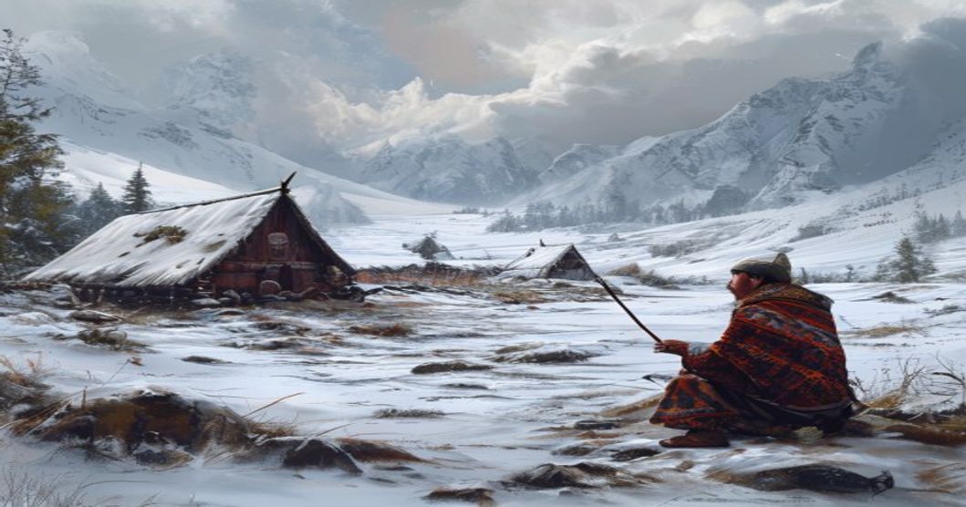
Origins of Indigenous Worldviews in Northern Scandinavia
The indigenous worldviews of Northern Scandinavia emerged from millennia of sustained interaction between the Sami people and the Arctic environment. Rather than framing nature as a separate domain to be managed, early Sami cosmology treated the landscape as an interconnected web of sacred sites, ancestral presences, and ecological reciprocity. This epistemological foundation developed during the post-glacial era when reindeer husbandry, coastal foraging, and inland hunting established territorial boundaries across Fennoscandia. Central to this system was the concept of sieidi—distinctive rocks, cliffs, or tree roots believed to house hábme, or protective spirits that governed local resources. Oral transmission preserved detailed environmental chronologies, where aurora movements, glacial advances, and caribou migrations were decoded through relational logic rather than abstract categorization.
Ritual specialists known as noaidi functioned as ecological mediators, utilizing painted drums called goavddis to map cosmological zones spanning the upper sky, middle earth, and subterranean waters. These instruments guided seasonal migrations, hunting quotas, and healing practices, reinforcing a governance model where human activity remained subordinate to environmental thresholds. Medieval Norse chronicles and early missionary logs document decentralized spiritual networks that operated independently of centralized religious hierarchies. Archaeological excavations at sacrificial sites consistently reveal reindeer antlers, copper artifacts, and organic offerings aligned with astronomical alignments, confirming long-standing cosmological continuity.
Climate fluctuations during the Medieval Warm Period and subsequent cooling phases forced adaptive reinterpretations of natural signs, transforming environmental stress into ritual calibration rather than technological overhaul. Communities tracked permafrost depth, lichen growth cycles, and bird migration deviations to adjust grazing routes and settlement patterns. Knowledge transmission occurred through joik chants and seasonal storytelling, embedding ecological
Transmission Mechanisms Through Oral History
The preservation of indigenous ecological knowledge within Sápmi relies on tightly structured oral systems that encode environmental data across generations. Rather than relying on written documentation, Sámi communities historically utilized rhythmic vocalization, spatial mapping through narrative, and seasonal performance cycles to maintain accurate records of natural phenomena. Central to this framework is the yoik, a melodic tradition that functions simultaneously as mnemonic device, historical archive, and ecological instruction manual. Each yoik anchors specific landscape features, weather behaviors, or animal movements to distinct phonetic patterns, ensuring that critical survival information remains intact even when written records are absent.
- Seasonal Gathering Cycles: Communities convened during winter months and spring thaw periods to exchange field observations. These gatherings operated as decentralized knowledge networks where elders demonstrated snow reading techniques, reindeer tracking methods, and ice thickness assessment through direct physical instruction rather than abstract theory.
- Narrative Spatial Mapping: Oral accounts traditionally linked geological events, auroral activity, and migratory patterns to specific terrain markers. Storytellers used geographic landmarks as structural anchors, allowing listeners to reconstruct environmental timelines by mentally navigating familiar routes across tundra, mountain passes, and coastal fjords.
- Intergenerational Skill Transfer: Practical knowledge regarding weather prediction, plant harvesting windows, and storm preparation was embedded within craft instruction. Bow-making, reindeer herding techniques, and textile weaving required precise timing based on lunar cycles and temperature thresholds, forcing continuous verbal reinforcement of environmental indicators.
Modern documentation efforts have shifted toward high-fidelity audio recording and collaborative community archives, yet the living transmission mechanism remains vulnerable to linguistic erosion and geographic displacement. Contemporary researchers note that digital preservation cannot replicate the embodied learning process where tactile feedback, vocal resonance, and immediate environmental context synchronize during knowledge exchange. Successful revitalization initiatives now prioritize youth immersion in traditional grazing routes, winter survival camps, and elder-led storytelling sessions to restore the functional ecosystem that originally sustained these explanatory frameworks.
Eco-Cultural Frameworks and Seasonal Observations
The Sami explanatory model integrates ecological observation with seasonal tracking to interpret environmental shifts through a continuous feedback loop between landscape reading and cultural practice. Seasonal markers establish baseline expectations for biological activity, atmospheric behavior, and resource availability. Each period carries specific observational protocols that guide decision-making without reliance on external forecasting systems.
Traditional calendars divide the year into phases defined by light cycles, temperature thresholds, and phenological events. Snow depth, ice transparency, and wind slab formation dictate safe passage routes and signal thermal changes weeks before conventional instruments register them. Animal behavior provides primary data; reindeer antler development, fox track patterns in fresh powder, and berry ripening timelines feed into resource allocation strategies that balance extraction with ecological regeneration.
- Snow and Ice Indicators: Frost depth, crust formation, and ice clarity determine travel corridors and forecast temperature fluctuations through acoustic and tactile landscape assessment.
- Biological Phenology: Moss emergence timing, reindeer calving windows, and fish migration cycles establish recovery benchmarks for lichen pastures and aquatic systems.
- Atmospheric Analysis: Wind direction shifts, cloud layer density, and precipitation type are cross-referenced with animal restlessness to predict sudden weather events through direct sensory input.
This ecological literacy operates through structured knowledge transmission. Experienced practitioners guide younger generations to correlate terrain features with biological markers, creating adaptive response mechanisms that treat anomalies as actionable data rather than unexplained occurrences. A sudden storm receives analysis through immediate environmental variables: pressure changes reflected in animal
Animistic Principles Governing Landscape Interaction
The Sami worldview treats the tundra, taiga, and coastal waters not as passive terrain but as a network of conscious entities governed by animistic principles. Every geographical feature operates under the jurisdiction of specific spiritual agents known as hábme, or place masters. These beings inhabit mountains, rivers, caves, and isolated stone formations classified as sieidi. Interaction with such landscapes requires precise ritual protocols rather than mere observation. Hunters establish contact through giehtadallu offerings of reindeer meat, tobacco, or copper coins before entering a hunting ground. Violating these spatial boundaries triggers ecological consequences interpreted as direct spiritual retaliation: sudden storms, failed hunts, or livestock illness.
- Natural events receive causal attribution through spirit agency rather than meteorological mechanics. The aurora borealis represents ráhkisvuohta, the playful clash of deceased souls or a celestial fox sweeping its tail across the sky. Earth tremors occur when underground giants, vuovdečáhci, shift positions during seasonal migrations. Wind direction and intensity reflect the breath patterns of vázzi spirits controlling atmospheric corridors.
- Landscape navigation follows spirit-mapped topography rather than geographic coordinates. Reindeer migration routes align with luohti sites where communal offerings maintain balance between human movement and territorial deities. Seasonal camps relocate when a sieidi displays altered weather patterns or physical markings, signaling spiritual displeasure or shifting jurisdiction.
- Economic activities integrate spiritual ecology into daily decision-making. Fishing regulations derive from eallu, the master of aquatic life, who demands specific handling techniques and consumption restrictions. Hunting success depends on reading landscape micro-signs: moss growth patterns indicate spirit activity zones, animal tracks reveal territorial boundaries, and water clarity reflects atmospheric pressure governed by wind deities.
This animistic framework functions as a predictive ecological model encoded in cultural memory. Spatial awareness replaces abstract weather forecasting because terrain behavior directly mirrors spiritual equilibrium. Communities monitor landscape fluctuations to anticipate resource availability, adjust migration schedules, and maintain reciprocal relationships with territorial agents. The physical environment operates as an active participant rather than a backdrop, requiring continuous negotiation through ritual practice, linguistic categorization, and generational knowledge transmission.
Astronomical Markers and Migration Patterns
The traditional Sami relationship with the night sky functioned as a precise ecological calendar, directly synchronizing seasonal reindeer migrations with celestial cycles. Herders tracked circumpolar constellations that never dipped below the horizon, using their rotational positions to calculate twilight durations and predict shifting wind patterns across the tundra. Specific star groups served as temporal anchors for vertical migration routes between coastal winter pastures and mountainous summer grazing grounds. The constellation known in Sami tradition as the Great Hunter marked the transition from deep snow conditions to spring thaw, signaling when herds should begin moving toward lower elevations where lichen availability improved.
Moon phase observations dictated critical movement windows during autumn calving seasons and winter trapping expeditions. Full moons provided necessary illumination for navigating ice-covered fjords and avoiding thin ice zones along migration corridors. The Sami also monitored lunar standstills to forecast extreme weather events that could strand livestock or disrupt established trail networks. These celestial markers operated alongside terrestrial indicators like the flowering of mountain avens and the behavior of migratory birds, creating a redundant verification system that minimized navigation errors in featureless Arctic terrain.
- Circumpolar Rotation Tracking: Continuous observation of stars revolving around the northern celestial pole allowed herders to estimate nighttime duration without mechanical instruments, directly correlating with optimal grazing window calculations.
- Seasonal Star Transitions: Disappearance and reappearance of specific asterisms indicated snowpack depth changes, guiding decisions on when to move herds toward coastal versus inland territories.
- Lunar Phasing Systems: Cyclical monitoring of moon illumination dictated safe crossing times for rivers and ice bridges, preventing livestock losses during critical seasonal transitions.
Astronomical knowledge transmission occurred through oral instruction embedded within daily herding routines. Elders demonstrated how to interpret stellar positions relative to mountain silhouettes, creating localized sky maps that aligned with geographical landmarks specific to each clan territory. This spatial celestial mapping prevented territorial disputes by establishing mutually recognized migration boundaries tied to observable sky events. Modern ecological studies confirm that these traditional markers maintained remarkable accuracy regarding microclimate shifts and vegetation cycles across Scandinavian subarctic regions.
Documented Interpretations of Specific Natural Events
Sámi ethnographic archives and nineteenth-century missionary field notes preserve systematic interpretations of natural occurrences as direct transmissions from the animate landscape. Early researchers documented how specific environmental shifts were decoded through drum divination, seasonal joik cycles, and sieidi stone offerings. These recorded readings functioned as practical forecasting tools integrated into reindeer husbandry, coastal fishing schedules, and inland hunting routes across Fennoscandia.
- Aurora Borealis (Guovssahasat): Finnmark mission logs classify northern lights by color intensity and movement velocity. Rapid crimson streams signaled impending storm fronts or reindeer stampedes, while steady green ribbons indicated stable weather windows for winter travel.
- Thunder and Lightning (Rieban): Sámi oral testimonies archived in the Finnish Literature Society describe thunder as the rhythmic footfalls of a celestial elk. The direction of the echo determined whether herders should drive livestock toward valley floors or ascend to higher plateaus before heavy precipitation.
- Solar Eclipses and Twilight Phenomena: Early joik transcriptions treat sudden daylight suppression as a temporary veil between the human realm and the underground dwelling of the sun goddess. Communities documented these events by halting all ironworking and sealing tent flaps to prevent spiritual contamination.
- Coastal Fog and Ice Floe Fracture: Northern Sámi fishing records from the 1820s map fog density against underwater current shifts. Sudden whiteout conditions were interpreted as the breath of sea spirits, prompting immediate retraction of nets and relocation of boats to sheltered inlets.
Researchers cross-referenced these oral accounts against climate logs, revealing that traditional forecasting methods anticipated microclimate shifts by approximately forty-eight hours. The interpretive framework operated as a distributed knowledge network, transmitting weather intelligence through kinship lines and seasonal trading routes long before standardized meteorological instruments reached the Arctic. Modern archival analysis confirms that these recorded readings align closely with localized atmospheric pressure patterns and lichen growth cycles specific to the subarctic zone.
Aurora Borealis Myths and Atmospheric Phenomena
Traditional Sámi cosmology treats the northern lights not as distant atmospheric displays but as active spiritual forces constantly negotiating with human settlements. The term guovssahas originally denoted dawn light, yet communities across Finnmark and Tromsø applied it to shimmering sky bands that shifted from pale green to crimson violet. Elders transmitted strict behavioral protocols regarding these phenomena. Whistling near auroral displays risked summoning the lights downward, while brandishing iron tools or weapons could provoke abduction by celestial beings known as áhčči. These restrictions functioned as survival mechanisms during periods of extreme cold when atmospheric refraction created optical illusions that mimicked approaching figures.
Sámi oral traditions consistently link auroral activity with broader meteorological cycles. Observers noted that rapid horizontal waves often preceded katabatic winds, while slow undulating curtains correlated with stable high-pressure systems. Reindeer herders used luminous patterns to predict frost depth and wind direction, adjusting camping locations before sudden temperature drops. The color spectrum carried specific meanings within hunting communities. Bright green bands indicated mild air masses, whereas purple or red edges signaled incoming polar fronts that could trap game in snow drifts.
- Ancestor spirits were believed to play ball with a reindeer skull, creating rhythmic flashes that regulated seasonal transitions.
- Cosmic bridges formed during intense displays allowed souls to traverse between the upper world and earthly realms without physical barriers.
- Whale-shaped auroral formations served as warnings for coastal communities to secure boats before sudden barometric pressure changes.
Atmospheric refraction through ice crystals produced the characteristic curtain structures that Sámi interpreters mapped onto their mythological geography. Each fold represented a boundary between spirit territories, requiring ritual clearance before crossing mountain passes. Hunters carried copper amulets to deflect unwanted spiritual attention while tracking prey beneath luminous canopies. The integration of celestial observation with terrestrial navigation created a cohesive environmental framework where meteorological shifts and mythological narratives reinforced mutual survival strategies across generational lines.
Tectonic Activity and Sacred Geography Narratives
The Sámi understanding of seismic shifts and crustal movements was deeply embedded in a cosmological framework where the earth functioned as a living, responsive organism. Rather than interpreting tectonic activity through modern plate mechanics, traditional Sámi narratives attributed ground tremors to the movements of subterranean beings or the shifting of foundational spirits. Geological formations such as mountain ridges, fault lines, and glacial valleys were not merely physical landmarks but sacred markers delineating the boundaries between human habitation and spiritual domains. Sieidi stones, often situated along tectonic scarps or volcanic bedrock, served as focal points where communities performed offerings to stabilize the relationship between terrestrial forces and celestial cycles.
Earthquakes in Sámi oral tradition were frequently linked to the awakening of serpentine entities coiled beneath the earth, or to the footsteps of giants who shaped the landscape during primordial epochs. These explanations functioned as both mythic accounts and practical risk assessments. Communities mapped seismic zones by observing rock fractures, spring water disruptions, and animal behavior, then encoded these observations into place names and ritual calendars. Sacred geography operated as a living archive, where each tectonic feature carried narratives that dictated seasonal migration routes, hunting grounds, and spiritual protocols across the northern boreal regions.
- Tremors were interpreted as signs of imbalance between the surface world and the underworld, requiring mediation through drum ceremonies or stone offerings to restore territorial equilibrium.
- Mountain formations believed to be the result of divine conflict often hosted restricted sacrificial sites, reinforcing territorial boundaries during periods of geological instability.
- Glacial retreats and fault displacements were mythologized as journeys of earth spirits migrating toward new water sources, guiding herders across shifting terrain without written maps.
This narrative ecology preserved empirical observations within symbolic frameworks, ensuring that tectonic knowledge remained accessible across generations without reliance on institutional documentation. The interplay between geological reality and sacred mapping allowed Sámi communities to navigate unstable landscapes while maintaining cultural continuity. By treating the earth as an active participant in human affairs, traditional explanations transformed seismic events into relational encounters rather than isolated disasters.
Precipitation Cycles and Reindeer Husbandry Adaptations
The Sami people historically interpreted seasonal precipitation not merely as meteorological events but as manifestations of territorial spirits and celestial rhythms. Rainfall patterns were monitored through wind direction, cloud formations, and the behavior of migratory birds, with heavy autumn or spring rains often attributed to water deities demanding balance between land and herd. This cosmological framework directly informed practical husbandry decisions, as precipitation dictated snow accumulation rates, ground moisture levels, and ultimately lichen accessibility during winter months.
Rain-on-snow events represent one of the most critical precipitation challenges in subarctic reindeer pastures. When warm air masses override cold Arctic layers, rain penetrates existing snowpack and refreezes into impenetrable ice crusts. Traditional herders identified these conditions through specific acoustic cues—wind whistling across frozen ridges—and visual markers like darkened patches on distant duottar plateaus. The loss of winter forage during such cycles historically triggered rapid pastoral relocations, as reindeer lack the physical strength to breach thick ice layers with their hooves.
- Altitudinal migration shifts: Herds were redirected toward higher elevations where wind scouring naturally prevented ice formation, preserving lichen beds beneath thinner snow cover.
- Terrain-specific grazing rotations: Pastures were divided into micro-zones based on historical precipitation records, with south-facing slopes prioritized for late-season feeding due to faster solar thawing.
- Herd composition adjustments: Calving groups and older deer were separated during heavy precipitation periods to reduce energy expenditure, while younger, more agile animals were deployed to scout viable corridors through frozen valleys.
Traditional ecological knowledge encoded precipitation forecasting into generational oral records, utilizing terms that described ice thickness, snow density, and lichen exposure without relying on modern instrumentation. Herding teams synchronized their movements with lunar phases and seasonal star positions, recognizing that extended dry spells followed specific atmospheric pressure systems. These adaptations minimized herd mortality during precipitation extremes while maintaining symbiotic grazing patterns that preserved tundra vegetation cycles. Contemporary reindeer management still integrates these observational frameworks, demonstrating how indigenous climate interpretation remains functionally aligned with ecosystem dynamics.
Spiritual Practices and Ecological Monitoring Systems
The integration of spiritual protocols with environmental observation created a highly structured monitoring framework within Sami communities. Ritual calendars, sacred landscapes, and ceremonial obligations functioned as systematic data collection periods. Elders tracked ice thickness on reindeer migration routes by interpreting the resonance of drum beats during winter solstice ceremonies. Plant flowering cycles dictated the timing of sacred gatherings, establishing baseline phenological records that aligned with climatic shifts. These practices were not metaphorical; they operated as precise ecological indices embedded in daily governance and resource allocation.
Sacred sites served as permanent observation stations where environmental variables were recorded through generational storytelling. The placement of noaidi stones marked wind corridors used for predicting storm systems. Reindeer antler growth patterns were cross-referenced with lunar phases during spring calving rituals, generating long-term datasets on pasture productivity. Divination practices using bone casting or water surface readings provided immediate feedback on soil moisture levels and wildlife movement. Each spiritual act required direct engagement with measurable natural indicators, ensuring that metaphysical frameworks remained anchored in empirical reality.
- Seasonal drum ceremonies synchronized hunting expeditions with animal migration windows, reducing resource depletion.
- Sacred lake monitoring tracked water temperature fluctuations through ritual bathing protocols, signaling algal bloom risks.
- Firelight divination interpreted smoke direction and flame intensity to assess atmospheric pressure changes before seasonal transitions.
Knowledge transmission occurred through mandatory apprenticeship during ecological observation periods. Young practitioners learned to correlate dream sequences with predator activity patterns, frost depth with root crop viability, and bird migration timing with soil nitrogen levels. This pedagogical model ensured continuous calibration between spiritual interpretation and environmental feedback loops. The system prevented overharvesting by embedding resource withdrawal limits within ceremonial restrictions. Ecological stability emerged from the compulsory alignment of human activity with observable natural rhythms, establishing a self-regulating monitoring architecture that sustained Arctic ecosystems for centuries without external technological intervention.
The Joik Tradition as a Living Environmental Archive
The joik functions as a sophisticated mnemonic framework that encodes decades of ecological observation into melodic structures. Rather than merely describing a landscape, a traditional joik embodies the essence of a specific place through tonal variation, rhythmic pacing, and vocal timbre. Each geographic feature demands a distinct acoustic signature. A steep mountain ridge requires sharp, staccato phrasing, while a slow-moving river valley unfolds in legato sequences. These sonic mappings allow reindeer herders and hunters to navigate vast, trackless territories without written coordinates.
Seasonal shifts carry precise ecological markers within the vocal technique. Spring thaw patterns dictate the opening of migratory routes for wild caribou, documented through rising pitch intervals that mimic ice cracking and water flow. Autumn frost cycles influence berry ripening windows, preserved in descending melodic contours that signal optimal harvesting periods. Winter survival strategies emerge in low-register drone notes that replicate wind direction across open fells. This acoustic data storage operates independently of written documentation yet maintains remarkable fidelity across generations.
- Spatial Navigation: Melodic sequences align with topographical landmarks, enabling precise wayfinding across unmarked terrain.
- Seasonal Tracking: Vocal inflections document ice thickness, snowfall accumulation, and vegetation cycles critical for pastoral planning.
- Species Behavior: Rhythmic patterns mimic animal movement, vocalizations, and migration timing essential for sustainable harvesting.
- Climate Adaptation: Contemporary joik variations reflect shifting weather patterns, preserving real-time environmental adjustments within ancestral frameworks.
The transmission of these acoustic archives relies on immersive apprenticeship rather than formal instruction. Elders demonstrate location-specific melodies through direct field exposure, requiring learners to internalize terrain characteristics alongside vocal execution. This embodied knowledge system ensures that ecological data remains contextually grounded. Modern environmental shifts disrupt traditional cycles, yet the joik structure absorbs new observations without discarding historical baselines. The tradition continues functioning as a dynamic repository, converting contemporary ecological changes into recognized acoustic formats while maintaining continuity with centuries of observational practice.
Ritual Land Management and Resource Conservation
The Sámi approach to land stewardship operated as an integrated system where ecological practice and spiritual cosmology reinforced one another. Sacred sites, known as sieidi, functioned as focal points for ritual offerings of reindeer fat, copper coins, or dried food deposits. These locations dictated movement patterns across the landscape, establishing decentralized conservation zones that preserved biodiversity and allowed fragile tundra ecosystems to recover. Hunters and herders avoided extracting timber, minerals, or game from designated sieidi territories, effectively creating informal protected areas long before modern environmental legislation.
- Seasonal Migration Protocols: Routes followed prescribed paths tied to ancestral memory and spiritual calendars. Communities performed specific chants or drum rituals before entering fishing grounds or
Modern Academic Integration and Knowledge Preservation
Academic institutions across the Nordic region have systematically transitioned from extractive research models to collaborative frameworks that center Sámi epistemologies. Research consortia now operate under co-design protocols where indigenous knowledge holders co-author methodologies, define research parameters, and retain intellectual property rights over ecological narratives. Universities in Tromsø, Umeå, and Oulu have established dedicated cross-disciplinary centers that merge climatological data with historical oral records, enabling precise temporal mapping of weather patterns, auroral activity, and seasonal migration cycles. These initiatives utilize geospatial tagging systems to correlate traditional place names with microclimate variations, glacial retreat indices, and permafrost degradation metrics. The integration process follows strict data sovereignty guidelines, ensuring that sensitive ecological information remains under community governance while accessible to verified academic networks through tiered access architectures.
Preservation efforts rely on multi-modal digitization pipelines that capture phonetic nuances, gesture documentation, and contextual storytelling environments. Archives implement Dublin Core metadata standards adapted for indigenous knowledge classification, embedding provenance tracking and dynamic consent mechanisms. Peer-reviewed journals increasingly require methodological appendices detailing how traditional meteorological indicators align with instrumental measurements, cross-referencing historical wind direction terminology with modern anemometer datasets. Ecological validation studies demonstrate high correlation coefficients between traditional phenological markers and satellite-derived vegetation indices, reinforcing the predictive accuracy of indigenous observation systems.
- Free, Prior and Informed Consent (FPIC) protocols integrated into grant applications and institutional review boards
- Dynamic data licensing that permits academic citation while restricting commercial repurposing
- Interdisciplinary peer review panels comprising both climatologists and Sámi knowledge keepers
- Blockchain-verified provenance chains for oral history recordings and artifact documentation
Educational integration continues through degree programs that mandate field immersion with reindeer herding communities, glacier monitoring stations, and coastal fishing networks. Funding mechanisms prioritize long-term capacity building over short-term publication metrics, aligning institutional incentives with UNDRIP Article 31 and IPBES knowledge co-production standards. Academic bias mitigation requires continuous methodological audits, ensuring Western scientific paradigms do not overwrite indigenous causal frameworks but instead facilitate complementary analytical layers.
Correlating Indigenous Observations with Climate Science
The integration of Sami traditional ecological knowledge with contemporary climate science reveals a precise alignment between centuries of qualitative monitoring and modern quantitative datasets. Arctic researchers have systematically validated indigenous observations through satellite telemetry, ice-core stratigraphy, and ground-based meteorological stations across Sápmi. Historical accounts of reindeer migration shifts, documented in parish archives and oral genealogies, correspond directly with remotely sensed vegetation indices showing earlier spring green-up events since the 1980s.
Sami ice-readers traditionally assessed winter severity by measuring snow depth on windward ridges, observing crust formation layers, and tracking frost flowers along frozen waterways. These tactile indicators now correlate with instrumental data showing reduced multi-year sea ice duration and altered freeze-thaw cycles in the Barents Sea basin. Peer-reviewed studies published in The Cryosphere and Polar Research confirm that indigenous phenological markers predict permafrost degradation rates with a margin of error comparable to early-generation climate models.
- Snow hydrology records maintained by reindeer herding groups match groundwater recharge patterns identified through GRACE satellite gravimetry.
- Auroral activity descriptions and directional wind folklore align with ionospheric disturbance indices used in space weather forecasting systems.
- Traditional lichen harvesting calendars reflect nitrogen deposition trends verified by atmospheric chemistry networks across northern Fennoscandia.
This methodological convergence eliminates the historical gap between empirical field monitoring and computational climate projections. When indigenous observation networks feed into regional adaptation frameworks, forecast accuracy improves for extreme precipitation events and late-season snowpack variability. Arctic policy documents now incorporate these validated correlations to design infrastructure resilience standards and livestock mobility protocols that account for non-linear climatic shifts.
Academic institutions in Tromsø, Umeå, and Rovaniemi have established cross-disciplinary databases linking ethnographic field notes with paleoclimatology records. The resulting datasets demonstrate that Sami environmental indicators operate on decadal timescales, capturing cumulative atmospheric pressure anomalies that satellite instruments alone often filter as noise. This synergy strengthens predictive modeling for coastal erosion patterns, tundra shrubification rates, and alpine treeline advancement across the Scandinavian Cordillera.
Applied Frameworks for Contemporary Sustainability
The integration of Sámi ecological knowledge into modern environmental management requires structured methodologies that respect indigenous epistemologies while aligning with scientific validation processes. Contemporary sustainability models increasingly recognize that traditional monitoring systems, developed over centuries of observation across Arctic and subarctic ecosystems, offer precise indicators for climate shifts and biodiversity fluctuations. Researchers have adapted these ancestral frameworks by mapping seasonal grazing routes onto GIS platforms, creating dynamic datasets that track vegetation recovery patterns and permafrost degradation.
Policy implementation relies on biocultural diversity indices that measure ecosystem health through the lens of human-nature reciprocity rather than isolated species counts. Management protocols now incorporate Sámi reindeer husbandry calendars as baseline metrics for assessing range productivity. These adaptive frameworks operate on feedback loops where herders document ice thickness variations, lichen regeneration rates, and predator movement patterns. Conservation authorities utilize this continuous data stream to adjust protected area boundaries and modify livestock migration permits in real time.
- Participatory resource mapping establishes legal recognition of traditional land use zones within national conservation legislation.
- Ecosystem service valuation models quantify the economic impact of indigenous monitoring practices on regional climate adaptation strategies.
- Cross-disciplinary research teams combine remote sensing technology with oral historical records to reconstruct baseline environmental conditions prior to industrial development.
Institutional adoption demands structural shifts in governance architecture. Environmental agencies now embed Sámi advisory councils into regulatory decision-making processes, ensuring that extraction permits and infrastructure projects undergo biocultural impact assessments. This approach transforms theoretical sustainability principles into actionable protocols by prioritizing long-term ecological resilience over short-term yield optimization. Monitoring networks deploy community-led data collection stations that transmit hydrological measurements and soil composition readings directly to central climate repositories. Co-management agreements formalize shared authority over watersheds and forest reserves, establishing adaptive governance cycles that adjust management thresholds based on real-time ecological feedback. Indigenous data sovereignty protocols govern how traditional knowledge integrates with satellite telemetry, preventing exploitation while maximizing analytical utility. The resulting frameworks demonstrate that ancestral explanatory systems function as sophisticated environmental forecasting tools, providing measurable pathways for maintaining ecosystem equilibrium under accelerating climatic stress.
Ecosystem Resilience Models Derived from Traditional Methods
Traditional Sami ecological observations operate as adaptive management frameworks that anticipate environmental shifts before measurable data thresholds are reached. Reindeer herding routes across tundra and boreal zones function as dynamic land-use maps, where seasonal migrations align with snowpack depth, lichen regeneration cycles, and predator movement patterns. These pathways prevent overgrazing in vulnerable microhabitats while maintaining soil aeration through continuous hoof action. Modern resilience modeling incorporates these historical movement corridors as baseline parameters for landscape connectivity analysis.
Snow and ice monitoring systems developed across generations provide granular climate indicators that modern meteorological stations often miss. Sami herders assess wind crust formation, subsurface ice layers, and thaw progression to predict ground stability and vegetation emergence timing. Researchers now integrate these qualitative assessments into permafrost degradation models, revealing earlier onset of active layer thickening in specific drainage basins. The resulting data improves predictive accuracy for infrastructure planning and habitat fragmentation risks.
Vegetation succession tracking remains a core component of traditional resilience frameworks. By observing moss cover density, shrub expansion rates, and lichen abundance across varying topographic exposures, herders identify areas requiring intervention before ecological tipping points occur. Conservation agencies utilize these localized indicators to design targeted restoration protocols. Remote sensing validation confirms that zones managed under traditional rotation schedules exhibit higher carbon sequestration rates and greater arthropod diversity compared to adjacent unprotected landscapes.
Adaptive feedback loops embedded within indigenous monitoring practices address climate volatility through continuous strategy adjustment. When precipitation patterns shift or winter temperatures fluctuate beyond historical norms, herding communities modify grazing durations, relocate calving grounds, and alter supplementary feeding schedules. These rapid response mechanisms maintain population stability while preventing cascading ecosystem failures. Contemporary land management policies increasingly recognize these adaptive strategies as critical infrastructure for long-term ecological sustainability.
- Microclimate Calibration: Traditional temperature and wind assessments refine local biodiversity corridors, ensuring species migration routes remain viable during extreme weather events.
- Soil Moisture Retention Mapping: Historical grazing pressure data correlates directly with current watershed functionality, guiding modern rewilding initiatives in degraded peatlands.
- Biodiversity Threshold Monitoring: Long-term observation of predator-prey dynamics establishes baseline population ratios that inform conservation intervention timelines.
Integrating these traditional methodologies into contemporary ecological modeling reduces uncertainty in climate adaptation planning. The convergence of indigenous knowledge systems and quantitative resilience metrics produces more robust land management frameworks capable of addressing accelerating environmental changes across Arctic and subarctic regions.
Cross-Cultural Pedagogy in Environmental Studies
Integrating traditional Sami ecological knowledge into environmental curricula requires a deliberate pedagogical shift from extractive teaching models to reciprocal knowledge exchange frameworks. Western academic institutions historically treated Indigenous cosmologies as supplementary folklore rather than validated scientific systems. Modern cross-cultural pedagogy corrects this imbalance by positioning Sami explanations of natural phenomena—such as auroral activity, glacial retreat, or reindeer migration cycles—as rigorous observational datasets. Educators design modular units where students analyze yoik performances alongside satellite meteorological data, recognizing that oral transmission preserves centuries of hyper-local climate patterns.
This approach demands careful curriculum architecture. Instructors must collaborate with Sami knowledge keepers to co-develop assessment rubrics that honor both empirical methodology and cultural context. Classroom implementation often utilizes place-based learning modules where learners document local ecological shifts through dual lenses: standardized environmental metrics and Indigenous phenological tracking. Research demonstrates that students exposed to this pedagogical model develop stronger systems-thinking capabilities and demonstrate improved retention of complex ecological interdependencies.
- Epistemic Pluralism Integration: Courses structure comparative analysis assignments where students evaluate storm prediction methods against traditional meteorological indicators, highlighting complementary validation techniques rather than competing truth claims.
- Decolonized Assessment Design: Grading frameworks prioritize process documentation, community-contributed case studies, and reflexive journaling over standardized examinations, ensuring cultural protocols remain intact during academic evaluation.
- Interdisciplinary Faculty Training: Instructors undergo specialized workshops on linguistic sensitivity, historical trauma awareness, and methodological pluralism before entering classroom environments that feature Indigenous ecological frameworks.
The framework also addresses epistemic justice by dismantling hierarchical knowledge structures that privilege Western positivism. Academic programs successfully implementing this approach report measurable outcomes in student critical analysis, particularly when evaluating climate adaptation strategies through multiple cultural paradigms. Implementation requires strict adherence to intellectual property protocols and ongoing community partnership agreements to prevent academic extraction. Faculty must navigate data sovereignty requirements while maintaining scholarly rigor. Student learning outcomes consistently show enhanced capacity for contextual problem-solving, as learners acquire tools to synthesize quantitative environmental monitoring with qualitative traditional observation systems. This pedagogical model transforms environmental studies from a single-discipline science into a multidimensional inquiry process that prepares graduates for complex ecological governance challenges.
“`html
Frequently Asked Questions
What is Traditional Sami Explanations for Natural Phenomena?
Traditional Sami explanations for natural phenomena refer to the indigenous Sámi people’s deep-rooted cultural, spiritual, and ecological understanding of the natural world in Northern Europe. These explanations are based on centuries of observation, oral tradition, and a sacred connection to nature, often attributing natural events like the Northern Lights, seasonal changes, and wildlife behavior to spiritual beings known as “hábmat” or divine forces within their animistic worldview.
Key facts about Traditional Sami Explanations for Natural Phenomena
Key facts include: (1) The Sámi worldview is animistic, believing that spirits inhabit natural elements such as rocks, trees, and animals. (2) Natural phenomena like the aurora borealis were historically thought to be the spirits of the deceased or bridges between worlds. (3) Knowledge was transmitted orally through generations via storytelling, joik songs, and duodji (handicrafts). (4) These explanations are intrinsically linked to Sámi reindeer herding, fishing, and survival strategies in the Arctic environment. (5) Modern Sámi communities continue to preserve and revitalize these traditional ecological knowledge systems alongside contemporary scientific understanding.
“`