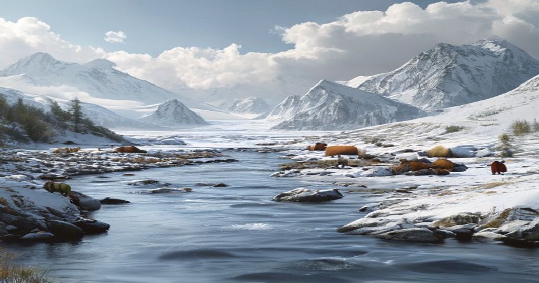
Sami Communities and Arctic Rivers: Geographic and Cultural Foundations
The territory historically inhabited by Sami peoples spans across the northern reaches of Norway, Sweden, Finland, and Russia’s Kola Peninsula, a landscape defined by tundra, boreal forests, and an extensive network of Arctic rivers. These waterways—including the Tana, Paatsjok, Neiden, Utsjoki, Torne, and Muonio—function as ecological corridors that dictate seasonal movement patterns, resource availability, and settlement distribution across high-latitude environments. River valleys provide critical shelter from harsh winds, moderate microclimates through thermal mass effects, and serve as natural drainage pathways for glacial meltwater and precipitation. The geomorphology of these regions, shaped by post-glacial rebound and permafrost dynamics, creates braided channels, gravel bars, and floodplains that sustain unique riparian ecosystems.
Sami cultural practices remain intrinsically linked to the hydrological rhythms of these Arctic rivers. Salmon and trout spawning runs in the Tana and Paatsjok systems have sustained local communities for millennia, with traditional fishing methods including fixed traps, spears, and seasonal net placements calibrated to water temperature and ice conditions. Reindeer herding routes frequently follow river corridors during spring and autumn migrations, as thawed banks provide access to lichen-rich pastures while frozen surfaces enable efficient travel across otherwise impassable wetlands. Historical trade networks connected Sami settlements with coastal markets via waterways, where fur, antler, and duodji crafts were exchanged for grain and iron tools. Spiritual frameworks embedded in Sami cosmology recognize rivers as living entities, with place names often referencing ancestral encounters, hunting grounds, or seasonal harvesting sites.
- Ecosystem Dynamics: Arctic rivers experience extreme seasonal variability, with spring snowmelt generating peak discharge that scours gravel beds and deposits nutrient-rich sediments. Winter ice cover typically persists for six to eight months, creating insulated aquatic habitats during daylight-minimum conditions.
- Traditional Ecological Knowledge: Sami hydrological monitoring includes tracking ice thickness patterns, water clarity shifts, and fish migration timing. These observations inform sustainable harvesting quotas and guide land-use planning across reindeer grazing districts.
- Contemporary Pressures: Hydropower dam construction has altered flow regimes in the Torne and Kemijoki basins, impacting salmon reproduction cycles. Climate-driven warming accelerates spring thaw, disrupts ice-road reliability, and shifts vegetation zones northward, requiring adaptive management strategies for both biodiversity and Indigenous livelihoods.
Legal frameworks governing Sami land rights intersect directly with river basin management. The Finnmark Act in Norway and similar recognition mechanisms in Sweden and Finland establish co-management structures where Sami parliaments participate in water resource allocation, environmental impact assessments, and conservation planning. International instruments including ILO Convention 169 and the UN Declaration on the Rights of Indigenous Peoples reinforce consultation requirements for infrastructure development along riparian zones. Current research focuses on paleo-hydrological reconstruction using sediment cores from river deltas, correlating historical flow data with reindeer population fluctuations and settlement archaeology. These interdisciplinary approaches demonstrate how Arctic river systems function as both ecological anchors and cultural archives, preserving millennia of adaptive human-environment interaction in one of Earth’s most rapidly changing biomes.
Historical Settlement Patterns Along Northern Waterways
The distribution of early human habitation across northern latitudes followed precise hydrological corridors rather than arbitrary territorial boundaries. Sami ancestral groups utilized major Arctic river networks as primary movement axes, aligning camp locations with seasonal fish runs and caribou migration paths. River valleys provided natural windbreaks, reliable freshwater access, and navigable routes during summer months when overland travel remained difficult due to permafrost thaw and dense taiga vegetation. Archaeological surveys consistently identify settlement clusters near river confluences and floodplain terraces, where sediment deposits created fertile microclimates suitable for temporary dwelling construction. These locations minimized exposure to harsh coastal gales while maximizing proximity to both aquatic and terrestrial food sources.
Settlement permanence varied according to hydrological stability and resource abundance. Communities establishing camps near glacial outwash plains experienced longer occupancy periods due to consistent meltwater flow and abundant char populations. Conversely, settlements positioned along steep-gradient tributaries demonstrated higher mobility rates, shifting bases multiple times annually to follow spawning cycles. Historical mapping of these patterns reveals a clear correlation between river discharge levels and camp density during the late Holocene period. Archaeological excavations along the Tana, Pechenga, and Tuloma river basins confirm that early inhabitants deliberately selected elevated riverbanks above spring flood lines to prevent water damage while maintaining immediate access to fishing weirs and hunting blinds.
- River confluence zones served as natural gathering points for seasonal trade and intertribal negotiations.
- Floodplain terraces provided stable ground for semi-permanent sod and timber structures during summer months.
- Ice-free periods dictated annual movement schedules, forcing communities to coordinate camp placements with hydrological windows.
- Archaeological stratigraphy along northern waterways demonstrates consistent occupation layers spanning over four millennia.
Long-term settlement patterns established by these early populations directly influenced subsequent cultural geography across Fennoscandia and the Kola Peninsula. The strategic positioning of camps along Arctic river systems created enduring network nodes that facilitated knowledge transfer, tool exchange, and genetic diversity among dispersed groups. Modern historical cartography continues to reference these ancient hydrological routes when analyzing regional demographic shifts and resource management strategies. Understanding these patterns requires examining sediment core data, paleobotanical remains, and traditional ecological knowledge preserved through oral histories. The riverine landscape functioned as both a physical corridor and a cultural framework, shaping how northern communities organized their lives around water flow rather than fixed political boundaries.
Traditional Reindeer Migration Corridors and River Crossings
Reindeer herds traverse vast Arctic landscapes following centuries-old seasonal routes that align precisely with microclimates, lichen abundance, and predator avoidance patterns. These migration corridors are not arbitrary; they follow topographical ridges, old lake beds, and historically reliable river valleys where snow depth remains manageable during winter months. Crossing points along frozen waterways serve as critical waypoints, traditionally identified through generational knowledge of ice thickness, wind drift patterns, and thermal springs that delay freezing. Sámi herders read subtle environmental cues—lichen growth orientation, bird flight paths, and even the behavior of wild reindeer—to locate optimal fords before early freeze-ups or late thaws compromise safety.
River ecosystems directly influence corridor viability. Seasonal flooding deposits nutrient-rich alluvial soils that sustain dense cloudberry patches and dwarf willow stands, providing essential summer grazing. Conversely, spring meltwaters create treacherous slush zones that force herds into narrow bottleneck passages, historically managed through controlled burning of surrounding scrub to maintain visibility and prevent stampedes. Traditional navigation relies on cairns, carved tree markers, and acoustic landmarks like echoing canyon walls that guide groups during whiteout conditions or polar night darkness.
Infrastructure development has increasingly fragmented these ancient pathways. Bridges, hydroelectric dams, and mining roads alter natural water flow, disrupt ice formation cycles, and introduce human activity that triggers herd avoidance behavior. Contemporary land-use planning now incorporates Sámi acoustic mapping techniques, translating oral tradition into spatial data for corridor preservation. Climate variability compounds these pressures; delayed freeze-thaw cycles force herds to conserve energy on unstable ice, while warmer winters increase parasite loads along damp crossing zones. Conservation frameworks now prioritize hydrological continuity, recognizing that riverine health dictates pasture regeneration rates and, ultimately, herd survival across the tundra biome.
Ancient Fishing Practices in Subarctic Ecosystems
The subarctic river systems that traverse Sami territories function as critical migratory corridors for Atlantic salmon, Arctic char, and vendace during brief summer months. Indigenous fishers synchronized their activities with precise hydrological cues, targeting spring spawning runs when fish ascended rapids to reach gravel beds. Winter fishing emerged equally vital, requiring engineered access through thick ice sheets that formed by late October. Communities carved geometric channels into frozen surfaces to maintain water flow and create stable platforms for night operations, utilizing wooden sleds reinforced with reindeer hide to transport heavy gear across snow-packed riverbanks.
- Subsurface weirs: Interlocking wooden stakes driven into riverbeds created funnel-shaped barriers that guided fish toward enclosed holding pens constructed from woven birch bark and willow branches. Mesh dimensions were calibrated to specific species, retaining only mature individuals while allowing juvenile passage.
- Ice fishing infrastructure: Drill holes were reinforced with carved stone collars to prevent ice collapse, while hand-forged iron hooks and sinew lines enabled vertical extraction of cod and trout from depths exceeding thirty meters. Lures crafted from fish scales and birch bark mimicked natural prey movements.
- Current-based gillnets: Nets woven from nettle fibers or reindeer hair utilized natural river velocities to tangle fish against mesh walls, minimizing manual retrieval efforts during peak migration windows. Buoyancy was maintained using hollowed wooden floats treated with pine resin for waterproofing.
Fishing operations operated under strict ecological protocols that prevented resource depletion. Elders monitored water temperature fluctuations and ice thickness readings to establish seasonal harvest quotas, ensuring juvenile populations remained intact for subsequent breeding cycles. Ritualistic practices accompanied each expedition; fishers observed silence during initial net deployment, offered dried reindeer meat to river spirits, and adhered to kinship-based distribution networks that prioritized community survival over individual accumulation. Post-catch preservation relied on cold-air smoking chambers and wind-drying racks positioned along sheltered fjord walls, producing shelf-stable protein reserves essential for surviving prolonged polar nights. Archaeological excavations near historic fishing stations reveal antler tines modified into barbed spears and ceramic-weighted nets, confirming technological continuity spanning millennia.
Ecological Dynamics of Arctic River Systems
Arctic river systems function as critical biogeochemical conduits within high-latitude catchments, where permafrost degradation directly controls hydrological connectivity and nutrient fluxes. Seasonal ice melt triggers abrupt discharge spikes that transport suspended sediments, dissolved organic matter, and nitrogen compounds from terrestrial soils into downstream aquatic habitats. These pulsed flow regimes shape benthic substrate composition, creating gravel beds and riffle zones essential for macroinvertebrate colonization and fish spawning success. Temperature thresholds dictate metabolic rates
Freshwater Biodiversity Supporting Indigenous Livelihoods
Arctic river networks operate as critical hydrological conduits that sustain specialized freshwater ecosystems across northern Fennoscandia and the Kola Peninsula. These waterways support cold-adapted aquatic communities, including Arctic char (Salvelinus alpinus), European whitefish (Coregonus lavaretus), and lamprey species that navigate seasonal discharge patterns to complete reproductive cycles. The structural complexity of riverbed substrates, riparian vegetation cover, and thermal stratification directly influences macroinvertebrate abundance, which forms the foundational trophic layer for both commercial fisheries and apex predators. Sami communities have historically calibrated subsistence activities around these biological rhythms, utilizing precise hydrological markers to time fishing expeditions, reindeer transhumance, and aquatic plant harvesting. Traditional ecological knowledge documents decades of flow variability, ice formation timing, and species migration windows, providing baseline data that complements contemporary environmental monitoring.
- Riparian buffer zones stabilize water temperature and filter agricultural runoff, maintaining dissolved oxygen levels required for fish spawning success.
- Seasonal flood pulses redistribute nutrients across wetland complexes, sustaining migratory bird populations and supporting reindeer forage regeneration.
- Indigenous-led water quality protocols track heavy metal accumulation, pH fluctuations, and sediment load to prevent bioaccumulation in food chains.
Climate-driven alterations to precipitation regimes and accelerated glacial melt disrupt historical flow consistency, triggering premature ice breakup and desynchronization between fish spawning
Glacial Melt Impacts on Water Temperature and Flow Regimes
Glacial melt directly alters the thermal dynamics and hydrological patterns of Arctic rivers. As ice masses retreat, discharge volumes increase during spring and early summer months, creating pronounced peak flows that frequently exceed historical averages. This accelerated runoff raises water temperatures rapidly, disrupting cold-water aquatic habitats. Many native fish species rely on stable thermal gradients to complete spawning cycles and larval development. Sudden temperature spikes reduce dissolved oxygen levels, stressing biological systems and shifting species composition toward warmer-tolerant organisms.
Flow regime modifications extend beyond temperature shifts. Traditional seasonal timing changes alter sediment transport capacity throughout the watershed. Meltwater carries high loads of fine glacial flour, increasing turbidity and reducing light penetration in river channels. This suspended sediment suppresses benthic macroinvertebrate populations, which form the foundational layer of Arctic food webs. River morphology also transforms as increased discharge widens channels, erodes banks, and deposits material across floodplains. These physical changes directly impact infrastructure stability and traditional resource access routes.
- Hydrological volatility requires adaptive management strategies that balance ecological preservation with cultural continuity for northern populations.
- Sami communities monitor these shifts closely because river conditions dictate reindeer migration corridors, fishing grounds, and travel safety during winter months.
- Unpredictable ice formation follows altered flow patterns, making river crossings hazardous earlier in the season or leaving thin ice persisting longer into spring.
Long-term monitoring reveals a clear trajectory toward flashier hydrographs, where precipitation events generate sharper runoff responses while baseflow conditions decline during warmer intervals. This dual pressure intensifies drought vulnerability in late summer while amplifying flood risks during peak melt periods. Adaptive infrastructure planning must account for increased channel mobility and reduced sediment retention capacity. Water temperature modeling combined with continuous flow data provides essential baseline metrics for ecosystem resilience assessments across northern river basins.
Cultural Heritage and Hydrological Stewardship
The relationship between Sami communities and Arctic rivers transcends mere resource extraction; it forms the foundation of a centuries-old hydrological stewardship system. Rivers in Sápmi function as ecological corridors, seasonal highways for reindeer herds, and vital arteries for fish species like Atlantic salmon and arctic char. Indigenous water governance relies on generational observation of ice formation, flow velocity, sediment deposition, and spawning cycles. This traditional ecological knowledge operates without centralized infrastructure, instead depending on decentralized monitoring by herders, fishermen, and elders who track watershed health through biological indicators.
Sacred geography intersects directly with hydrology. Waterfalls, rapids, and confluences often mark boundaries between seasonal territories or serve as ritual sites where offerings are made to ensure successful hunts and sustainable harvests. The concept of luondu—the living spirit within nature—demands reciprocal care rather than extraction. When river systems degrade due to mining runoff, hydropower diversions, or climate-driven permafrost thaw, cultural continuity fractures alongside ecological balance.
Modern stewardship integrates ancestral protocols with contemporary watershed science:
- Community-led monitoring programs pair digital water quality sensors with oral histories recorded by elders.
- Legal frameworks across Norway, Sweden, and Finland increasingly recognize Sami co-management rights, though implementation gaps persist.
- Sustainable flow regimes require maintaining minimum ecological flows during spring thaws and autumn spawning windows.
- Traditional ice road networks function as natural flood mitigation channels, directing meltwater away from vulnerable settlements.
Preserving this hydrological heritage demands policy that treats rivers as legal persons rather than commodities. Watershed councils incorporating Sami representatives ensure that dam operations, fishing quotas, and land-use permits align with seasonal migration calendars. Educational initiatives teach younger generations how to read water clarity, interpret fish behavior, and navigate glacial outburst risks through hands-on field training alongside herding families. The survival of Arctic river ecosystems remains inextricably linked to the continuous transmission of this knowledge across generations.
Sacred Sites and Spiritual Connections to Running Water
Within Sámi cosmology, flowing water operates as a primary conduit between the physical landscape and the invisible realm of ancestral spirits. Arctic rivers in Finnmark, Troms, and Lapland function as active spiritual arteries that dictate seasonal rituals, hunting routes, and community boundaries. Specific riverine locations, particularly where currents converge with glacial melt or ancient bedrock formations, are classified as vuoibme—sacred spaces requiring reverence and strict behavioral protocols. These sites operate as thresholds where the boundary between human habitation and spirit domains dissolves, demanding offerings such as reindeer antlers, dried fish, or carved wooden tokens to maintain ecological balance and personal fortune.
The topography of these rivers creates natural altars at rapids, waterfalls, and sharp meanders. Traditional practitioners utilized the acoustic resonance of rushing water for trance states during divination ceremonies. The relentless movement of Arctic streams mirrors the Sámi understanding of cyclical time, where past, present, and future coexist within the same hydrological cycle. Fish migrations, particularly Atlantic salmon and whitefish, are interpreted as spiritual messengers carrying guidance from upstream territories to downstream settlements. Ritual gatherings historically occurred at sieidi formations embedded in riverbanks, where stone alignments marked ancestral boundaries and served as orientation points for celestial navigation.
- River bends with submerged bedrock outcrops function as natural energy focal points for seasonal joik performances that map ecological changes across generations.
- Traditional taboos govern behavior near sacred waterfalls, prohibiting loud speech or unauthorized harvesting to prevent spiritual displacement of local guardians.
- Modern conservation frameworks increasingly recognize these hydrological sites as dual-purpose assets, preserving both watershed integrity and intangible cultural heritage through community-led monitoring programs.
Contemporary Sámi scholars and land rights advocates emphasize that protecting these riverine sacred sites requires integrated hydrological management. Industrial development, dam construction, and altered flow regimes directly compromise spiritual practices by disrupting the acoustic and visual continuity of ancestral waterways. Legal recognition of Sámi customary law in Norway, Sweden, and Finland now incorporates hydrological preservation as a core component of cultural sustainability. Maintaining unobstructed river corridors ensures that both aquatic ecosystems and spiritual geography remain intact for future generations.
Indigenous Knowledge Systems in River Monitoring
Traditional ecological knowledge held by Sami communities provides a critical framework for tracking hydrological changes across Arctic waterways. Generations of observation have produced highly localized monitoring techniques that complement satellite data and sensor networks. Field practitioners rely on specific environmental markers rather than abstract measurements. They assess river health through direct interaction with the landscape, noting shifts in flow patterns, sediment composition, and seasonal timing.
Key indicators include:
- Ice formation and thaw cycles: Traditional observations track freeze-up dates, ice thickness variations, and break-up patterns. These metrics reveal temperature fluctuations long before instrumental records become reliable.
- Water clarity and turbidity: Changes in visibility signal upstream erosion, permafrost degradation, or altered precipitation regimes. Sami herders and fishers interpret sediment loads as early warnings for ecosystem stress.
- Fish migration timing and spawning grounds: Historical records of salmon, trout, and whitefish movements establish baseline ecological rhythms. Deviations indicate thermal pollution, dam impacts, or altered river connectivity.
- Vegetation and riparian zone shifts: The spread of shrub lines along banks reflects warming trends. Traditional land use practices monitor these boundaries to adjust grazing routes and fishing access.
Modern hydrological models frequently underestimate rapid Arctic transformations because they lack granular, place-based data. Indigenous monitoring fills this gap by capturing micro-scale variations across remote catchments. Researchers now collaborate with Sami knowledge holders to validate remote sensing outputs against ground-truth observations. This co-production of knowledge improves predictive accuracy for flood events, drought cycles, and ice-related hazards. Community-led tracking also preserves linguistic and cultural connections to specific water bodies, ensuring that adaptation strategies remain grounded in lived experience rather than theoretical projections.
The integration of these systems into official environmental management frameworks reduces monitoring costs while increasing data resolution. When traditional indicators align with instrumental readings, confidence in climate models strengthens. Conversely, discrepancies highlight areas requiring targeted field investigation. Maintaining this knowledge base requires formal recognition of indigenous data sovereignty, funding for community-led research stations, and educational programs that transmit observational skills to younger generations.
Oral Histories Documenting Centuries of Watershed Change
For generations, Sami elders have preserved watershed dynamics through meticulously structured oral narratives that span multiple centuries. These accounts operate as living hydrological archives, capturing subtle shifts in river discharge, seasonal ice formation, and aquatic species migration long before instrumental records existed. Each geographical feature within Sápmi carries a specific toponym that encodes functional knowledge about water flow, substrate composition, and flood risk. When transcribed and cross-referenced with modern dendrochronology and glaciological data, these narratives reveal measurable watershed transformations dating back to the Little Ice Age and earlier.
The transmission mechanism relies heavily on place-based storytelling rather than abstract description. Knowledge carriers describe river behavior through direct observation of indicator species, including Atlantic salmon spawning grounds, char distribution, and reindeer crossing points during spring thaw. These observations are embedded in seasonal calendars that track hydrological cycles against astronomical markers. The accuracy of these records becomes apparent when comparing historical accounts of rapid ice breakups or prolonged drought periods with contemporary gauge stations along the Tana, Anarjohka, and Kvænangen systems.
Modern research initiatives increasingly validate this indigenous documentation framework. Sediment core analysis from Arctic lakes shows accelerated erosion patterns that align precisely with oral descriptions of intensified rainfall events during the mid-twentieth century. Permafrost degradation timelines documented through elder interviews correspond with ground-penetrating radar surveys revealing subsurface meltwater channel expansion. Fishery records maintained by coastal Sami communities match historical catch data, confirming northward migration routes for anadromous species as water temperatures shifted.
- Toponymic analysis reveals over two hundred distinct river descriptors that catalog flow velocity, substrate composition, and seasonal accessibility
- Intergenerational knowledge transfer follows strict pedagogical protocols requiring direct field immersion along watershed boundaries
- Hydrological memory preserves baseline conditions prior to twentieth-century industrial extraction and dam construction
- Cross-validation with satellite telemetry confirms documented migration route alterations for both aquatic and terrestrial species
Preserving these narratives requires structured documentation that respects epistemological boundaries while enabling scientific integration. Audio recordings must capture dialectal variations specific to each drainage basin, as terminology differs significantly between inland reindeer herding territories and coastal fishing communities. Digital archiving protocols prioritize native language preservation alongside standardized translation, ensuring that ecological concepts remain semantically intact rather than reduced to simplified equivalents. This approach maintains the functional precision required for watershed management applications.
Contemporary Challenges and Climate Adaptation Strategies
Arctic river systems traversing Sápmi are experiencing accelerated hydrological instability driven by rapid temperature anomalies and shifting precipitation patterns. Reduced winter ice thickness compromises safe reindeer crossing routes, while earlier spring thaw triggers premature snowmelt runoff that disrupts traditional grazing calendars. Permafrost degradation along riverbanks accelerates bank erosion, increasing sediment loads and altering aquatic habitats critical for native salmonid populations. Communities face compounding pressures from infrastructure vulnerability, including bridge failures and road washouts caused by erratic freeze-thaw cycles.
Adaptation frameworks now prioritize hybrid knowledge systems that merge indigenous ecological observation with satellite-derived hydrological modeling. Local monitoring networks deploy low-cost water temperature loggers and stage gauges to track real-time flow variations, enabling dynamic pasture relocation decisions. Municipal planning incorporates permeable land surfaces and elevated infrastructure foundations to mitigate flood risks from intensified precipitation events. Cross-jurisdictional data sharing between Sámi parliaments and environmental agencies standardizes river health indicators, supporting evidence-based resource allocation.
- Dynamic Migration Routing: Digital pasture maps updated with daily ice thickness metrics guide reindeer herders away from unstable waterways toward designated safe corridors.
- Erosion Control Protocols: Bioengineered riparian buffers using native willow and birch species stabilize shorelines while filtering agricultural runoff before it reaches spawning grounds.
- Community-Led Early Warning Systems: Text-based alert networks transmit real-time ice jam forecasts and flash flood alerts directly to herding families and municipal emergency coordinators.
Funding mechanisms increasingly target indigenous-led resilience projects, channeling climate finance toward culturally appropriate infrastructure upgrades and youth training programs in hydrological monitoring. Policy integration requires formal recognition of Sámi water rights within transboundary river management agreements, ensuring traditional stewardship practices dictate modern conservation priorities. Research institutions collaborate with local cooperatives to develop drought-resistant pasture grasses and modified fishing gear that withstands fluctuating turbidity levels. Long-term adaptation success depends on maintaining ecological continuity while embedding adaptive capacity into daily decision-making structures across all administrative tiers.
Infrastructure Development Threatening Riparian Zones
Large-scale infrastructure projects across northern Fennoscandia and Siberia are rapidly altering the hydrological integrity of Arctic river systems that sustain both ecological balance and Sami livelihoods. Road networks, hydropower dams, mining access routes, and pipeline corridors introduce direct physical disruption to riparian buffers, which serve as critical filtration zones, thermal regulators, and sediment traps. The construction phase alone triggers extensive soil compaction and vegetation removal, eliminating the root systems that stabilize riverbanks against seasonal thaw flooding and spring ice jams.
Sediment loading escalates dramatically when heavy machinery operates within floodplains. Fine particulate matter settles into gravel spawning beds, suffocating Arctic char and whitefish populations that form the foundation of traditional Sami subsistence fishing. Altered drainage patterns redirect surface runoff into previously dry valleys, creating ephemeral wetlands that displace established moss-lichen communities essential for reindeer lichen pastures during winter months.
- Permafrost degradation accelerates along linear infrastructure corridors, releasing stored methane and collapsing ground stability. This subsidence fractures riverbanks, increasing lateral erosion rates by up to forty percent compared to undisturbed zones.
- Thermal insulation effects from asphalt roadways and bridge abutments raise soil temperatures during winter, preventing proper frost penetration. Thawed ground loses structural cohesion, leading to slumping that widens channel widths and reduces navigable flow capacity.
- Chemical contamination from de-icing salts, fuel leaks, and mining tailings migrates through shallow groundwater tables, bypassing natural riparian filtration. Heavy metals and polycyclic aromatic hydrocarbons accumulate in benthic macroinvertebrates, disrupting trophic cascades that sustain avian and mammalian predators.
The cumulative impact extends beyond immediate habitat loss. Fragmented riparian corridors sever historical reindeer migration pathways, forcing herds into suboptimal grazing territories where forage quality deteriorates rapidly. Sami communities report declining water clarity in sacred streams, alongside reduced yields of cloudberry and bog myrtle harvested along river margins. Engineering solutions that prioritize standard mitigation measures often fail to account for the dynamic seasonal flooding regimes characteristic of high-latitude watersheds. Sustainable infrastructure planning requires geotechnical surveys mapped to permafrost depth gradients, hydrological modeling that incorporates spring break-up dynamics, and continuous monitoring protocols co-designed with indigenous knowledge holders. Without adaptive management frameworks, linear development will continue to compress functional riparian width below ecological thresholds necessary for watershed resilience.
Legal Battles Over Water Extraction and Land Rights
The intersection of industrial water extraction and indigenous land tenure in Arctic Scandinavia has generated complex litigation centered on the Sámi people’s historical stewardship of river systems. Commercial operations, including hydroelectric dams, mining enterprises, and pulp mills, routinely secure water withdrawal permits through national environmental agencies. These permits frequently bypass customary usage rights that sustain reindeer herding, salmon fishing, and freshwater harvesting. Legal challenges consistently target procedural deficiencies in permit issuance, arguing that statutory frameworks fail to recognize water as a shared ecological resource rather than a commodified industrial input.
Norwegian, Swedish, and Finnish jurisprudence operates within overlapping mandates. The United Nations Declaration on the Rights of Indigenous Peoples establishes free, prior, and informed consent as a binding standard for resource extraction. International Labour Organization Convention 169 reinforces territorial claims and requires meaningful consultation before licensing decisions. Domestic courts interpret these instruments variably, often deferring to parliamentary sovereignty while acknowledging Sámi reindeer husbandry rights under the Norwegian Reindeer Husbandry Act and Swedish Sami Act. Litigation strategies now prioritize hydrological impact assessments over surface land boundaries, recognizing that river fragmentation directly undermines subsistence economies.
- Permit appeals frequently cite Section 2 of the Finnish Environmental Protection Act, demanding cumulative ecological baseline studies before approving new extraction zones.
- Swedish administrative courts have repeatedly overturned water rights licenses when consultation records lack documented Sámi parliamentary input or independent hydrological verification.
- Norwegian Supreme Court precedents now require mining operators to fund long-term river monitoring programs tied to indigenous livelihood indicators.
Land rights disputes extend beyond statutory permits into historical title validation. Communal grazing corridors, traditionally mapped through oral transmission and seasonal migration patterns, face legal marginalization when national cadastres classify rivers as state-owned public domain. Indigenous advocacy groups leverage satellite telemetry data, historical fishing weirs, and climate resilience studies to establish continuous usage claims. Regulatory bodies increasingly recognize that water extraction permits must align with watershed management plans co-developed by Sámi municipalities. Judicial outcomes remain fragmented across borders, yet the trajectory consistently pressures licensing authorities to integrate hydrological continuity into land tenure determinations.
Youth-Led Initiatives Preserving Arctic Hydrological Traditions
Young Sami practitioners are bridging ancestral hydrological knowledge with contemporary environmental monitoring to safeguard river ecosystems across Sápmi. These initiatives operate on a foundational principle: water movement dictates seasonal migration routes, reindeer grazing patterns, and traditional fishing calendars. When younger generations document ice breakup dates, current velocities, and sediment shifts, they generate localized datasets that fill critical gaps in regional climate models.
Field operations typically combine GPS mapping software with oral history archives collected from elders. Participants record microclimate fluctuations, track permafrost degradation near riverbanks, and catalog changes in fish spawning grounds. This dual methodology ensures that quantitative measurements never override qualitative cultural context. Community workshops in Tromsø, Finnmark, and Lapland now integrate digital hydrology tools into standard curricula, allowing students to overlay historical flood records with real-time satellite imagery.
- Sámi youth collect water quality samples from tributaries feeding the Tana, Deatnu, and Vuotna river systems, analyzing pH levels and dissolved oxygen concentrations to detect industrial runoff or glacial melt acceleration.
- Mobile applications developed by university partnerships enable real-time reporting of ice conditions, allowing rapid response when unexpected freeze-thaw cycles threaten traditional crossing paths.
- Intergenerational mentorship programs pair experienced navigators with data analysts to translate river behavior forecasts into actionable land-use recommendations for local municipalities.
These grassroots efforts directly challenge standardized environmental assessments that often overlook subsurface hydrology and seasonal flow variations. By maintaining active stewardship over watershed boundaries, young Sami leaders secure legal recognition of traditional water rights while establishing community-owned monitoring stations. The resulting frameworks influence regional conservation policies, ensuring that infrastructure projects undergo rigorous ecological review before altering natural drainage patterns.
Sustainable Coexistence: Policy Frameworks and Future Pathways
The integration of Sami traditional ecological knowledge into Arctic river governance requires a structural shift from extractive resource management to co-management models that recognize hydrological systems as living networks rather than commodity reserves. Modern policy frameworks must anchor themselves in the United Nations Declaration on the Rights of Indigenous Peoples, specifically Article 29 and Article 32, which mandate free, prior, and informed consent for any development impacting traditional territories. When rivers cross municipal or national boundaries, fragmented jurisdiction creates enforcement blind spots that accelerate sediment disruption, thermal pollution, and migration pattern collapse. Bridging these gaps demands standardized water quality baselines that incorporate Sami seasonal indicators alongside satellite telemetry and hydrological sensors.
Existing regulatory structures often treat environmental impact assessments as procedural checkboxes rather than continuous feedback loops. Effective coexistence depends on adaptive governance mechanisms that embed indigenous monitoring stations directly into regional water authority dashboards. Funding allocations should prioritize community-led riparian restoration, native fish passage rehabilitation, and permafrost thaw mitigation along riverbanks. Legal recognition of Sami water rights must extend beyond ceremonial use to include commercial harvesting, cultural transmission, and ecological stewardship within designated watershed zones.
- Participatory Data Infrastructure: Deploy low-cost sensor networks co-maintained by Sami elders and hydrologists to track flow velocity, dissolved oxygen, and thermal shifts in real time.
- Transboundary Coordination Protocols: Establish joint river management councils with veto authority over upstream infrastructure projects that alter downstream sediment loads or spawning habitats.
- Climate Resilience Financing: Direct green bond proceeds toward peatland restoration, erosion control, and indigenous-led early warning systems for extreme flood events.
Future policy pathways must transition from static conservation targets to dynamic adaptive management frameworks that adjust harvest quotas, seasonal access windows, and infrastructure setbacks based on continuous ecological feedback. Capacity building initiatives should fund bilingual environmental technicians, indigenous legal advocates, and watershed modelers trained in both glaciology and reindeer migration ecology. Cross-sector collaboration between hydroelectric operators, tourism regulators, and Sami johttu councils requires transparent revenue-sharing models that directly finance river health monitoring programs. Measurable success indicators include stabilized spawning ground temperatures, restored riparian buffer widths, increased indigenous workforce participation in water governance, and legally binding co-management agreements ratified at the regional level.
Community-Based Conservation Models in Northern Territories
Indigenous-led conservation initiatives in northern territories operate through decentralized governance frameworks that merge statutory environmental regulations with centuries-old ecological observation systems. Sami herding cooperatives manage riverine corridors by tracking ice thickness, water temperature fluctuations, and salmon spawning cycles using generational mapping techniques. These protocols replace standardized monitoring grids with dynamic seasonal indicators calibrated to microclimatic shifts across tundra basins. Funding streams flow through co-management agreements where municipal environmental agencies allocate grants directly to local stewardship councils, bypassing bureaucratic intermediaries that historically fragmented resource allocation. Decision-making matrices prioritize cumulative impact assessments over isolated species targets, ensuring riparian habitats retain structural integrity during summer thaw periods.
- Traditional Ecological Knowledge Integration: River flow predictions rely on historical ice break-up dates recorded in oral archives, cross-referenced with satellite telemetry to validate hydrological models.
- Co-Management Governance: Joint steering committees comprising herding representatives, municipal planners, and academic ecologists establish binding harvest quotas that adjust annually based on observed biomass indices.
- Capacity Building Infrastructure: Regional training centers equip local monitors with water quality sensors and drone mapping tools while preserving decision-making authority within indigenous administrative bodies.
Climate adaptation strategies emerge from adaptive resource rotation schedules rather than fixed conservation boundaries. When spring floods accelerate sediment deposition in lower river channels, stewardship groups implement temporary grazing restrictions that align with natural floodplain regeneration cycles. Legal recognition of customary land tenure enables these rotations to function without litigation delays, though jurisdictional overlaps between national park authorities and traditional use zones occasionally create enforcement bottlenecks. Successful implementations demonstrate measurable improvements in riparian vegetation cover, fish passage efficiency, and reindeer calving ground stability across monitored watersheds. Long-term viability depends on continuous data sharing protocols that translate field observations into actionable policy adjustments within municipal environmental planning cycles.
Integrating Traditional Ecological Knowledge with Modern Science
Traditional Ecological Knowledge possessed by Sami communities provides granular, place-based hydrological data that modern Arctic monitoring networks frequently overlook due to sparse sensor deployment and harsh environmental conditions. Indigenous observers document ice formation sequences, water turbidity shifts, and seasonal flow variations through generations of sustained engagement with riverine ecosystems. These observations capture micro-climatic fluctuations and permafrost degradation patterns that satellite imagery or periodic field surveys miss. When researchers overlay Sami phenological records with instrumental measurements, they establish high-resolution baselines for hydrological modeling. Collaborative frameworks replace extractive data collection by establishing shared ownership protocols, ensuring community oversight over how observational metrics feed into academic publications and policy documents.
- Ice Condition Tracking: Sami herders record freeze-up dates, ice thickness progression, and break-up timing using tactile and visual indicators. These records validate remote sensing algorithms and improve flood forecasting accuracy for downstream municipalities.
- Sediment and Water Quality Indicators: Generational knowledge of fish spawning grounds, benthic organism presence, and seasonal discoloration events aligns with chemical analysis results. This alignment enables rapid identification of contamination sources without relying solely on laboratory sampling cycles.
- Permafrost Thaw Correlation: Observations of bank erosion rates, ground subsidence near riverbanks, and altered groundwater discharge points provide early warning markers for infrastructural planning and habitat restoration initiatives.
Methodological integration requires standardized data translation protocols that preserve contextual nuances while meeting scientific reproducibility standards. Participatory GIS mapping allows Sami observers to geotag historical landmarks alongside contemporary sensor locations, creating hybrid datasets that bridge temporal gaps in climate research. Funding mechanisms increasingly mandate co-design structures where Indigenous knowledge holders serve as principal investigators rather than informal consultants. This shift corrects historical power imbalances and accelerates the adoption of culturally aligned river management strategies across Nordic jurisdictions. Cross-disciplinary teams now combine hydrological modeling with oral history archives to reconstruct century-long flow regimes, enabling more resilient adaptive management frameworks for vulnerable Arctic watersheds. Telemetry calibration benefits directly from community-verified baseline readings, reducing equipment drift errors during extreme temperature swings.
Establishing community-led data governance platforms ensures that long-term river health assessments remain accessible to local stakeholders while meeting open-access scientific requirements. Peer-reviewed journals now recognize TEK-derived datasets as primary sources, mandating explicit citation practices that credit Indigenous contributors alongside academic authors. This institutional recognition strengthens cross-border conservation initiatives and aligns hydrological research with established freshwater ecosystem protection standards.
Eco-Tourism Guidelines Protecting Sensitive Riverine Habitats
Strict operational frameworks govern eco-tourism activities across Sami-inhabited river valleys to prevent degradation of fragile riparian ecosystems. Trail construction follows engineered boardwalk systems that elevate foot traffic above permafrost layers, eliminating soil compaction and root suffocation along active waterways. Water access protocols restrict direct contact with spawning zones during peak reproductive periods, typically spanning May through August. Certified local guides enforce group size limitations, mandate silent approach techniques near avian nesting territories, and operate mandatory pack-out waste removal systems that prevent microplastic contamination of cold-water habitats.
- River crossing infrastructure utilizes reinforced fording stations and seasonal suspension bridges to distribute weight load and minimize bank erosion patterns.
- Lodging facilities implement closed-loop greywater filtration units that separate organic matter before discharge, preventing nutrient loading that triggers harmful algal proliferation in oligotrophic streams.
- Visitor orientation programs integrate traditional Sami ecological monitoring techniques, teaching participants how reindeer corridor shifts directly correlate with seasonal water table fluctuations and riparian vegetation recovery cycles.
- Permit licensing requires comprehensive baseline biodiversity surveys conducted by accredited ecologists before seasonal operations commence.
Sediment management strategies require silt curtains and temporary diversion weirs during construction phases, preventing turbidity spikes that disrupt benthic invertebrate communities. Invasive species screening stations inspect footwear and equipment at trailhead checkpoints, eliminating pathogen introduction into pristine aquatic networks. Seasonal zoning algorithms divide river valleys into high-access zones, restricted buffer corridors, and absolute no-visit sanctuaries based on hydrological sensitivity ratings. Guide training programs include emergency spill response certification and wildlife disturbance mitigation protocols that prioritize animal flight thresholds over tourist proximity. These operational standards align with international sustainable tourism frameworks while honoring Sami custodial rights over ancestral waterways.
Frequently Asked Questions
What is Sami Communities and Arctic Rivers?
Sami Communities and Arctic Rivers refers to the indigenous Saami people’s traditional territories, cultural practices, and their vital relationship with the cold-water river ecosystems across northern Scandinavia and the Kola Peninsula. These rivers are essential for reindeer migration routes, salmon fishing, and maintaining the delicate high-arctic biodiversity that has sustained Sami culture for centuries.
Key facts about Sami Communities and Arctic Rivers
• The Saami are Europe’s only officially recognized indigenous people, with livelihoods deeply connected to riverine ecosystems.
• Spring thaw floods in Arctic rivers trigger critical salmon runs and nutrient cycling that support both wildlife and traditional Sami subsistence.
• Rising temperatures and glacial melt are altering river flow patterns, threatening fish stocks and reindeer grazing corridors.
• Modern conservation initiatives increasingly integrate Saami ecological knowledge to protect water quality and cultural heritage.