Geological Origins & Arctic Ecological Networks
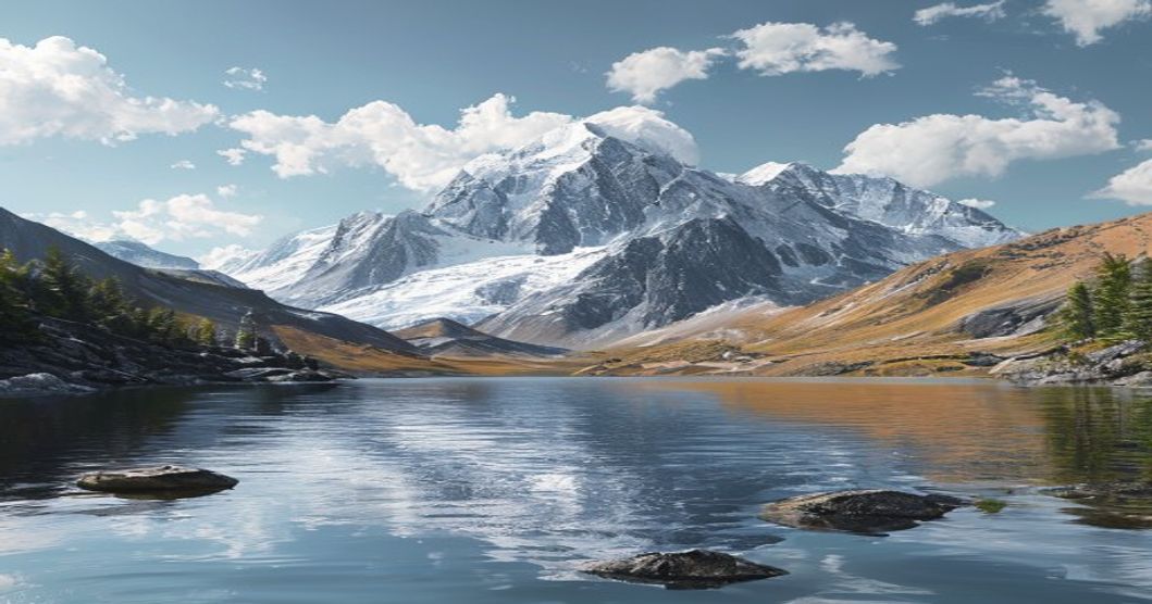
The mountain ranges and freshwater basins recognized within Sámi sacred geography originate from Precambrian shield formations, later sculpted by Pleistocene glaciations that carved deep U-shaped valleys and deposited moraine ridges. These tectonic remnants now host oligotrophic lake systems characterized by low nutrient concentrations, high clarity, and specialized benthic communities adapted to extreme seasonal light variation. The surrounding terrain supports classic altitudinal zonation, transitioning from boreal taiga at lower elevations through dwarf shrub heath and lichen-dominated tundra at summit plateaus.
Gliacial Hydrology & Aquatic Biodiversity
Lake formation resulted primarily from ice-sheet scouring and post-glacial isostatic rebound, creating basins that retain water year-round despite shallow groundwater tables. These waters exhibit high dissolved oxygen levels, low alkalinity, and distinct thermal stratification during summer months. Endemic invertebrate assemblages, including Arctic charr (Salvelinus alpinus) and specialized amphipod populations, maintain closed trophic loops dependent on seasonal algae blooms and terrestrial insect subsidies.
Permafrost Dynamics & Vegetation Patterning
Mountain slopes above the treeline operate within discontinuous permafrost zones where active layer depth fluctuates between ten and forty centimeters annually. This freeze-thaw cycle drives solifluction terracing and polygonal ground patterns that dictate microhabitat distribution. Flora consists of slow-growing perennial species adapted to short growing seasons, including reindeer lichen (Cladonia rangiferina), mountain avens (Dryas octopetala), and dwarf birch (Betula nana), all contributing to thin but highly carbon-dense soil profiles.
Sámi Cosmology & Sacred Landscape Mapping
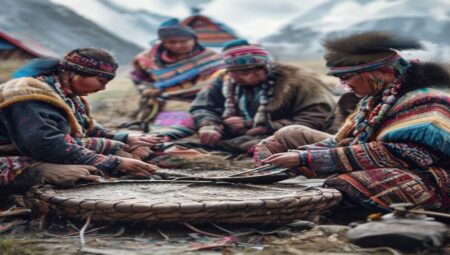
Indigenous spiritual geography across Fennoscandian Lapland does not treat mountains and water bodies as isolated features but as interconnected nodes within a living relational network. Historical land surveys reveal deliberate alignment between sacred sites, seasonal pastures, and astronomical markers, indicating centuries of systematic environmental observation. Knowledge transmission relied on place-based storytelling where topography functioned as a mnemonic archive for resource management, weather prediction, and kinship mapping.
Sieidi Stones & Ritual Geography
Sieidi formations represent naturally occurring or deliberately positioned rock outcrops designated as focal points for offering rituals. These structures typically exhibit distinct acoustic properties, wind channeling effects, or mineral compositions that historically marked navigational waypoints and territorial boundaries. Archaeological surveys document copper coin deposits, reindeer antler fragments, and soot layers within sieidi depressions, confirming continuous use from pre-Christian periods through the nineteenth century.
Oral Histories & Ancestral Navigation Networks
Lake systems functioned as seasonal highways connecting dispersed settlement clusters. Traditional route planning incorporated current patterns, ice thickness progression, and avian migration indicators to determine safe passage windows. Narrative archives describe specific water bodies as guardians of territorial integrity, where transgressing prescribed boundaries without proper recognition was believed to disrupt ecological equilibrium. This cosmological framework directly informed sustainable harvesting quotas and rotational grazing schedules.
Protected Corridors & Traditional Land Use
Modern conservation frameworks increasingly recognize that biodiversity retention in these regions depends on maintaining historical land-use mosaics rather than strict exclusion protocols. Reindeer pastoralism has historically prevented shrub encroachment, maintained open grazing lawns, and accelerated nutrient cycling through seasonal manure distribution across watershed boundaries.
Reindeer Pastoral Routes & Seasonal Migration Patterns
Calving grounds occupy elevated plateau zones where predator visibility remains optimal and insect harassment stays minimal during late spring. Autumn migration corridors follow natural drainage lines that provide wind protection and reliable forage availability. Historical tracking data demonstrates that these routes avoid ecologically fragile wetlands during thaw periods, instead utilizing moraine ridges and frozen lake surfaces to minimize soil compaction.
Peatland Conservation & Carbon Sequestration Metrics
Intermontane basins contain extensive raised bog complexes with carbon accumulation rates exceeding two millimeters annually. These peatlands regulate regional hydrology by attenuating spring runoff, reducing downstream flood peaks, and maintaining baseflow during summer droughts. Scientific monitoring confirms that undisturbed sites store approximately three hundred metric tons of carbon per hectare, making their protection critical to national emissions reduction targets.
Eco-Tourism Standards & Visitor Protocols
Responsible access requires adherence to differentiated zoning models that separate high-traffic recreational corridors from ecologically sensitive or culturally restricted areas. Operators must implement real-time visitor cap systems during breeding seasons and utilize satellite tracking to prevent unauthorized off-trail movement in permafrost transition zones.
Indigenous-Led Stewardship & Access Regulations
Management agreements increasingly mandate co-governance structures where Sámi land rights determine seasonal closure periods and monitoring responsibilities. Traditional knowledge holders conduct annual vegetation integrity assessments, documenting shifts in lichen coverage, water turbidity, and wildlife presence to adjust visitor allowances accordingly.
Low-Impact Navigation & Seasonal Environmental Windows
Summer access remains optimal during July and August when trail conditions stabilize and insect populations peak below nuisance thresholds. Winter expeditions require avalanche assessment training and knowledge of snowpack layering mechanics to prevent cornice collapse on ridge lines. All navigation must follow established cairn networks, utilizing compass bearings and topographic contour reading rather than digital mapping applications that frequently fail in high-latitude magnetic anomalies.
Frequently Asked Questions about Sami Sacred Mountains and Lakes
What is Sami Sacred Mountains and Lakes?
The Sami Sacred Mountains and Lakes refer to a network of culturally and spiritually significant natural landscapes across Sápmi, the traditional homeland of the Sámi people spanning parts of Norway, Sweden, Finland, and Russia. These sites are central to Sámi mythology, reindeer herding routes, and traditional spiritual practices.
Key facts about Sami Sacred Mountains and Lakes
Key facts include their recognition as UNESCO World Heritage sites (such as the Laponian Area), their integral role in Sámi cosmology and seasonal migrations, the presence of ancient rock carvings and sacrificial sites, and their ongoing protection under indigenous land rights frameworks. They remain vital to Sámi cultural identity and sustainable land management.