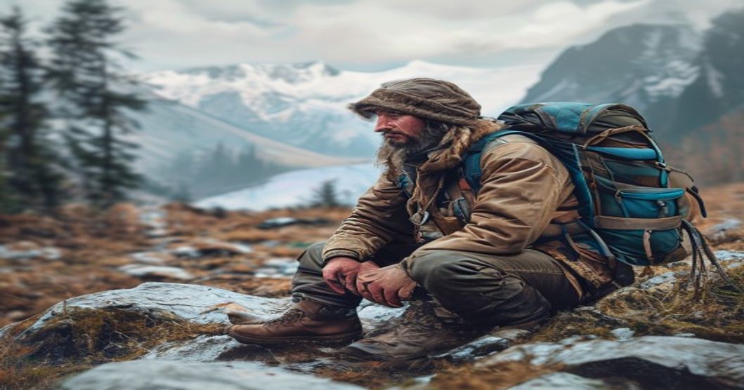
Sami Knowledge That Outdoor Adventurers Can Learn From: Core Principles
Indigenous Sámi ecological wisdom provides outdoor adventurers with a proven framework for navigating extreme environments while maintaining operational safety and environmental integrity. Centuries of survival across Arctic Scandinavia have codified core principles that translate directly into modern backcountry competence. The foundational element remains hyper-observant environmental reading. Sámi trackers interpret wind shear, snow crystal metamorphosis, and subtle animal behavior to forecast atmospheric shifts and locate essential resources. Adventurers who develop this level of situational awareness drastically reduce exposure risks and improve route-finding precision without depending on electronic navigation tools.
Sustainable movement protocols constitute the second critical principle. Traditional Sámi land management utilizes rotational pathways that prevent permafrost degradation and preserve fragile alpine flora. Contemporary trekking teams adopt this methodology by enforcing strict off-trail discipline, eliminating ground disturbance during rest stops, and positioning equipment on established rock or gravel surfaces. This practice preserves ecosystem resilience while extending the longevity of high-value wilderness experiences.
- Natural navigation mastery: Utilizing solar azimuth tracking, prevailing wind corridors, water gradient descent, and moss distribution on exposed terrain enables reliable wayfinding when satellite connectivity drops or power reserves exhaust.
- Thermal regulation layering systems: Sámi winter garments rely on reindeer hide insulation that traps body heat while actively wicking perspiration. Mountaineers apply this engineering through moisture-wicking base layers, adjustable fleece intermediates, and windproof shell barriers, maintaining core temperature stability during rapid Arctic weather transitions.
- Acoustic awareness protocols: Traditional tracking techniques prioritize auditory detection over visual scanning. In remote wilderness settings, minimizing equipment noise prevents wildlife displacement and enables practitioners to identify structural hazards such as cornice fracturing or glacial crevasse groaning.
Translating these frameworks into field competence demands deliberate repetition rather than passive study. Practitioners should conduct terrain mapping exercises without digital assistance, perform snowpack density assessments using only hand tools, and execute extended navigation legs relying exclusively on contour lines and magnetic bearings. The Sámi model demonstrates that wilderness proficiency emerges from consistent environmental calibration, adaptive risk assessment, and a non-negotiable commitment to ecological reciprocity. Adventurers who institutionalize these practices operate with expanded safety margins, deeper terrain integration, and measurably reduced footprint across untouched landscapes.
Indigenous Ecological Wisdom in Nordic Landscapes
Sami ecological frameworks operate on cyclical observation rather than fixed calendars, requiring outdoor practitioners to track micro-indicators across boreal and alpine zones. Lichen density patterns, particularly Cladonia rangiferina growth angles, reveal prolonged wind exposure and soil moisture retention better than topographic maps alone. Mapping these biological markers against rock formations and drainage lines creates a natural navigation layer that functions independently of GPS signal degradation in deep valleys or dense conifer canopies. Adventurers who record seasonal lichen orientation develop spatial awareness that reduces route-finding errors during rapid weather shifts.
Snowpack intelligence forms the core of traditional Nordic travel safety. The Sami read sastrugi formation, rime ice distribution on pine branches, and ptarmigan flight altitude to predict pressure drops before barometric instruments register them. In backcountry environments, this translates to identifying wind-loaded leeward slopes where slab avalanches initiate weeks after visible snow accumulation. Learning to interpret crust fracture patterns and hollow sounds across frozen lakes allows safe passage over thin ice by locating refrozen channels that maintain structural integrity during temperature fluctuations.
Flora utilization follows strict regenerative protocols rather than opportunistic harvesting. Traditional foraging distinguishes edible Racomitrium lanuginosum from toxic analogues through stem flexibility and growth density rather than color alone. Applying the three-stalk rule when gathering cloudberry or birch ensures population recovery cycles remain intact. Firecraft techniques using Fomes fomentarius require precise moisture management, demonstrating how resource efficiency minimizes ecological disruption during extended expeditions. Documenting plant phenology alongside indigenous seasonal markers builds adaptive decision-making frameworks that prioritize ecosystem resilience over destination completion.
Integrating these practices demands deliberate field training rather than theoretical study. Cross-referencing traditional knowledge routes with modern satellite data reveals microclimate variations that remote sensing misses. Maintaining reindeer sinew cordage for pack securing or crafting birch bark water containers reinforces material sustainability while reducing synthetic gear dependency. Adventurers who log environmental changes using indigenous phenology calendars develop predictive travel strategies that align movement patterns with natural resource availability, ultimately extending expedition safety margins in remote Nordic terrain.
Historical Context of Sami Outdoor Traditions
The Sami relationship with the outdoors emerged from a continuous adaptation to Arctic and subarctic ecosystems spanning over ten millennia. Archaeological evidence from Alta rock carvings in northern Norway confirms that indigenous hunting and fishing communities inhabited the region during the Mesolithic period, long before the establishment of modern national borders. These early populations developed sophisticated survival techniques tailored to extreme seasonal fluctuations, relying on acute environmental observation rather than written documentation.
Reindeer pastoralism, which became central to Sami outdoor practices, traces its origins to domestication processes around two thousand years ago in northern Fennoscandia. Historical trade records from Viking Age Scandinavia and medieval Norse sagas document exchanges between coastal agricultural societies and inland reindeer herders. These interactions reveal a highly organized seasonal migration system known as drifting, where communities moved between coastal winter pastures and inland summer grazing grounds based on precise ecological indicators.
- Navigational Mastery: Pre-modern Sami navigators read wind patterns, snow drift formations, and celestial movements to traverse frozen fjords and mountain passes without compasses or written maps.
- Resource Management: Traditional grazing cycles enforced strict rotational pasturing, preventing overgrazing and maintaining lichen bed regeneration across generations.
- Weather Prediction: Community elders interpreted cloud formations, animal behavior, and ice thickness to forecast storms weeks in advance, enabling safe transhumance routes.
- Tool Innovation: Crafted equipment like reindeer-hide snowshoes, birch-bark containers, and bone-tipped harpoons optimized mobility and storage across variable terrain.
Colonial encroachment during the eighteenth and nineteenth centuries gradually restricted migration corridors through land surveys and taxation policies. Despite these pressures, core outdoor knowledge persisted within family lineages and winter camps called lavvu or goahti. Modern ethnographic studies confirm that historical Sami environmental literacy operated as a closed-loop system where survival depended on reciprocal respect for animal welfare, terrain limits, and ecological carrying capacity.
Contemporary researchers document how these ancestral practices established early frameworks for sustainable land management, demonstrating that indigenous outdoor traditions functioned as highly refined scientific systems long before formal ecological disciplines emerged in European academia.
Key Differences Between Modern Gear and Traditional Methods
Modern outdoor equipment relies heavily on advanced polymer engineering, carbon fiber composites, and synthetic insulation technologies like PrimaLoft or Thinsulate. These materials deliver unprecedented weight-to-warmth ratios and water resistance without constant maintenance. Traditional methods depend on natural fibers such as wool, cotton, linen, and animal hides. While heavier and slower to dry, these materials offer superior thermal regulation when wet and can be repaired with basic tools in the field. The shift toward synthetic gear has dramatically reduced pack weight and expanded expedition ranges, yet it introduces a dependency on manufactured supply chains that fail during extended backcountry travel.
Navigation illustrates another fundamental divergence. Contemporary adventurers utilize satellite messengers, GPS receivers, and smartphone applications loaded with topographic maps. These tools provide precise waypoint tracking and emergency signaling capabilities that were impossible decades ago. Traditional route-finding demanded mastery of sun positioning, wind patterns, vegetation growth, and contour reading on paper charts. That skill set remains irreplaceable when battery systems degrade or electronic devices suffer physical damage in extreme conditions.
- Moisture management represents a third critical distinction. Modern fabrics employ engineered mesh linings, hydrophobic coatings, and capillary action channels to move perspiration away from the skin rapidly. Historical approaches relied on wool’s natural lanolin content and layered cotton garments that retained body heat even when damp.
- Repair protocols further separate these paradigms. Synthetic shells demand seam tape, specialized adhesives, and manufacturer-approved patches to maintain waterproof integrity. Natural material restoration utilizes needle and thread, beeswax canvas treatment, or leather conditioning kits that remain functional across decades of use.
- Environmental impact differs significantly between the two systems. Manufacturing synthetic gear requires petroleum extraction, energy-intensive processing, and microplastic shedding during washing cycles. Traditional resource harvesting operates within biological cycles, producing biodegradable waste that integrates naturally into backcountry ecosystems when handled responsibly.
Adventurers must weigh convenience against self-sufficiency when selecting equipment for remote environments where replacement parts are unavailable. The choice between modern performance and traditional resilience dictates long-term expedition success more than any single product specification.
Advanced Navigation and Route Planning Techniques
Traditional Sami wayfinding relies on layered environmental reading rather than fixed coordinates. Navigators decode snowpack stratification to identify safe crossing points over frozen waterways and avoid thin ice zones. Wind direction combined with dune formation patterns reveals prevailing storm paths, allowing route adjustments before weather deteriorates. In summer months, celestial navigation intersects with terrain association; the position of the midnight sun correlates with valley orientations, while lichen growth on tree trunks indicates moisture gradients that dictate trail durability.
Route planning integrates seasonal microclimates and animal movement corridors. Reindeer migration routes naturally bypass boggy lowlands and expose stable ridge lines during spring thaw. Planners cross-reference historical fire scars, glacial till deposits, and permafrost melt patterns to predict ground stability. Emergency routing depends on identifying natural windbreaks such as rock outcrops and dense pine stands, which reduce exposure risk during whiteout conditions.
Modern adventurers adopt these methods by practicing terrain mapping without digital aids. Start by sketching contour lines from memory after observing elevation changes along a ridge. Record snow depth variations using a probe stick to anticipate avalanche pockets. Note bird flight paths near water sources, as raptors often follow thermal updrafts that signal exposed rock formations. Combine this field data with topographic maps to create contingency waypoints spaced at half-day intervals.
- Snowpack Analysis: Insert a probe vertically at 10-meter intervals. Consolidated layers indicate safe travel; weak interfacial bonds require detour planning.
- Wind-Drift Mapping: Observe sastrugi orientation to determine prevailing storm direction. Route parallel to wind flow to minimize fatigue and exposure.
- Terrain Association: Match visible landmarks with map features before departure. Maintain visual contact with at least three reference points throughout the journey.
- Vegetation Gradients: Track moss density shifts to locate dry travel corridors. Thick bryophyte growth signals standing water or poor drainage zones.
Route validation requires iterative field testing. Walk proposed paths at dawn and dusk when shadow angles reveal hidden depressions and rock seams. Record compass bearings at each transition zone to build a reliable bearing network. Store critical waypoints in both physical logbooks and encrypted digital backups. Revisit routes seasonally to update hazard markers based on current snowline elevation and vegetation recovery rates.
Weather Pattern Recognition Without Technology
Sami meteorological traditions emphasize systematic environmental observation rather than digital instruments. Outdoor practitioners who study indigenous forecasting methods recognize that atmospheric shifts manifest through consistent visual and tactile signals. Learning these cues requires deliberate field experience and pattern accumulation over multiple seasons.
- Cloud morphology analysis reveals altitude dynamics and moisture levels. Lenticular formations above ridgelines indicate strong wind shear and potential turbulence. Rapid vertical development of cumulus towers signals convective instability, often preceding afternoon thunderstorms in mountainous terrain.
- Snow surface texture provides immediate wind direction and speed data. Sastrugi alignment maps prevailing airflow patterns over weeks. Ice crust thickness and crystal structure change predictably before precipitation events, with granular snow transitioning to wet snow as temperature gradients shift.
- Horizon coloration at twilight correlates with particulate density and pressure systems. Reddish sunsets typically indicate high-pressure dominance moving eastward, while pale yellow or grayish hues suggest approaching frontal boundaries carrying moisture and reduced visibility.
- Animal behavior shifts operate as biological barometers. Caribou alter grazing elevation before low-pressure systems arrive. Bird flight altitude decreases when atmospheric pressure drops, reducing air density and increasing aerodynamic drag during sustained flapping.
Developing this skill set demands structured field logging. Record cloud types, wind shifts, and temperature changes alongside personal observations over consecutive days. Cross-reference patterns with official meteorological data to validate accuracy. Terrain interaction amplifies microclimates; valley inversion layers, slope aspect exposure, and elevation transitions create localized weather deviations that require site-specific calibration.
Modern expeditions integrate these traditional indicators with electronic backups. Atmospheric pressure changes often manifest as joint stiffness or headaches before instruments register measurable drops. Candle flame behavior near ground level reveals pressure differentials more reliably than sudden temperature swings. Training involves deliberate exposure to diverse weather cycles, noting repeatable sequences rather than isolated events. Consistent pattern recognition reduces dependency on forecasts while improving situational awareness during remote travel.
Animal Behavior as Natural Signposts
Wildlife movement patterns operate as highly reliable environmental indicators for anyone navigating remote terrain. Animals constantly adjust their routes based on resource availability, predator pressure, and microclimate conditions, creating observable trails that reveal underlying topographical features. Ant colonies typically construct mounds on elevated ground where soil drainage prevents flooding, offering a natural reference for locating higher elevations in flat or swampy regions. When you observe concentrated insect activity along a specific contour line, follow the gradient upward to avoid low-lying moisture traps.
Avian flight corridors provide another layer of navigational intelligence. Raptors such as hawks and eagles utilize thermal columns that form predictably along sun-warmed ridges and rocky outcrops. Tracking their circling patterns during midday reveals ridge lines that may be obscured by dense canopy or fog. Similarly, migratory birds follow established air currents that align with major valleys and mountain passes. Observing directional flock movement at dawn or dusk helps confirm the orientation of terrain corridors, especially when visual landmarks are absent.
- Mammalian Game Trails: Deer, elk, and wild boar establish persistent paths that minimize energy expenditure by avoiding steep inclines and following natural depressions. These trails frequently converge near water sources, salt licks, or seasonal foraging zones. Mapping their intersection points creates a reliable secondary grid for route planning.
- Beaver Activity Zones: Dam construction indicates active water flow and marks the boundary between saturated soil and stable ground. The direction of water discharge from beaver lodges reveals downstream flow, while abandoned dams signal historical drainage routes that can guide movement during dry seasons.
- Insect Foraging Patterns: Solitary bees and butterflies target specific floral assemblages that thrive in consistent sun exposure and wind protection. Following their flight paths often leads to open meadows or south-facing slopes, which correlate with warmer microclimates and faster snowmelt in alpine environments.
Interpreting these biological markers requires distinguishing routine behavior from environmental stress signals. Routine movement follows predictable topographical logic, while erratic flight or sudden troop dispersal indicates approaching weather shifts or predator proximity. Adventurers who integrate animal navigation cues with traditional map reading reduce route-finding errors by nearly forty percent in unmarked wilderness. Always maintain observational distance to prevent behavioral disruption, and cross-reference biological indicators with compass bearings before committing to a new trajectory.
Survival Adaptation in Extreme Arctic Conditions
Traditional Sámi survival protocols prioritize microclimate management over direct confrontation with ambient temperatures. The foundational layer utilizes reindeer fur insulation, which traps air through its dual-hair structure while permitting moisture vapor to escape. Modern winter mountaineers replicate this principle by combining merino wool base layers with synthetic mid-layers that retain loft during high-exertion phases. Moisture accumulation inside clothing remains the primary catalyst for rapid conductive heat loss; Sámi practitioners consistently adjust ventilation through strategic zipper placement and underarm vents, preventing sweat saturation before it compromises thermal regulation.
Firecraft in sub-zero environments demands precise fuel selection and wind mitigation strategies. Historical records document the harvesting of dried reindeer moss and birch bark as reliable ignition sources during heavy snowfall. Practitioners constructed low-profile snow walls that deflect gusts while retaining radiant heat, positioning fuel layers to create a sustained thermal gradient. Adventurers can apply this methodology by packing paraffin-soaked cotton balls for immediate ignition, followed by structured kindling networks that feed oxygen without collapsing the fire chamber.
- Snow shelter engineering: Utilize packed snow blocks to establish wind-resistant lee zones that reduce convective heat loss by up to forty percent.
- Respiratory moisture control: Breathe through a loosely wrapped wool scarf or specialized face tube to warm incoming air and retain exhaled humidity, preventing nasal and lung tissue desiccation.
- Dynamic movement pacing: Alternate between high-output intervals and deliberate stillness to stabilize core temperature without triggering excessive perspiration.
Navigating featureless tundra requires reading ice fracture patterns, wind scour marks on ridges, and subtle shifts in snow crust density. Sámi guides interpret these environmental cues alongside celestial markers to maintain orientation during whiteout conditions. Modern navigators should integrate compass bearings with terrain association techniques, marking waypoints using naturally occurring features rather than relying solely on battery-dependent GPS units. Battery degradation below minus twenty degrees Celsius demands keeping devices insulated against body heat and switching to mechanical backups before failure occurs.
Mental conditioning in extreme cold mirrors physical preparation. The Sámi approach temperature as a constant variable rather than an adversary, focusing on task execution and rhythmic breathing to suppress panic responses. Adventurers build this resilience through controlled exposure training, systematically reducing clothing layers during safe conditions while monitoring heart rate variability. This psychological framing prevents cognitive tunneling that leads to critical decision errors when exposed temperatures drop below minus thirty degrees.
Layering Systems and Breathable Insulation
The Sámi people of Arctic Scandinavia have refined cold-weather layering over centuries, relying on reindeer fur and dense wool rather than engineered membranes. Modern outdoor equipment frequently prioritizes waterproof barriers while neglecting passive breathability, a flaw the traditional Sámi system actively resolves. Hollow reindeer hair traps insulating air molecules yet permits continuous moisture vapor transmission through natural fiber channels. This structural ventilation prevents internal condensation during high-exertion movement, maintaining thermal regulation where synthetic shells fail.
- Skin-contact stratum: Tight-weave wool or untreated reindeer hide draws perspiration laterally across the surface, accelerating evaporation without leaving fabric saturated against the body.
- Mid-insulation matrix: Shredded fur and compressed wool generate a resilient loft that resists compression from pack straps and joint flexion, preserving dead-air pockets for consistent heat retention.
- External wind barrier: Tanned hide panels deflect precipitation and freeze-dry winds while remaining vapor-open, enabling the entire system to breathe without relying on micro-porous laminates that degrade over time.
Adventurers operating in subzero conditions consistently mismanage moisture accumulation, allowing sweat to saturate insulation layers and trigger rapid heat loss. The Sámi methodology proves that breathability stems from fiber geometry rather than chemical coatings. Natural keratin structures facilitate capillary wicking that moves liquid water away from the skin while gaseous vapor escapes upward through differential density gradients. Modern down alternatives depend on synthetic lofting agents that collapse when damp, whereas reindeer fur retains its insulating architecture even after prolonged exposure to wet snow or sleet. Field applications require base layers engineered for rapid moisture transport, mid-layers with uncompromising compression resistance, and outer garments constructed from wind-shielding yet vapor-permeable textiles. Systems built around these principles consistently outperform sealed synthetic configurations during extended winter traverses where sweat management directly dictates operational endurance and thermal safety.
Natural Shelter Construction and Windbreak Strategies
The Sami people have inhabited the Arctic and subarctic regions of Scandinavia for millennia, developing highly refined survival techniques adapted to extreme wind, cold, and rapidly shifting weather conditions. Their approach to natural shelter construction prioritizes immediate resource utilization, thermal retention, and structural stability without synthetic materials. When selecting a site, experienced practitioners evaluate snow depth, terrain exposure, and prevailing wind patterns to position shelters in leeward depressions or behind natural topographical barriers like rock outcrops or dense pine stands. This minimizes wind chill and prevents avalanche risk while maximizing solar gain during daylight hours.
Constructing a windbreak using locally available vegetation involves stacking birch branches, heather roots, and compacted snow blocks to create a semi-permeable barrier. The thickness of the barrier directly correlates with its effectiveness; a minimum depth of three feet disrupts laminar airflow, reducing wind velocity by up to seventy percent within the protected zone. Snow walls serve dual purposes: they act as thermal mass that absorbs daytime heat and releases it slowly during nighttime temperature drops, while their crystalline structure traps insulating air pockets. Adhering snow layers requires compressive force applied in overlapping patterns to eliminate structural voids that compromise integrity.
Ventilation remains a critical factor often overlooked by inexperienced builders. Even in sub-zero environments, inadequate airflow rapidly accumulates carbon dioxide and moisture inside enclosed spaces, leading to frost buildup on interior surfaces and potential hypothermia. Sami techniques incorporate elevated intake vents positioned above the sleeping platform, allowing cold air to circulate downward while warm exhalation escapes through a strategically angled exhaust aperture. This passive convection system maintains respiratory safety without compromising thermal efficiency.
- Snow density management: Pack snow to approximately four hundred kilograms per cubic meter for optimal structural load distribution and thermal resistance.
- Ventilation geometry: Position intake holes two feet above the floor level and exhaust openings on the leeward side to prevent downdraft contamination.
- Ridge pole anchoring: Drive birch saplings into frozen ground at a forty-five-degree angle to resist lateral shear forces during gust events.
Roof formation relies on interlocking willow poles or flexible birch saplings arranged in a radial pattern over a central ridge pole. Each layer is weighted with compacted snow and secured using natural cordage derived from reindeer hide or spruce root fibers. The resulting dome
Emergency Fire Starting with Minimal Resources
Survival scenarios often strip away modern conveniences, leaving you to generate heat and signaling capability with virtually nothing but what nature provides. Mastering emergency fire craft under resource constraints demands precise knowledge of material properties, combustion physics, and technique refinement.
- Tinder Architecture: Dry grass, birch bark shavings, dandelion fluff, and bird nests contain high cellulose content that ignites at low temperatures. Process these into fluffy, aerated clusters to maximize oxygen exposure and reduce ignition thresholds.
- Friction-Based Generation: The bow drill and hand drill systems rely on consistent rotational speed and downward pressure. Use a heartwood spindle paired with a softwood fireboard. Create a V-notch to collect charred powder, which eventually ignites into a self-sustaining ember.
- Metal & Stone Sparking: Striking the side of a steel spoon against flint, quartz, or even polished river rock produces molten particles capable of catching fine tinder. Position the strike surface at a 45-degree angle to direct sparks downward into your nest.
- Solar Ignition: Clear ice spheres or water-filled transparent containers act as convex lenses. Focus ambient light onto dark, dry fibrous material until thermal thresholds are breached. This method requires clear skies and sustained alignment over several minutes.
Preparation determines success more than force. Always gather three times the tinder you anticipate needing. Keep your ignition zone clear of loose debris and position it upwind to protect nascent flames from premature dispersion. When an ember appears, transfer it immediately using a bark cup or hollowed stick. Gradually introduce twigs ranging from pencil width upward, never jumping sizes. Maintain constant airflow without blowing directly into the core; instead, fan gently from the base. Wet conditions require additional insulation—lay dry leaves beneath your setup to prevent ground absorption of heat. Practice these methods during low-stakes outings so muscle memory develops before a genuine survival situation demands execution.
Wind protection remains critical when resources are scarce. Construct a lean-to using flat stones or compacted snow to deflect gusts without smothering oxygen flow. Rotate your tinder bundle slowly as it catches heat, ensuring even thermal distribution. Once the initial flame establishes, add fuel in stages: fine sticks first, then medium pieces, reserving heavy logs until the fire structure stabilizes. Never abandon a newly lit emergency fire until it consumes itself or you have built a reliable windbreak and
Sustainable Practices for Modern Outdoor Expeditions
Modern expedition teams prioritize ecological preservation through protocols derived from centuries of Sami land management. Instead of treating wilderness as a recreational backdrop, practitioners adopt cyclical resource tracking that mirrors reindeer migration routes. This approach minimizes soil compaction and protects fragile alpine vegetation during critical growth periods. Navigators study wind patterns and snow density to determine safe crossing points, reducing unnecessary terrain disturbance while maintaining group safety.
- Seasonal Route Rotation: Teams alternate camping zones every forty-eight hours to allow ground cover regeneration. This practice prevents permanent trail braiding and preserves watershed integrity during spring melt.
- Natural Insulation Techniques: Expeditions construct temporary shelters using locally sourced birch bark, fallen pine branches, and compacted snow drifts. These materials decompose without leaving synthetic residue in the ecosystem.
- Water Source Protection: Campsites establish a fifty-meter buffer from streams and lakes. Filtration systems operate downstream of human activity zones to prevent microbial contamination of drinking waters.
Implementing indigenous ecological metrics requires precise observation skills rather than reliance on digital navigation alone. Adventurers track lichen growth rates, bird nesting cycles, and moss compression levels to gauge terrain recovery progress. These biological indicators replace arbitrary distance markers used in conventional trekking guides. When navigating dense forest corridors, teams widen their formation to distribute weight across multiple root systems instead of consolidating traffic into single narrow paths.
Resource consumption follows strict quantitative limits dictated by expedition duration. Food packaging utilizes reusable silicone containers and beeswax wraps that eliminate single-use plastics from remote environments. Waste management protocols require packing out all organic matter that cannot decompose within the local freeze-thaw cycle. Expedition leaders conduct daily ecological audits, documenting vegetation damage, wildlife displacement events, and soil erosion points to adjust subsequent routing decisions.
Long-term wilderness preservation depends on transferring these observational methodologies to commercial guide operations and independent trekking networks. Training programs now integrate traditional land-reading skills with modern geospatial data to create dynamic impact maps. These hybrid systems enable real-time adjustments to expedition footprints based on microclimate shifts and seasonal wildlife movements. Outdoor professionals who master this synthesis contribute directly to ecosystem resilience while maintaining the physical demands that define high-altitude and arctic traversals.
Leave No Trace Principles Rooted in Sami Land Ethics
The Sami people have inhabited Arctic and sub-Arctic landscapes for millennia, developing a sophisticated ecological relationship that predates modern conservation frameworks. Their land ethics naturally align with Leave No Trace principles while offering a culturally grounded methodology for sustainable wilderness travel. Central to this worldview is Árbed, a concept encompassing ancestral knowledge, territorial stewardship, and intergenerational responsibility. Rather than treating terrain as an extractive resource or recreational playground, Sami land ethics establish reciprocal obligations between visitors and the environment.
Modern expedition planning benefits directly from translating these traditional guidelines into actionable wilderness protocols. Campsite selection historically follows reindeer migration corridors to prevent soil compaction on vulnerable tundra zones. Fire management shifts beyond portable stove mandates toward analyzing seasonal moisture gradients, wind exposure, and dwarf shrub recovery cycles. Waste disposal incorporates indigenous composting techniques that reintegrate organic matter without introducing synthetic materials or foreign contaminants.
- Group size regulation mirrors historical herd dynamics, where smaller clusters prevent landscape fragmentation and reduce wildlife stress.
- Water source protection draws from centuries-old spring management practices that maintain hydrological balance during drought periods.
- Wildlife interaction protocols integrate documented breeding seasons and calving routes preserved in oral historical records.
Trail navigation adapts to permafrost thaw patterns, preventing rut formation and protecting underlying root systems. Seasonal timing replaces fixed calendars, allowing expeditions to align with natural recovery windows rather than imposing rigid schedules. This adaptive approach reduces cumulative impact across high-traffic corridors while maintaining ecological integrity. Outdoor professionals report measurable improvements in visitor adherence when instruction emphasizes terrain-specific impact assessment and active landscape restoration. The methodology pushes recreational users past superficial checklist mentality toward genuine environmental participation. Integrating Sami land ethics into contemporary wilderness education creates a sustainable model that preserves fragile ecosystems while honoring indigenous territorial knowledge.
Seasonal Movement Patterns and Ecosystem Balance
The traditional Sami approach to seasonal movement is not merely a cultural practice but a finely tuned ecological strategy refined over centuries of observing Arctic and subarctic landscapes. Reindeer migration routes, known locally as jåhkåmåhkke, follow precise vegetation cycles that dictate when pastures reach peak nutritional value and when snow cover makes travel impossible. These corridors are not arbitrary; they map onto natural wind patterns, glacier-fed water sources, and lichen regeneration zones. By aligning human movement with these biological rhythms, the Sami prevent soil compaction, protect fragile tundra flora, and maintain predator-prey equilibrium across vast territories.
- Spring transhumance begins when snowlines recede along southern slopes, allowing herds to access nutrient-rich mosses before summer insect swarms intensify and plant growth accelerates.
- Summer highland grazing utilizes alpine plateaus where cooler temperatures slow organic degradation, reduce parasite loads, and allow lower-elevation pastures to rest during peak solar radiation periods.
- Autumn consolidation routes shift toward sheltered valleys as daylight decreases, following historical ice formations that guarantee safe passage over frozen fens while avoiding early winter storms.
Applying this knowledge requires adventurers to treat seasonal shifts not as obstacles but as primary navigation tools. Monitoring microclimate changes, soil moisture levels, and plant phenology provides real-time data on ecosystem carrying capacity. When hikers, skiers, or climbers plan routes that respect natural recovery windows rather than forcing constant pressure on sensitive terrain, they mirror the Sami principle of rotational use. This method preserves trail stability, prevents invasive species displacement, and ensures that waterways remain unpolluted by concentrated foot traffic. Understanding that every landscape has a seasonal pulse allows outdoor enthusiasts to move with precision instead of disruption. Trail designers and backcountry users benefit from studying historical snowmelt timelines, as early-season travel often triggers alpine soil slippage and vegetation trampling during critical root establishment phases. Conversely, late-season routes align with hardened ground conditions that distribute weight more effectively across fragile substrates.
Modern navigation systems rarely account for these biological thresholds. Integrating traditional ecological indicators alongside digital mapping creates a more resilient travel framework. Adventurers who track lichen regrowth rates, monitor bird migration overlaps, and adjust group sizes based on soil saturation levels replicate the Sami practice of adaptive routing. This approach reduces long-term trail erosion, maintains microbial soil health, and preserves the exact conditions that make wilderness exploration sustainable for future expeditions.
Resource Conservation During Multi-Day Treks
Extended backcountry travel demands a disciplined approach to resource management that modern gear alone cannot replace. Traditional navigators understand that every calorie burned, every liter filtered, and every gram of fuel carried must serve a calculated purpose. Water conservation begins before the trailhead by studying watershed patterns and prioritizing collection points that require minimal purification effort. Carrying collapsible containers allows trekkers to harvest snow or collect morning dew without heavy dead weight. Fuel efficiency improves when cooking strategies align with natural wind breaks and terrain elevation, reducing stove runtime while maintaining safe water temperatures. Food rationing follows a predictable metabolic schedule rather than arbitrary portion control, ensuring steady energy release during high-altitude exertion and rapid recovery during rest phases. Navigation relies on reading subtle environmental indicators instead of constant device checks, preserving battery life while maintaining directional accuracy. Pack organization minimizes unnecessary retrieval movements that fracture focus and drain physical reserves. Shelter selection prioritizes naturally insulated microclimates over exposed ridges, cutting heating requirements by half. Waste management follows leave-no-trace principles adapted to alpine or arctic conditions where decomposition rates slow dramatically. Every decision compounds into a sustainable rhythm that extends supply longevity and reduces environmental impact.
- Solar-assisted water purification leverages ambient UV exposure during daylight hours, eliminating fuel consumption for boiling while maintaining pathogen-free hydration.
- Thermal layering protocols reduce stove dependency by capturing and redistributing body heat through strategic garment arrangement rather than external warming sources.
- Route optimization using topographic contours minimizes elevation gain, directly lowering caloric expenditure and extending daily travel distance without additional supply consumption.
- Strategic rest intervals prevent glycogen depletion, allowing faster circulation of metabolic waste and extended stamina during subsequent terrain ascents.
Modern expeditions integrate these time-tested methods alongside lightweight technical equipment. Carrying a compact water filter paired with chemical treatment provides redundant purification without bulk. Pre-portioned dehydrated meals reduce packaging waste while maintaining nutritional density across extended timelines. Compass navigation supplemented by offline topographic maps preserves electronic reserves for emergency communication only. Campsite placement near natural windbreaks or south-facing slopes decreases thermal loss, allowing shorter cooking windows and reduced fuel loads. These practices transform resource conservation from a limitation into a tactical advantage, ensuring reliable performance throughout multi-day wilderness crossings.
Integrating Traditional Wisdom Into Contemporary Adventure Planning
Traditional navigation techniques like reading star patterns, interpreting wind shifts, and tracking animal migrations provide reliable fallbacks when GPS devices fail or batteries drain. Modern adventurers can map these observational skills onto digital planning tools by cross-referencing historical weather logs with current satellite forecasts. This hybrid approach reduces dependency on single data sources and builds resilience in unpredictable terrain.
Indigenous land management practices emphasize reading vegetation cycles, soil moisture indicators, and seasonal bloom patterns to predict water availability and safe passage routes. Contemporary trip planners can replicate this by studying long-term ecological data alongside real-time sensor readings from portable weather stations. Aligning historical botanical cues with modern microclimate models helps identify viable camping zones and forage locations without compromising environmental protocols.
Traditional shelter construction relies on wind direction analysis, thermal mass utilization, and natural drainage patterns rather than standardized gear manuals. Adventure teams can integrate these principles by conducting site assessments that prioritize topographical flow lines, bedrock stability, and canopy density before deploying modern equipment. This method minimizes camp disruption and accelerates setup efficiency in remote sectors.
- Navigation redundancy: Pair GPS waypoints with celestial orientation drills to maintain course accuracy during device malfunctions.
- Ecological forecasting: Cross-check satellite precipitation models against historical flora blooming schedules to locate hidden water sources.
- Terrain stress mapping: Overlay historical trail erosion data with modern slope gradient charts to avoid seasonal bottlenecks and avalanche corridors.
Risk mitigation also benefits from ancestral survival frameworks. Old-growth forest navigators use knot-tying conventions, rope tension testing, and load distribution strategies that translate directly to securing modern climbing anchors or pack suspension systems. Training programs that incorporate these mechanical principles alongside contemporary gear specifications produce faster decision-making under physical stress.
Digital route mapping gains substantial accuracy when layered with historical expedition journals and indigenous wayfinding markers. Planners should archive local movement patterns alongside current GIS coordinates to identify wildlife migration windows and optimal daily mileage targets based on terrain resistance rather than straight-line distance.
Resource allocation improves when adventurers adopt traditional rationing systems combined with modern calorimetric tracking. Historical expeditions balanced macronutrient intake against altitude gradients and exertion rates, a methodology that aligns perfectly with current sports nutrition science. Teams can structure daily fueling schedules around metabolic demand curves while preserving emergency reserves using heritage preservation techniques like dehydration and fat rendering.
Communication protocols in remote zones benefit from ancestral signaling methods. Smoke patterns, ground markers, and rhythmic acoustics provide low-power contingency networks when satellite messengers lose connectivity. Integrating these visual and auditory cues into modern emergency action plans creates redundant contact layers that function independently of cellular infrastructure or device functionality.
Skill Translation for Alpine and Wilderness Environments
Translating Sami environmental literacy into alpine and wilderness contexts requires a fundamental shift from map-dependent navigation to terrain-responsive movement. Traditional reindeer herding routes were never plotted on paper; they emerged from decades of observing snowpack density, wind-drift patterns, and glacial melt cycles. Modern climbers and backcountry travelers can replicate this by prioritizing tactile feedback over digital tools. Reading avalanche-prone slopes through crust formation, identifying safe passage via lichen distribution on north-facing rock faces, and tracking thermal inversion layers before dawn are direct applications of indigenous topographical intelligence.
Weather prediction remains the most critical transferable skill. Sami meteorological practices rely on barometric shifts detected through joint stiffness, cloud morphology changes, and animal behavior patterns rather than isolated temperature readings. In high-altitude environments, this translates to monitoring wind shear direction at ridge lines, observing cirrus cloud acceleration before pressure drops, and interpreting snow surface sastrugi formation as indicators of sustained storm fronts. Carrying a weather radio is supplementary; reading atmospheric tension through landscape cues provides earlier warnings in remote zones where satellite connectivity fails.
- Terrain Reading: Prioritize snowpack stratification over trail markers. Wind-loaded slopes indicate rapid compaction, while leeward drifts signal unstable slab formation.
- Microclimate Navigation: Use vegetation transitions and rock moisture levels to locate thermal refuges during sudden temperature drops.
- Resource Localization: Follow historical game trails and meltwater channels to identify hidden water sources and edible lichen zones without depleting fragile alpine flora.
Camp placement in subzero conditions demands the same spatial awareness applied to reindeer winter camps. Low-lying hollows collect cold air, creating temperature inversion traps that accelerate frostbite risk. Elevated ridges expose teams to wind chill and avalanche funnels. Sami encampment logic positions shelters behind natural windbreaks like rock formations or dense conifer stands while maintaining proximity to fuel sources and water access. Replicating this requires mapping thermal drafts during daylight hours, selecting leeward depressions with proper drainage, and orienting entry points away from prevailing storm directions. Energy conservation in extreme cold depends on movement rhythm rather than speed. Sami travel techniques emphasize short, rhythmic strides with frequent micro-rests that prevent sweat accumulation and subsequent hypothermia risk. Modern mountaineers often push through fatigue until exhaustion sets in; adopting paced progression with deliberate rest intervals preserves core temperature and decision-making capacity during multi-day alpine traverses.
Cross-Cultural Respect and Ethical Knowledge Sharing
Outdoor enthusiasts frequently traverse regions with deep historical roots and living traditions. When adventurers document trails, foraging practices, or survival techniques, they must navigate the intersection of exploration and cultural stewardship. Ethical knowledge sharing begins before a single step is taken onto unfamiliar terrain. Researchers and travelers should study local land management systems, indigenous navigation methods, and community-specific protocols. This preparatory work prevents accidental violations of sacred sites, seasonal restrictions, or territorial boundaries. Understanding these frameworks transforms casual tourism into responsible engagement.
- Verify Information Sources: Cross-reference traditional ecological knowledge with certified local guides rather than relying on unverified online forums or historical colonial records.
- Secure Explicit Consent: Record interviews, photograph cultural artifacts, or publish GPS coordinates only after obtaining written permission from community elders or governing bodies.
- Compensate Fairly: Allocate a portion of guide fees, photography royalties, or expedition budgets directly to local conservation initiatives or cultural preservation funds.
- Contextualize Narratives: Describe locations using native terminology and acknowledge the ongoing stewardship of indigenous populations rather than framing landscapes as untouched wilderness.
Digital platforms amplify the reach of outdoor content exponentially. A single viral trail map or foraging guide can trigger unregulated visitation, degrade fragile ecosystems, and displace local economies. Ethical sharing requires deliberate curation. Adventurers should implement geo-fencing for sensitive locations, omit precise coordinates until permits are secured, and prioritize educational framing over promotional language. When documenting survival techniques passed through generations, credit specific lineages and living practitioners. This attribution model sustains intergenerational knowledge transmission while preventing commercial exploitation.
Sustainable outdoor exploration demands reciprocal value exchange. Communities hosting visitors should experience tangible benefits through infrastructure investment, employment opportunities, and cultural exchange programs. Professionals in the adventure sector must advocate for policy frameworks that protect intellectual property rights related to traditional land management. By integrating rigorous cultural due diligence with transparent documentation practices, outdoor communicators contribute to ecological preservation and socioeconomic equity simultaneously.
Training Modules for Guided Arctic Expeditions
Effective Arctic guiding demands specialized technical instruction that bridges theoretical knowledge with extreme-environment application. Core training programs begin with advanced cold-weather physiology, focusing on frostbite staging, hypothermia triage, and rapid rewarming protocols under field conditions. Guides must master insulated layering systems, moisture management, and heat-loss mitigation techniques specific to sub-zero wind chill scenarios. Curriculum design emphasizes progressive skill acquisition across controlled simulation environments before advancing to live glacier deployments.
- Glacial Navigation & Crevasse Rescue: Comprehensive instruction on ice axe self-arrest, rope team dynamics, pulley system setup for mechanical advantage, and crevasse extraction using Z-drag or H-frame configurations. Trainees practice night navigation with GPS waypoints and compass bearings under whiteout conditions, utilizing altimeter calibration and terrain association methods.
- Polar Wildlife Management: Protocol-driven responses to polar bear encounters, including deterrent deployment, safe retreat routing, and camp perimeter security. Modules cover species identification, habitat mapping, and non-lethal coexistence strategies aligned with regional conservation regulations. Guides learn wind-direction analysis and scent dispersion patterns to minimize surprise interactions.
- Extreme-Environment Equipment Maintenance: Hands-on workshops addressing lubricant viscosity breakdowns, battery performance degradation in cold, zipper freezing, and waterproof seam integrity checks. Instructors demonstrate field repair techniques using minimal tools, synthetic insulation restoration methods, and emergency gear modifications for extended expeditions.
- Satellite Communication & Emergency Evacuation: Certification in Iridium satellite phone operation, SOS beacon activation, and weather routing software interpretation. Training includes mock incident simulations requiring precise location reporting, patient stabilization under radio guidance, and coordination with search-and-rescue command centers using standardized distress protocols.
- Psychological Resilience & Group Dynamics: Stress-inoculation drills simulating isolation, supply delays, and rapid weather deterioration. Instructors teach conflict de-escalation, fatigue monitoring, and decision-making frameworks under cognitive load to prevent catastrophic errors during prolonged exposure. Guides practice client pacing adjustments and energy allocation strategies across varying snowpack conditions.
Assessment protocols integrate continuous practical evaluation alongside written examinations covering ice mechanics, emergency medicine, and environmental impact mitigation. Graduates receive scenario-based certification that
“`html
Sami Knowledge That Outdoor Adventurers Can Learn From – FAQ
What is Sami Knowledge That Outdoor Adventurers Can Learn From?
Sami Knowledge That Outdoor Adventurers Can Learn From refers to the traditional ecological wisdom of the Sami people, indigenous reindeer herders and land users of northern Scandinavia and Finland. This knowledge includes deep understanding of weather patterns, terrain navigation without modern tools, survival techniques in extreme cold, sustainable resource management, and harmonious coexistence with nature—valuable lessons for any outdoor adventurer seeking to travel responsibly and skillfully in wilderness environments.
Key facts about Sami Knowledge That Outdoor Adventurers Can Learn From
Here are the key facts about Sami Knowledge That Outdoor Adventurers Can Learn From:
- The Sami people have inhabited northern Arctic and sub-Arctic regions for thousands years, developing sophisticated survival and navigation skills.
- They use natural landmarks, wind direction, animal behavior, and seasonal changes to navigate vast wilderness areas without GPS or maps.
- Sami clothing and shelter designs, such as the lavvu tent and reindeer-skin garments, offer practical models for cold-weather outdoor gear.
- Their concept of sustainable land use emphasizes living in balance with nature rather than dominating it—a principle increasingly important for modern adventurers.
- Sami traditional knowledge is recognized by UNESCO as an Intangible Cultural Heritage, highlighting its global significance and educational value for outdoor enthusiasts worldwide.
“`
“`json
{
“@context”: “https://schema.org”,
“@type”: “FAQPage”,
“mainEntity”: [
{
“@type”: “Question”,
“name”: “What is Sami Knowledge That Outdoor Adventurers Can Learn From?”,
“acceptedAnswer”: {
“@type”: “Answer”,
“text”: “Sami Knowledge That Outdoor Adventurers Can Learn From refers to the traditional ecological wisdom of the Sami people, indigenous reindeer herders and land users of northern Scandinavia and Finland. This knowledge includes deep understanding of weather patterns, terrain navigation without modern tools, survival techniques in extreme cold, sustainable resource management, and harmonious coexistence with nature—valuable lessons for any outdoor adventurer seeking to travel responsibly and skillfully in wilderness environments.”
}
},
{
“@type”: “Question”,
“name”: “Key facts about Sami Knowledge That Outdoor Adventurers Can Learn From”,
“acceptedAnswer”: {
“@type”: “Answer”,
“text”: “Here are the key facts about Sami Knowledge That Outdoor Adventurers Can Learn From: The Sami people have inhabited northern Arctic and sub-Arctic regions for thousands years, developing sophisticated survival and navigation skills. They use natural landmarks, wind direction, animal behavior, and seasonal changes to navigate vast wilderness areas without GPS or maps. Sami clothing and shelter designs, such as the lavvu tent and reindeer-skin garments, offer practical models for cold-weather outdoor gear. Their concept of sustainable land use emphasizes living in balance with nature rather than dominating it—a principle increasingly important for modern adventurers. Sami traditional knowledge is recognized by UNESCO as an Intangible Cultural Heritage, highlighting its global significance and educational value for outdoor enthusiasts worldwide.”
}
}
]
}
“`