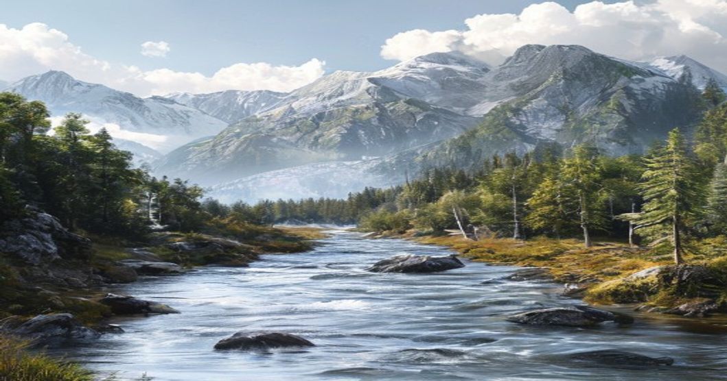
Rivers, Mountains and Forests in Sami Traditions: A Comprehensive Guide
The Sami cultural landscape operates as a living archive where topography dictates seasonal rhythms, spiritual practices, and subsistence strategies across Fennoscandia. Rivers function as both ecological corridors and sacred pathways. Seasonal fish migrations along waterways determined the timing of siida movements, while specific river sections served as sieidi sites for offerings and boundary negotiations between neighboring groups. Water purification rituals tied to flowing streams remain central to contemporary Sami environmental stewardship, reinforcing a worldview that treats aquatic systems as animate entities rather than passive resources.
- River Navigation & Sacred Geography: Traditional canoe routes followed current patterns to access spawning grounds. Water temperature fluctuations signaled optimal fishing windows without depleting population cycles.
- Boundary Markers & Negotiation Sites: Natural rock formations near river bends historically facilitated territorial agreements between different siida communities.
Mountain ridges establish the vertical dimension of traditional navigation and herding routes. Steep slopes influenced the development of specialized reindeer gear and insulated clothing designed for rapid altitude changes. Elevated terrain provided natural windbreaks for winter encampments and served as observation points for tracking herd movements across vast territories. Certain peaks were historically recognized as dwelling places for nature spirits, guiding where hunting parties could safely operate without disrupting ecological balance. Modern GIS mapping projects frequently overlay these historical elevation markers with contemporary reindeer grazing data, demonstrating how centuries of observational knowledge align with current habitat modeling.
- Elevation & Seasonal Timing: Reindeer herds migrate to higher ground in late summer to escape insect pressure and access nutrient-rich alpine forage.
- Spiritual Topography: Mountain caves and exposed ridges functioned as ceremonial spaces where seasonal transitions were marked through smoke offerings and drum readings.
Forest boundaries mark the transition between summer pastures and autumn calving grounds. Birch, Scots pine, and spruce define material culture through bark construction techniques, resin extraction methods, and medicinal plant identification. The siida system relies on precise forest density assessments to determine sustainable grazing pressure. Traditional knowledge includes detailed classifications of tree age, soil composition, and lichen availability that directly predict reindeer forage quality. Contemporary land rights negotiations consistently reference these documented spatial relationships, proving that indigenous forest management predates modern conservation frameworks by generations. The integration of river networks, mountain corridors, and woodland zones creates a continuous ecological matrix where every geographic feature maintains functional and symbolic purpose within Sami cosmology.
Rivers as Lifeblood in Indigenous Navigation and Rituals
Rivers function as the central nervous system of Sápmi, weaving together ecological knowledge, seasonal movement, and spiritual practice. For generations, Sami communities have interpreted waterways not as passive landscapes but as active participants in human survival. River currents dictate reindeer migration corridors, signal optimal fishing windows, and mark territorial boundaries through natural features like rapids, gravel bars, and tributary junctions. Navigation relies on reading water velocity, sediment patterns, and ice dynamics across seasons. Traditional wayfinding incorporates observational markers such as submerged rock formations, willow growth along banks, and the acoustic resonance of flowing water in narrow gorges. These hydrological cues replace artificial instruments, creating a dynamic cartography passed through oral instruction rather than drawn maps.
Ritual practice surrounding rivers emphasizes reciprocity and seasonal alignment. Spring thaw ceremonies acknowledge the release of stored energy from frozen landscapes, while autumn flows trigger purification rites before winter settlement. Practitioners leave offerings of tobacco, copper coins, or reindeer hair at sacred confluences to honor water guardians. Confluence points serve as liminal spaces where land, water, and sky converge, making them primary locations for noaidi journeys. Drumming patterns mimic river rhythms during healing sessions, reinforcing the belief that human vitality mirrors aquatic flow. Historical trade routes followed major river valleys, connecting coastal communities with inland pastoralists. Kayaks and reindeer-drawn sledges adapted to seasonal water levels, requiring precise understanding of floodplains and drainage basins. Elders taught navigation through mnemonic songs that encoded distance, hazard locations, and seasonal timing into melodic structures.
- Seasonal current reading: Monitoring meltwater volume to determine safe passage for boats and sledges.
- Tributary mapping: Using branching waterways as natural guides across vast tundra and boreal zones.
- Waterway offerings: Depositing personal items at specific coordinates to maintain relational balance with aquatic spirits.
- Rapids acoustics: Interpreting white noise patterns for weather prediction and herd movement timing.
Mountains as Gateways to the Spiritual Realm
In Sámi cosmology, mountains operate as critical thresholds where the material world intersects with the invisible realm of spirits and ancestral forces. These elevated landforms are not merely geographical markers but active spiritual conduits that facilitate communication between humans and haldi, the protective mountain spirits believed to govern hunting success, weather patterns, and seasonal fertility. Traditional Sámi navigators historically read mountain silhouettes as celestial maps, aligning ritual movements with specific peaks during solstices and equinoxes to maintain cosmic balance.
Ritual access to these spiritual gateways required strict adherence to sieidi protocols. Sacred stone formations positioned at mountain foothills or ridge lines served as physical anchors for spiritual energy. Communities deposited reindeer antlers, copper coins, or carved wooden figures at these sites before hunting expeditions or seasonal migrations. The act of leaving offerings was never transactional but functioned as a reciprocal acknowledgment of territorial sovereignty and spiritual reciprocity.
- Sacred peak orientation: Specific mountains were designated for male or female spirit veneration based on solar trajectory and wind direction.
- Drum journey alignment: Noaidi practitioners mapped drum skins to mountain ranges, using percussion rhythms to navigate spiritual corridors during trance states.
- Seasonal threshold days: Communities observed precise lunar phases when mountain mist patterns indicated active spirit passage windows.
The ecological architecture of mountainous Sámi territories directly shaped ritual calendars and community identity. Valleys beneath sacred peaks functioned as buffer zones where hunting restrictions, vocal taboos, and movement protocols maintained spiritual hygiene. Modern archaeological surveys confirm that pre-Christian rock carvings frequently depict figures ascending ridgelines toward triangular peak silhouettes, corroborating oral histories of vertical pilgrimage routes. These topographical pathways remain encoded in contemporary Sámi land-use documentation, demonstrating how spiritual geography continues to inform territorial stewardship and cultural continuity.
Forests and Fjell: Ecological Knowledge and Seasonal Cycles
The boreal forests and alpine fjell landscapes serve as foundational ecosystems for Sámi livelihoods, shaping centuries of adaptive ecological strategies. These environments are not passive natural features but active components of a dynamic cultural landscape. The transition from dense coniferous woodlands to open treeline zones creates distinct microclimates that dictate resource availability. Reindeer herding communities navigate this gradient through precise seasonal movements, relying on accumulated observations passed down across generations. Each ecological zone provides specific nutritional profiles and shelter opportunities essential for herd survival during extreme weather events.
Seasonal cycles structure the entire annual rhythm of Sámi land use. Spring brings calving grounds in lower forested valleys where snow melt patterns create nutrient-rich pastures. Summer shifts grazing pressure to elevated fjell plateaus, where short growing seasons produce dense lichen beds and aromatic shrubs. Autumn triggers long-distance migrations back toward winter forests, guided by wind direction, snow crust formation, and reindeer instinctual pathways. Winter months transform the landscape into a restricted travel network where deep snowdrifts require careful route selection to prevent herd exhaustion.
Traditional ecological knowledge operates through highly specific observation frameworks. Herders monitor birch leaf development as an indicator of lichen regeneration cycles. They track cloud formations and air pressure changes to predict sudden weather shifts across exposed mountain passes. Plant identification extends beyond culinary use into veterinary applications, with certain mosses administered for gastrointestinal health in stressed animals. Snow density testing determines travel viability, while tree bark stripping patterns reveal historical herd movements and territorial boundaries.
- Lichen harvesting follows strict rotational intervals to allow recovery periods
- Controlled grazing pressure prevents forest encroachment on open pastures
- Snow depth measurements guide daily migration distances
- Tree line boundaries shift according to historical climate data
This seasonal knowledge system functions as a continuous feedback loop between human activity and environmental response. Modern conservation initiatives increasingly recognize these practices as sustainable land management models. The integration of historical migration routes with contemporary climate monitoring creates adaptive frameworks for preserving both cultural heritage and fragile northern ecosystems.
Reindeer Migration Routes and Natural Landmarks
Reindeer herding among the Sami people operates as a sophisticated ecological system mapped across the topography of Sápmi. Migration corridors are not random trails but precisely calibrated pathways that synchronize with seasonal vegetation cycles, snowpack depth, and predator avoidance behaviors. These routes traditionally link wintering zones within dense boreal forests to summer pastures situated on exposed mountain ridges and wide river floodplains. The animals navigate using inherited spatial memory, guided by distinct natural markers such as glacially carved valleys, ancient stone outcrops, and seasonal waterways that remain visible throughout the year.
Natural landmarks function simultaneously as navigational aids and cultural reference points. Specific mountains hold ceremonial significance, historically serving as locations for sieidi rituals where reindeer herders sought protection during calving periods and harsh weather events. Rivers act as dynamic ecological highways, providing mineral-rich grazing along their banks while offering clear visual orientation when forest canopies close or snow obscures the horizon. Forest margins mark critical transition ecotones where reindeer exploit lichen-dominated understories and seek windbreaks during autumn storms.
- Winter pastures rely on coniferous canopy protection and abundant ground lichen
- Spring thaw routes follow river valleys as ice barriers dissolve
- Summer grazing grounds utilize alpine plateaus for insect relief and fresh vegetation
- Autumn migration paths align with mountain passes before early snowfall
Contemporary telemetry studies confirm that modern herd movements still follow these ancestral pathways with remarkable consistency, validating centuries of accumulated land-based knowledge passed through generations of herders. The synchronization between migration timing and landscape features dictates the rhythm of Sam
Sacred Sites and Roovddit in Traditional Worship
Sami spiritual geography operates through a precisely mapped network of sacred sites rather than centralized worship structures. These locations function as active interfaces between human settlements and roovddit, the ancestral spirits and nature guardians that inhabit specific territorial zones. The Sami cosmological framework treats the landscape as a living archive where physical topography and spiritual presence remain inseparable. Every outcrop, spring, ancient tree line, or seasonal crossing point can serve as a threshold where daily survival intersects with ritual obligation.
Roovddit require consistent recognition through established offerings and strict behavioral protocols. Communities identified these sites through multigenerational oral transmission, marking them with stone cairns, carved boulders, or deliberately positioned wooden markers. Transgressing the boundaries surrounding a sacred location was considered physically and spiritually hazardous, potentially disrupting reindeer migration routes, causing livestock illness, or triggering environmental instability. The authority of roovddit extended across hunting territories, fishing waters, and winter camping grounds, demanding continuous negotiation between human activity and territorial respect.
Ritual practice at these sites followed rigid seasonal calendars synchronized with animal movements and ecological shifts. Participants delivered reindeer calves, goats, or sheep to designated sacrificial stones known as boazovuoibmebáiki. Blood was poured directly onto rock surfaces, meat portions were buried in shallow depressions, and birch branches were woven into natural formations. Drum ceremonies frequently accompanied these offerings, with painted drum symbols mapping cosmic layers that mirrored the physical terrain below. Experienced elders or ritual specialists directed the proceedings, interpreting smoke trajectories, animal behavior, and drum vibrations to verify whether the roovddit accepted the presented goods.
- Sacrificial stones: Designated outcrops where blood and meat were deposited to sustain reciprocal relationships with territorial spirits and secure hunting yields.
- Mountain peaks and ridges: Elevated roovddit zones governing weather conditions, large-scale game movements, and community-wide prosperity across expansive territories.
- Lakes and river confluences: Water-based sacred locations protecting fish stocks, regulating seasonal migrations, and anchoring ancestral memory within aquatic systems.
- Ancient forest groves: Dense woodland sectors where tree spirits required acoustic silence, specific botanical offerings, and strictly controlled human access.
Missionary campaigns historically dismantled numerous sacred sites, relocating populations to church-centered settlements and outlawing drum rituals. The underlying spatial knowledge survived through family lineages, seasonal land use patterns, and localized ecological memory. Contemporary Sami practitioners and cultural researchers now reconstruct surviving site locations using archival documents, elder testimonies, and landscape archaeology. Modern revival initiatives prioritize ecological protection alongside spiritual practice, acknowledging that safeguarding these terrains directly sustains both cultural transmission and regional biodiversity.
Language, Place Names, and Oral History Preservation
The Sami linguistic framework operates as a highly specialized ecological database where topographical features are documented through precise lexical categories. Rivers, mountains, and forest zones receive distinct naming conventions that encode seasonal water levels, glacial erosion patterns, and boreal vegetation transitions. Speakers differentiate between slow-moving alpine streams, rapid glacial outflows, and stagnant wetland channels using separate root words that reflect hydrological behavior rather than generic descriptors. Mountain terminology similarly tracks elevation gradients, rock composition, and historical grazing routes, allowing communities to navigate terrain without relying on external surveying tools.
Place names function as living cartographic records where each coordinate carries layered historical usage data. A single ridge might hold multiple identifiers depending on reindeer migration timing, berry harvesting windows, or historical hunting encounters. These toponyms preserve micro-historical events that standard mapping systems routinely erase. The linguistic structure prioritizes functional geography over abstract boundaries, embedding ecological causality directly into the vocabulary. Researchers document how dialectal variations across Finnmark, Troms, and Sápmi reveal distinct environmental adaptations tied to watershed systems and forest density gradients.
- Mnemonic transmission mechanisms utilize rhythmic vocal patterns that map terrain features onto melodic sequences, enabling spatial recall without written reference points.
- Intergenerational teaching protocols require direct environmental immersion where children associate lexical items with physical landmarks during seasonal movements.
- Digital preservation initiatives cross-reference archived recordings with geospatial data to validate traditional land use zones against contemporary ecological shifts.
Oral history preservation relies on deliberate knowledge sequencing where elders structure narratives around watershed boundaries, elevation changes, and forest succession stages. Yoik performances operate as acoustic topographical guides that encode route memory, resource locations, and seasonal danger zones into harmonic structures. Contemporary documentation projects prioritize recording native pronunciation alongside ecological context rather than isolating vocabulary lists. Linguistic continuity remains directly tied to territorial stewardship practices that depend on precise environmental terminology.
Modern Conservation Efforts and Indigenous Stewardship
Traditional Sami land management principles are increasingly recognized as vital components of contemporary ecological preservation strategies across Sápmi. The siida system, historically organized around seasonal reindeer migration routes and sustainable resource extraction, now informs modern co-management frameworks in Norway, Sweden, and Finland. Government agencies and environmental organizations collaborate directly with Sami parliaments to establish protected zones that prioritize both biodiversity recovery and cultural continuity. These partnerships operate on the premise that indigenous stewardship offers proven methods for maintaining landscape integrity over centuries of environmental fluctuation.
Current initiatives frequently focus on restoring degraded alpine tundra and boreal forest ecosystems through community-led monitoring programs. Sami herders document lichen growth patterns, river ice formation dates, and avian migration shifts, generating hyper-local data that complements satellite imagery and climate models. This ground-level intelligence enables adaptive management strategies for transboundary protected areas. Legal instruments such as the Finnmark Act in Norway have transferred significant land ownership to local communities, allowing Sami councils to regulate grazing intensity and restrict industrial encroachment in ecologically sensitive corridors.
Several cross-border conservation projects explicitly integrate traditional ecological knowledge with scientific methodology:
- River restoration efforts along the Torne and Muonio basins utilize historical watercourse maps to reestablish natural floodplains and spawning grounds for native salmon populations.
- Forest management protocols prohibit clear-cutting in areas designated as sacred groves or critical winter feeding zones, preserving old-growth stands that function as carbon sinks and wildlife corridors.
- Wind energy developments undergo rigorous environmental impact assessments that mandate Sami consultation, resulting in turbine repositioning and seasonal operational restrictions to protect migratory pathways.
Despite these advances, implementation gaps persist between policy commitments and on-ground enforcement. Climate acceleration threatens permafrost stability and alters vegetation zones faster than traditional adaptation cycles can accommodate. Nevertheless, the convergence of indigenous land rights advocacy and modern conservation science continues to reshape environmental governance. Communities that maintain active stewardship roles demonstrate measurably higher rates of ecosystem recovery, proving that cultural preservation and ecological resilience operate as mutually reinforcing objectives rather than competing priorities.
Educational Resources and Cultural Documentation
The preservation and transmission of Sámi ecological knowledge relies heavily on structured educational frameworks and rigorous cultural documentation initiatives. Indigenous communities across Sápmi have developed comprehensive archives that capture the spiritual and practical significance of rivers, mountains, and boreal forests within traditional learning systems. University collaborations with Sámi institutions, including the Sámi University of Applied Sciences in Guovdageaidnu, produce peer-reviewed materials that integrate yoik melodies, seasonal land-use patterns, and place-name etymology into formal curricula. These resources are not static; they evolve through continuous fieldwork and community validation processes.
Digital repositories now host thousands of hours of recorded oral histories, detailing how specific waterways function as migration corridors for reindeer herds or serve as sites for ritual purification. Geospatial mapping projects allow elders to overlay traditional hunting grounds with modern conservation boundaries, creating interactive educational tools for regional schools. Academic publications frequently analyze the linguistic markers embedded in mountain nomenclature, revealing centuries of environmental observation encoded in Sámi dialects. Classroom modules derived from these archives teach students to interpret forest stratification as an indicator of microclimate shifts, reinforcing adaptive management strategies passed down through generations.
- Participatory Mapping Protocols: Knowledge holders collaboratively digitize ancestral territories using GIS technology, ensuring sacred coordinates remain protected while enabling academic analysis.
- Multimedia Curriculum Integration: Regional schools combine satellite imagery with hand-drawn traditional maps, allowing learners to correlate ecological zones with mythological narratives and seasonal resource cycles.
- Data Sovereignty Frameworks: Research agreements mandate community control over archival access, preventing unauthorized commercial exploitation of sensitive geographical information.
Ethical documentation protocols strictly prioritize community consent and long-term cultural continuity. Teacher training programs across Finnmark, Troms, and Norrbotten integrate these materials into standardized environmental science courses, ensuring that indigenous epistemologies receive equal weight alongside Western ecological models. Continuous funding streams support the digitization of fragile parchment manuscripts and audio recordings, safeguarding irreplaceable cultural memory against historical erasure.
Frequently Asked Questions
What is Rivers, Mountains and Forests in Sami Traditions?
Rivers, mountains, and forests hold deep spiritual and cultural significance in Sami traditions. These natural elements are viewed as sacred beings with their own spirits, integral to the Sami cosmology, mythology, and sustainable relationship with nature.
Key facts about Rivers, Mountains and Forests in Sami Traditions
Key facts include: (1) Natural features are believed to be inhabited by spirits that must be respected through rituals. (2) The Sami do not own the land but have rights to use it sustainably for reindeer herding, fishing, and hunting. (3) Sacred sites like seids (sacred mountains) and specific lakes or forests are used for worship and historical storytelling.