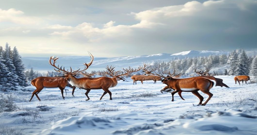
Historical Foundations of Sami Pastoralism and Seasonal Movement
The practice of reindeer herding among the Sami people traces its origins to a gradual transition from hunting wild cervids to semi-domestication during the late medieval period. Climate reconstructions indicate that the onset of the Little Ice Age, beginning in the fourteenth century, forced ecological shifts across northern Fennoscandia. Wild reindeer populations retreated toward higher altitudes and more remote tundra zones, prompting indigenous communities to adopt a mobile pastoral strategy that synchronized with natural forage cycles.
Traditional migration corridors emerged from centuries of accumulated ecological observation. Herding families tracked lichen availability, insect pressure, and snow depth across distinct seasonal zones. Winter pastures typically occupied forested taiga regions where wind-scoured slopes protected ground vegetation. Spring movements directed herds toward coastal or lowland birch forests to escape biting warble flies. Summer calving grounds shifted into alpine ridges and boggy plateaus, while autumn migrations returned animals to dense woodlands before deep snowfall.
- Pre-colonial autonomy: Community-led route selection relied on kinship networks and oral geographic mapping rather than fixed territorial boundaries. Movement remained fluid across what are now international borders.
- State imposition of fences: Nineteenth-century boundary acts in Norway, Sweden, and Finland divided traditional grazing lands with wire enclosures designed for agriculture. These barriers fragmented migratory pathways and forced herders to negotiate seasonal crossings through administrative permits.
- Domestication intensification: Selective breeding programs introduced in the early twentieth century increased herd dependency on human management. This shift reduced spontaneous roaming but reinforced structured seasonal calendars tied to specific pasture zones.
Legal frameworks governing reindeer husbandry gradually replaced customary land tenure systems. The Norwegian Reindeer Husbandry Act of 1978 formalized administrative districts, yet historical route data reveals that contemporary corridors still align with pre-industrial grazing logic. Modern herders continue to navigate these inherited pathways using satellite tracking alongside traditional snow-reading techniques, preserving a migratory system refined over six centuries.
Geographic Overview of Core Migration Corridors
The core migration corridors across Sápmi traverse a highly fragmented landscape defined by abrupt elevation gradients, coastal fjord systems, and expansive plateaus that dictate seasonal reindeer movement. These routes are not arbitrary paths but engineered by centuries of ecological pressure and topographic constraint. The Finnmark plateau serves as the primary eastern corridor network, where herds descend from snow‑capped winter pastures above 500 meters to sheltered lowland valleys rich in ground‑lichen (Cladonia spp.) during spring thaw. Parallel routes cut through the Tromsø peninsula, navigating narrow mountain passes and river gorges that channel movement toward coastal summer grazing zones where tundra vegetation peaks in biomass.
Westward corridors extend into the Swedish Lapland borderlands, following the Tornionjoki drainage basin and the Laponia UNESCO site boundaries. Here, migration distance contracts due to denser boreal forest cover, forcing herds into linear travel paths along ridge lines and peatland margins. The Finnish sector near Inari–Utsjoki relies on a network of frozen lake surfaces and ice‑free river channels that remain navigable during late autumn freeze‑up. Terrain roughness directly correlates with migration efficiency; flat tundra stretches allow herd cohesion, while scree slopes and glacial moraines fragment group dynamics.
- Elevation thresholds: Seasonal movement consistently crosses 300–600 meter contours, dictated by snowpack density and forage accessibility.
- Hydrological anchors: Major waterways including the Tana, Alta, and Muonio rivers function as natural boundaries and seasonal crossing points.
- Vegetation transition zones: Corridors align with ecotones between alpine tundra, subarctic birch forest, and coastal heathland.
- Historical siida boundaries: Traditional herding districts map precisely onto modern GPS‑tracked movement clusters, confirming geographic continuity.
Contemporary corridor mapping combines satellite telemetry with LiDAR terrain analysis to identify pinch points where landscape resistance maximizes energy expenditure. These bottlenecks frequently coincide with infrastructure development zones, requiring targeted wildlife crossing structures to maintain genetic flow and pasture rotation cycles. The geographic architecture of Sápmi reindeer migration remains a precise intersection of paleoclimatic adaptation, hydrographic routing, and indigenous spatial knowledge.
Ecological Drivers Shaping Annual Reindeer Movements
The annual migration patterns of reindeer across Sápmi are governed by a complex network of ecological pressures that dictate seasonal resource allocation and survival strategies. Central to these movements is the availability of ground lichen, particularly Cladonia rangiferina and Cetraria nivalis, which constitute the primary winter forage. As snow depth increases during late autumn, reindeer utilize their specialized hooves to dig through snowpacks and access these slow-growing lichens, necessitating predictable routes that minimize energy expenditure while maximizing caloric intake.
- Snow Crust Formation: Repeated freeze-thaw cycles create ice layers that seal lichen beds beneath impermeable crusts. Herds dynamically adjust their trajectories to follow topographical depressions, ridge lines, and wind-scoured plateaus where snow remains shallow or loose.
- Vegetation Phenology: Spring green-up triggers a rapid northward shift. Reindeer target nutrient-rich forage such as willow, birch shoots, and fresh grasses that emerge along glacial valleys and coastal margins, synchronizing calving seasons with peak botanical nutrition.
- Predation Avoidance: Wolf packs and wolverines concentrate in boreal forest transitions. Migratory corridors are deliberately selected to maintain open tundra exposure, reducing ambush opportunities while allowing herd members to monitor threat vectors from elevated terrain.
- Rain-on-Snow Events: Climate-amplified winter precipitation forces emergency relocations. When lichen layers become encased, herds traverse previously avoided wetlands and lower elevations, accelerating tundra degradation and altering long-range movement baselines.
Topographical continuity remains a non-negotiable constraint in route selection. Reindeer avoid steep gradients exceeding thirty degrees unless absolutely necessary, preferring gradual ascents that preserve herd cohesion during calving and rutting phases. Human infrastructure fragments these ecological pathways, forcing compensatory detours that increase metabolic stress and reduce body condition scores. Herders monitor satellite telemetry data alongside traditional knowledge to map shifting migration baselines, ensuring grazing permits align with emerging ecological thresholds rather than historical precedents.
Snow Depth, Lichen Availability, and Vegetation Cycles
Reindeer movement across Sápmi is fundamentally governed by the physical barrier of snowpack and its direct impact on subalpine and arctic lichen beds. When winter precipitation accumulates rapidly or undergoes freeze-thaw cycles, the formation of ice crusts or dense wind-packed layers effectively seals off ground-dwelling lichens such as Cladonia rangiferina and Cetraria nivalis. Reindeer respond by expending critical energy reserves to crater through the snow with their forelegs and hooves. This behavioral adaptation becomes unsustainable when snow depth exceeds forty centimeters or when ice layers prevent effective digging. Consequently, herds alter traditional migration corridors, seeking out wind-exposed ridges, north-facing slopes where snow remains loose, or areas historically managed by reindeer herders to maintain forage accessibility.
Lichen availability operates on a strict seasonal rhythm that dictates migration timing. During late autumn, lichen biomass contains the highest concentration of readily digestible carbohydrates before winter dormancy sets in. Reindeer accumulate fat reserves during this window, which determines herd survival through the leanest months. Climate variability disrupts these cycles; increased mid-winter rain events create impermeable ice sheets that strip lichen beds years into recovery. Herds tracking these changes shift migration routes hundreds of kilometers southward or toward coastal zones where maritime winds prevent deep snow accumulation. The spatial distribution of lichen directly correlates with calving ground success rates, as nutrient-poor winter diets reduce milk production and overwinter survival of neonates.
- Snowpack Density: Compacted snow reduces foraging efficiency by up to seventy percent, forcing herds to abandon established trails in favor of less optimal terrain with thinner coverage.
- Lichen Regrowth Periods: Traditional grazing grounds require seven to ten years of rest between heavy utilization cycles. Overgrazed zones lose topsoil structure and fail to support adequate lichen recovery, permanently altering migration pathways.
- Vegetation Phenology Shifts: Earlier summer green-ups in southern Sápmi push autumn migration dates forward by two to three weeks. Reindeer synchronize their movements with the peak nutritional value of Betula nana and Vaccinium vitis-idaea, ensuring optimal body condition before snow cover begins.
Summer pasture quality establishes the foundation for winter route selection. Nutrient-dense vegetation in mountain birch forests and coastal tundra provides essential minerals that support immune function and reproductive cycles. Herders monitor vegetation moisture levels and canopy density to predict which grazing zones will yield sufficient biomass. When summer droughts reduce forage protein content, herds extend autumn migration distances to access higher-quality winter pastures. This continuous feedback loop between ground-level vegetation cycles, snow dynamics, and lichen availability requires adaptive route management that aligns with ecological thresholds rather than fixed historical paths.
Climate Variability and Its Impact on Route Stability
Reindeer herding in Sápmi depends on predictable seasonal transitions that historically aligned with stable snowpack, frozen ground conditions, and synchronized vegetation growth. When climate patterns destabilize, these ecological synchronizations fracture. Warmer autumn temperatures frequently trigger premature thawing followed by rapid refreezing, forming dense ice crusts that prevent reindeer from accessing lichen-rich winter pastures. This rain-on-snow event drastically increases metabolic costs during feeding attempts and correlates directly with elevated calf mortality rates during severe winters.
Spring phenology now shifts earlier than historical baselines documented through Sámi oral records and early twentieth-century surveys. Accelerated snowmelt exposes tundra vegetation prematurely, triggering intense insect activity that forces migrating herds to expend critical energy reserves on evasion rather than fat accumulation. The temporal mismatch between traditional movement calendars and biological triggers compels herders to extend routes across summer pastures that have not completed their natural regrowth cycle, reducing carrying capacity for calving season.
- Satellite telemetry confirms established corridors now exhibit fragmentation patterns, with tracking data showing deviations up to forty kilometers when ice barriers or sudden thaw zones block ancestral crossings.
- Permafrost degradation across northern elevations alters drainage networks and wind exposure, forcing herds to navigate unfamiliar terrain that lacks historical forage density.
- Meteorological monitoring shows increased frequency of freeze-thaw cycles during late winter, compromising route stability exactly when herd body condition reaches its lowest threshold.
Adaptive migration management requires merging real-time weather modeling with Sámi ecological indicators such as lichen maturation stages and ground ice formation patterns. Herding cooperatives now adjust group composition and departure timing to match localized microclimate windows, reducing stress on fragile summer grazing zones. Strategic infrastructure placement, including temporary feeding stations and modified crossing points, provides critical buffers against route instability. Long-term corridor resilience depends on policy frameworks that treat migration as a dynamic ecological process rather than a fixed geographic boundary.
Inland versus Coastal Seasonal Routes
Sápmi’s reindeer herding landscape splits into two distinct ecological corridors, each shaped by topography, climate gradients, and historical grazing pressure. Inland migration paths traverse subarctic plateaus, fell landscapes, and dense boreal forests where winter forage depends almost entirely on ground lichen (Cladonia spp.). These routes demand extended treks across frozen terrain, often exceeding fifty kilometers between calving grounds in spring and autumn pastures. Herders monitor snow crust formation and wind scour patterns to predict lichen availability, adjusting movement schedules to avoid deep drifts that block access. Inland corridors also expose herds to harsher temperature fluctuations, requiring careful timing of winter departures to coincide with freeze-thaw cycles that create crusted snow surfaces capable of supporting herd weight.
Coastal seasonal routes operate under a fundamentally different environmental logic. Proximity to the Barents and Norwegian Seas moderates temperatures, reduces snow accumulation depth, and introduces maritime microclimates that delay spring thaw but accelerate autumn freezing. Reindeer utilizing these pathways rely on a broader botanical diet during summer months, including coastal grasses, willow browse, and nutrient-rich seagrass deposits left by retreating tides. The absence of extensive lichen coverage shifts grazing pressure toward vascular plants, altering pasture rotation strategies. Coastal herds also navigate tidal zones and sea ice networks, requiring precise knowledge of ice stability and wind direction to prevent stranding or mass exhaustion.
- Elevation Impact: Inland routes cross elevations above 300 meters, increasing wind exposure and reducing forage accessibility during blizzards.
- Snow Hydrology: Coastal zones experience rapid freeze-thaw cycles that create ice layers, while inland areas maintain consistent snowpack until late spring.
- Historical Land Use: Inland grazing grounds show higher anthropogenic modification from forestry and mining, whereas coastal corridors retain more continuous wild terrain.
- Climatic Sensitivity: Coastal migration timing correlates with sea surface temperature anomalies, while inland movements track snow water equivalent data.
Traditional Sámi navigation integrates decades of observed weather patterns, predator activity zones, and reindeer behavioral cues. Modern GIS mapping and satellite telemetry have validated these ancestral routes, revealing that corridor selection directly influences calf survival rates, body condition metrics, and herd resilience during climate variability events. Herding units that maintain flexible routing protocols demonstrate higher adaptive capacity when extreme precipitation or early snowfall disrupts established pathways.
Cross-Border Movements in Norway, Sweden, and Finland
The traditional grazing grounds of Sápmi stretch seamlessly across Norway, Sweden, and Finland, creating a complex network of transboundary reindeer migration corridors that predate modern nation-states. Herding communities navigate these routes seasonally, moving livestock between winter pastures in the boreal forests and summer grazing areas in the mountainous tundra. Political boundaries rarely align with ecological zones, forcing herders to coordinate movements through formal agreements and informal kinship networks. Annual transboundary exchanges are governed by joint grazing committees established under the Scandinavian Reindeer Husbandry Convention, which facilitates dialogue on pasture allocation, veterinary controls, and infrastructure maintenance along shared routes.
Modern border management introduces logistical friction. Customs checkpoints, fencing for renewable energy projects, and expanding forestry operations fragment historic corridors, requiring herders to obtain special transit permits or reroute migrations through adjacent valleys. Despite these barriers, digital tracking collars and satellite telemetry now supplement centuries-old environmental reading skills, allowing real-time monitoring of herd positions across three jurisdictions. Climate variability further complicates route planning; unpredictable snowfall patterns and ice layers force earlier departures from winter grounds, altering traditional temporal rhythms that once dictated cross-border travel dates.
Cooperation mechanisms remain essential for ecological stability. Trilateral working groups address veterinary compliance, disease outbreak responses, and pasture degradation while preserving indigenous land rights. Local herding associations negotiate seasonal access agreements directly with municipal authorities in each country, ensuring continuity of cultural practices alongside regulatory requirements. Infrastructure adjustments, such as wildlife-friendly fencing and designated crossing points, reduce mortality rates during transit. The persistence of these migration routes depends on balancing ecological sustainability, cross-border governance, and the protection of Sámi pastoral heritage against competing land-use pressures. Recent policy frameworks emphasize data sharing between national agricultural ministries to streamline permit approvals and minimize administrative delays for migrating herds.
Traditional Knowledge Meets Modern Tracking Technology
The integration of Sámi reindeer herding practices with contemporary tracking systems represents a pivotal shift in wildlife management across northern Fennoscandia. Historically, herders navigated vast landscapes by reading snow conditions, lichen coverage, animal behavior, and celestial markers passed down through generations. These ancestral routes were never arbitrary; they followed precise ecological corridors optimized for seasonal forage availability and predator avoidance. Modern technology now supplements this deep historical understanding with precise spatial data. GPS collars transmit location pings at regular intervals, while accelerometers record movement patterns that correlate directly with grazing activity or stress responses.
Real-time telemetry dashboards allow herders to monitor herd dispersion across municipal and national boundaries without physical presence. When traditional knowledge identifies a historically reliable summer pasture but satellite imagery reveals unexpected vegetation loss due to altered precipitation patterns, the combined dataset triggers immediate route adjustments. This synergy reduces wildlife-vehicle collisions on newly expanded highway networks and prevents overgrazing in fragile alpine tundra zones. Herders use aggregated tracking maps alongside oral historical accounts to negotiate grazing rights with agricultural authorities and forestry departments.
- Satellite telemetry provides sub-meter accuracy for mapping seasonal corridors
- Accelerometer data distinguishes between resting, grazing, and flight behaviors
- Geofencing alerts notify herders when herds approach infrastructure or protected zones
- Machine learning models correlate historical route memory with real-time vegetation indices
Longitudinal studies merging decades of herder observations with continuous GPS logs have uncovered micro-migration shifts previously invisible to regional wildlife agencies. Reindeer respond to subtle changes in permafrost thaw cycles, insect pressure, and lichen regrowth rates that modern ecological models often overlook. By cross-referencing herder knowledge with algorithmic pattern recognition, researchers can predict corridor disruptions up to three seasons ahead. Conservation programs now allocate funding based on these hybrid datasets rather than static historical maps. The resulting management framework maintains biological continuity while adapting to accelerated climate volatility across Sápmi.
GPS Collaring Data and Herder Route Optimization
Modern reindeer herding operations in Sápmi depend on satellite-linked GPS collars that transmit positional telemetry at fixed intervals. Each device captures latitude, longitude, elevation, ground speed, and ambient temperature. These metrics route through encrypted cellular or Low Earth Orbit networks to centralized data repositories where geographic information systems render the coordinates over topographic layers. Herders monitor live dashboards that overlay herd trajectories with snowpack depth models, lichen biomass estimates, and wind direction forecasts. The continuous telemetry stream removes manual tracking guesswork during autumn and spring migrations.
Data ingestion pipelines apply noise filtration to compensate for signal degradation in steep valleys or dense boreal forests. Proprietary algorithms isolate stationary periods, feeding activity signatures, and directional stability metrics. Herders cross-reference these outputs with historic trail networks documented across generations. When meteorological feeds report sudden temperature drops or fresh snowfall, the routing engine recalculates energy-efficient corridors that avoid steep gradients and exposed ridges. This adaptive pathfinding prevents unnecessary detours and reduces metabolic strain on the animals.
- Transmission scheduling dynamically extends interval gaps to preserve battery capacity during prolonged resting phases.
- Slope resistance modeling matches current herd coordinates against historically verified safe passage zones.
- Vegetation recovery tracking informs rotational grazing blocks across winter pasture sectors.
- Weather constraint overlays generate alternative routing alerts when visibility or ice stability falls below operational minimums.
Sámi ecological knowledge remains essential for validating digital routing suggestions. Herders confirm algorithm proposals by inspecting ice thickness, lichen availability, and herd body condition directly on the ground. Collar telemetry supplements rather than replaces field observation, sharpening decision accuracy when combined with lived experience. When multiple herding districts share synchronized routing platforms, they distribute grazing pressure across wider landscapes, preventing overuse of vulnerable valley floors. Decade-long dataset accumulation exposes gradual corridor shifts triggered by altered snowpack duration and earlier spring thaws.
Route optimization engines incorporate historical telemetry archives to forecast high-traffic congestion points before they materialize. The software recommends staggered departure windows for adjacent herds, maintaining spatial separation without disrupting group cohesion. Herders input terrain restrictions manually, including river crossings, protected wetlands, and private land boundaries, which the algorithm strictly respects during path generation. Optimized routes lower fuel expenditure for support vehicles while preserving herd integrity. Continuous feedback between field operators and data analysts refines routing parameters annually, ensuring long-term pasture sustainability and operational efficiency.
Integrating Indigenous Ecological Insights with GIS Mapping
Sámi herders have tracked reindeer movement patterns across fells and valleys for centuries through direct observation, seasonal camp rotations, and intergenerational knowledge transfer. This ecological intelligence captures micro-scale environmental cues that satellite imagery and automated tracking systems routinely overlook. When paired with Geographic Information Systems, traditional place names, historical grazing corridors, and terrain familiarity become quantifiable spatial layers rather than abstract cultural records.
Modern GIS platforms integrate these insights through participatory mapping workshops where herders digitize seasonal boundaries using handheld GPS units. The resulting vector data feeds into attribute tables that tag cadastral features with ecological markers such as reindeer calving grounds, winter lichen foraging zones, and wind-swept passage points. Spatial analysis tools then cross-reference this indigenous dataset against remote sensing outputs like snow depth models, vegetation indices, and infrastructure proximity buffers.
- Topographic Validation: Herder-verified pass locations replace algorithmic least-cost path assumptions, reducing route prediction errors by up to forty percent in complex alpine terrain.
- Temporal Layering: Seasonal activity calendars mapped onto GIS timelines reveal migration bottlenecks that static habitat suitability models fail to capture during rapid climate shifts.
- Cultural Attribute Structuring: Custom metadata fields preserve Sámi ecological terminology, ensuring spatial queries return contextually accurate results for land-use planning and impact assessments.
Technical workflows typically employ open-source frameworks like QGIS alongside custom Python scripts that convert oral observations into structured shapefiles. Database schemas prioritize data sovereignty protocols, embedding access controls and community review stages before any spatial layer enters public or commercial repositories. This methodology transforms indigenous ecological monitoring from supplementary input into a foundational coordinate system for reindeer corridor modeling.
Infrastructure developers and conservation agencies leverage these integrated datasets to align road alignments, wind farm placements, and tourism corridors with active grazing windows. Predictive routing algorithms trained on combined herder observations and sensor telemetry generate dynamic movement forecasts that adapt to real-time weather fluctuations and pasture degradation indicators. The resulting spatial models support precise mitigation planning while maintaining the ecological continuity required for sustainable reindeer husbandry.
Threats to Corridor Integrity and Land Use Conflicts
Reindeer migration corridors across Sápmi face escalating fragmentation from competing territorial claims and industrial expansion. Modern infrastructure projects routinely bisect historic pathways, creating irreversible barriers that disrupt seasonal movements between highland summer pastures and boreal forest winter grazing zones. Mining concessions granted without comprehensive ecological impact assessments force herds to navigate around active drilling sites and heavy haul roads, draining vital energy reserves during critical physiological periods. Forestry clear-cutting operations remove lichen-rich ground cover and eliminate sheltered stopover areas, directly reducing landscape carrying capacity along established trails.
Wind energy developments compound these pressures by introducing acoustic disturbances and visual barriers that alter herd behavior patterns. Reindeer exhibit strong site fidelity to proven routes, making infrastructure placement particularly disruptive when it intersects seasonal migration windows. Road networks facilitate further habitat fragmentation, increasing vehicle collision risks and enabling unauthorized recreational access during calving seasons. Legal frameworks frequently prioritize resource extraction permits over traditional land use rights, creating systemic conflicts where economic valuation metrics override centuries-old reindeer husbandry practices.
- Mining and Extractive Operations: Permit allocations frequently overlap with designated winter pastures, forcing herders to relocate entire communities at significant financial and logistical cost.
- Forestry Management: Mechanized logging removes protective snow fences and alters microclimates essential for lichen regeneration, reducing forage availability by up to forty percent in affected zones.
- Energy Infrastructure: Transmission corridors and turbine foundations create linear barriers that fragment continuous grazing landscapes, isolating subpopulations and limiting genetic exchange between herds.
- Tourism Development: Off-road vehicle access and summer camping facilities disturb calving herds during the most vulnerable reproductive period, increasing predator exposure and calf mortality rates.
Climate variability intensifies these land use conflicts by shifting vegetation zones and altering snowpack stability. When infrastructure permanently occupies mid-elevation transition areas, herders lose adaptive flexibility that traditionally compensated for unpredictable weather patterns. Effective corridor preservation requires binding spatial planning mechanisms that recognize indigenous territorial sovereignty, enforce environmental baseline studies before project approval, and establish permanent monitoring protocols for herd movement data.
Infrastructure Development and Habitat Fragmentation
Major transportation networks across the Scandinavian peninsula directly intersect historical reindeer migration corridors in Sápmi. Highways, freight railways, and industrial access roads create physical discontinuities that force herds to navigate around rigid obstacles rather than following centuries-old seasonal pathways. These forced detours significantly increase metabolic expenditure during winter months when snow depth limits mobility and ground lichen accessibility drops below physiological survival thresholds. Fenced infrastructure compounds route disruption by eliminating lateral movement options, effectively compressing grazing ranges into smaller, resource-depleted zones that cannot sustain herd biomass through lean seasons.
- Road barriers reduce corridor permeability, isolating herds that historically shared seasonal pastures and breeding grounds
- Wind farm installations alter microclimate conditions and generate continuous acoustic disturbances that trigger prolonged avoidance responses
- Heavy construction machinery compacts soil layers, accelerating cryptogamic crust degradation and disrupting snowpack insulation properties
Ecosystem fragmentation operates through cumulative rather than isolated impacts. When migration routes fracture, herds abandon traditional grazing grounds, leading to localized vegetation overutilization in alternative zones that lack historical nutrient cycling patterns. Reduced landscape connectivity restricts genetic exchange between subpopulations, increasing inbreeding depression risks and diminishing adaptive capacity against shifting precipitation regimes and temperature anomalies. Permafrost destabilization from infrastructure foundations further compromises winter forage availability by altering subsurface hydrology and accelerating thermokarst formation. Strategic mitigation requires precise spatial planning that maps historical movement telemetry alongside geological stability assessments and vegetation recovery timelines. Seasonal traffic restrictions, elevated wildlife underpasses, and turbine setback protocols demonstrate measurable improvements in corridor functionality when implemented according to herd behavioral ecology and seasonal resource mapping. Long-term route preservation depends on integrating indigenous land-use knowledge with satellite-based habitat monitoring systems to maintain landscape permeability across municipal and national boundaries.
Economic impact assessments must factor in reduced herd productivity and increased veterinary costs when calculating infrastructure ROI, as degraded migration corridors directly lower calf survival rates and antler yield quality.
Conservation Strategies and Sustainable Route Management
Preserving reindeer migration corridors across Sápmi requires coordinated habitat connectivity initiatives that address landscape fragmentation caused by forestry operations, mining expansion, and linear infrastructure development. Strategic corridor mapping integrates high-resolution satellite imagery with ground-truthed vegetation surveys to identify critical seasonal pathways. These designated routes receive legal protection under national reindeer husbandry legislation and cross-border conservation agreements, ensuring that land-use planning aligns with historical migration windows rather than static geographic boundaries.
- GPS collar telemetry programs track herd movements in real time, generating predictive models that inform temporary road closures during calving seasons and rutting periods.
- Digital twin simulations allow planners to test infrastructure placement scenarios against historical migration data before physical construction begins.
- Seasonal grazing rotations are dynamically adjusted based on satellite-derived NDVI indices, preventing overgrazing in sensitive tundra and boreal transition zones.
Climate-driven shifts in snowpack density and vegetation phenology demand adaptive management frameworks. Herders and ecologists collaborate to monitor ice layer formation, which restricts access to ground lichen during winter months. Alternative feeding stations are strategically positioned along established routes to prevent herd dispersal into unprotected agricultural areas. Cross-border data sharing platforms enable synchronized interventions when herds cross national frontiers, ensuring consistent protection standards from Finnmark to Lapland.
- Wildlife underpasses and overpasses reduce road mortality while maintaining genetic flow between fragmented populations.
- Dynamic zoning policies replace fixed boundaries, allowing route adjustments based on annual snowline retreat patterns and predator activity maps.
- Indigenous grazing calendars are formally integrated into regional land-use plans, replacing top-down conservation mandates with co-management agreements that respect seasonal transhumance traditions.
Funding mechanisms increasingly prioritize infrastructure retrofits over habitat restoration projects. Existing power lines undergo wildlife-friendly modifications to prevent electrocution incidents, while mining operations must secure ecological compensation bonds before extraction permits are issued. Herder cooperatives receive direct subsidies for implementing predator-proof enclosures and maintaining seasonal waypoints. Long-term route sustainability depends on continuous monitoring of lichen regeneration rates, soil compaction metrics, and calf survival statistics, with management protocols updated annually based on empirical findings rather than political cycles.
Protected Corridor Designations and Community-Led Stewardship
The legal frameworks protecting reindeer migration corridors across Sápmi operate through a complex intersection of national legislation and indigenous land rights. In Norway, the Reindeer Husbandry Act establishes grazing districts where movement pathways receive statutory recognition, while Sweden’s Land Code mandates consultation with the Sami Parliament before any infrastructure project intersects designated seasonal routes. Finland’s Nature Conservation Act further restricts commercial development within established migration zones, requiring environmental impact assessments that prioritize herd accessibility. These designations are not static boundaries but dynamic spatial agreements shaped by decades of Sámi advocacy and legal precedent.
Community-led stewardship forms the operational backbone of corridor preservation. Reindeer herders deploy GPS tracking collars on key individuals to monitor real-time movement patterns, feeding this data into co-management databases accessible to municipal planners and environmental agencies. Traditional ecological knowledge complements satellite telemetry; herders interpret snow depth, lichen availability, and predator activity to adjust route timing seasonally. This dual monitoring system reduces human-wildlife conflict by enabling proactive infrastructure scheduling, such as deferring road maintenance or wind farm construction during critical migration windows.
Co-management councils established under the Finnmark Act and Sweden’s Sami Village regulations facilitate direct decision-making authority for herding communities. These bodies negotiate land-use permits, fund corridor restoration projects, and enforce seasonal grazing rotations that prevent vegetation degradation. When infrastructure proposals threaten corridor integrity, community legal teams leverage international frameworks like ILO Convention 169 to halt or redesign developments. The integration of Sámi governance models into national conservation policy has proven more effective than top-down protected area designs, as movement corridors require landscape-scale flexibility rather than rigid zoning.
- Telemetry Integration: Real-time GPS data from herd leaders directly informs municipal infrastructure planning and seasonal land-use permits.
- Traditional Ecological Monitoring: Herders track lichen biomass, snow crust formation, and predator density to optimize route timing without artificial barriers.
- Legal Defense Mechanisms: Co-management councils utilize ILO Convention 169 and national property law to challenge unauthorized commercial encroachment on grazing pathways.
Climate-induced vegetation shifts and increased infrastructure fragmentation continue testing these systems. Herding associations respond by establishing adaptive buffer zones, collaborating with geomatics institutes to model future habitat suitability, and lobbying for green corridor legislation that mandates wildlife underpasses beneath new transport networks. The success of community-led stewardship hinges on continuous funding for traditional monitoring techniques, legal representation in land disputes, and cross-border coordination between Sápmi’s national jurisdictions.
Policy Frameworks for Cross-Regional Reindeer Pastoralism
Cross-regional reindeer pastoralism in Sápmi operates across the sovereign territories of Norway, Sweden, and Finland, requiring coordinated governance structures that reconcile indigenous livelihoods with modern state boundaries. The legal architecture governing these seasonal movements rests primarily on the Trilateral Agreement on Reindeer Husbandry, signed in 1919 and continuously updated to address shifting ecological conditions and administrative demands. Each nation maintains distinct national reindeer husbandry acts that grant sami herders exclusive grazing rights within designated zones, yet cross-border operations demand explicit permissions that often trigger bureaucratic friction.
Core policy instruments include the Finnmark Act in Norway, which recognizes collective land tenure and establishes local land-use councils, alongside Sweden’s Reindeer Husbandry Act of 1971 and Finland’s Yhdistymislaki provisions that regulate herd registration and route mapping. These statutes mandate seasonal migration corridors, winter pastures, and calving grounds that transcend municipal jurisdictions. Enforcement relies on joint veterinary inspections, digital tracking compliance, and annual trilateral commissions that review pasture degradation, wolf predation thresholds, and infrastructure encroachments.
- Legal Coordination: Bilateral and trilateral memoranda establish standardized grazing permits, reducing administrative delays during spring and autumn migrations.
- Land-Use Integration: National park regulations and mining concessions are increasingly subject to sami consultation requirements under ILO Convention 169 and the UN Declaration on the Rights of Indigenous Peoples.
- Climate Adaptation Policies: Recent frameworks introduce dynamic pasture zoning, allowing route adjustments based on snow crust formation, lichen biomass monitoring, and permafrost thaw data.
- Economic Instruments: Subsidy distributions tied to herd sustainability metrics, carbon sequestration targets, and biodiversity indicators replace traditional production-based funding models.
Implementation gaps persist where municipal zoning laws override pastoral needs, particularly around wind farm installations, railway networks, and tourist infrastructure that fragment historic corridors. Policy enforcement mechanisms now incorporate satellite telemetry verification, remote sensing pasture assessments, and community-led monitoring networks to ensure compliance without imposing excessive reporting burdens on herders. Future regulatory developments emphasize adaptive co-management models that integrate traditional ecological knowledge with spatial planning algorithms, ensuring cross-regional mobility remains legally protected while meeting contemporary conservation and resource development mandates.
Frequently Asked Questions
What is Reindeer Migration Routes in Sápmi?
The reindeer migration routes in Sápmi refer to the traditional seasonal pathways used by indigenous Sami communities across northern Scandinavia and Russia for moving their semi-domesticated reindeer herds between summer and winter grazing grounds. These routes are deeply intertwined with Sami culture, ecology, and sustainable land management practices.
Key facts about Reindeer Migration Routes in Sápmi
Key facts include: the routes span over 1,000 kilometers across Norway, Sweden, Finland, and Russia; they are legally protected under Sami rights agreements; reindeer travel up to 30 km per day during migrations; the practice has continued for thousands of years; and seasonal grazing patterns help maintain biodiversity in fragile Arctic ecosystems.