Indigenous Astronomy in Sami Culture: A Comprehensive Guide
The Sámi people of Fennoscandia developed a highly sophisticated celestial knowledge system that functioned as a practical calendar, navigation tool, and ecological indicator long before written records existed. This indigenous astronomy was not merely observational but deeply integrated into daily survival, particularly reindeer herding, fishing, and hunting across the Arctic tundra. Without modern instruments, Sámi elders decoded subtle shifts in the night sky to predict seasonal transitions, ice conditions, and animal migrations.
Sámi star lore identifies constellations differently than Western systems, mapping celestial patterns onto familiar fauna and landscape features. The most prominent is Boazu (the Reindeer), formed by the stars of Cassiopeia and Andromeda, which served as a critical marker for autumn migrations when the herd moves southward. The Dollá (Fox) constellation, visible in Ursa Minor, guided hunters during winter nights, while Guolli (the Salmon), located near Orion’s belt, signaled optimal fishing periods before ice formation. The Pleiades cluster, known as Sijdda Várregh, functioned as a precise seasonal clock; its evening visibility dictated the timing of salt harvesting and reindeer calving preparations. Lunar phases governed short-term planning, with elders reading waxing and waning cycles to determine safe travel windows across frozen lakes and rivers.
- Celestial tracking relied on horizon astronomy, where landmarks like mountains, fjords, and coastal inlets aligned with rising or setting stars to create natural wayfinding corridors.
- The Sámi lunar calendar divided the year into twelve months based on moon phases, each carrying specific names tied to environmental conditions such as Goassemánnu (the month of thawing ice) and Dállemánnu (the deep snow month).
- Winter solstice observations structured community gatherings and ritual practices, ensuring social cohesion during the period of continuous darkness.
Modern ethnoastronomical research confirms that Sámi celestial observations match precise astronomical data from centuries past. Contemporary Sámi scholars and cultural organizations are actively documenting oral star maps, digitizing traditional knowledge, and integrating it into educational curricula. This revival preserves a resilient epistemological framework that demonstrates how indigenous societies maintained ecological balance through rigorous sky-watching protocols. Field studies reveal that horizon-based observations compensated for the lack of latitude lines in early navigation, enabling accurate seasonal forecasting without mathematical calculations.
Historical Foundations of Sami Celestial Knowledge
The historical foundations of Sami celestial knowledge emerge from millennia of uninterrupted observation across the Fennoscandian Arctic. Long before written documentation, Sámi communities mapped the night sky to synchronize survival strategies with extreme seasonal shifts. Celestial markers dictated reindeer migration routes, fishing seasons, and winter hunting cycles. The Pleiades cluster, known as Giera, signaled the onset of autumn pastures, while Orion’s Belt, referred to as Biegga, guided travelers through snowdrifts during polar nights. These star systems functioned not merely as navigational tools but as integral components of a cosmological framework that linked human activity with natural rhythms.
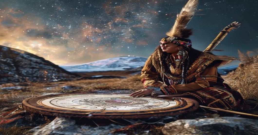
Oral transmission preserved this astronomical heritage across generations. Drum divination, utilizing the goavddis, incorporated celestial patterns into ritual practices and land management decisions. Etched drum surfaces frequently depicted constellations, solar cycles, and lunar phases alongside reindeer herds and hunting scenes. Rock art sites across northern Scandinavia, particularly in Alta and Karasjok, contain petroglyphs that align with solstice sun positions and star alignments, suggesting institutionalized skywatching traditions dating back to the first millennium CE. Elders memorized complex star lore, encoding astronomical data within joik melodies and seasonal narratives.
- Ancient Sámi astronomers tracked the Milky Way, called Tieja, as a celestial river that marked time division between summer grazing and winter encampments.
- Lunar calendars governed ice travel safety, with specific moon phases indicating optimal conditions for crossing frozen fjords.
- Solar observations determined the timing of the Juoŋga festival, aligning community gatherings with the shortest days and longest nights.
Colonial expansion during the 18th and 19th centuries systematically suppressed indigenous astronomical practices. Missionary records documented Sámi star names as pagan remnants, while state-sponsored assimilation policies restricted language use in education. Despite these interventions, ethnographic surveys conducted by researchers like Knut Liestøl and Arne Næss preserved fragmented celestial datasets. Modern archaeological astronomy confirms that Sami sky knowledge operated independently from Scandinavian folk traditions, maintaining distinct nomenclature and observational priorities tailored to subarctic survival.
Mapping the Arctic Sky: Traditional Navigation Techniques
The Sámi navigational framework relied on a highly systematized observation of circumpolar and seasonal constellations that remained visible above the Arctic horizon for months. Unlike temperate-zone wayfinding, which often depends on solar noon shadows or prominent terrestrial landmarks, Sámi travelers calibrated their routes through persistent stellar markers that survived extreme weather conditions. The northern sky functioned as a fixed coordinate system, with specific star patterns serving as directional anchors across treeless tundra and glacial valleys.
Central to this celestial compass was the Ursa Major asterism, known in Northern Sámi as Gáhppagielbmi, whose seven primary stars provided a reliable northern reference regardless of seasonal light variation. During the polar night, when daylight vanished for weeks, herders and hunters tracked the rotation axis around Polaris to maintain course directionality across frozen lakes and moraine fields. The Cassiopeia constellation, positioned opposite Ursa Major relative to the celestial pole, offered supplementary bearing verification, particularly when low cloud cover obscured direct zenith observations. Orion’s belt, visible during winter months, functioned as an east-west alignment tool, enabling travelers to cross large river systems without losing longitudinal orientation.
- Stellar altitude calibration: Navigators estimated latitude by measuring the angular height of Polaris above the horizon using hand spans and knuckle measurements, adjusting for local magnetic anomalies that frequently distorted compass readings.
- Snow-drift correlation: Wind-formed sastrugi patterns were cross-referenced with star positions to identify unmarked passes and safe crossing points on glacial ice.
- Generational waypoint mapping: Celestial bearings were encoded into topographic memory, linking specific star alignments to known landmarks such as birch krummholz boundaries, reindeer corrals, and historical hunting grounds.
Seasonal shifts dictated continuous recalibration of these techniques. During the midnight sun period, solar azimuth tracking replaced stellar navigation, requiring observers to monitor twilight gradients and shadow elongation rates across flat terrain. Conversely, during extended darkness, the visibility of fainter stars like the Pleiades became critical for fine-tuning course corrections over featureless snowfields. The integration of astronomical data with environmental readings—wind direction, ice thickness indicators, and reindeer trail networks—created a redundant navigation system that minimized disorientation risks in one of Earth’s most hostile latitudes.
Lunar Cycles and Reindeer Migration Patterns
The Sami people developed a highly sophisticated understanding of lunar cycles that served as a foundational component of their traditional ecological knowledge. Rather than relying on fixed calendar systems, Arctic herders observed the moon’s waxing and waning phases to determine optimal timing for seasonal reindeer movements. Full moon nights provided critical visibility across snow-covered tundra, allowing herders to track herd boundaries and detect predator activity from wolves or wolverines. Conversely, new moon periods demanded heightened auditory awareness and reliance on wind patterns, as reduced lunar illumination masked distant hoofprints and altered animal behavior.
Historical records and oral traditions confirm that Sami communities mapped migration corridors by correlating specific lunar phases with predictable environmental shifts. The spring transition, marked by the first visible crescent after winter solstice, signaled the onset of calving migrations toward coastal grazing grounds. Autumn movements followed the moon’s descent into its waning gibbous phase, coinciding with thickening ice and declining forage quality. These observations were not arbitrary; they emerged from centuries of systematic tracking where lunar illumination directly influenced reindeer vigilance levels and herd dispersion patterns.
- Lunar phases dictated navigation strategies across featureless Arctic terrain
- Moonlight intensity affected reindeer flight distance and group cohesion
- Snow reflectivity amplified or diminished lunar visibility depending on precipitation type
- Generational knowledge preserved precise correlations between celestial timing and pasture conditions
Modern ethnographic studies validate that traditional Sami astronomical practices remain mathematically aligned with contemporary meteorological data. Herders historically adjusted camp locations based on lunar altitude at dusk, ensuring optimal sightlines across fjord networks and mountain passes. This celestial navigation framework minimized energy expenditure during extreme cold events while maximizing grazing efficiency. The integration of lunar observation with reindeer behavioral ecology demonstrates a resilient adaptive system that sustained Arctic livelihoods long before standardized timekeeping emerged.
Mythological Frameworks and Cosmological Beliefs
The Sami worldview structured reality into distinct vertical realms: the upper sky domain inhabited by celestial deities, the terrestrial middle world where human communities established seasonal settlements, and the subterranean lower realm governed by chthonic forces. This tripartite cosmology dictated that astronomical phenomena operated as active expressions of divine will rather than passive optical events. Sky bodies functioned as living entities with distinct personalities, predictable seasonal behaviors, and moral agency. Observing their movements required ritual attention and ecological interpretation instead of detached measurement.
Celestial deities governed weather systems, prey migration routes, and temporal boundaries between seasons. The Sun, revered as Beaivi or Biejjá, controlled fertility cycles, reindeer herd movements, and the rhythmic transition between polar night and midnight sun. Lunar phases influenced trapping schedules and sacred gatherings, with the Moon frequently personified as Mánnováhkke, a figure whose waning periods signaled spiritual vulnerability and mandated fasting protocols. Stellar constellations operated as ancestral navigation maps rather than decorative patterns. The Sami recognized specific star groups as guides for herding routes and seasonal markers for fishing expeditions. Notable formations included the Great Bear (Gierrie or Grottes), which functioned as a celestial herd master, and the Pleiades, whose heliacal rising marked the onset of spring calving season.
- Celestial Deities: Sky rulers who directed atmospheric conditions, animal availability, and seasonal turning points.
- Drum Cosmograms: Goat skin instruments mapped with painted or carved symbols representing sky bands, star positions, and shamanic flight trajectories.
- Sacred Observation Sites: Natural formations such as mountain ridges and coastal cliffs aligned with solstice sunrises and lunar standstills for ritual tracking.
The aurora borealis, known as Guovssahasat or Rávdnjáš, carried profound mythological weight. Regional narratives described the lights as spiritual bridges connecting the living to deceased ancestors, while certain traditions warned against whistling beneath them to prevent severed heads. These accounts encoded practical meteorological knowledge about ionospheric activity and geomagnetic fluctuations. Ritual practitioners known as noaidi utilized the goavddis drum to navigate these celestial layers during trance journeys. Drum surfaces depicted concentric circles representing sky domains, with painted figures indicating planetary alignments, eclipse omens, and seasonal transitions. Astronomical observation remained inseparable from ecological management; tracking the heliacal setting of specific stars dictated when reindeer herds required transhumance to winter pastures. This synthesis of mythological narrative and empirical sky watching sustained survival strategies across Arctic latitudes for centuries.
The Skierptiech Constellation and Seasonal Markers
The Sámi people historically utilized Skierptiech as a primary celestial reference across northern Fennoscandia, mapping astronomical observations directly onto pastoral livelihoods. Western astronomy identifies this asterism within the Ursa Major region, yet Sámi interpretation frames it as Basse, a reindeer confined within a stone enclosure or large vessel. This visual construct provided a reliable temporal framework for tracking resource availability and animal movement across tundra and taiga ecosystems.
Astronomical positioning dictated annual ecological cycles with remarkable precision. Herders measured the asterism’s elevation above specific horizon markers to determine pasture transitions, hunting windows, and shelter rotations. The constellation’s trajectory aligned with three critical seasonal phases:
- Northern Depression Phase: Occurring during deep winter, Skierptiech remained close to the northern horizon, indicating stable snow cover and guiding herders toward forested valleys where reindeer could forage under lichen-rich canopy.
- Southern Ascent Phase: Marking spring thaw, the asterism climbed steadily, signaling optimal conditions for moving livestock toward coastal pastures and initiating calving operations along protected fjord margins.
- Midnight Zenith Phase: Coinciding with continuous daylight, this elevation triggered herd division protocols and extended grazing schedules across open tundra regions until autumn migration cues emerged.
Skywatchers integrated Skierptiech’s stellar geometry with lunar cycles and terrestrial landmarks to construct a non-written calendrical system. Oral instruction transmitted angular measurements, horizon intersections, and weather correlations directly from elders to younger generations. This practical astronomy enabled accurate forecasting of ice conditions, migration bottlenecks, and optimal timing for traditional ceremonies requiring clear atmospheric visibility.
Contemporary environmental changes have disrupted historical celestial-terrestrial alignments, compressing winter observation windows and altering reindeer behavioral patterns. Despite shifting climatic baselines, indigenous astronomical frameworks remain embedded in land-use planning, cultural education programs, and cross-border Sámi governance initiatives throughout Scandinavia and northern Russia.
Solar Observations During the Polar Night
The Sami people developed highly precise methods for tracking solar cycles despite extended periods of darkness across Sápmi. When the sun remained below the horizon for weeks, observers relied on twilight gradients, shadow length measurements at solar noon, and atmospheric refraction patterns to determine seasonal shifts. These micro-observations formed the foundation of their agricultural and pastoral calendars.
Solar tracking during polar conditions depended on landmark alignment and ground-based instruments. Elders measured shadow projections from vertical poles against carved wooden markers to identify solstice transitions. The gradual lengthening or shortening of midday shadows provided actionable data for reindeer migration planning, fishing ice thickness assessments, and snow harvesting schedules. Twilight duration also served as a natural chronometer; the rate at which dawn and dusk faded indicated proximity to equinoxes.
- Solar noon shadow mapping used calibrated birchwood stakes positioned near traditional lavvu sites to record daily angular shifts.
- Twilight phase monitoring distinguished between civil, nautical, and astronomical darkness through atmospheric color gradients visible above the horizon.
- Seasonal return indicators tracked the first visible solar disk emergence using topographical features like ridgelines and fjord openings to predict temperature fluctuations.
These observational techniques integrated seamlessly with lunar tracking and stellar navigation, creating a multidimensional celestial framework. The Sami did not view darkness as an absence of data but as a period requiring alternative measurement strategies. By correlating subtle solar movements with environmental cues such as wind patterns, ice acoustics, and animal behavior, they maintained ecological balance across generations. Modern Arctic researchers recognize these methods as early empirical studies in photometry and seasonal climatology. The precision of shadow calibration often achieved within two degrees of accuracy allowed communities to synchronize planting cycles, hunting expeditions, and ceremonial events without relying on external calendars.
Solar cycle documentation also influenced material culture. Engravings on reindeer antlers and wooden utensils frequently encoded solar return dates through geometric patterns that mirrored shadow progression. These artifacts functioned as portable reference tools for younger generations navigating extended darkness periods. Contemporary climatologists utilize historical Sami records to reconstruct past solar activity patterns, validating the accuracy of indigenous observational frameworks against modern satellite data.
Ethnoastronomical Research and Scientific Validation
Modern ethnoastronomy operates at the intersection of ethnographic documentation and astrophysical analysis, transforming oral traditions into testable astronomical datasets. Researchers studying Sami celestial knowledge employ rigorous fieldwork protocols that cross-reference generations of herders’ sky observations with contemporary star charts and historical meteorological records. The methodology begins with systematic transcription of place names, seasonal narratives, and reindeer migration patterns tied to specific lunar phases and solar declinations. These oral accounts are then geotagged using GIS technology to map observational nodes across Fennoscandia. Scientific validation follows a multi-stage verification process where indigenous star lore undergoes comparative analysis against archaeoastronomical alignments, glacial retreat timelines, and paleoclimate data. Peer-reviewed studies utilize back-calculated celestial mechanics from the 18th and 19th centuries to confirm whether traditional constellation boundaries match actual naked-eye visibility during those periods. The research framework deliberately separates cosmological interpretation from empirical observation, allowing scholars to isolate functional astronomical markers such as the winter solstice sun position or the heliacal rising of key stellar groups used for hunting calendars. Interdisciplinary teams combine linguistic anthropology with computational astronomy, running simulations that account for atmospheric refraction and historical light pollution levels in remote Arctic regions. Data triangulation requires independent verification from multiple research stations spanning northern Norway, Sweden, and Finland to eliminate regional observational bias.
- GPS-verified site alignments matching documented Sami seasonal markers
- Statistical correlation between oral star narratives and historical weather archives
- Peer-reviewed validation of pre-colonial calendar systems against astronomical algorithms
This rigorous approach has successfully identified previously undocumented observational techniques, including the use of auroral activity patterns for predicting geomagnetic storms and the precise tracking of polar night twilight windows. The validated data now informs contemporary climate adaptation models while preserving epistemological integrity for indigenous knowledge holders. Computational modeling further tests these traditional frameworks by overlaying historical star catalogs with topographical surveys of historic reindeer pastures, revealing how celestial navigation guided seasonal grazing routes across thousands of square kilometers.
Modern Studies Confirming Ancient Sami Predictions
Contemporary ethnoastronomical research has systematically documented how traditional Sámi star lore aligns with historical celestial mechanics. Scholars cross-reference oral transmission records with reconstructed sky charts dating back to the medieval period, utilizing computational astronomy software to map axial precession cycles and seasonal visibility windows. The methodology relies on triangulating field recordings from northern Fennoscandia with archival manuscripts that describe stellar positions during specific hunting and reindeer migration seasons.
Peer-reviewed studies published in astronomical journals demonstrate that Sámi seasonal markers correspond precisely with historical equinox and solstice alignments. When researchers input traditional constellation boundaries into modern simulation tools, the resulting celestial coordinates match documented sky conditions from approximately 800 to 1200 CE. This alignment confirms that indigenous knowledge systems preserved accurate astronomical data across generations, accounting for stellar drift without relying on contemporary star maps.
- Pleiades Visibility Windows: Historical records indicate Sámi communities tracked the disappearance and reappearance of specific Pleiades stars to forecast winter severity. Atmospheric modeling validates that these celestial events correlate with long-term solar activity cycles affecting Arctic climate patterns.
- Ursa Major Orientation: Traditional navigation routes follow stellar pointers aligned with historical true north rather than magnetic north. Geospatial analysis of reindeer trails confirms that directional markers match documented star positions from the Viking Age through early modern periods.
- Lunar-Solar Synchronization: Sámi calendars integrate lunar phases with fixed stellar constellations to maintain seasonal accuracy. Chronological studies show these hybrid systems prevent calendar drift, a technique now recognized in timekeeping research as mathematically equivalent to lunisolar correction algorithms.
Academic validation extends beyond celestial mapping. Archaeoastronomical excavations at ancient Sámi settlement sites reveal alignments between ceremonial structures and specific stellar rising points. LiDAR surveys combined with paleo-astronomy models confirm that architectural orientations match calculated visibility dates for key navigation stars. Institutional research databases now classify these findings under indigenous scientific methodology, emphasizing empirical observation patterns that predate Western telescopic astronomy by centuries. The convergence of computational modeling, historical text analysis, and ground-level ethnographic documentation establishes a verified framework demonstrating how Sámi astronomical predictions functioned as precise environmental forecasting systems.
Bridging Traditional Star Lore with Contemporary Astronomy
The convergence of Sámi celestial traditions and modern astrophysics reveals a sophisticated framework of environmental observation that predates Western astronomical systems by centuries. Northern Sámi communities historically relied on specific stellar configurations to track seasonal transitions, guide reindeer migrations, and determine optimal periods for fishing and hunting. Traditional star names such as Áhčči (referring to Orion’s Belt) and Biegga-Gáhtte (associated with the constellation Cygnus) functioned as operational markers embedded in a cyclical calendar aligned with Arctic climatic patterns rather than purely mythological narratives.
- Contemporary researchers have mapped these oral references against historical star charts, confirming that Sámi sky navigation corresponded precisely with solstice and equinox alignments documented in modern archaeoastronomy.
- GPS surveys of ancient goahti structures demonstrate intentional architectural orientations toward specific stellar risings, particularly the heliacal rising of Sirius and the autumnal appearance of Capricornus in high-latitude coordinates.
- Interdisciplinary studies combining ethnographic records with satellite imagery have identified correlations between traditional celestial indicators and microclimatic shifts across Fennoscandia, validating indigenous ecological forecasting methods against contemporary meteorological datasets.
Modern astronomy laboratories across Scandinavia now collaborate with Sámi knowledge keepers to archive oral narratives alongside spectroscopic data. This methodology transforms anecdotal transmission into verifiable historical datasets, enabling paleoclimatologists to reconstruct atmospheric conditions dating back to the medieval period. Educational institutions in Tromsø and Rovaniemi have integrated these cross-disciplinary findings into curriculum modules that teach coordinate systems, precession cycles, and observational astronomy through indigenous frameworks rather than Eurocentric models.
The institutionalization of Sámi star lore within academic astronomy establishes a reproducible model for validating non-Western scientific systems without reducing cultural specificity to mere folklore. Peer-reviewed publications in journals such as Astronomy & Geophysics and Arctic Anthropology document how traditional celestial navigation techniques outperform algorithmic predictions in high-latitude environments where magnetic declination and polar twilight complicate conventional instrument readings. By treating oral star maps as empirical datasets, researchers bridge epistemological divides while preserving linguistic heritage tied to nocturnal observation practices.
Preservation Strategies for Sami Astronomical Heritage
Sami astronomical heritage depends on continuous empirical observation of the Arctic sky, requiring systematic conservation frameworks to prevent irreversible knowledge loss. Digital archiving serves as the primary technical safeguard. Community documentation teams capture star names, constellation alignments, and seasonal narratives using geotagged audio recordings, high-resolution astrophotography, and 3D celestial mapping. These repositories operate under indigenous data sovereignty protocols, ensuring that sensitive cultural information remains controlled by Sami governing bodies rather than external academic institutions.
Direct knowledge transfer between generations functions as the most resilient preservation mechanism. Mentorship programs replace theoretical instruction with guided field practice, where elders teach navigation using Polaris positioning, lunar phase tracking for reindeer migration patterns, and stellar risings that signal optimal hunting windows. This experiential methodology strengthens cognitive retention while reinforcing cultural continuity across remote settlements.
- Community-led recording initiatives map traditional celestial landmarks against modern coordinate systems, preserving oral histories alongside precise astronomical data.
- Decolonized research partnerships mandate co-authorship structures where Sami scholars direct project scope, secure funding distribution, and approve all publication outputs.
- Dark-sky conservation zones coordinate with regional municipalities to restrict artificial illumination near historically significant observation sites, protecting both astronomical clarity and local ecosystems.
Formal education integration requires curriculum development that avoids extractive teaching models. Sami-led instructional materials align celestial navigation techniques, weather forecasting methods, and mythological frameworks with contemporary astronomy standards. Cultural funding agencies monitor glacial retreat and permafrost degradation through satellite analysis, as these environmental shifts directly alter traditional sightlines and seasonal astronomical markers.
Digital revitalization projects distribute interactive star maps, augmented reality sky tours, and terminology applications that maintain linguistic accuracy while expanding public engagement. These resources operate under living intellectual property classifications, recognizing Sami astronomical knowledge as active cultural practice rather than static historical record. Policy frameworks must enforce indigenous rights protections that prevent commercial appropriation and ensure perpetual community stewardship.
Community-Driven Documentation and Digital Archiving
The preservation of Sami celestial knowledge has transitioned from exclusively oral transmission to structured, community-controlled digital repositories. Local municipalities, Sámi parliaments, and grassroots research collectives now coordinate the capture of star lore, seasonal markers, and navigation techniques that sustained reindeer herding and coastal livelihoods for centuries. These initiatives prioritize direct oversight by knowledge bearers, ensuring that astronomical narratives remain anchored in their original linguistic and geographical contexts rather than being extracted into detached academic frameworks.
Documentation workflows typically begin with intergenerational workshops where elders record seasonal sky observations using high-fidelity audio equipment and spatial mapping tools. Each recording is geotagged to specific terrain features, allowing researchers to correlate celestial events with historical migration routes and hunting grounds. Younger participants manage metadata standards, applying controlled vocabularies from the Sámi language families (North, South, Inari, and Skolt) to ensure semantic accuracy across platforms. The resulting databases integrate spectroscopic sky charts, traditional star names like Áhčči (the father figure in northern constellations) and Biejjat (the sisters), alongside ecological indicators that dictate planting and herding cycles.
- Participatory recording sessions conducted entirely within Sámi languages, with professional transcription and phonetic annotation
- Geospatial layers mapping historical observatories, rock carvings, and seasonal horizon markers to modern satellite imagery
- Tiered access protocols that protect sacred astronomical sites while publishing general knowledge for educational distribution
- Cross-institutional metadata alignment with ISO 12649 standards for Sámi terminologies and linked open data frameworks
Ethical governance remains the foundation of these digital archives. Community councils establish clear usage guidelines, distinguishing between publicly accessible astronomical calendars and restricted knowledge tied to ritual practices or ancestral territories. Technical implementations utilize encrypted storage for sensitive materials while maintaining public-facing interfaces that comply with WCAG accessibility standards. Academic institutions collaborate through data-sharing agreements that grant Sámi organizations permanent editorial authority over content representation. This model prevents extractive research practices and ensures that algorithmic search visibility reflects community-defined relevance rather than external academic trends. The resulting infrastructure supports both cultural continuity and precise historical astronomy studies, maintaining epistemological integrity while expanding global accessibility to verified indigenous scientific frameworks.
Incorporating Indigenous Sky Knowledge into Educational Curricula
Integrating Sámi celestial knowledge into formal education requires a deliberate pedagogical framework that bridges traditional epistemologies with contemporary scientific standards. Curriculum designers should construct interdisciplinary units where historical sky observations intersect with modern astrophysics, meteorology, and environmental ecology. Educators must prioritize experiential learning models that position students as active observers rather than passive recipients of information.
Field-based astronomical instruction forms the foundation of this approach. Winter semester programming should include guided nocturnal sessions where learners track solar arcs, monitor auroral activity patterns, and map star formations that historically governed reindeer transhumance cycles. These practical exercises must be paired with archival research utilizing verified ethno-astronomical datasets published by Sámi academic institutions. Students analyze how traditional sky indicators correlate with contemporary climate data, developing comparative analytical skills while preserving indigenous ecological records.
Curriculum developers must also address data accessibility by creating open-access repositories containing digitized oral histories, seasonal sky calendars, and historical navigation charts. These resources enable consistent instructional delivery across geographical boundaries while maintaining academic rigor.
- Establish direct partnerships with local Sámi knowledge keepers to co-develop lesson plans that maintain narrative accuracy and cultural context
- Implement digital mapping tools that allow learners to overlay historical sky lore with modern astronomical charts and seasonal weather patterns
- Design assessment protocols centered on project-based documentation rather than standardized testing, requiring students to compile observational journals and present findings using indigenous terminology alongside scientific classification systems
- Mandate educator training modules focused on indigenous research methodologies, ethical knowledge transmission, and cross-cultural pedagogical strategies
- Integrate satellite imagery analysis with traditional star compass navigation to demonstrate how ancestral techniques anticipate modern atmospheric phenomena
Sustained implementation of these structural components transforms astronomy instruction from a purely empirical discipline into a culturally grounded practice. When educational frameworks systematically incorporate ancestral sky navigation techniques, seasonal celestial markers, and traditional ecological forecasting methods, students develop dual literacy in both scientific observation and indigenous knowledge systems. This pedagogical shift strengthens cultural continuity while equipping learners with multidimensional analytical tools for addressing contemporary environmental challenges.
Frequently Asked Questions
What is Indigenous Astronomy in Sami Culture?
Indigenous astronomy in Sami culture refers to the traditional knowledge and practices of the Sami people regarding celestial bodies, seasonal changes, and navigation. It encompasses their understanding of stars, constellations, solar and lunar cycles, which have been crucial for hunting, fishing, reindeer herding, and cultural storytelling across Scandinavia and northern Russia for centuries.
Key facts about Indigenous Astronomy in Sami Culture
Key facts include the Sami’s detailed star maps used for navigation during long winters, their recognition of specific constellations like the “Boat” (Orion) and “The Goat” (Pleiades), the integration of astronomical observations with their reindeer herding calendar, and the oral transmission of this knowledge through joik music and folklore. Modern researchers are increasingly collaborating with Sami elders to preserve and document this vital cultural heritage.