How Sami Communities Crossed Frozen Landscapes
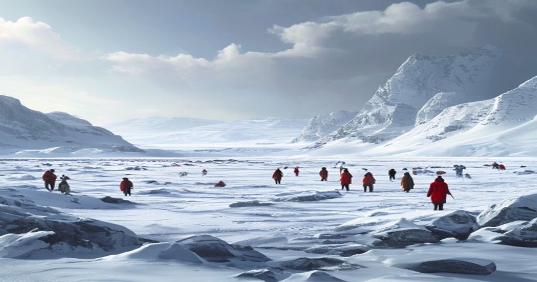
The Sámi people navigated Arctic tundra and frozen waterways for centuries through meticulously transmitted environmental intelligence rather than mechanical instruments. Ice stability dictated seasonal migration patterns, requiring constant assessment of thermal gradients and wind scour zones. Thin ice near river confluences concealed powerful subterranean currents, while sastrugi formations revealed prevailing storm directions that could rapidly compromise load-bearing capacity.
Mobility relied on specialized equipment engineered from regional materials. Wooden skis treated with pine resin reduced friction on crystalline snowpack, enabling hunters to cover twenty kilometers daily without sinking. Reindeer-drawn sleds utilized ash frames lashed with cured hide cordage, distributing weight across multiple animals to prevent individual exhaustion. Harness angles were calibrated to align with the dogs’ sternum structure, preserving joint integrity during prolonged expeditions.
Environmental reading formed the core of every crossing strategy. Travelers tapped ice surfaces with hollowed birch poles, interpreting acoustic resonance to identify structural defects before committing weight. Cloud formations and auroral activity signaled barometric shifts that could alter freeze rates within hours. Frost patterns on exposed bedrock indicated subsurface temperature variations, guiding route selection toward thermally stable corridors.
- Navigation: Topographic waypoints replaced magnetic compasses during whiteout conditions. Mountain ridges, frozen river bends, and glacial erratics created consistent reference points across featureless snowfields.
- Terrain Assessment: Wind direction determined snow accumulation patterns, highlighting hidden crevasses near lake edges and stream inlets.
- Resource Management: Multi-day crossings required calculated caloric intake. Dried reindeer meat and rendered fat provided sustained energy, while layered fur garments regulated thermoregulation without restricting joint mobility.
Campsite placement followed strict microclimate analysis. Locations near natural windbreaks prevented snow drift accumulation, while proximity to flowing water ensured meltwater availability during extreme cold snaps. Oral transmission mechanisms preserved these methodologies across generations, embedding survival intelligence into cultural practice rather than written documentation.
Ancient Migration Routes and Seasonal Pathways
The historical movement of Sami populations across Arctic and subarctic terrain relied on a sophisticated network of seasonal pathways that aligned with reindeer behavior, topographical features, and climatic cycles. These routes were not arbitrary trails but carefully calibrated corridors that shifted between highland summer pastures and lowland winter feeding grounds. The transition periods required precise timing, dictated by snow depth, wind direction, and the availability of lichens beneath the ice crust. Herders navigated using visual markers such as glacial moraines, exposed bedrock formations, and distinct tree lines, while also interpreting animal migration patterns and solar angles for orientation during prolonged darkness.
Each corridor functioned as a dynamic system rather than a fixed line. In spring, communities followed meltwater channels and emerging vegetation zones to guide reindeer away from deep snowpacks. Summer passages traversed wind-swept plateaus where insect pressure decreased and grazing remained optimal. Autumn migrations demanded rapid movement across thinning ice fields before freeze-up trapped herds in inaccessible terrain. Winter routes utilized sheltered valleys, coastal fjords, and birch forest edges where wood supply and fuel sources sustained temporary camps. The knowledge of these pathways was encoded in oral narratives, drum illustrations, and place names that mapped resource availability across generations.
- Highland Summer Corridors: Elevated routes avoided mosquito swarms and provided access to nutrient-rich alpine vegetation critical for post-winter recovery.
- Coastal Winter Arteries: Saltwater-influenced zones prevented snow compaction, allowing reindeer to excavate ground lichen beneath frozen crusts.
- River Valley Transitions: Natural drainage lines served as windbreaks and navigation guides during whiteout conditions common in late winter.
Modern political boundaries frequently intersect these historical pathways, fragmenting traditional movement patterns. The underlying ecological logic remains unchanged. Reindeer require specific forage cycles, snow stability determines herd mobility, and microclimates dictate camp placement. Contemporary herders still reference ancestral route markers, adjusting modern tracking technology with time-tested environmental readings. The continuity of these seasonal corridors demonstrates how Arctic communities transformed geographic constraints into sustainable mobility frameworks, maintaining ecological balance while ensuring cultural transmission across millennia.
Reindeer Herding Corridors Across Boreal Terrain
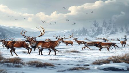
The reindeer herding corridors that traverse the boreal terrain function as dynamic ecological arteries, linking high-altitude winter grazing zones with lowland summer pastures across northern Scandinavia and Siberia. These routes are not arbitrary paths but carefully calibrated networks shaped by centuries of environmental observation. The boreal forest, characterized by dense coniferous canopies, permafrost pockets, and nutrient-poor soils, dictates movement patterns through seasonal resource distribution. Lichen beds, particularly Cladonia species, form the nutritional backbone of winter survival, requiring herders to follow topographical features that minimize snow compaction while maximizing foraging efficiency.
Navigating these corridors demands precise reading of microclimates and terrain gradients. Herders utilize wind-scoured ridges, frozen river valleys, and moraine deposits as natural guideposts during whiteout conditions. The density of the canopy directly influences solar radiation retention, which in turn affects snow crust formation a critical factor that determines whether reindeer can penetrate to their forage. Communities map these pathways using generational memory, noting where ice layers fracture predictably and where shallow soil over bedrock exposes mineral licks essential for dietary balance.
- Topographical continuity ensures minimal energy expenditure during seasonal migrations, with routes avoiding steep inclines that stress aged or pregnant animals.
- Hydrological markers such as thawing streams and frozen wetlands serve as temporal indicators, signaling when to shift from forested winter grounds to open tundra pastures.
- Vegetation stratification dictates corridor width; dense undergrowth narrows passage during autumn rutting periods when herd cohesion is paramount.
- Predator avoidance vectors influence route selection, with herders historically routing groups along cliff edges and wind-exposed plateaus where wolves and wolverines struggle to maintain pursuit.
Maintenance of these corridors relies on active landscape stewardship rather than passive observation. Traditional practices include controlled burning of overgrown shrublands to stimulate lichen regeneration, strategic placement of salt blocks at corridor intersections, and seasonal blocking of unauthorized trails that fragment herd movement. The knowledge system embedded in these routes operates on a multi-decadal cycle, tracking shifts in snowpack depth, tree line elevation, and predator range expansion. Modern herding operations now integrate satellite telemetry with ancestral route mapping, identifying where glacial melt patterns are altering traditional water crossings and where infrastructure development encroaches upon critical migration bottlenecks.
Climate volatility has introduced new parameters to corridor management. Warmer winters produce ice layers that seal lichen beneath impenetrable crusts, forcing herders to extend routes into higher elevations or adjacent watersheds. Permafrost degradation creates unstable ground conditions in historically reliable passages, requiring real-time route adjustments and temporary corridor closures. Despite these pressures, the structural integrity of reindeer herding networks remains anchored in place-based knowledge, where terrain features are read not as static boundaries but as living indicators of ecosystem health.
Navigational Mastery on Ice and Snow
Navigating frozen tundra and dense boreal forests required an intimate understanding of microclimates, terrain psychology, and seasonal shifts. Sami herders developed a layered approach to orientation that relied on continuous environmental feedback rather than fixed cartographic references. Wind-driven snow formations served as primary directional indicators. Cornices formed on leeward slopes consistently pointed away from prevailing storm directions, while saivu patterns revealed the exact trajectory of recent weather systems. Cross-country skiers tracked these drift lines to maintain course when visibility dropped below fifty meters.
Directional accuracy depended on multiple overlapping reference points. Fallen trees indicated historical wind direction and forest density changes. Ridges created natural wind corridors that altered snow compaction rates, allowing travelers to distinguish open tundra from sheltered valleys. Water bodies remained critical anchors because frozen lakes displayed distinct fracture patterns that aligned with magnetic north and topographic contours.
- Reading saivu markers placed at historical crossing points
- Monitoring reindeer migration routes for consistent terrain traversal
- Utilizing star positions during polar night periods
- Interpreting ice coloration to determine safe passage zones
- Following animal tracks through deep powder when visual landmarks vanished
Astronomical observation formed the secondary layer of this system. During winter months, Polaris provided a stable northern reference, while moon phase cycles dictated travel timing and route selection. The Sami tracked lunar illumination to predict daylight duration and plan expeditions accordingly. Biological indicators complemented celestial navigation. Bird flight patterns signaled approaching fronts, and wolf howls helped calibrate distance across flat expanses where depth perception failed.
Knowledge transmission occurred through deliberate spatial mapping exercises conducted during communal gatherings. Elders guided youth through blindfolded orientation drills, reinforcing tactile recognition of snow hardness variations and ground elevation changes. This pedagogical method ensured that navigational competence survived generations without reliance on written instruments. Modern climate shifts have altered traditional ice stability patterns, yet the underlying principles remain embedded in indigenous wayfinding protocols.
Reading Wind Patterns and Snow Drift Formations
The traditional Arctic traveler depended on precise atmospheric observation to interpret surface stability across frozen terrain. Wind direction dictated snow redistribution, transforming uniform blankets into complex topographical layers that either facilitated travel or concealed hidden hazards. Prevailing winds scoured windward exposures, leaving thin crusts directly over ice surfaces. These zones demanded immediate weight distribution strategies, as the lack of insulating snow allowed rapid heat loss from underlying water bodies. Leeward slopes accumulated dense, wind-packed slabs that often formed hard rind layers capable of supporting sled loads, yet these same formations frequently trapped weak basal planes beneath their compressed structure. Navigators evaluated drift height and gradient to determine safe passage corridors, avoiding steep leeward faces where cornice development threatened sudden collapse.
- Sastrugi ridges aligned parallel to wind direction provided reliable indicators of sustained airflow strength and recent storm trajectories.
- Katabatic drainage flows settled in depressions, creating deep powder pockets that obscured true ground elevation and ice thickness variations.
- Windward ice surfaces exhibited polished, glassy textures from abrasive crystal scouring, signaling load-bearing capacity but also rapid thinning during temperature fluctuations.
- Leeward drifts displayed stepped fracture lines where wind-loaded snow compressed against terrain barriers, requiring careful route selection to prevent sliding fractures.
Seasonal shifts altered these patterns systematically. Winter gales consolidated snow grains through sublimation and refreezing cycles, producing granular layers that responded predictably to pressure testing. Spring temperature swings generated melt-freeze crusts on wind-exposed surfaces, altering traction dynamics for reindeer sled runners. Experienced guides tracked horizon visibility reduction caused by blowing snow plumes, using these atmospheric cues to anticipate sudden whiteout conditions. By correlating ridge orientation with distant glacial features and tundra drainage channels, travelers constructed mental navigation matrices that updated daily through tactile surface feedback and visual survey techniques. This environmental literacy enabled safe passage across thousands of kilometers of dynamic frozen ground without relying on modern instruments. Direct wind measurement through snow crystal density gradients revealed underlying ice stability, as prolonged exposure accelerated basal evaporation while sheltered zones retained moisture pockets that indicated thicker frozen strata below.
Landmark Recognition Without Compass Dependency
The Sami people historically traversed vast, featureless tundra and snow-covered mountains long before modern navigational tools existed. Their survival depended on an acute understanding of the environment through visual cues. In absence of a magnetic compass, they developed sophisticated landmark recognition systems. These included identifying specific mountain peaks, rock formations, river bends, and even subtle variations in snow drift patterns shaped by prevailing winds.
- Terrain Triangulation: Navigators memorized sightlines between fixed topographic features, calculating bearings through repeated visual cross-referencing rather than instrument measurement.
- Vegetation Indicators: The orientation of lichen growth on northern tree trunks provided reliable directional markers across boreal zones, while moss density signaled moisture retention and sheltered valleys.
- Snow Texture Analysis: Wind-sculpted sastrugi patterns revealed prevailing atmospheric flow, allowing travelers to maintain consistent headings during whiteout conditions when visual horizons disappeared.
Sun position during winter months offered limited but crucial reference points for timing and general bearing. Reindeer migration routes also served as established pathways, with communities memorizing seasonal waypoints embedded in the topography. Rock cairns marked safe passages across treacherous ice fields and glacial valleys, functioning as permanent wayfinding anchors. Each family or regional group maintained oral maps passed through generations, embedding geographic knowledge into cultural narratives.
Navigational strategy shifted dynamically with weather conditions. Whiteout blinding forced travelers to rely on tactile feedback from snow texture and wind direction against their face. The Sami also utilized natural light refraction
Survival Techniques in Subzero Arctic Environments
The Sami people developed highly specialized survival protocols to traverse frozen Fennoscandian terrain during extreme winter expeditions. Central to their endurance was a layered clothing system crafted from reindeer hide, which trapped insulating air pockets while remaining breathable during physical exertion. The inner layer featured fine deerskin for moisture wicking, while the outer coat incorporated un-tanned fur to shed wind and precipitation. Footwear utilized dual-layer construction with dried grass inserts and soles made from elk or reindeer leg skin, providing critical traction on ice and reducing heat loss through direct ground contact.
- Thermal Regulation & Layering: Garments were tailored to allow joint flexibility without compromising coverage. Leather toggles and drawstrings created adjustable ventilation points that prevented sweat accumulation during uphill crossings, directly mitigating hypothermia risk.
- Firecraft in Extreme Cold: Traditional ignition relied on dry lichen packed into birch bark cups and struck with iron pyrite. The Sami stored tinder within hollowed reindeer antlers, keeping it dry under clothing against the skin for immediate use when temperatures dropped below minus thirty degrees Celsius.
- Nutritional Strategy: Expeditions carried frozen reindeer muscle strips, rendered fat in bladder pouches, and bone marrow extracted using iron tools. Consuming raw fat provided rapid caloric conversion, while small frequent meals maintained core temperature without triggering metabolic crashes common in prolonged fasting.
- Snow Shelter Engineering: When blizzards struck unexpectedly, travelers excavated wind-scoured depressions into deep snowpacks. Reinforcing walls with packed ice blocks and sealing entrances with reindeer hides created microclimates that retained body heat while blocking wind chill.
- Ice Thickness Assessment: Crossings over frozen waterways required precise structural evaluation. Travelers drove reinforced iron spikes into the surface at intervals, listening for acoustic resonance to differentiate between safe blue ice and dangerous white ice formations laden with trapped air bubbles.
Route planning depended on interpreting natural indicators across vast distances. The Sami tracked reindeer urine crystals in snow drifts, identified wind direction through lichen growth patterns on northern tree lines, and measured temperature gradients by comparing shadow lengths against known topographical features. Emergency signaling utilized reflective ice mirrors crafted from polished metal fragments, directing sunlight toward distant settlements or neighboring herding groups during whiteout conditions.
These methodologies emerged from centuries of iterative adaptation rather than theoretical design. Each technique addressed specific physiological threats unique to subzero exposure, including rapid conduction loss, frostbite progression, and cognitive impairment from oxygen deprivation at altitude. Modern Arctic researchers continue to validate the efficiency of these practices through material testing and thermoregulatory modeling.
Constructing Temporary Ice Shelters and Windbreaks
The construction of temporary shelters and windbreaks during frozen migrations relied on precise environmental reading and rapid resource utilization. Sami travelers identified stable ice formations along riverbanks, fjords, or lake edges where snow accumulation provided natural insulation. Solid ice served as a rigid foundation, while compacted snow blocks formed the primary structural walls. Builders selected ice slabs measuring approximately thirty to fifty centimeters in thickness, ensuring each piece was free of fractures that could compromise load distribution.
The assembly process followed a crisscross stacking method, mirroring traditional log cabin techniques but adapted for slippery surfaces. Each layer interlocked with the one below, creating friction that prevented lateral shifting under wind pressure. Windbreaks required strategic orientation relative to prevailing Arctic gales. Teams positioned compacted snow walls at a forty-five-degree angle to channel airflow upward rather than allowing it to strike the shelter directly. The outer faces were often smoothed using reindeer antlers or wooden scrapers, reducing surface turbulence and minimizing snow drift formation around the structure.
Reinforcement came from spruce branches woven through ice seams, acting as natural rebar that held fractured blocks together during temperature fluctuations. Reindeer hides stretched over frameless supports created secondary wind barriers, their dense hair trapping still air and dramatically lowering convective heat loss. Interior insulation depended on layered ground coverings. Dried grasses, reindeer moss, and split pine bark formed a thermal barrier between occupants and the conductive ice floor. Ventilation holes drilled near ceiling height prevented carbon dioxide accumulation while allowing moisture to escape, maintaining structural integrity against interior condensation.
- Material Selection: Ice slabs required specific density thresholds to withstand compression without shattering under foot traffic or snow load.
- Structural Mechanics: Interlocking joints distributed shear forces evenly across the entire wall plane, eliminating stress concentration points.
- Thermal Management: Layered ground coverings reduced conductive heat transfer by up to seventy percent compared to direct ice contact.
These shelters required minimal tools but demanded extensive knowledge of snowpack density, wind shear patterns, and ice thickness variations. Successful construction reduced exposure time by hours, directly impacting survival rates during rapid weather shifts or forced detours across unstable sea ice.
Caloric Intake and Frostbite Prevention Methods
Crossing vast frozen territories demanded a precise balance between energy expenditure and metabolic recovery. Traditional Sami sustenance relied heavily on dense, slow-burning nutrients derived from reindeer herds. Dried venison strips, known as suovas, provided sustained protein release without requiring immediate digestion. Reindeer fat, rendered and stored in hollowed bones or birch bark containers, served as the primary caloric foundation. Each gram of animal fat yields more than twice the energy of carbohydrates, making it essential for maintaining core temperature during multi-day treks across snow-covered plateaus.
- Blood and marrow consumption delivered rapid iron and mineral replenishment after exertion, preventing early fatigue and circulatory collapse in sub-zero conditions.
- Fermented reindeer milk introduced beneficial bacteria that enhanced nutrient absorption while supplying liquid calories without melting snow or carrying heavy water supplies.
- Lichen paste (reindeer moss) acted as a carbohydrate reserve during late winter when fresh meat was scarce, though it required prolonged boiling to neutralize usnic acid.
Frostbite mitigation operated on physiological and behavioral principles rather than reactive treatment. Skin exposure was minimized through layered reindeer hide garments tailored to wind direction and activity level. The outer tunic featured a shaggy exterior to shed ice crystals, while the inner lining trapped insulating air pockets near the epidermis. Feet received specialized attention: double-layered wool socks worn over split reindeer hides allowed moisture wicking during movement, followed by dry fur boots when stationary. Applying rendered fat to exposed facial skin created a hydrophobic barrier that reduced evaporative cooling and prevented ice crystal adhesion.
Strategic pacing dictated daily progress. Travelers synchronized rest intervals with wind shifts, using snow trenches as temporary windbreaks to lower convective heat loss. Body heat was actively redistributed through partner sharing inside fur-lined travel bags during sudden whiteout conditions. Fire preparation remained secondary to movement efficiency; carrying dry birch bark and resin-soaked pine knots allowed rapid ignition when shelter construction became necessary. Navigation relied on reading snow drift patterns and air temperature gradients, enabling communities to identify wind-scoured ridges where frostbite risk dropped significantly due to reduced moisture saturation.
Cultural Rituals Embedded in Winter Journeys
Winter travel among the Sami functioned as a continuous ceremonial practice rather than simple logistics, embedding ecological preservation within daily survival routines. Reindeer migration patterns dictated movement, yet each departure required specific preparatory rites that maintained intergenerational knowledge transfer. Elders conducted offerings at sieidi sites before crossing frozen fjords or navigating mountain passes, establishing spiritual waypoints that reinforced territorial boundaries and requested favorable weather conditions.
Reindeer preparation followed strict traditional protocols designed for extreme thermal stress. Herders applied pine resin to hooves to prevent cracking, a technique synchronized with specialized vocalizations that guided animals across thin ice without causing panic. Women maintained group cohesion during extended sleigh expeditions through rhythmic chants, which served dual purposes: regulating reindeer breathing patterns and encoding topographical data within melodic structures. These acoustic maps identified safe river crossings, unstable snow bridges, and sheltered valleys decades before written cartography existed.
- Sieidi Offerings: Sacred stone deposits where families left iron nails or reindeer antlers to honor landscape spirits before major migrations.
- Resin Hoof Treatment: Pine sap application combined with rhythmic walking patterns that hardened naturally in subzero temperatures.
- Sleigh Positioning: Tents aligned according to prevailing winds and aurora visibility, optimizing thermal efficiency while maintaining spiritual orientation.
Camp establishment required ritual precision that transformed environmental monitoring into a living archive. Hunters determined ice thickness by striking poles against frozen surfaces, interpreting acoustic resonance as practical divination. Snow depth measurements traveled through generational storytelling, where specific ridge formations became reliable markers for future routes. Meals centered on reindeer bone broth and dried fish, consumed in a sequence that honored the animal’s spirit and acknowledged environmental reciprocity.
Tool maintenance incorporated juniper smoke rituals, simultaneously repelling insects during spring melt cycles and reinforcing communal bonds around fire pits. Seasonal transitions triggered antler arrangements at camp boundaries, symbolizing movement cycles and marking generational knowledge transfer. Young herders received their first sleigh reins during these gatherings, learning ethical frameworks governing animal welfare alongside practical handling techniques. This experiential transmission embedded survival strategies within cultural memory, ensuring ecological adaptation remained dynamic rather than static.
Spiritual Practices During Long Frozen Crossings
Long traverses across frozen tundra, ice-covered fjords, and treacherous river crossings demanded more than physical endurance from Sami travelers. Spiritual discipline formed an operational layer of survival, woven into daily movement through ritualized attention to landscape and sound. Joik functioned as both navigational anchor and protective invocation. Rather than performing melodies for performance, travelers encoded route memory, weather patterns, and ancestral warnings into vocal sequences that matched stride rhythm and wind conditions. The acoustic properties of open ice amplified low-frequency tones, allowing groups to maintain orientation when whiteout conditions erased horizon lines.
Sacred stone formations known as sieidi served as wayfinding markers and ritual stops during extended journeys. Travelers paused at these geological features to deposit offerings—historically reindeer milk, later tobacco or iron nails—while reciting specific requests for safe passage, successful hunting, or storm protection. The noaidi, recognized community figures with documented training in spiritual navigation, advised on timing departures based on seasonal animal migration, ice thickness indicators, and celestial alignment. Drum patterns recorded before departure often mapped expected terrain features, transforming portable cultural memory into real-time decision-making tools.
- Omen Interpretation: Ice crack frequency, bird flight altitude, and wind direction shifts were read as direct environmental feedback requiring immediate route adjustment or rest.
- Vocal Preservation Techniques: Group joik cycles maintained group cohesion during isolation periods, with tonal shifts signaling changes in terrain difficulty or approaching weather fronts.
- Ritual Silence Windows: Extended quiet intervals followed major sieidi interactions to allow auditory calibration of ambient ice sounds and detect structural weaknesses before weight distribution increased.
These practices operated as integrated survival protocols rather than abstract belief systems. The spiritual framework emphasized reciprocal relationship with frozen ecosystems, where respect manifested through measured movement, territory acknowledgment upon landmark arrival, and cessation of unnecessary noise during critical ice navigation phases. Historical expedition logs from northern Scandinavia consistently note lower accident rates among groups maintaining structured spiritual routines compared to those treating crossings as purely logistical challenges.
Generational Knowledge Transmission Through Oral Tradition
The Sami people’s capacity to navigate expansive Arctic territories depended entirely on a continuously updated verbal archive rather than cartographic records. Elders embedded critical environmental data into joik melodies, seasonal chants, and practical narratives during extended winter gatherings. These oral frameworks preserved exact measurements of snow density, wind direction shifts, river ice stability, and reindeer corridor locations. Children acquired this information through direct field observation combined with repetitive auditory reinforcement, converting abstract terrain warnings into automatic decision-making patterns.
The transmission mechanism functioned without centralized instruction. Experienced hunters and herders delivered geographic intelligence through contextual storytelling during migration routes. When an elder described how specific lichen growth patterns indicated safe passage over thin ice, listeners learned to read microsigns across frozen surfaces. This verbal database also contained navigational algorithms disguised as folklore. Directional markers were memorized through rhythmic cadences that linked terrain features to auditory cues, enabling travelers to maintain orientation during whiteout conditions when horizontal visibility collapsed.
The system demonstrated remarkable adaptability because information evolved alongside environmental changes. New glacial formations or altered wind corridors received immediate verification during communal gatherings, keeping the oral database synchronized with current conditions. Young adults tested these verbal instructions against actual terrain, correcting inaccuracies through collective field validation rather than written revision. This decentralized knowledge network ensured every community member carried functional geographic intelligence without relying on fragile physical documents.
- Snowpack Assessment: Verbal descriptions of crystal structure and wind slab formation guided safe route planning across unstable terrain.
- Ice Navigation: Rhythmic chants encoded river current patterns, thickness variations, and hidden pressure ridge locations.
- Wildlife Corridors: Seasonal migration routes were mapped through auditory landmarks that aligned with animal movement cycles.
This dynamic transmission method created a resilient survival framework where knowledge survived displacement events, resource scarcity, and extreme isolation. Memory reinforcement occurred through daily reindeer handling routines and seasonal preparation rituals, embedding geographic intelligence into routine activity. Contemporary environmental researchers analyzing these historical techniques now recognize the sophisticated cognitive mapping processes behind what previously appeared as simple traditional tales.
Modern Challenges and Climate Shifts on Traditional Paths
Traditional Sámi migration corridors depend on consistent ice stability and predictable snowpack, conditions that have deteriorated rapidly across Fennoscandia and northern Russia. Warmer winters produce thin ice layers on lakes and rivers, while irregular freeze-thaw cycles create hazardous slush zones where reindeer hooves lose traction. These shifts force herders to abandon established routes, increasing energy expenditure for livestock and raising mortality rates during winter months. The loss of reliable frozen pathways disrupts seasonal pasture rotation, a practice refined over centuries to prevent overgrazing and maintain herd health.
Industrial expansion compounds ecological pressure. Transport networks, mining operations, and renewable energy projects frequently cross ancestral grazing zones without adequate Sámi consultation. Fencing along roads and railways fragments migration corridors, isolating reindeer from critical winter feeding areas. Legal disputes over land use rights remain unresolved in several jurisdictions, leaving herding communities to navigate overlapping regulatory frameworks that prioritize extraction over traditional livelihoods. Climate stress and infrastructure fragmentation operate simultaneously, reducing the effective carrying capacity of designated grazing lands.
- Real-time route adaptation: Herders combine GPS collar data from reindeer with satellite snow-depth measurements to identify viable crossings before ice failure occurs.
- Traditional knowledge integration: Elders document historical freeze patterns, wind drift formations, and terrain markers that predict safe passage during transitional seasons.
- Community-led monitoring networks: Youth groups establish local weather stations and share ice-thickness reports through regional herding cooperatives to enable rapid route adjustments.
Cross-border coordination remains essential for preserving mobility corridors that extend across national boundaries. Sápmi spans Norway, Sweden, Finland, and Russia, requiring harmonized climate adaptation policies that recognize seasonal movement as a continuous ecological process rather than a domestic boundary issue. Municipal planning authorities increasingly incorporate traditional migration maps into land-use zoning, yet enforcement gaps persist where rapid infrastructure development outpaces consultation protocols. Sustaining these pathways demands integrated resource management that treats Sámi herding practices as adaptive systems capable of informing broader climate resilience strategies.
Impact of Warming Temperatures on Ice Stability
Rising ambient temperatures fundamentally alter the structural integrity of seasonal ice formations across northern Scandinavian and Eurasian tundra zones. Ice thickness no longer develops at historical rates, creating hazardous thin spots that compromise safe passage for reindeer herders and travelers relying on frozen waterways. Thermal fluctuations accelerate freeze-thaw cycles, fracturing snow bridges and undermining load-bearing capacity. Traditional routes once marked by consistent ice density now require constant re-evaluation to avoid sudden collapse.
- Reduced Ice Thickness: Average winter ice growth has declined by up to forty percent in key Sami territories over recent decades, forcing longer detours around unsafe zones.
- Unpredictable Freeze-Thaw Patterns: Diurnal temperature swings cause internal cracking and slush layers that weaken structural cohesion long before surface visibility changes.
- Snow Cover Degradation: Warmer conditions compress snowpacks, reducing insulation for underlying ice and accelerating melt from ground thermal radiation.
Historical travel corridors depended on predictable freeze dates and uniform snow depth to establish safe crossing points. Modern temperature volatility disrupts these natural markers, requiring communities to blend satellite monitoring with generational knowledge. Ice clarity also shifts, allowing sunlight to penetrate deeper and melt internal layers from within. Algal growth on warming ice surfaces further reduces traction for reindeer hooves and sled runners. Safety protocols now demand real-time thickness testing and revised route planning during what was previously stable winter months.
The erosion of reliable frozen pathways directly impacts seasonal resource access, emergency response times, and cultural continuity. Communities adapt by extending travel windows into late autumn and early spring, but these shifts increase exposure to extreme weather and reduce daylight hours for navigation. Engineering adjustments now focus on dynamic load distribution models rather than static historical averages. Reindeer herders report increased energy expenditure during crossings, while traditional ice-bridge construction techniques require modified reinforcement strategies using locally sourced wooden pilings and compacted snow layers.
Preserving Ancestral Routes Against Industrial Development
Industrial expansion across northern Fennoscandia directly threatens the continuity of Sami reindeer herding corridors. Mining concessions, clear-cut forestry operations, and renewable energy infrastructure fragment lichen-rich pastures that require decades to recover. These routes are not arbitrary paths but geographically calibrated networks optimized through generations of winter pasture management. When heavy machinery compacts snow layers or construction barriers block seasonal movement, caribou herds face caloric deficits, reduced calf survival rates, and genetic isolation. The ecological cascade extends beyond livestock; wetland drainage for timber extraction alters microclimates that historically regulated migration timing.
- Spatial Fragmentation: Linear infrastructure like roads and power lines disrupts navigational memory. Reindeer rely on topographical landmarks and snowpack consistency to traverse mountain passes. Physical barriers force detours that increase energy expenditure by up to forty percent.
- Pasture Degradation: Open-pit mining leaches heavy metals into acidic soils, while forestry roads accelerate permafrost thaw. Lichen crusts, the primary winter forage, require thirty to fifty years to regenerate after mechanical disturbance.
- Legal Precedents: Courts in Norway, Sweden, and Finland increasingly recognize grazing rights as indigenous land use rather than recreational access. ILO Convention 169 mandates free, prior, and informed consent for projects impacting traditional territories.
- Monitoring Protocols: GPS collar data combined with drone surveys now track route abandonment patterns. Communities overlay historical migration maps with current zoning permits to identify critical chokepoints requiring buffer zones.
Economic development models that exclude traditional land management consistently fail long-term viability assessments. Co-governance frameworks established in northern Norway and Swedish Lapland demonstrate how joint environmental impact assessments reduce project delays while protecting grazing corridors. Traditional Ecological Knowledge provides precise seasonal calendars that modern satellite imagery alone cannot replicate. Herders document ice thickness thresholds, wind exposure zones, and predator movement patterns that dictate route adjustments. These datasets inform municipal planning committees when evaluating infrastructure proposals.
Sustainable corridor preservation requires mandatory ecological stepping stones between industrial sites. Land-use agreements must integrate winter pasture connectivity into regional development permits. Funding mechanisms should prioritize ground-penetrating radar surveys to locate undisturbed lichen beds beneath modern roadways. Policy enforcement demands independent monitoring boards with herder representation. When infrastructure planning aligns with migratory physiology rather than resource extraction timelines, both economic outputs and cultural continuity remain intact.
“`html
Frequently Asked Questions
“`