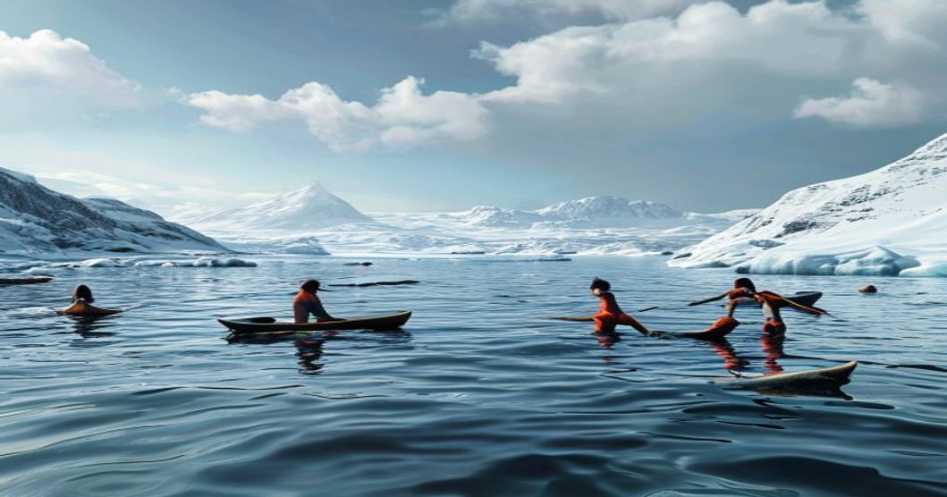
Understanding Indigenous Relationships With Arctic Waterways
Arctic waterways function as the primary ecological and cultural infrastructure for Indigenous communities across Circumpolar latitudes, dictating subsistence cycles, navigation protocols, and
Historical Navigation Routes and Seasonal Migration Patterns
Indigenous communities across the Arctic developed intricate knowledge of waterway networks that dictated survival, trade, and cultural continuity. Navigation relied on precise observation of ice formations, tidal currents, and underwater topography. Routes were not fixed lines but dynamic pathways adapted to shifting pack ice and seasonal openings. Historical navigation methods combined celestial reading with environmental markers. Navigators tracked star positions relative to horizon landmarks, interpreted wind patterns through snowdrift formations, and read water color variations that indicated depth or submerged reefs. Kayaks and umiaks were engineered for specific hydrological conditions, with hull designs optimized for both open-water speed and ice-fragment clearance.
- Kananglik ice bridges formed during winter freeze periods created temporary overland corridors that intersected major waterways, allowing communities to bypass treacherous coastal currents.
- Spring thaw triggered annual migrations of ringed seals and walrus along established coastal passages. Hunters followed predictable movement corridors mapped through oral transmission across generations.
- Summer navigation required mastery of tidal eddies and glacial meltwater discharge zones, where freshwater layers created distinct thermal boundaries that affected vessel stability.
Seasonal migration patterns operated on a cyclical calendar tied to astronomical events rather than fixed dates. The appearance of the Pleiades constellation signaled optimal timing for northward journeys along the Bering Strait corridor. Autumn equinox conditions dictated retreat routes as sea ice advanced from northern shelves. Communities maintained wayfinding stations at strategic headlands, where windsocks made of reindeer hide indicated safe passage windows. Coastal foraging routes followed predictable kelp forest boundaries, where sea otter activity indicated productive feeding grounds. Winter ice-walk pathways utilized pressure ridge formations as natural windbreaks during cross-strait crossings.
Waterway knowledge extended beyond physical geography into ecological forecasting. Elders monitored kelp bed density, bird flight altitudes, and crustacean bloom cycles to predict ice stability and prey concentration zones. This integrated observation system enabled sustainable harvest quotas long before modern stock assessment methodologies existed. Navigation routes functioned as living archives, encoded in place names that described current behavior, historical hazards, and seasonal resource availability.
Traditional Ecological Knowledge in Ice and Current Monitoring
Indigenous communities have developed highly sophisticated observation systems for tracking Arctic ice dynamics and water movement long before instrumental instruments existed. Hunters and coastal navigators rely on visual cues, tactile feedback, and atmospheric indicators to assess ice stability and current behavior. The thickness of snow cover directly correlates with underlying ice strength, while subtle changes in ice color reveal freezing progression or meltwater saturation. Experienced observers interpret wind direction, temperature gradients, and avian flight patterns to predict shifts in tidal flows and river discharge.
This knowledge operates through continuous generational dialogue rather than static documentation. Elders transmit precise terminology for different ice stages, allowing communities to coordinate travel, hunting, and resource management with remarkable accuracy. Modern hydrological sensors often struggle to capture micro-variations that TEK practitioners detect through direct environmental interaction. The cumulative observational data spans centuries, providing a longitudinal baseline that complements satellite imagery and scientific models.
- Visual Stratigraphy: Practitioners analyze ice transparency and internal fracture lines to determine structural integrity and safe passage windows during seasonal transitions.
- Acoustic Monitoring: Listening to the distinct cracking sounds of expanding or compressing ice provides real-time data on thermal stress and hydrodynamic pressure exerted by moving water masses.
- Tidal Synchronization: Coastal navigators track water displacement patterns against submerged landmarks, mapping subsurface currents that influence sediment transport, kelp bed development, and fish migration routes.
Integrating these field-tested protocols with contemporary monitoring frameworks grants researchers granular insights about freeze-up timing, break-up patterns, and subsurface current acceleration. This systematic approach strengthens community resilience while preserving culturally significant navigation techniques essential for sustainable Arctic resource management and climate adaptation strategies.
Long-term tracking requires meticulous attention to microclimatic fluctuations and seasonal lag effects. Practitioners document freeze-up sequences by recording the initial formation of shorefast ice, monitoring its expansion rate, and noting areas where thermal upwelling delays solidification. Current velocity is measured indirectly through debris drift patterns, foam line behavior, and the movement of surface algae blooms. These indicators collectively form a predictive matrix that guides winter travel planning and summer navigation decisions.
Cultural Rituals and Spiritual Connections to Marine Systems
Arctic indigenous communities have historically structured their ecological survival around reciprocal relationships with marine ecosystems, where spiritual practice and subsistence harvesting operate as interdependent systems. Rather than treating waterways as inert commodities, peoples such as the Inuit, Yupik, Sámi, and Nenets recognize aquatic environments as active participants in communal continuity. This cosmological framework manifests through precise ceremonial protocols that govern interaction with marine species. When a ringed seal is harvested, its skull is carefully preserved and returned to the ice within specific orientation patterns. The ritual acknowledges the animal’s voluntary offering, ensuring future hunts remain successful by maintaining spiritual equilibrium. Similarly, bowhead and gray whale falls among Alaskan Native groups involve communal feasting, skeletal preservation, and vocalized gratitude. These practices encode generational knowledge about migration timing, reproductive cycles, and oceanographic shifts, functioning as living archives rather than symbolic tradition.
- Ceremonial Taboos: Strict behavioral codes dictate silence during ice navigation, gender-specific roles in fish processing, and seasonal restrictions on harvesting near breeding grounds. Violations are interpreted as ecological disruption rather than moral failure.
- Ancestral Navigation Rites: Elders conduct water-divination ceremonies using carved ivory or bone instruments to read thermal currents and ice thickness. These methods integrate meteorological observation with spiritual consultation, guiding seasonal migrations across fjords and coastal shelves.
- Spiritual Reciprocity Frameworks: Marine organisms are addressed as kin or teachers in oral histories. Ritual offerings of tobacco, dried fish, or carved figurines precede hunting expeditions, reinforcing a contractual relationship between human communities and aquatic life cycles.
The integration of spirituality into marine management ensures sustainable extraction rates long before modern conservation models emerged. Taboos surrounding pregnant females, juvenile migrations, and spawning aggregations function as culturally enforced quotas. Violent or wasteful harvesting is prohibited not through legal statutes but through communal accountability and spiritual consequence. Contemporary researchers document how these practices align with population dynamics of Arctic cod, walrus, and beluga whales. The ceremonial calendar dictates harvest windows that coincide with post-breeding recovery periods, preventing overexploitation during vulnerable ecological phases. Waterways serve as conduits for ancestral communication, where ice fractures are read as omens, tidal patterns inform dream interpretation, and storm formations guide communal decision-making. This epistemological framework transforms marine geography into a sacred text, where every current, temperature shift, and species behavior carries relational meaning. Communities maintain these practices through intergenerational mentorship, ensuring that spiritual protocols adapt to changing ice conditions without severing their foundational ecological logic.
Sustainable Harvesting Practices and Resource Management
Indigenous communities across the Arctic have cultivated harvesting systems that prioritize long-term ecological balance over short-term yield. These practices emerge from centuries of direct observation, intergenerational knowledge transfer, and strict cultural protocols governing access to waterways. Harvesters track subtle environmental indicators such as ice thickness, current velocity, bird migration patterns, and marine mammal breathing hole formations to determine optimal collection windows. Seasonal calendars dictate when specific species may be taken, ensuring reproductive cycles remain undisturbed and population dynamics stay stable.
- Rotational Zone Allocation: Harvesting territories shift annually based on observed ecological recovery rates, preventing localized depletion and allowing benthic habitats to regenerate between extraction periods.
- Species-Specific Quota Enforcement: Catch limits are calibrated using historical biomass data, fat reserves in harvested tissue, and juvenile recruitment tracking rather than fixed numerical targets.
- Seasonal Timing Protocols: Ice stability thresholds, current velocity benchmarks, and migratory arrival dates determine precise collection windows to avoid disrupting breeding or molting cycles.
Modern co-management frameworks integrate these observational systems with satellite telemetry, genetic stock analysis, and acoustic monitoring. Indigenous representatives sit alongside fisheries biologists to adjust quotas dynamically as sea ice retreats and species distributions shift. Community-led monitoring programs document water temperature anomalies, pollutant accumulation in blubber tissue, and changes in plankton blooms that directly affect food web stability. Regulatory compliance is maintained through transparent catch reporting and peer enforcement mechanisms rooted in cultural accountability rather than external oversight.
Adaptive governance remains central to sustaining these waterways. Harvesting protocols evolve alongside environmental feedback loops, allowing communities to modify techniques when traditional indicators become unreliable due to rapid climate shifts. Training
Contemporary Challenges Facing Arctic Indigenous Communities
Arctic waterways serve as critical arteries for Indigenous subsistence, transportation, and cultural continuity, yet accelerating environmental shifts are fundamentally altering their stability and accessibility. Thinning sea ice and prolonged open-water seasons disrupt established travel corridors, forcing communities to rely on expensive motorized transport rather than traditional routes that historically operated within predictable freeze-thaw cycles. Permafrost degradation compounds these vulnerabilities by destabilizing coastal infrastructure, accelerating shoreline erosion at rates exceeding two meters annually in vulnerable regions like Alaska’s North Slope and northern Canada’s Inuvialuit Settlement Region. This physical transformation directly threatens food sovereignty, as unpredictable ice conditions compromise safety for hunting seals, walrus, and beluga whales—species that form the nutritional backbone of many coastal settlements.
Industrial expansion introduces additional compounding pressures. Increased maritime traffic opens previously inaccessible routes, raising the risk of oil spills in ecologically sensitive marine habitats where bioremediation remains largely ineffective under subzero conditions. Offshore resource extraction projects frequently bypass meaningful consultation processes, leading to overlapping jurisdictional conflicts between federal agencies, provincial governments, and Indigenous land claims organizations. Legal frameworks such as the United Nations Declaration on the Rights of Indigenous Peoples establish clear standards for free, prior, and informed consent, yet implementation gaps persist across Arctic states, leaving communities with limited leverage against corporate development timelines.
- Economic Marginalization: Traditional economies struggle to compete with wage labor markets driven by extractive industries, accelerating outmigration of youth and fragmenting intergenerational knowledge transfer.
- Policy Exclusion: Marine spatial planning initiatives often prioritize commercial shipping and conservation zoning without integrating Indigenous ecological knowledge, resulting in management plans that ignore seasonal migration patterns and sacred site locations.
- Health Impacts: Contaminant bioaccumulation in marine food webs intensifies as warmer waters alter species distribution, exposing populations to higher levels of mercury and persistent organic pollutants that cross the placental barrier.
Adaptation requires decentralized governance models that embed local monitoring networks into national climate strategies. Community-led ice road certification programs, satellite-based wildlife tracking partnerships, and legally binding revenue-sharing agreements demonstrate viable pathways toward sustainable coexistence. Without immediate policy realignment and targeted funding for Indigenous-led conservation initiatives, the structural erosion of Arctic waterway relationships will continue to undermine both ecological resilience and cultural preservation.
Climate Change Acceleration and Sea Ice Loss Dynamics
The Arctic is warming at approximately four times the global average, a phenomenon driven by polar amplification and complex feedback mechanisms that rapidly destabilize marine ice systems. As ambient temperatures rise, the reflective albedo of frozen surfaces diminishes, exposing darker ocean water that absorbs solar radiation rather than reflecting it. This positive feedback loop accelerates thermal expansion and reduces ice formation thresholds, fundamentally altering hydrological cycles across northern latitudes.
Decades of satellite telemetry confirm a relentless contraction in both the spatial extent and structural integrity of Arctic sea ice. Multi-year ice formations, once spanning several meters in thickness, have been largely replaced by thinner, seasonal ice layers that fracture unpredictably during autumn storms. The disappearance of stable ice platforms disrupts natural pressure ridges and leads, critical navigation markers historically used by Inuit, Yupik, and Sámi navigators to traverse frozen waterways safely.
- Thermal degradation patterns vary regionally, with the Barents and Chukchi seas experiencing earlier freeze-up delays and later breakup cycles.
- Polynya expansion creates unpredictable open-water corridors that compromise traditional ice-road infrastructure and emergency evacuation routes.
- Salinity stratification shifts alter freshwater discharge timing from glacial melt, directly impacting marine food webs and subsistence harvesting schedules.
Indigenous waterway management relies on intergenerational observation of ice stability, wind patterns, and wildlife migration corridors. Rapid hydrological destabilization fractures these observational frameworks, forcing communities to abandon established travel routes and adapt hunting seasons that no longer align with ecological rhythms. Traditional kinship-based resource distribution networks face operational breakdowns as safe passage windows narrow and coastal erosion accelerates infrastructure vulnerability. Monitoring protocols now require real-time meteorological data integration alongside historical ice core records to maintain navigational safety and cultural continuity in rapidly shifting marine environments.
Industrial Development and Infrastructure Encroachment
Arctic waterways have historically functioned as vital ecological corridors and cultural arteries for Indigenous communities across the circumpolar north. The expansion of industrial development and infrastructure projects has systematically fractured these interconnected systems. Resource extraction operations, particularly in oil and gas sectors, rely heavily on navigable waterways for logistics, while large-scale mining initiatives require extensive land-based transport networks that cross traditional travel routes. Pipelines, access roads, and deep-water ports alter hydrological patterns, increase sediment runoff, and introduce chemical contaminants directly into fragile polar ecosystems. These physical modifications compound the stress already placed on aquatic habitats by climate-driven thawing permafrost and shifting ice regimes.
Ecosystem disruption extends beyond immediate construction zones. Navigational corridors used for seasonal hunting and fishing are fragmented by commercial shipping lanes and industrial buffer zones, forcing communities to abandon ancestral grounds or navigate increasingly hazardous conditions. Water quality degradation from heavy metal leaching, diesel spills, and brine discharge directly threatens subsistence species such as Arctic char, walrus, and ringed seals, undermining food security and cultural transmission.
- Cumulative watershed impacts are frequently dismissed in isolation during permitting processes.
- Lack of real-time monitoring systems prevents early detection of hydrological thresholds.
- Regulatory approvals often bypass binding consultation protocols, prioritizing corporate timelines over ecological continuity.
Sustainable management requires structural shifts in planning frameworks. Indigenous-led co-governance models must replace unilateral infrastructure zoning, integrating traditional ecological knowledge into baseline hydrological assessments and establishing mandatory buffer zones around culturally significant sites. Long-term watershed integrity depends on enforcing strict contamination controls, halting unregulated deep-water port expansions, and aligning economic development with proven stewardship practices.
Legal Frameworks and Land Claim Agreements in the Arctic
Indigenous governance of Arctic waterways operates within a complex intersection of international human rights instruments and domestic land claim settlements. The United Nations Declaration on the Rights of Indigenous Peoples establishes free, prior, and informed consent as the baseline for any development affecting traditional marine territories. National implementations vary significantly across circumpolar states, yet all recognize that historical navigation routes, seasonal hunting grounds, and coastal access remain legally protected under modern treaty frameworks.
Land claim agreements in Canada, Scandinavia, Greenland, and Russia explicitly delineate resource jurisdiction over inland waterways, coastal zones, and adjacent marine environments. The Nunavut Land Claims Agreement of 1993 created co-management institutions that regulate seal hunting corridors, polar bear migration paths, and offshore mineral exploration along the Arctic coastline. In Norway and Sweden, Saami parliamentary statutes grant authority over freshwater fisheries and reindeer transhumance routes that intersect with river systems. Greenland’s Home Rule Act and subsequent Self-Government Act transfer marine licensing decisions to local authorities, ensuring that Inuit communities retain veto power over commercial shipping permits in designated traditional waters.
- Nunavut Land Claims Agreement (1993): Establishes the Nunavut Wildlife Management Board and Marine Management Board, which review all offshore development projects affecting Inuit waterway access.
- Saami Conventions in Norway and Sweden: Codify reindeer herding zones that overlap with river networks and coastal fjords, requiring state consultation before dam construction or dredging.
- Greenland Self-Government Act (2009): Transfers control over fisheries licensing, marine spatial planning, and environmental impact assessments to the Inatsisartut and municipal councils.
- Russian Federal Law on Guarantees of the Rights of Indigenous Peoples of the North: Mandates state registration of traditional waterway use and restricts industrial navigation in declared ancestral territories.
Court precedents across the circumpolar region consistently affirm that maritime boundaries do not override historical Indigenous usage rights. Litigation regarding the Northwest Passage, Bering Strait shipping lanes, and Svalbard territorial waters has reinforced that treaty obligations require continuous consultation rather than retroactive compensation. Climate-driven ice retreat has intensified disputes over newly accessible channels, prompting legal frameworks to adapt through dynamic zoning policies that prioritize traditional ecological knowledge in marine spatial planning. Regulatory bodies now integrate real-time environmental monitoring with Indigenous observation networks to enforce sustainable harvest quotas and prevent unauthorized commercial incursions.
The enforcement mechanism relies on joint administrative boards composed of treaty signatories, government appointees, and community representatives. These entities possess binding authority over licensing, dispute resolution, and habitat restoration funding. Recent amendments to national Arctic policies explicitly reference UNDRIP Article 25, recognizing that spiritual and cultural continuity depends on uninterrupted access to seasonal waterways. Legal challenges against pipeline extensions, deep-sea mining permits, and military navigation exercises consistently cite treaty language that reserves subsistence rights above commercial utility. Compliance monitoring occurs through satellite tracking of traditional vessels, acoustic wildlife surveys, and community-led water quality testing programs.
Youth Engagement and Intergenerational Knowledge Transfer
Knowledge transmission across Arctic Indigenous communities operates through immersive, place-based learning rather than formal classroom instruction. Elders and experienced hunters guide younger generations directly on frozen lakes, river systems, and coastal waters, teaching navigation by star patterns, ice thickness assessment, seasonal current shifts, and species behavior. This experiential pedagogy embeds ecological data into daily practice, ensuring that hydrological awareness remains dynamic rather than static.
- Elder-youth pairing: Structured mentorship where elders demonstrate safe ice travel, weather interpretation, and traditional fishing techniques while youth record observations in bilingual field journals.
- Seasonal immersion: Extended stays at water-based camps during freeze-up and break-up periods allow continuous monitoring of hydrological changes and resource availability.
- Language-integrated instruction: Technical terminology for water conditions, marine mammals, and ice formations is taught in Indigenous languages to preserve precise ecological vocabulary.
Contemporary engagement models increasingly blend traditional methods with community-driven documentation. Digital mapping projects enable youth to overlay historical travel routes with real-time satellite data, creating interactive archives that track glacial melt patterns, permafrost degradation, and shifting migration corridors. Educational partnerships between tribal councils and regional universities now fund waterway stewardship fellowships, where participants conduct independent ecological surveys while documenting oral histories from knowledge keepers.
The continuity of this transfer directly influences adaptive capacity in rapidly changing Arctic environments. Communities maintaining strong intergenerational learning cycles demonstrate faster response times to infrastructure damage caused by ice instability, more accurate resource allocation during seasonal hunts, and higher retention rates of traditional navigation protocols. When youth actively participate in hydrological monitoring, they transform passive cultural inheritance into active environmental management, ensuring that Indigenous waterway relationships remain functionally relevant rather than historically preserved.
Community-Led Conservation and Future Waterway Stewardship
Indigenous communities across the Arctic have transitioned from historical marginalization to proactive leadership in freshwater and coastal ecosystem management. This shift relies on integrating traditional ecological knowledge with modern hydrological monitoring techniques to establish adaptive conservation frameworks that respond directly to rapid climatic fluctuations.
- Traditional Monitoring Networks: Elders and youth conduct seasonal ice thickness assessments, track wildlife migration patterns, and document water clarity changes that signal glacial melt acceleration or pollutant accumulation along river corridors.
- Co-Management Agreements: Legal partnerships between Indigenous councils and federal agencies enforce catch quotas, regulate industrial runoff, and establish buffer zones along critical spawning grounds while maintaining cultural access to ancestral fishing sites.
- Youth Knowledge Transfer Programs: Structured apprenticeships pair older generations with younger members to preserve navigation techniques, water purification methods, and seasonal harvesting calendars that align with natural hydrological cycles.
- Digital Infrastructure Integration: Low-cost turbidity sensors, temperature loggers, and satellite-linked buoys transmit real-time data to community-controlled servers, eliminating reliance on external research institutions for baseline environmental reporting.
Modern stewardship initiatives prioritize continuous data collection across remote watersheds. These networks enable rapid response to contamination events or abnormal flow rates triggered by permafrost degradation and altered precipitation patterns. These systems also track dissolved oxygen levels and heavy metal concentrations, providing early warnings for ecosystem stress before visible degradation occurs.
Simultaneously, Indigenous governance structures are formalizing water rights through land claim settlements that explicitly recognize riparian sovereignty and restrict extractive operations within designated watershed boundaries.
Long-term resilience depends on scaling these localized models into transboundary conservation corridors. Cross-regional alliances facilitate shared research funding, standardized monitoring protocols, and unified advocacy for climate adaptation grants. By anchoring policy decisions in place-based observations rather than external projections, Arctic waterway management aligns ecological preservation with cultural continuity while establishing replicable frameworks for global freshwater governance.
Co-Management Models with Government Environmental Agencies
Co-management arrangements represent a structural shift in how Arctic waterways are governed, moving away from unilateral state control toward collaborative frameworks that legally recognize Indigenous sovereignty over traditional territories. These models operate through formalized agreements where government environmental agencies share regulatory authority, monitoring responsibilities, and policy development with Indigenous governing bodies. The foundation rests on integrating Western scientific data collection with Indigenous Knowledge Systems, which document centuries of hydrological patterns, ice dynamics, wildlife migration routes, and seasonal resource availability.
Operational mechanisms typically include joint advisory councils, co-stewardship compacts, and shared funding allocations for environmental assessments. Government departments establish technical working groups that require mandatory representation from local Indigenous communities during impact analysis phases. Data collection protocols mandate cross-verification methods, ensuring that satellite imagery, water quality sampling, and acoustic monitoring align with oral histories, seasonal calendars, and place-based ecological observations. This dual-validation approach reduces regulatory blind spots in remote polar regions where conventional survey infrastructure remains limited.
- Joint Regulatory Committees: Establish binding decision-making authority over fishing quotas, shipping corridors, and habitat protection zones, requiring unanimous consensus or structured voting frameworks before policy implementation.
- Traditional Knowledge Documentation Protocols: Standardize the translation of community-recorded ecological data into legally admissible formats for environmental impact statements and resource allocation models.
- Capacity-Building Funding Streams: Direct federal grants toward Indigenous-led monitoring programs, providing equipment, technical training, and administrative support to sustain long-term stewardship operations.
Legal mandates underpinning these structures vary by jurisdiction but consistently emphasize procedural fairness, free prior informed consent, and transparent dispute resolution mechanisms. Implementation challenges frequently involve funding volatility, bureaucratic delays, and power imbalances that can marginalize community voices during high-stakes resource negotiations. Successful frameworks mitigate these risks through independent oversight panels, fixed-term co-management renewals, and performance metrics tied directly to ecological indicators rather than administrative compliance. The resulting governance architecture strengthens watershed resilience while preserving cultural continuity across Arctic coastal and inland water systems.
Indigenous-Led Monitoring Networks and Data Sovereignty
Indigenous communities across the Arctic have established autonomous monitoring networks that operate independently of external research institutions and governmental agencies. These systems prioritize direct environmental observation, real-time hydrological tracking, and continuous ice flow analysis. Local field technicians, community researchers, and knowledge holders deploy calibrated instruments along critical migration corridors, traditional harvesting grounds, and freshwater discharge points. Raw measurements remain physically stored within regional Indigenous cooperatives or municipal data centers, ensuring that environmental information never transfers to outside repositories without explicit governance approval.
Data sovereignty governs every phase of environmental documentation within these networks. Collection protocols require free, prior, and informed consent from elected community councils before any sensor deployment occurs. Storage architectures utilize encrypted local servers with redundant backup systems situated within Arctic jurisdictions. Distribution agreements mandate co-authorship requirements for external academics accessing the archives. Funding bodies must negotiate data licensing terms directly with Indigenous oversight committees rather than relying on institutional partnerships or grant conditionalities.
- Hydrological sensors track salinity gradients, temperature fluctuations, and dissolved oxygen levels across interconnected river systems
- Satellite telemetry validates seasonal ice breakup timelines while acoustic receivers record fish migration frequencies beneath frozen surfaces
- Community analysts cross-reference historical oral records with contemporary sensor outputs to identify long-term hydrological shifts
- Legal frameworks increasingly recognize Indigenous data trusts as legitimate regulatory entities within territorial management statutes
Governance structures enforce strict classification tiers that separate public climate indicators from culturally sensitive location data. Restricted archives preserve harvest timing records, sacred site coordinates, and detailed current mapping files accessible only to authorized community personnel. Equipment procurement, budget allocation, and technical staffing decisions remain under independent oversight committees composed of local representatives. This structural autonomy eliminates sampling bias common in external research initiatives and produces high-resolution environmental baselines tailored to localized ecosystem dynamics.
Monitoring infrastructure generates actionable intelligence for territorial management and climate adaptation planning. Real-time current mapping prevents vessel grounding during unpredictable melt cycles. Water contamination alerts trigger immediate fishing closures before public health thresholds breach. Ice thickness gradients inform safe travel routing across frozen river networks. These autonomous systems transform environmental observation into operational strategy, reinforcing community jurisdiction while establishing replicable frameworks for northern resource governance.
Revitalizing Traditional Navigation and Craft Techniques
Traditional Arctic navigation relies on a sophisticated synthesis of environmental reading, acoustic cues, and generational memory that modern positioning systems cannot replicate. Indigenous navigators historically tracked subtle shifts in ice texture, wind patterns, auroral activity, and seabird flight paths to determine safe passage across frozen seas and open channels. Revitalizing these methods involves structured knowledge transmission through hands-on mentorship, where elders demonstrate how to interpret swell direction against distant mountain silhouettes or read the color variations of pack ice to identify lead openings.
- Celestial wayfinding remains critical during polar nights, with communities preserving hand-drawn star charts that map seasonal positions relative to specific coastal landmarks and glacial outcrops.
- Acoustic mapping techniques involve listening for water flow through underwater ridges and identifying the distinctive cracking sounds that signal shifting ice pressure zones ahead of visible fractures.
- Tactile route recording uses carved bone and antler markers embedded in vessel frames to document distance, current speed, and seasonal migration corridors without relying on written documentation.
Boat construction practices have undergone parallel renewal, prioritizing historically accurate materials and load-bearing engineering. Craftspersons now source traditional timber from glacial till deposits, prepare hide through fermentation and stretching processes, and apply seal blubber oil to achieve waterproof integrity without synthetic coatings. The lacing patterns found in umiak seams distribute stress evenly across flexible hulls, allowing vessels to absorb impact from floating ice rather than fracture under pressure. Modern workshops combine these ancestral methods with structural testing protocols, ensuring that reconstructed craft meet contemporary safety standards while preserving original displacement ratios and paddling ergonomics.
- Intergenerational training programs operate directly on construction sites, where apprentices learn knot systems, rib placement sequences, and tension calibration through guided repetition and real-time correction.
- Digital preservation initiatives document tool marks, grain orientation preferences, and seasonal harvesting calendars to prevent irreversible loss of specialized woodworking knowledge across fragmented communities.
- Cross-regional exchanges facilitate the comparison of Inuit, Yupik, Chukchi, and Sámi maritime traditions, revealing shared adaptive strategies for extreme marine environments and standardizedizing safety benchmarks.
Contemporary revitalization extends beyond technical replication. Communities establish navigation academies that pair traditional route planning with modern meteorological data, creating hybrid decision-making frameworks for resource extraction vessels and emergency response teams. Knowledge keepers integrate oral histories containing depth soundings, current eddies, and historical ice retention zones into updated nautical charts maintained by indigenous territorial authorities. This approach ensures that craft techniques remain living systems rather than static artifacts, directly supporting food sovereignty, cultural continuity, and climate resilience across Arctic coastal populations.
Policy Integration for Long-Term Arctic Ecosystem Protection
Effective policy integration requires bridging traditional ecological knowledge with contemporary regulatory frameworks. Indigenous communities possess generational data regarding ice dynamics, migration corridors, and hydrological shifts that formal environmental assessments frequently overlook. When governance structures incorporate this lived experience, compliance rates improve and enforcement becomes more precise. Cross-jurisdictional agreements must recognize indigenous land tenure, water rights, and co-management authority as foundational elements rather than advisory inputs.
Legal Mechanisms and Co-Governance Models
- Establishing indigenous-led environmental review boards with statutory veto authority on development proposals near sensitive thaw zones
- Mandating real-time data sharing protocols between federal meteorological services and community observation networks for accurate ice thickness tracking
- Creating adaptive management frameworks that adjust commercial harvesting limits based on annual hydrological reports generated by local stewards
- Securing permanent legal recognition of indigenous water stewardship zones under international conservation treaties to prevent regulatory fragmentation
Implementation challenges often stem from fragmented funding cycles and bureaucratic delays in translating community recommendations into actionable legislation. Streamlining approval pathways requires dedicated liaison offices staffed by bilingual administrators familiar with both statutory requirements and traditional governance structures. Training programs for regulatory inspectors must include immersive modules on indigenous hydrological tracking methods, ensuring field assessments align with ground-level realities rather than satellite-only interpretations.
Long-term ecosystem resilience depends on embedding intergenerational knowledge into statutory environmental impact assessments. When policy frameworks treat indigenous relationships with waterways as active management systems rather than cultural heritage, conservation targets become measurable and enforceable. Continuous feedback loops between community monitors and legislative bodies allow rapid response to accelerated permafrost degradation, algal bloom patterns, and salinity fluctuations that threaten baseline biodiversity. Sustainable Arctic waterway protection ultimately requires regulatory structures that recognize indigenous authority as the primary mechanism for ecological continuity.
Frequently Asked Questions
What is Indigenous Relationships With Arctic Waterways?
Indigenous relationships with Arctic waterways refer to the deep, centuries-old connections that Native and Inuit communities maintain with rivers, lakes, seas, and ice routes in the Arctic region. These relationships are foundational to cultural identity, spiritual practices, traditional ecological knowledge, and sustainable livelihoods, emphasizing harmony, stewardship, and reciprocal respect for aquatic ecosystems.
Key facts about Indigenous Relationships With Arctic Waterways
Key facts include: (1) Waterways serve as traditional transportation routes for hunting and trade long before modern infrastructure; (2) Indigenous knowledge systems guide sustainable fishing and wildlife management; (3) Climate change and melting ice threaten these relationships by disrupting migration patterns and access to ancestral lands; (4) Legal recognition of Indigenous water rights is growing globally, supporting co-management agreements in Arctic governance.